photo above c. 1953, courtesy of SCDoT (full version)
Historic US highway endpoints in Florence, SC
|
1927-1935
|
 |
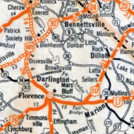
c. 1931, Gousha
|
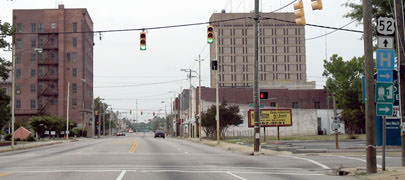
When the US routes were first laid out in 1926, two of them ended in Florence: US 76 and US 601. (Actually the entirety of US 601 is shown on that map, because it ran north only as far as US 1 in Cheraw). The photo below was looking west on Palmetto Street in Florence:
Nitzman, May 2007
|
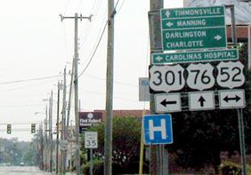
Back in the day, there was no US 52 or US 301 (at least not in Florence). But US 17 did run through Florence: southbound was to the left on Irby Street, while northbound was to the right on Irby for one block, then east on Cheves Street. Straight ahead on Palmetto was the east beginning of US 76. The large photo at the top of this page was taken at that same intersection, a couple decades after US 76 had been extended out of Florence, but it gives a good feel for what the junction looked like back then. The shot below was taken looking north on Irby:
Nitzman, May 2007
|
(detail)
|
|
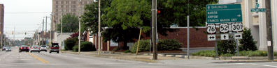
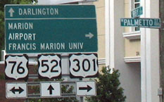
This was northbound US 17, which continued straight ahead for one more block. US 76 began to the left on Palmetto. Today US 301 turns right on Palmetto, which is also US 76. But in the late 1920s and early 1930s, highway traffic to the east of Irby used Cheves, not Palmetto. This photo was taken from just ahead, one block to the north:
|
Nitzman, May 2007
|
Here at Cheves, northbound US 17 went to the right. The south beginning of US 601 was to the left on Cheves -- after one block, traffic was directed north again via Coit Street. It was not long before highway designations in Florence changed quite a bit, and since the mid-1930s all of Florence's US routes pass through (rather than end in) the city.
Research and/or photo credits: Alex Nitzman; Mike Roberson; Dale Sanderson
Page originally created 2007;
last updated Aug. 2, 2020.
last updated Aug. 2, 2020.
