US highway endpoint near Joplin, MO
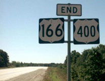
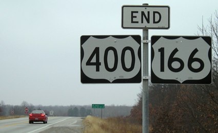
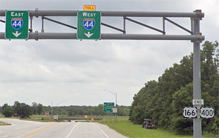
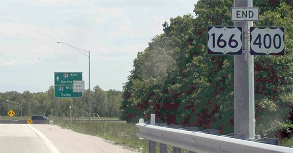
That assembly is no longer there -- it was removed when a new roundabout was put in for access to a new casino. Now a sign bridge has been installed, and the "End" assembly is mounted on the upright:
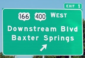
That is not the original alignment of US 166 -- rather, that road was built as a connector to I-44 sometime in the 1950s. US 166 was signed further east of there until 1965, but as soon as I-44 was open between Joplin and Springfield, the designation was truncated to that interchange (and the remaining non-interstate segment of US 166 was re-designated as MO 174). US 400 was commissioned in 1994, and its east end has always been there. It is overlapped with US 166 for about eight miles (from Baxter Springs KS), and the two routes share the same eastern terminus. The I-44 interchange is just ahead -- the green mileage sign points straight ahead to "Joplin 7", and a right turn (to the westbound on-ramp) says "Tulsa OK 99".
|
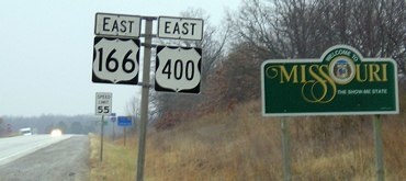
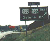
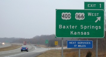
Interesting how the control city was changed from "Galena" to "Baxter Springs", and it is unfortunate that such ugly US route shields were used (it is possible that the Downstream Casino Resort paid for the new signs [in return for getting the name of their road on the sign], and their contractor used shields that were not MUCTD-compliant). US 166-400 misses entering Oklahoma by a fraction of a mile: Downstream Boulevard heads west and enters Kansas after about 1/10th mile. Then it continues southwest for another half-mile, ending at the casino, which is located in Oklahoma (although the parking lot is in Kansas). It is also interesting to note that Joplin has apparently annexed all the way out to the stateline; the exit for central Joplin is another seven miles ahead.
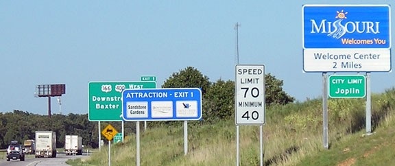
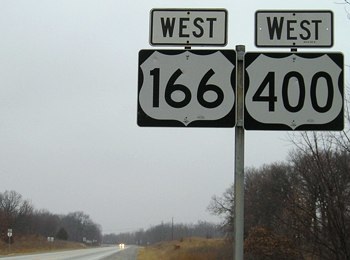
Drivers taking that exit will still be in Missouri when they see the first westbound confirmation markers... |
...but not by much: the car with headlights on is right about at the Kansas state line. That is also right about where the aforementioned roundabout is now situated. From there, one can head west on Downstream, and then turn to the south onto a little-known and poorly-maintained road that leads about a half-mile south, to the southeast corner of Kansas / northeast corner of Oklahoma. The material that follows is not road-related, but those curious about geographical points-of-interest may enjoy reading on. If not, you can use one of these buttons to escape:
|
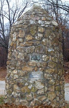
This particular tri-point would have been established no later than 1857, which is when the Kansas-Oklahoma line was surveyed. Here is a photo of the nearby 1930s monument:
|
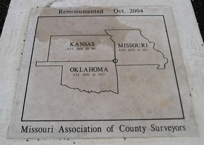
That stands entirely in Kansas; it may have been built there because the actual point was on the road (or at least its right-of-way). A few feet to the east sits a newer monument. This may occupy the former location of a benchmark, which disappeared sometime during the 1990s:
|
Research and/or photo credits: Rich Carlson; Jeremy Lance; Jeff Morrison; Dale Sanderson; Collin Sweeney
Page originally created 2000;
last updated Jan. 25, 2020.
last updated Jan. 25, 2020.
