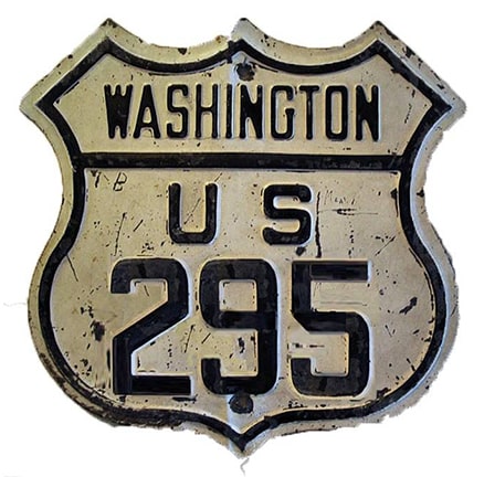
End of historic US highway 295 |
 |
|
|
|
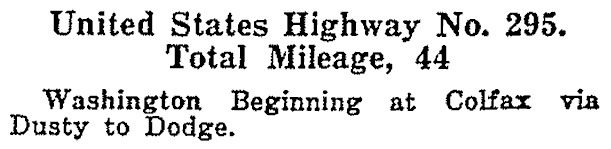
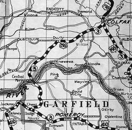
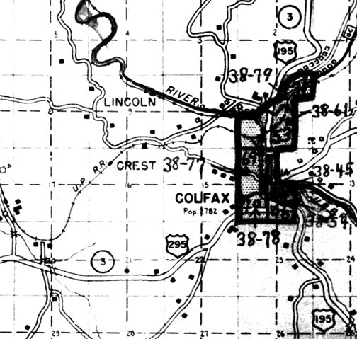
An original 1926 route, US 295 was decommissioned in 1967. During those 41 years it connected US 195 in Colfax to US 410 at Dodge (US 410 is now US 12, but that change took effect only about a year before US 295 was eliminated):
c. 1933, WSDoT
|
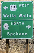
This photo gives a great overview of the historic south terminus. The road in the lower right corner, winding down the hill to about the center of the photo, is WA hwy. 127. The car down at lower left was on westbound US 12 -- that designation continues off the left side of the photo, but traffic curves to a stop sign at WA 127. Southbound WA 127 to westbound US 12 is an uninterrupted movement. WA 127 was formerly US 295, and that designation ended here at its junction with US 410 (although it is uncertain whether this intersection was always configured the same way it is now):
Elbert, July 2005
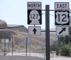
The signs along the right edge of the photo are shown close-up below:
|
Elbert, July 2005
|

Sanderson, Mar. 2001
|
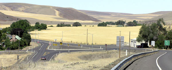
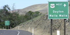
Westbound US 12 traffic (such as the dump truck) must stop and then make a left turn. Presumably that is because the majority of traffic coming through here is travelling between Spokane and Walla Walla. If the driver of the dump truck was looking straight ahead, he would see this sign:
|
Elbert, July 2005
|
|
Historically it was US 295 that began off to the right. These photos show the former beginning of US 295, approaching from eastbound on former US 410, which continued to the right, up the Pataha Valley, while US 295 began by ascending the hills at left via today's WA 127:
|

Elbert, July 2005
|
Elbert, July 2005
|
Eastbound US 12 follows an unsigned, one-tenth-mile-long WA state route called "US 12 Wye Connector" to join with the mainline ahead. The southernmost segment of old US 295 is visible at far left.
|
27 miles north of Dodge, WA 127 ends at WA 26 in Dusty. From there, WA 26 follows the route of historic US 295 to Colfax. But originally, just shy of Colfax, US 295 followed what is now Airport Road, and then Almota Road into town:
c. 1936, WSDoT
|
Almota curves east on Fairview Street, and then traffic was directed north on Main, ending at the junction with US 195:
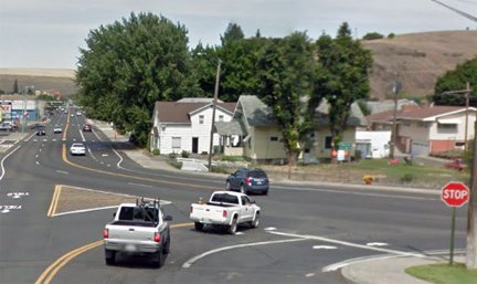
Google Maps Street View, Aug. 2013
That was looking north on Main at the original north endpoint of US 295; straight ahead on Main is northbound US 195, while southbound is to the right. This image was looking the opposite direction (south on Main):

Google Maps Street View, Aug. 2013
|
That was taken from southbound US 195, which continues to the left. Straight ahead was the original north beginning of US 295.
|
The current alignment of WA 26 (which comes into the north side of Colfax) opened in 1938, but was originally signed as US 295. This first photo was taken just a few years after that; it shows an interesting sign which was formerly at the north end of US 295. The next photo shows modern signage at the same location:
|
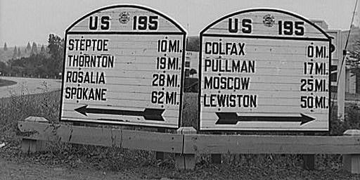
Lee, 1941 (preserved in the American Memory Collection of the Library of Congress)
|
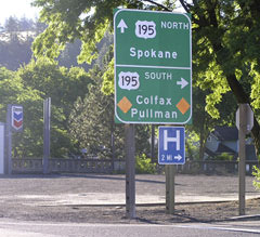
Elbert, July 2005
|
|
This photo was taken from southbound US 195; it shows the signage where WA 26 splits off from US 195. Downtown Colfax is about a half-mile ahead; to the right was formerly the north beginning of US 295:
|
Elbert, July 2005
|
|
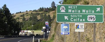
This last shot shows the historic north beginning of US 295 (to the left) from northbound US 195. The green sign in the distance points left to Walla Walla and Seattle -- which seems reasonable -- but the use of "Vantage" as the control point on the nearer sign is interesting. Vantage is on the Columbia River, right about where WA 26 meets I-90. But it is about 140 miles away, and it is a very small town, so it is rarely going to be a final destination for anyone.
|
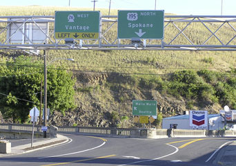
Elbert, July 2005
|
Research and/or photo credits: Nathan Edgars; Chris Elbert; Russell Lee; Dale Sanderson; Michael Summa
Page originally created 2001;
last updated Dec. 4, 2023.
last updated Dec. 4, 2023.
