Current and historic US highway endpoints in Port Arthur, TX
|
1934-present
|
 |
US 59 was commissioned in 1934 to run from the Canada border to Port Arthur. The US 69 designation arrived the next year, south from Kansas City. Then in 1939, US 59 was rerouted to go south and west from Tenaha (as it does today), so US 96 was commissioned to replace the old segment of US 59 between Tenaha and Port Arthur. That same year, the US 287 designation was extended into Texas. It meets US 69 at Woodville, and overlaps with it to Port Arthur. So, although US 59 was the first of the federal routes to serve Port Arthur, it is also the only US designation that was ever removed from there.
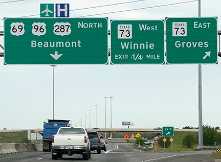
Initially, highway traffic between Beaumont and Pt. Arthur used the road that is today designated as TX hwy. 347 (Twin City Highway). In the Griffing Park neighborhood, the route did a couple jogs and traffic ended up heading south on 9th Avenue, reaching TX hwy. 87 at 16th Street (now known as Gulfway Drive). This route was probably used by US 59 and US 69, but that did not last long: today's road (Woodworth Boulevard/Memorial Boulevard) was built between 1935 and 1938. So US 96 and US 287 probably never used the old route.
Initially, highway traffic between Beaumont and Pt. Arthur used the road that is today designated as TX hwy. 347 (Twin City Highway). In the Griffing Park neighborhood, the route did a couple jogs and traffic ended up heading south on 9th Avenue, reaching TX hwy. 87 at 16th Street (now known as Gulfway Drive). This route was probably used by US 59 and US 69, but that did not last long: today's road (Woodworth Boulevard/Memorial Boulevard) was built between 1935 and 1938. So US 96 and US 287 probably never used the old route.
But that uncertainty is not relevant to the question of endpoints, because initially the US routes did not end at their junction with TX 87. Instead, they turned southwest on Gulfway and headed towards the downtown area, overlapped with TX 87. After about two miles, the US route designations ended at Houston Avenue, while TX 87 continued southwest out of town, as illustrated on this map:
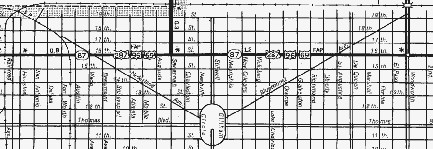
c. 1961, TXDoT
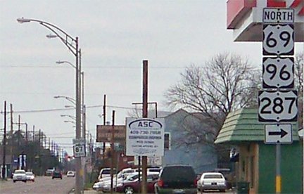
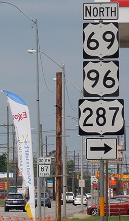
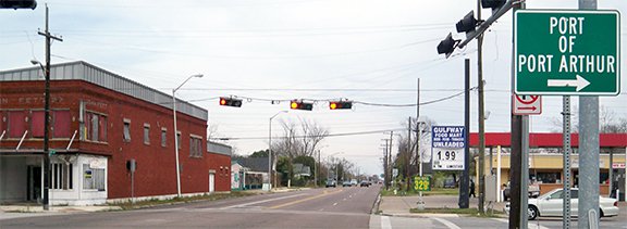
At the time of that map, US 69-96-287 came in on Woodworth (at upper right), but the map shows how traffic was directed to turn onto 16th (today's Gulfway). The * at far left marks where the US designations ended. Why at Houston? Probably because that road provides access to the downtown area, the courthouse, and city hall. In fact, for a time there was a signed business loop off Gulfway, formed by Houston, Procter Street, and Woodworth. These first photos show the last southbound signage on the route:
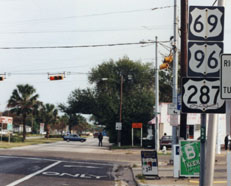
Taylor, 2000
|
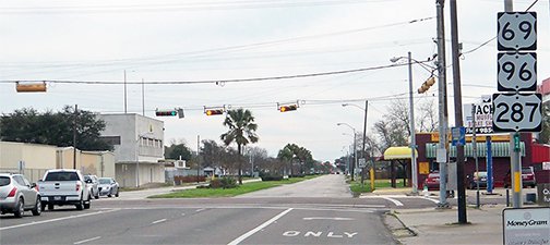
Karners, Jan. 2015
|
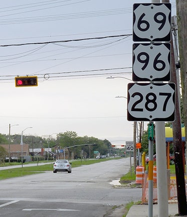
Sanderson, Mar. 2023
|
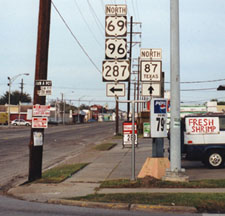
Those were posted for the benefit of traffic heading southeast on Woodworth. That seems like a pointless place to post reassurance markers, since the US routes end right there at Gulfway. In fact, one wonders if those signs were originally intended to be posted on the other side of Woodworth, for traffic heading the opposite direction, because there were no northbound reassurance markers for nearly two miles...
|
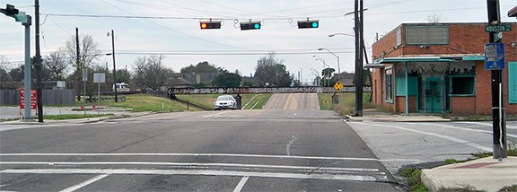
...but if not, then an "End" tab would be a welcome addition to that signpost. And that particular location would also be an appropriate place for a "JCT TX 87" sign; historically, TX 87 was referenced in the median on the far side of that intersection:
|
Taylor, 2000
|
|
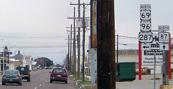
That assembly was posted until at least 2013, but it was gone by sometime in 2014. Today that is where US 69-96-287 ends. This shot was looking southwest on Gulfway. Today the south beginning of all three routes is to the right on Woodworth...
|
Karners, Jan. 2015
|
Sanderson, Mar. 2023
|
|
...but as the map above shows, they formerly continued ahead with TX 87 for two miles. This next photo shows where they originally ended at Houston:
|
Karners, Jan. 2015
|

(detail)
|
Not only is that the historic endpoint of US 69-96-287, but it was also the south end of US 59 between 1934-1939. Not much to see here anymore, although the sign at far right is kind of interesting.
|
Here we are heading the opposite direction (north on TX 87/Gulfway). To the right on Houston was the south beginning of the business loop, and straight ahead is where the US routes began:
|
Karners, Jan. 2015
|
|
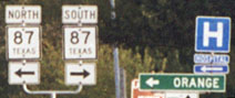
Continuing ahead a couple miles, we come the intersection shown here:
|
Taylor, 2000
|
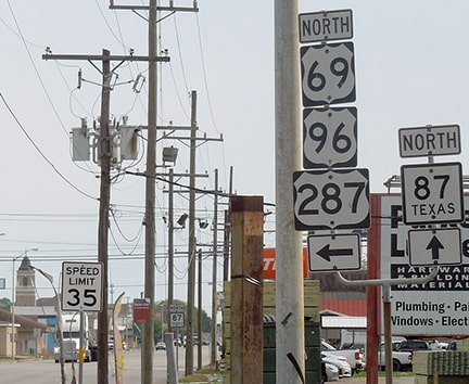
Karners, Jan. 2015
|
Sanderson, Mar. 2023
|
|
The current beginning of US 69-96-287 is to the left on Woodworth. To the right on Woodworth was the north beginning of the business loop. Traffic turning left does not encounter any reassurance signage confirming they are following the US routes for nearly two miles:
|
Sanderson, Mar. 2023
|
Research and/or photo credits: Nathan Edgars; Karin and Martin Karner; Dale Sanderson; Stephen Taylor
Page originally created 2003;
last updated Dec. 4, 2023.
last updated Dec. 4, 2023.
