End of US highway 395 |
 |
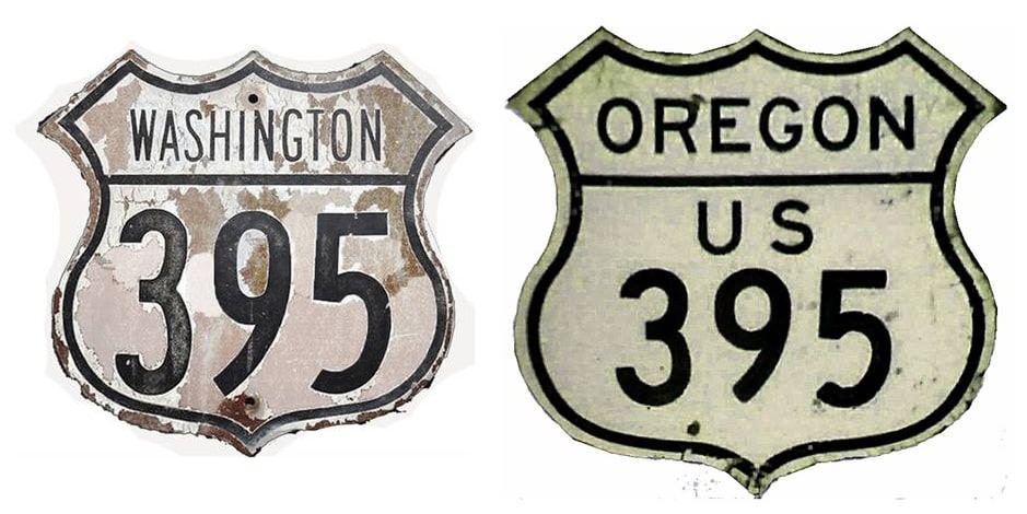
Summa
|
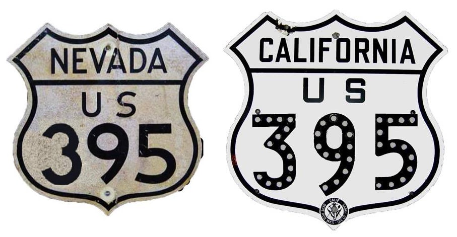
Summa
|
|
1926-1934
|
1934-1979
|
1979-present
|
|
Mileage: in 1989 AASHTO listed a figure of 1326 miles for US 395... however, that included the mileage of US 395's associated business routes. According to the state subtotals on AASHTO's 1989 spreadsheet, mainline US 395's actual end-to-end total at the time was 1305 miles. That closely matches our own 2020 measurement, which yielded 1303.7 miles. Historically, when it went to San Diego, US 395 was 1436.7 miles long.
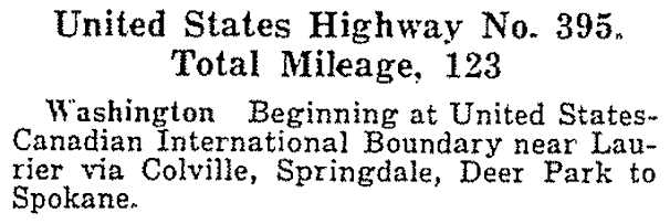
The following excerpt was from AASHO's Apr. 1927 route log: |
|
|
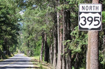
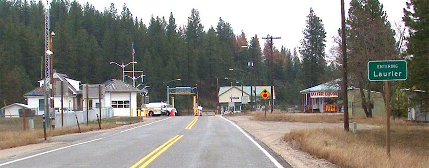
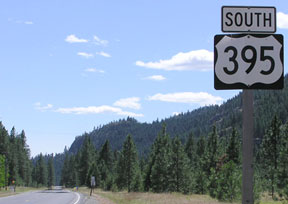
US 395 was an original 1926 route, and ever since then its north end has been at Laurier -- which is not so much a town as it is simply a port of entry. This photo shows the last northbound US 395 shield, which was about 10 miles south of the Canada line:
|
Elbert, July 2008
|
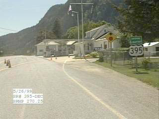
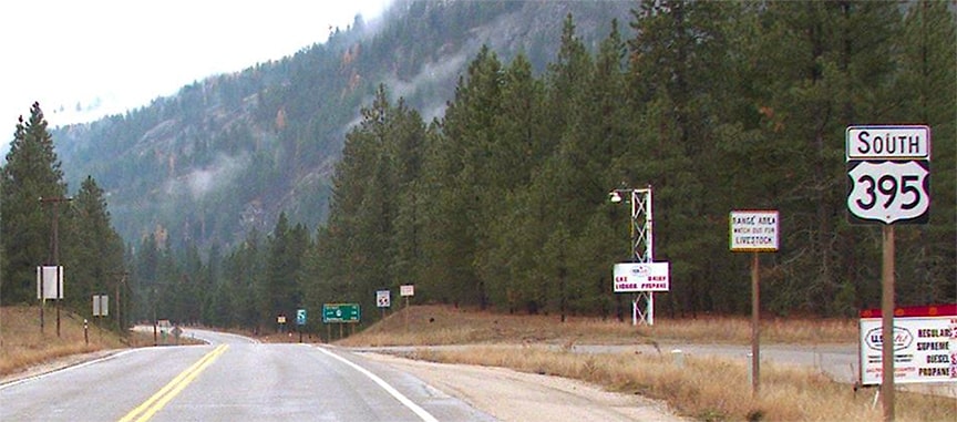
This series of photos shows signage approaching the border at the north end of US 395:
|
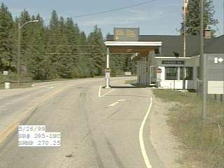
SRweb, 1999
|
Sometime in the 2000s, the customs facility on the Canada side was replaced and upgraded:
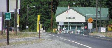
Elbert, July 2008
|
SRweb, 2021
|
The photo below shows what was formerly the first US 395 sign, heading south out of Canada...
SRweb, 1999
|
...but that was gone by 2008. Since then, the first confirming marker has been replaced a few times:
Elbert, July 2008
|
At that point, travelers are 111 miles north of US 395's original south terminus in Spokane:
SRweb, 2021
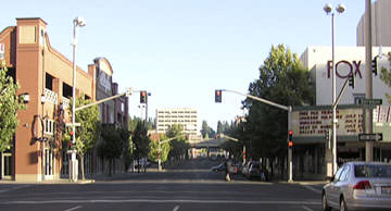
c. 1927, Rand McNally
|
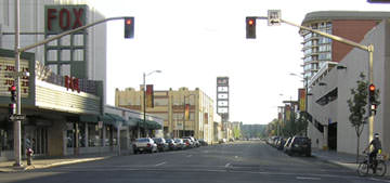
That was once westbound US 10, and to the right on Monroe was the south beginning of US 395 (which is routed along Division Street today, not Monroe).
The original US 395 was quite a short route, but in 1934 the designation was extended south from Spokane, all the way down to San Diego, increasing the length of the route to nearly 1500 miles. Then in 1979 California obtained approval to truncate the south end of US 395 to its junction with I-15, at what is now the outskirts of Hesperia. Here is that agenda item from AASHTO's meeting in June of that year: |


|
This photo represents the south beginning of US 395 for northbound I-15 traffic. This is a partial interchange where traffic exits right but then flies over the freeway via the overpass just visible in the distance:
|
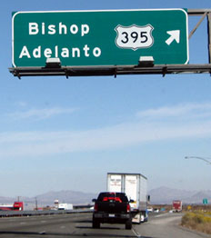
Field/Nitzman, Nov. 2008
|
In 2023 the road was under construction, and the exit arrow had been covered with duct tape:
Sanderson, Oct. 2023
|
|
Things are a little different for southbound traffic; drivers heading south on one highway but wanting to go north on the other must use the Joshua Street interchange:
|
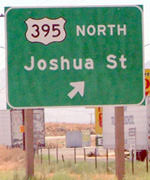
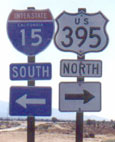
Sanderson, July 2004
|
|
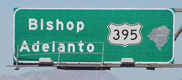
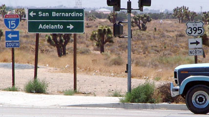
After exiting there from southbound I-15, travelers should turn west (right) on Joshua to reach US 395, although there has not been any signage to that effect in years. At the junction with 395 itself, signage was posted historically...
|
Pezeshkpour, Nov. 2000
|
Sanderson, July 2004
|
|
...but it appears that 395 signs get stolen a lot, and there were none at that location at the time of my 2023 visit. The only indication that I was at US 395 was an overhead street blade:
|
Sanderson, Oct. 2023
|
|
The road to the south (left) from Joshua serves as an onramp to southbound I-15. But if one were to take a right turn there, historically the first northbound confirming marker was posted immediately...
|
Field/Nitzman, Nov. 2008
|
Sanderson, July 2004
|
|
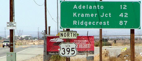
...however those signs are gone now too. At the time of my visit, the first northbound confirming assembly was seven miles north of Joshua, just north of the junction with CA hwy. 18 in Victorville:
|
Sanderson, Oct. 2023
|
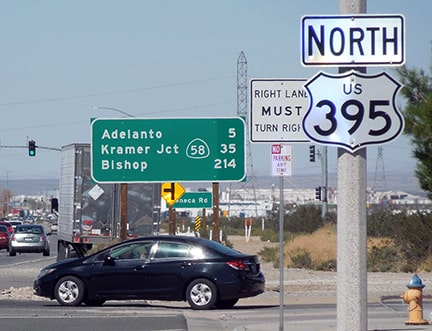
Incidentally, "Kramer Jct" is shown on some maps as "Four Corners"; it is at the junction of US 395 and CA hwy. 58.
Research and/or photo credits: Chris Elbert; Andy Field; Cameron Kaiser; Alex Nitzman; Ali Pezeshkpour; Dale Sanderson; Michael Summa
Page originally created 2001;
last updated Dec. 7, 2023.
last updated Dec. 7, 2023.
