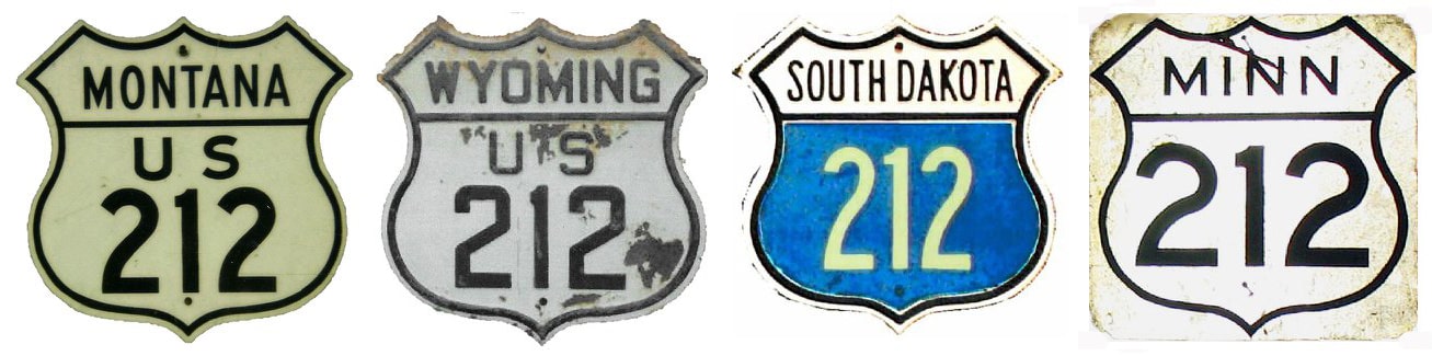
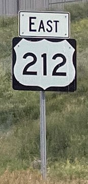
End of US highway 212 |
 |
|
1926-1934
|
1934-1939
|
1939-1961
|
|
1961-1979
|
1978-1990
|
1990-present
|
Summa
|
Mileage: in 1989 AASHTO listed a figure of 949 miles for US 212. That exactly matches our own 2020 measurement, which yielded 949.0 miles. Historically, when it went to St. Paul, US 212 was 968.3 miles long.
|
|
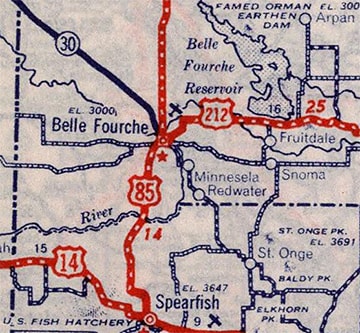
Originally the west end of US 212 was at its junction with US 85 in Belle Fourche (not far from the geographic center of the 50 states):
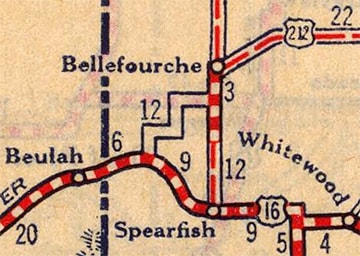
c. 1927, Rand McNally
Today US 212 skirts the north side of town, but originally highway traffic was directed along what is now poorly-marked as Business 212. Coming from the east, that route follows the railroad into town, then north on 10th Avenue, then west on State Street. Originally US 85 may have been routed entirely along 6th Avenue:
|
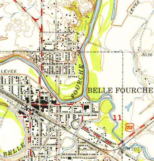
USGS topo: c. 1956; basemap: c. 2015
|
|
Certainly by the time of the topo map shown there, US 85 traffic was still using 6th to the north of State. In either case, the west end of US 212 would have been on State at 6th. This photo was looking west on State: northbound US 85 was to the right on 6th, and southbound was straight ahead, so US 212 ended here:
|
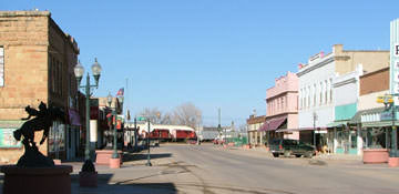
Sanderson, Mar. 2004
|
Today, US 85 is one block ahead; State ends there because the railroad runs through on the far side (some railcars are visible in the distance). The business route goes north (right) with US 85 to reconnect with modern US 212.
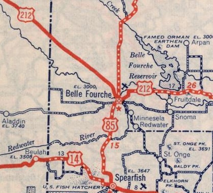
c. 1939, Rand McNally
|
c. 1940, Rand McNally
|
|
As those maps illustrate, US 212 was extended west out of Belle Fourche in 1939. Its new terminus was in Miles City (at Broadus MT, US 212 was routed north along what is now MT hwy. 59). Then in 1961, US 212 assumed its current form: it was truncated at Broadus and instead extended westerly through Billings (maps and more info on the US 312 page). From there it follows what was originally US 12 (and later US 312) through Red Lodge to its terminus at Silver Gate, which is at the northeast entrance of Yellowstone.
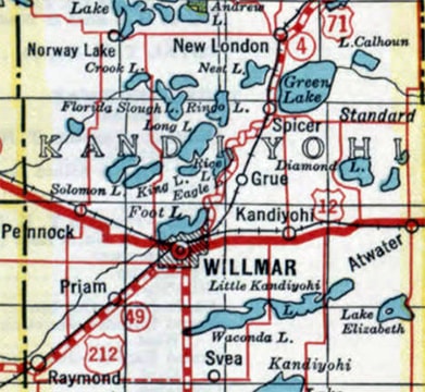
The east end of US 212 was originally in Willmar (a city it no longer serves at all). From Montevideo MN, US 212 was originally routed due east (via what is now MN hwy. 7) to Clara City. There it went northeast on modern MN 23 to Willmar:
|
c. 1933, MN DoT
|
|
Today at 45th Street, MN 23 veers east on a newer bypass around the city, but US 212 would have continued northeast on what is now CR 15. That soon curves east as 19th Avenue, which then meets 1st Street (historic US 71). From there, the US 212 designation likely would have been overlapped with US 71 north on 1st to US 12. This photo shows that spot:
|
Castleman, 2003
|
There we are looking north on 1st at Litchfield Avenue. Litchfield was probably the old US 12 through Willmar, so this is where US 212 would have ended. These days, US 12 traffic is routed onto a bypass about two blocks ahead. However, the bridge ahead flies over this bypass (as well as the railyards), so there is no direct access to US 12 there -- that is why the sign points left and says "TO US 12".
In 1934, the US 212 designation was removed from the Montevideo-Willmar segment, and the route more or less began to assume its modern path: southeast from Montevideo to Granite Falls, then east to Chaska and up to St. Paul. Minnesota's 1934 map showed the US 212 designation extended past St. Paul and all the way to the Wisconsin line at Stillwater (using essentially what are now MN hwys. 5 and 36). However, AASHO never approved that extension, and US 212 was never actually signed that far east. The next year's map showed the US 212 designation ending in St. Paul, where it remained for about 45 years.
In 1934, the US 212 designation was removed from the Montevideo-Willmar segment, and the route more or less began to assume its modern path: southeast from Montevideo to Granite Falls, then east to Chaska and up to St. Paul. Minnesota's 1934 map showed the US 212 designation extended past St. Paul and all the way to the Wisconsin line at Stillwater (using essentially what are now MN hwys. 5 and 36). However, AASHO never approved that extension, and US 212 was never actually signed that far east. The next year's map showed the US 212 designation ending in St. Paul, where it remained for about 45 years.
|
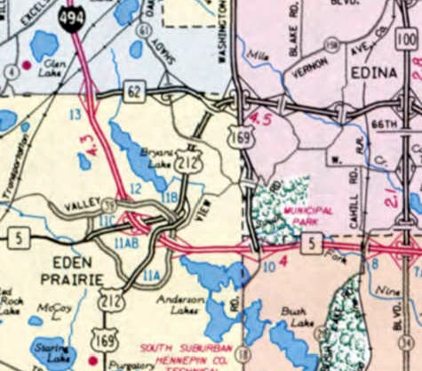
In 1978, the US 212 designation was shortened such that it no longer served central Minneapolis or St. Paul, and it no longer connects with its "parent", US 12. At the time, US 169 went through downtown Shakopee, then crossed the river and joined with US 212 in Chanhassen. From there the two routes were co-signed northeast along Flying Cloud Drive, but then US 212 signage quietly disappeared shortly beyond its crossing of I-494 in Eden Prairie, approximately at the intersection of Flying Cloud and Valley View Road:
|
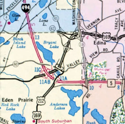
c. 1981, MN DoT
|
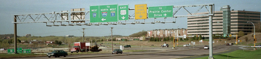
Castleman, Spring 2004
|
The photo above was looking northeast on Flying Cloud at Valley View (CR 39), and here is an enlargement of the sign visible in the distance at far right:
|
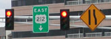
Otterson, May 2004
|
|
That "East 212" sign formerly read "North US 169 / End US 212". US 212 has long been planned to come in via the freeway at far left (currently MN 5), and until US 169 was rerouted, it was assumed that 212 would meet 169 there (hence the endpoint). But US 212 traffic was not routed onto the former MN 5 expressway nearly as soon as originally anticipated. As it turned out, US 169 ended up moving long before US 212 did: in 1990, US 169 was rerouted off Flying Cloud and along its present course. So US 212 was extended northeast a bit along former 169 to its current terminus at modern 169, on the line between Eden Prairie and Edina:
|
c. 1991, MN DoT
|
As of 2023, the last eastbound trailblazer looked like this:
Lilja, Jun. 2023
|
|
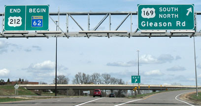
This photo shows the "End" signage, but the "Begin" sign was a bit misleading: although eastbound US 212 does become eastbound MN 62 ahead, 62 does not "begin" here -- it also goes to the west (although drivers cannot access that direction from this partial interchange):
Nitzman, Apr. 2007
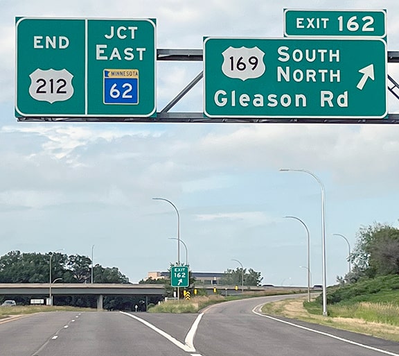
The verbiage on that panel was changed sometime between 2019-2021:
|
Lilja, Jun. 2023
|
|
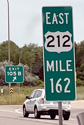
Despite the word "End" there, US 212 actually continues ahead for about another mile before joining MN 62 traffic, and there is one more reference to US 212 ahead, just before the merge point:
|
Lilja, Jun. 2023
|
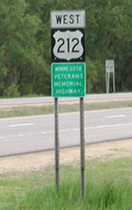
The next shots were from the opposite direction, and they show the east beginning of US 212 as seen from westbound MN 62:
|

Castleman, Spring 2004
|
Barnes, Sep. 2023
|
|
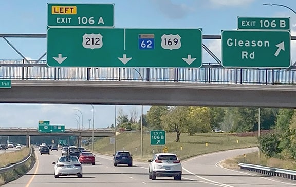
Here we are on northbound US 169, at the exit to the east beginning of US 212:
|
Nitzman, Apr. 2007
|
|
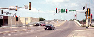
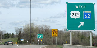
Drivers exiting there will soon see the first westbound confirming assembly:
|
Otterson, May 2004
|

Huntoon, Jul. 2024
|
Research and/or photo credits: Joseph Barnes; Monte Castleman; Chris Elbert; Perry Huntoon; Patrick Lilja; Alex Nitzman; Bob Otterson; Dale Sanderson; Michael Summa
Page originally created 2003;
last updated Jul. 9, 2024.
last updated Jul. 9, 2024.
