Historic north endpoints of US highway 61
|
1927-1990
|
 |
|
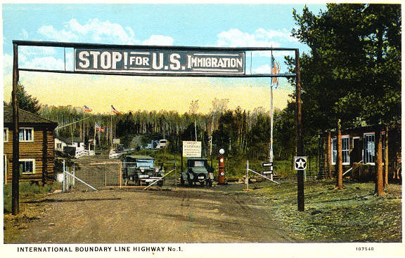
US 61 originally continued north from its current terminus (along present-day state highways and county roads) through Duluth, and then along the scenic North Shore of Lake Superior, all the way to the Canada border. Until the 1960s, US 61 followed what is now Road 17 to Mineral Center, then modern Road 89 to Pigeon River. The image on this postcard was taken sometime around 1925:
|
|
|
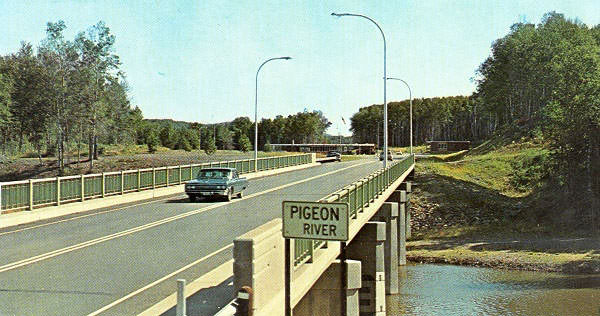
That gives a good feel for what the border crossing looked like, back when the US route system was young. This next one is looking north. It is undated, but the car is a mid-1950s model:
|

|
|
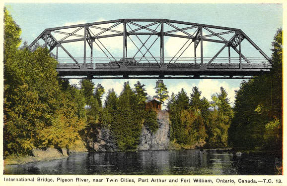
Here is a card showing that old bridge in profile. It was taken looking downstream, so the north beginning of US 61 was to the right:
|
|
|
In 1963, US 61 was re-routed such that it went through Grand Portage to a new port of entry about four miles northeast of there (in other words, the same route as modern MN hwy. 61). This postcard was probably from around 1970:
|
|
That was looking south into the US, at the former north beginning of US 61. Monte reports the view has not changed much, except that the building on the right is gone now. The National Park Service map for Grand Portage National Monument does a good job of showing both former segments of US 61:
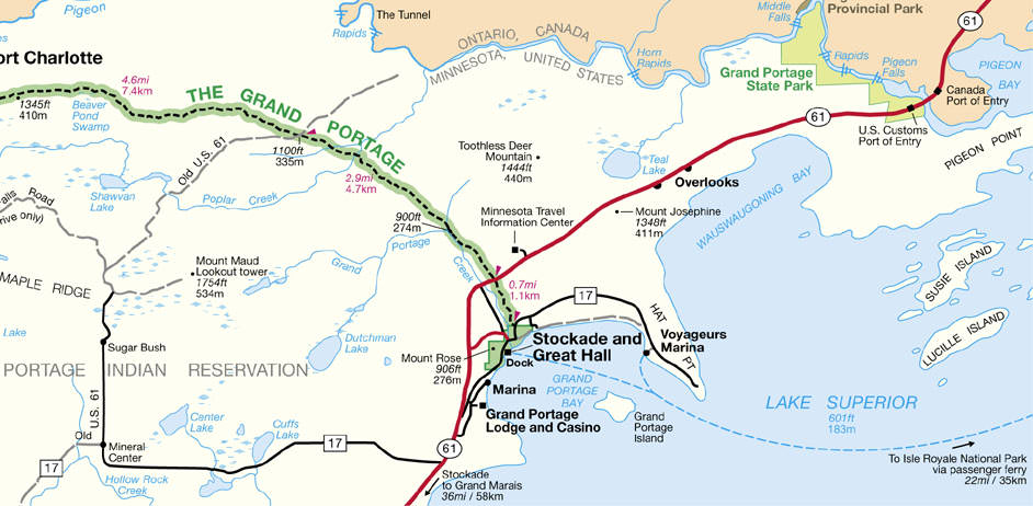
Notice the route of "Old US 61" (along the left side). It is not shown going all the way to the border because it is now a private road at that point. Of course, MN hwy. 61 could also be labeled "old US 61". For more info and photos, here are a couple good external sites:
Research and/or photo credits: Monte Castleman; Carl Moore; Steve Riner; Dale Sanderson
Page originally created 1999;
last updated Nov. 13, 2023.
last updated Nov. 13, 2023.
