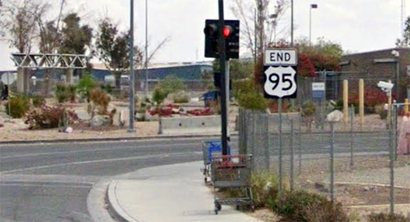
End of US highway 95 |
 |
Summa
|
Summa
|
|
1926-1927
|
1927-1939
|
1939-1960
|
1960-present
|
|
Mileage: in 1989 AASHTO listed a figure of 1689 miles for US 95... however, that included the mileage of US 95's associated business/spur/alternate routes. According to the state subtotals on AASHTO's 1989 spreadsheet, mainline US 95's actual end-to-end total at the time was 1554 miles. That is reasonably close to our own 2020 measurement, which yielded 1561.9 miles (reroutings and realignments likely explain the difference).
|
|
|
The north end of US 95 has been at the Canada border in Eastport ID since the beginning. This 1927 map shows that it might have gone to Porthill instead...
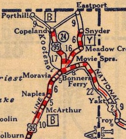
c. 1927, Rand McNally
|
...but that was probably an error, as official route logs have always listed Eastport as the terminus, and maps from a few years later are more explicit about that:
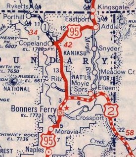
c. 1940, Rand McNally
|
|
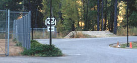
In 2000, there was no "End" sign. As a matter of fact, there wasn't even a town -- Eastport is simply a port of entry situated in the Moyie River Valley. This photo shows the north end of US 95 (the name of the British Columbian border crossing is Kingsgate):
|

Taylor, 2000
|
|
The sign at left says "Return to USA" and points left; if a driver turns that way, they will see one of the first southbound US 95 signs:
|
Taylor, 2000
|
|
The 1926 plan called for US 95 to continue south from Weiser ID, ending in Fruitland, at its junction with US 30. Several maps from the late 1920s and early '30s showed this, as well as a short "US 630" bridging the river across from Weiser. However, roads in the area were probably never signposted this way...
|
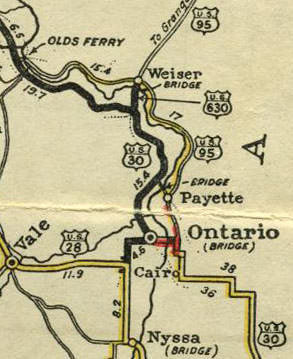
c. 1927, Terminal Hotels
|
...because already by April 1927, a US 30N had replaced US 95 from Fruitland to Weiser, as well as US 630 from Weiser across to US 30 in Oregon (more info on this page). This map shows how area highways were actually signed (with the exception of "US 30S", which was a map error):
|
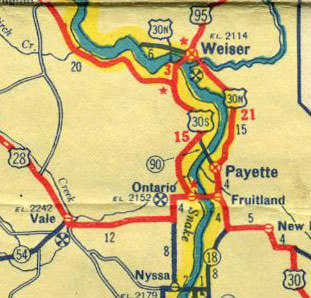
c. 1937, Texaco
|
|
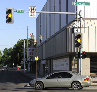
So the first signed south end of US 95 was in Weiser. This photo shows the historic junction there, as seen from what was formerly southbound US 95, which followed State Street to this point and ended. Westbound US 30N was probably to the right on Main Street, although some maps indicate that it may have gone ahead two blocks before turning right on Commercial Street. Regardless, eastbound US 30N was to the left (a movement that cannot be made anymore, because Main is one-way through downtown. Today the next block [Idaho Street] is used for eastbound traffic.) Much later, when Spur 95 was introduced, its north beginning was to the right, and the signs shown in these photos are leftovers from that arrangement:
|
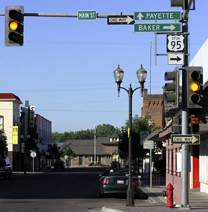
Elbert, July 2005
|
|
This next photo was looking west on Main at State. This was formerly westbound US 30N (which continued either by turning left or going straight ahead). Northbound US 95 originally began to the right. At the time, Spur 95 (the designation that now serves in place of US 30N south and west from here) was well-signed through Weiser.
|
Elbert, July 2005
|
|
Today in Weiser, Spur 95 goes a few blocks beyond its original north end, because in the 1990s US 95 was rerouted such that it bypasses downtown to the east via East 7th Street. This photo was looking east on Main at 7th, and it shows where Spur 95 ends now. Historically, this was eastbound US 30N, and later southbound US 95, both of which continued to the right:
|
Elbert, July 2005
|
|
In 1939, US 95 was extended about 1000 miles further south from Weiser, to end at the junction with US 60-70 in Blythe CA:

c. 1940, Rand McNally
|
CA Highways and Public Works magazine, date unknown
|
The preceding photo was looking west on Hobsonway, which carried US 60-70 traffic. To the right on Intake Boulevard was the south beginning of US 95. The following shot was looking north at the same intersection, about an eighth-mile north of the I-10 interchange. Hobsonway is the crossroad, so for about 20 years the south beginning of US 95 was straight ahead:
Field, Nov. 2000
|
|
In 1960 the US 95 designation was extended to the Mexico border (via the AZ hwy. 95 shown on the previous map). Originally, heading south from Yuma AZ, US 95 was routed through San Luis along Main Street. It had to be, because at the time that was practically the only road in town, as can be seen on the 1965 topo map, shown here:
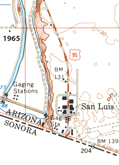
c. 1965 USGS topo and c. 2022 basemap
|
By the turn of the century, just before reaching the customs station, US 95 traffic was directed east for one block on "A" Street (now renamed to Urtuzuastegui Street), then south again on First Street (now renamed to William Brooks Avenue), where an "End" assembly was posted:
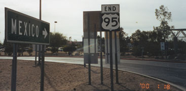
Faye/Sandy, Jan. 2000
That shot was looking south on Brooks (just south of Urt), where the road curves to the east again, towards the border crossing. The front side of the sign assembly behind that "End" sign is visible in this photo:
Faye/Sandy, Jan. 2000
|
|
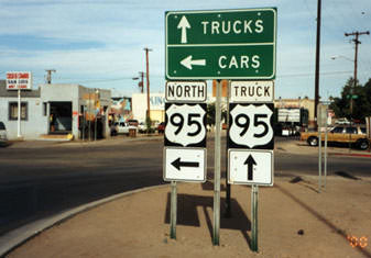
That was heading north out of Mexico. At the time, trucks were directed north on Brooks for one block to "B" Street, then west to Main, but cars followed the mainline routing, which was west (left) for a block on Urt and then north again on Main. After making that turn onto Main, the first northbound sign is posted:
|
Karners, Dec. 2011
|
Sanderson, Oct. 2023
|
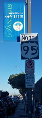
As of 2023, that sign was still there on Main, even though for quite some time now additional signage has been posted to keep most border traffic off Main (as can also be seen on the animated map above). Drivers heading northbound from the border are directed to follow Brooks, and on that street just north of Urt, twin signs proclaim the beginning of US 95:
Sanderson, Oct. 2023
|
Each of those signs are shown close-up in the photos below:
|
Sanderson, Oct. 2023
|
Sanderson, Oct. 2023
|
|
From there, drivers now go all the way up to "D" Street before cutting over to Main.
Southbound US 95 traffic is now directed onto Archibald Street (one block to the west of Main). When that change was first implemented, an "End" assembly was actually posted near the gore point... |
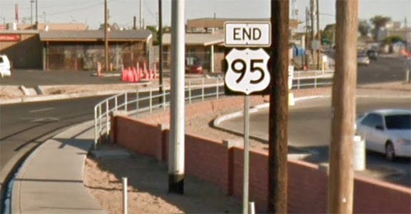
Google Maps Street View, May 2015
|
|
...but by 2018 that had been corrected, as shown here (and in the background were visible the last southbound trailblazers):
|
|
|
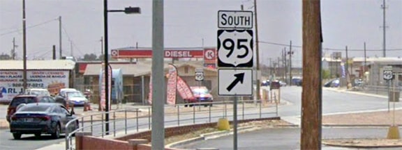
A few blocks ahead the last southbound US 95 signs direct drivers to turn east on Urt...
|
Sanderson, Oct. 2023
|
|
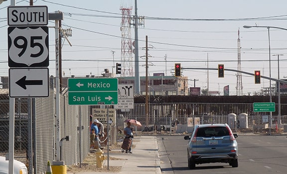
...and the large green sign in the background is shown close-up here:
|
Sanderson, Oct. 2023
|
|
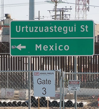
Historically, after making that left turn, drivers were immediately greeted with a properly-placed "End" assembly (but unfortunately this was gone by the time of my 2023 visit):
|
Google Maps Street View, Mar. 2021
|
There traffic can either veer right into Mexico, or else enter a roundabout where the options are to continue east on Urt or north on Main. For more info, please see U.S. 95 and Idaho's North and South Highway, by Richard Weingroff.
Research and/or photo credits: Chris Elbert; Andy Field; Karin and Martin Karner; Dale Sanderson; Faye/Sandy; Michael Summa; Stephen Taylor
Page originally created 2000;
last updated Dec. 18, 2023.
last updated Dec. 18, 2023.
