End of US highway 8 |
 |
|
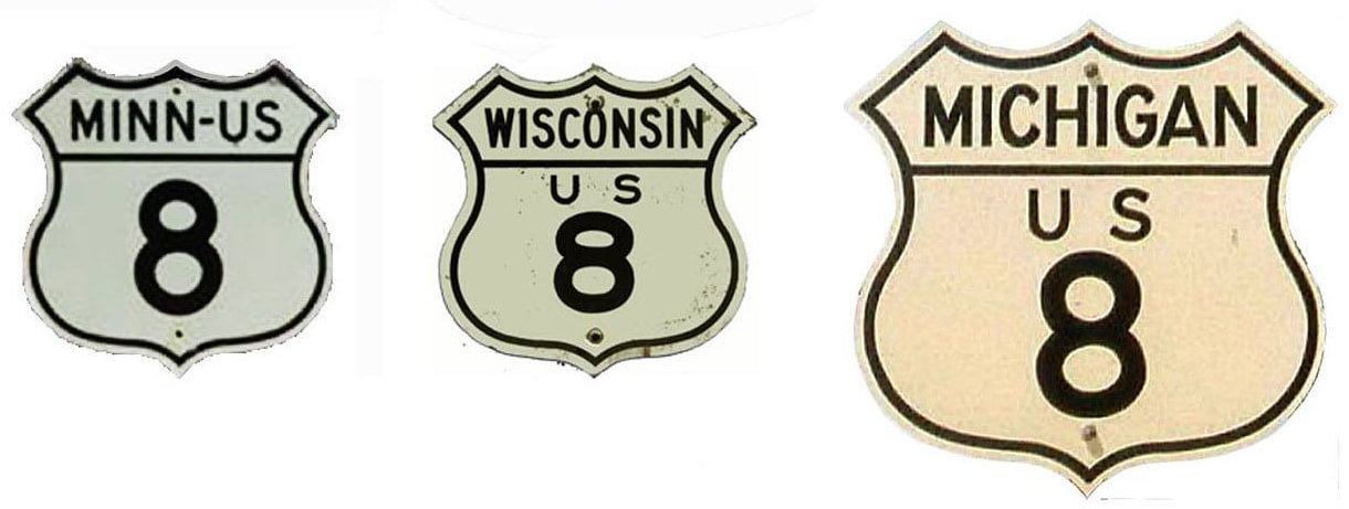
1926-1929
|
1929-1930
|
1930-1979
|
1979-present
|
Summa
|
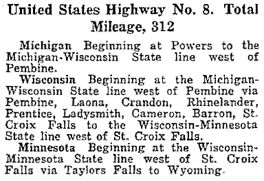
Mileage: in 1989 AASHTO listed a figure of 281 miles for US 8. That closely matches our own 2020 measurement, which yielded 279.6 miles. Historically, when it went to downtown Minneapolis, US 8 was 308.6 miles long.
|
|
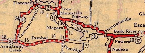
US 8 was originally supposed to begin at US 41 in Powers MI. The following excerpt is from AASHO's April 1927 route log:
|
The route was to be signed with US 2 west to Hermansville, then southwesterly through Faithorn, crossing the Menominee River near there into Wisconsin; it was to connect with its current route at or near Pembine WI:
c. 1927, Rand McNally
|
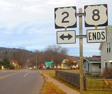
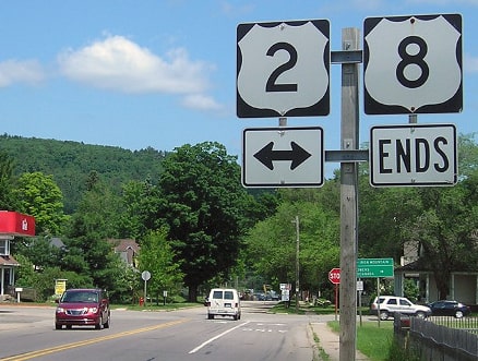
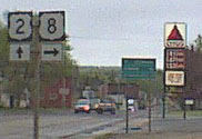
However, despite what that map showed, a direct road between Pembine and Hermansville has never been built. So when US 8 was first actually implemented, it appears to have been routed north from Pembine with US 141 to US 2 between Iron Mountain and Quinnesec MI. It is unclear whether it was co-signed east with US 2 to Powers -- or actually, whether it was even signed at all before 1929. At any rate, it was only a few years before the east end of US 8 was shifted to its current terminus at Norway. These photos were taken looking north on Brown Street, approaching 7th Avenue (US 2)...
Dienhart, Dec. 2017
|
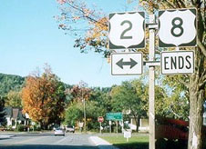
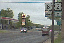
Morrison, June 2018
|
Camp, Sep. 2001
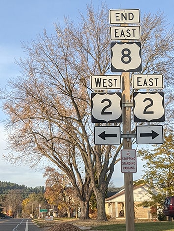
...but that assembly has since been moved and replaced with a new design:
|
|
Morrison, June 2018
|

|
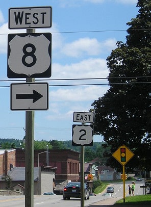
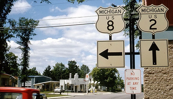
...and here we are looking west on 7th approaching Brown:
Allen, 2002
|
Lindsay, 1965 (linked to source)
|
Allen, June 2009
|
|
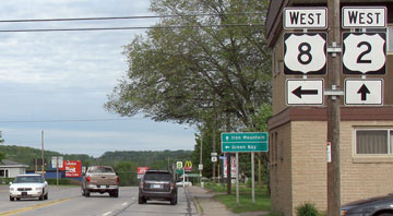
If a traveler takes that left turn, they will soon see the first westbound marker:
|
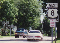
Mortell, 1996
|
Morrison, June 2018
|
|
The original west end of US 8 was at US 61 in Wyoming. From Chisago City, US 8 followed what would later become MN hwy. 98 to Wyoming, and what is now Chisago County route 22:
|
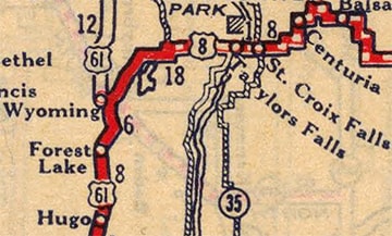
c. 1927, Rand McNally
|
|
In town, this is apparently known as Rumohr Avenue or Wyoming Trail. The view in this photo was looking west on CR 22:
|
Castleman, Oct. 2005
|
That was the original west end of US 8. As of this writing, US 61 still serves Wyoming; it runs along what is locally called Superior Street, Forest Boulevard, and/or Chisago CR 30. In 1930 the west end of US 8 was extended to Minneapolis. Over the years it had a couple different termini there, as we will see below. But first, an interesing note about dates: it was 1976 when Minnesota obtained permission from AASHTO to truncate the US 8 designation out of Minneapolis. Here is that agenda item from the minutes of their meeting in July of that year...
|
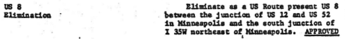
...but despite that, I have heard that US 8 remained in Minneapolis for another five years. From 1930 all the way to 1978, US 8 was signposted to a terminus at the intersection of 3rd and Washington (see the Minneapolis page). Then from 1978-1981 the terminus was truncated to the intersection of Broadway and New Brighton Boulevard. This photo was looking east on Broadway:
|
Castleman, May 2004
|
To the left, New Brighton heads off at a northeasterly angle -- the car turning that direction is at the former west beginning of US 8. It is unusual that the US 8 designation ended here, since Broadway was not designated as a highway. But there is an interchange with I-35W just to the left, and since New Brighton extends only another quarter-mile to this intersection, maybe the state figured they might as well just maintain the entire road...
|
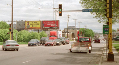
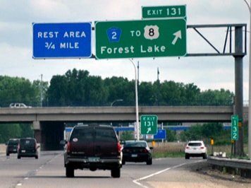
...but that lasted only about three years, anyway: in 1979 the US 8 designation was truncated to its current location in Forest Lake. This photo was taken where US 8 merges with I-35 at partial-interchange 132:
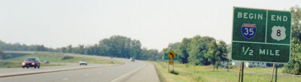
Osbaldeston, Sep. 2002
|
Kasprzyk, summer 2016
|
|
The flyover in the distance is also visible in this photo, which was taken from northbound I-35 at the west beginning of US 8:
|

Castleman, summer 2002
|
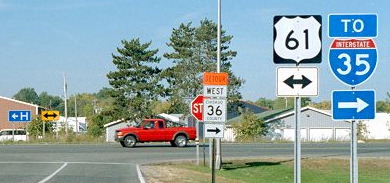
Traffic on southbound I-35 does not have direct access to US 8. Rather, drivers are directed to exit at Broadway, head east, and then north:
|
Kasprzyk, summer 2016
|
|
Drivers exiting there will soon see the first eastbound marker:
|

Nitzman, Apr. 2007
|
The signage in the distance is in reference to US 8's first junction, which is with US 61. Jeff Morrison's page has more photos and commentary regarding this terminus.
|
Research and/or photo credits: Patrick Allen; Christopher Bessert; Barry Camp; Monte Castleman; Paul Dienhart; Bruce Kasprzyk; Jim Lindsay; Tyler Mace; Jeff Morrison; Robert Mortell; Alex Nitzman; Greg Osbaldeston; Steve Riner; Dale Sanderson; Michael Summa
Page originally created 2002;
last updated Dec. 11, 2023.
last updated Dec. 11, 2023.
