End of US highway 27 |
 |
Summa
|
Summa
|
|
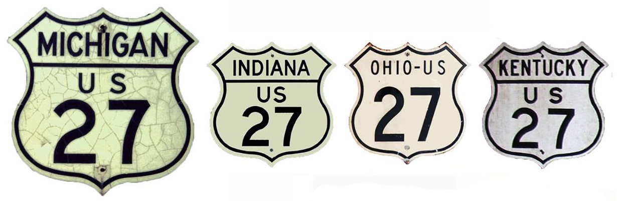
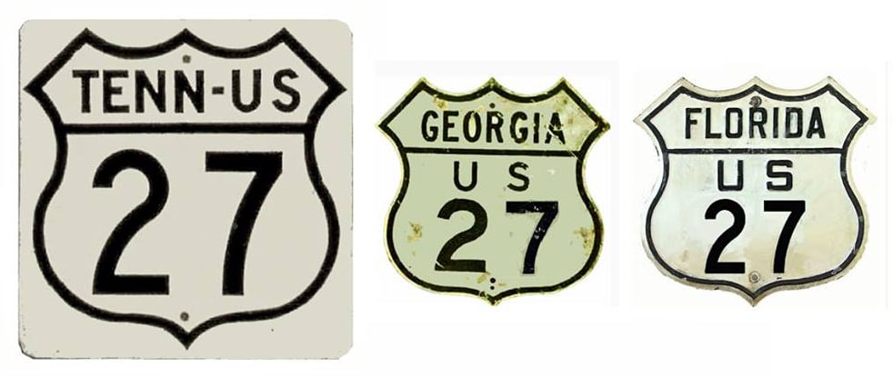
1926-1927
|
1927-1934
|
1934-1937
|
1937-1948
|
|
1948-1957; 1959-1961
|
1957-1959
|
1961-1999
|
1999-present
|
Mileage: in 1989 AASHTO listed a figure of 1865 miles for US 27... however, that included the mileage of US 27's associated business/alternate routes. According to the state subtotals on AASHTO's 1989 spreadsheet, mainline US 27's actual end-to-end total was 1627 miles... but at the time, US 27 still ended in Grayling. Since then it has been truncated to Ft. Wayne, and our own 2020 measurement yielded 1356.8 miles. At the time of its historic maximum extent (to St. Ignace) US 27 was 1717.8 miles long.
|
When the US routes were originally commissioned in 1926, US 27 continued north of Grayling to its end at US 23 in Cheboygan:
|
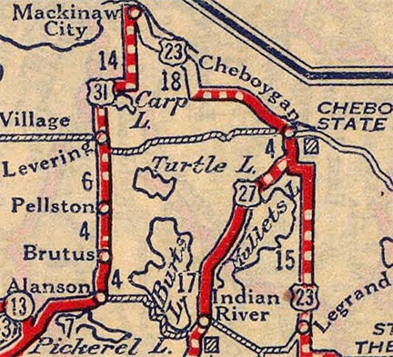
c. 1927, Rand McNally
|
Reynolds, Sep. 2002
|
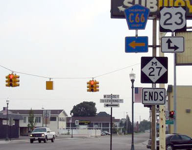
The modern end of M-27 is the historic end of US 27. By 1937, the US 27 designation had been extended with US 23 into Mackinaw City. Then, after the Mackinac Bridge was completed in late 1957, US 27 was signed over it, ending at US 2 in St. Ignace, on the Upper Peninsula. That lasted only about two years, until I-75 was routed over the Bridge: at that point, US 27 was truncated back to Mackinaw. But that did not last long, either: in 1961, all of US 27 north of Grayling was decommissioned. In 1974, initially Michigan and Indiana jointly requested that AASHTO decommission the US 27 designation north of Ft. Wayne, but then Michigan changed their mind, so the request was denied:
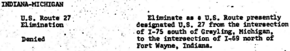
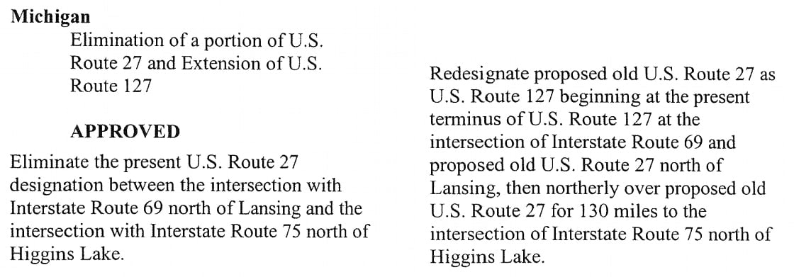
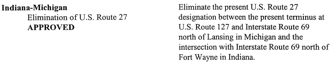
After another 25 years passed, the same idea was proposed, except this time it included a request to extend US 127 north along the former US 27. Following are excerpts from the minutes of AASHTO's two meetings held in 1999:
|
|
|
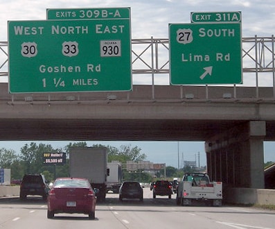
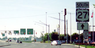
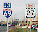
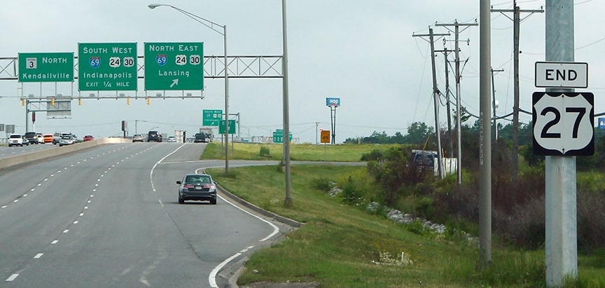
So since then the northern terminus of US 27 has been in Ft. Wayne. This shot was taken from southbound I-69:
|
Morrison, July 2017
|
|
That part of I-69 was concurrent with US 27, which continued by taking this exit to southbound Lima Road. But now that interchange marks the north beginning of US 27. Similar overhead signage exists for the opposite direction (northbound I-69), and upon taking that exit, the right turn to the beginning of US 27 is marked thus:
|
Karners, Jul. 2010
|
|
This shot was taken looking south on Lima:
|
Mortell, 2001
|
I-69 is just ahead, and that is where US 27 actually begins; on the far side is the first southbound confirming assembly:
|

Karners, Jul. 2010
|
These photos were taken looking the opposite direction (north on Lima):
McDowell, 2000

Karners, Jul. 2010
|
Lintz, Jun. 2014
|
|
In the distance is the interchange with I-69, which marks the actual north end of US 27... although there is at least one US 27 sign further north which as of 2015 had continued to escape notice -- this was in Auburn IN:
|

Turner, Sep. 2015
|
That first "End" sign above was probably posted in 1999, when the removal of US 27 from Michigan was approved. However, until 2002 US 27 was still co-signed with I-69 in Michigan, north from the Indiana line to Lansing, and from there north on its own to I-75 near Grayling.
|
The original south end of US 27 was in Cincinnati. But already by the next year US 27 may have been informally extended to Lexington KY. In Oct. 1927 it was officially approved for extension to Chattanooga. Here is that agenda item from the minutes of AASHO's executive committee meeting:
|
In 1934 the designation was lengthened further south, to Tallahassee.
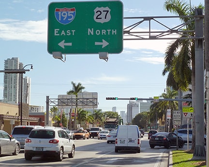
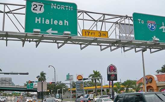
US 27 was extended all the way down to Miami in 1948, mostly along what had been state routes. Ever since then, US 27 has been routed past Hialeah on Okeechobee Road, and then due east on NW 36th Street, ending at Biscayne Boulevard (US 1): |
c. 1947, FDoT
|
Here are some of the "End" assemblies that have been posted at that intersection over the years:
Summa, 1975
|
Field, 2000
|
Karners, Jan. 2010
|
|
That last sign was not MUTCD-compliant; the shield looked like it had jowls. Fortunately, it was replaced with a standard shield in about 2012. However, as of 2017, the US 1 signs just ahead were still the ugly kind:
|
Karners, Dec. 2016
|
Karners, Dec. 2016
|
|
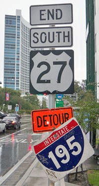
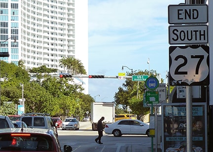
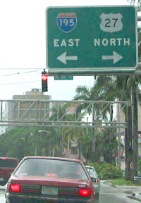
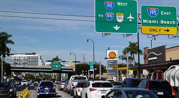
That is where US 27 ends today, but drivers continuing east from this intersection end up on I-195 (the Julia Tuttle Causeway) over Biscayne Bay to Miami Beach.
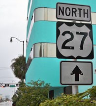
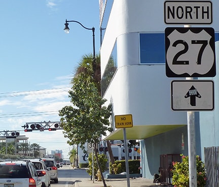
These photos show the south beginning of US 27 as seen from southbound US 1: |
Cozart, Dec. 2003
|
Karners, Dec. 2016
|
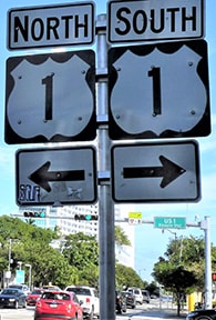
The view from the opposite direction (north on US 1) changed in about 2011 -- formerly there was a large sign bridge that pointed to the beginning of US 27, but there is no longer any reference to that route:
Karners, Jan. 2010
|
Karners, Dec. 2016
|
|
Assuming a driver is alert enough to make that left turn, they are immediately greeted with the first northbound confirming marker, which has also had jowls since at least 2010:
|
Karners, Jan. 2010
|
Karners, Dec. 2016
|
Research and/or photo credits: Christopher Bessert; Justin Cozart; Andy Field; Adam Froehlig; Karin and Martin Karner; Josh Lintz; Shawn McDowell; Jeff Morrison; Robert Mortell; Brian Reynolds; Dale Sanderson; Michael Summa; Charles Turner
Page originally created 2000;
last updated Jan. 7, 2024.
last updated Jan. 7, 2024.
