End of US highway 270 |
 |
|
1930-1931
|
1931-1934
|
1934-1937
|
1937-1980
|
1980-present
|
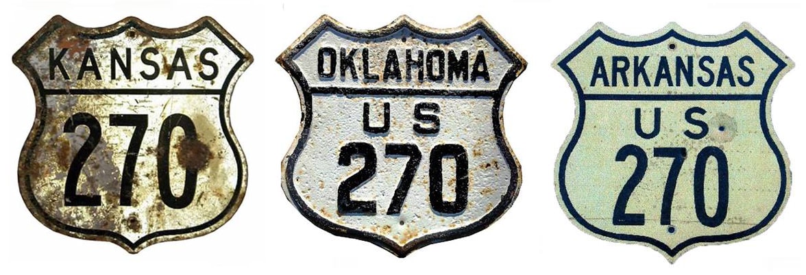
Summa
|
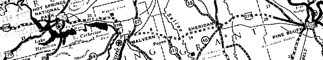
Mileage: in 1989 AASHTO listed a figure of 655 miles for US 270... however, that included the mileage of US 270's associated business routes. According to the state subtotals on AASHTO's 1989 spreadsheet, mainline US 270's actual end-to-end total at the time was 643 miles. That closely matches our own 2020 measurement, which yielded 642.8 miles. Historically, when it went to Syracuse, US 270 was 759.2 miles long.
|

|
The east beginning of US 270 was originally to the left, on Albert Pike Road. For information about its original west terminus, please see the Oklahoma City page.
In 1931 AASHO approved a westward extension of US 270 to Forgan. The 1932 issue of OK DoT's state highway map shows that extension was in progress, but it appears that segment of the route was not considered complete until 1934: |

c. 1937, OK DoT
|
|
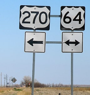
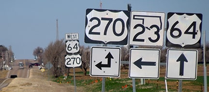
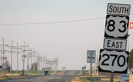
These photos were looking north on westbound US 270 at its "Y" intersection with US 64:
|

Sanderson, Jan. 2003
To the right is a slip ramp leading to eastbound US 64 (just behind the camera). Today the US 270 designation goes straight ahead to the stop sign, then turns left with westbound US 64 through Forgan. But from 1934-1937 that was its west terminus:
|
Sanderson, Apr. 2021
|
|
Here we are looking east on US 64-270:
|
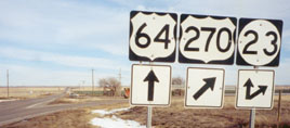
Sanderson, Jan. 2003
Forgan is about a mile behind the camera. Historically to the right was the west beginning of US 270:
|
Sanderson, Apr. 2021
|
|
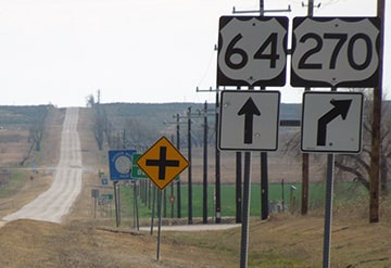
One more perspective: this was looking west on US 64:
|
Sanderson, Apr. 2021
|
Historically the west beginning of US 270 was to the left. Personally I think that should be the case again, because ahead, the remaining 30 miles of US 270 to Liberal is entirely overlapped with other US routes (more below).
|
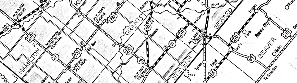
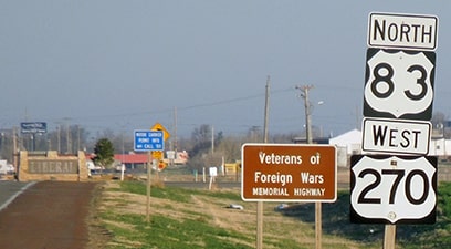
But first: the west end of US 270 was extended to Syracuse in 1937. From Liberal, US 270 formerly went north with US 83 to what is now KS hwy. 51, then west to Hugoton. From there, north on K-25 to Ulysses; west on US 160 to Johnson City; and north on K-27, ending at US 50 in Syracuse:
c. 1938, KS DoT
|
Sanderson, Apr. 2021
|

|
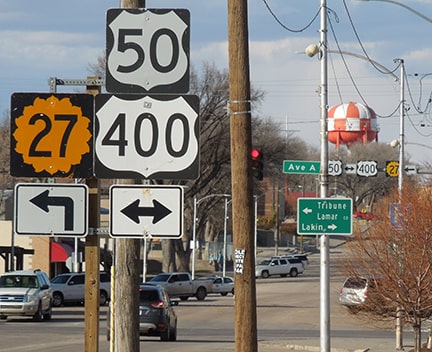
These next shots were taken looking west and east (respectively) on US 50. The west beginning of US 270 was to the south on Main, along today's K-27:
|
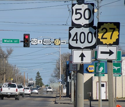
Sanderson, Apr. 2021
|
In 1967, Kansas tried to extend US 270 due north of Syracuse to Goodland, but AASHO denied the request (more info here). The preceding 1985 photo was taken about ten years before US 400 was commissioned, but the US 270 signs were still up, even though the designation had officially been truncated to Liberal by that time.
|

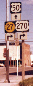
US 270 began at the light ahead, until about 2000. That was when the Liberal bypass was opened to traffic, and US 83-270 traffic was routed onto it. But two decades later there was still a junction sign on southbound Kansas. It was quite faded, but it had been intentionally remounted, even though Kansas had long since been removed from the highway system:
|
Sanderson, Apr. 2021
|

|
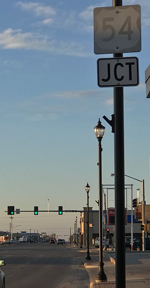
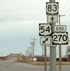
US 270 still ends at its junction with US 54, but its current terminus is about a mile east of the historic endpoint. Here we are looking southwest on Pancake; these signs illustrate how US 83 runs both ways, but US 270 is only to the south (US 54 runs at a severe diagonal compared to the rest of the city, which is why diagonal arrows were used on these assemblies):
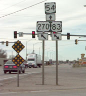
Sanderson, Nov. 2001
|
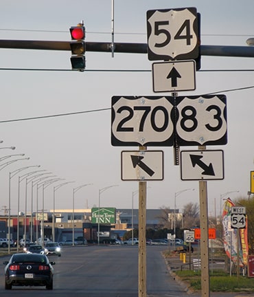
Sanderson, Apr. 2021
This area has several signage errors and oddities. For example, the assembly heading the opposite direction (east on US 54) indicated US 270 began to the left (north), when it actually begins the opposite direction:
|
Sanderson, Apr. 2021
|
|
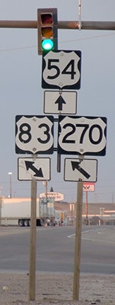
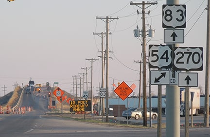
Heading south on the US 83 bypass, signs correctly indicate that US 83 continues ahead, and eastbound US 270 begins ahead:

Sanderson, Nov. 2001
|
Sanderson, Apr. 2021
|
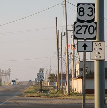
Just south of the junction is the first eastbound US 270 marker...
Sanderson, Apr. 2021
|
|
...but farther ahead, along the three-mile stretch between there and the Oklahoma line, four more reassurance assemblies were posted in Kansas, and they all referenced only US 83. None of them included a reference to US 270 (although, as soon as one crosses the state line, Oklahoma DoT has dutifully posted a US 270 marker along with US 83).
Heading the opposite direction, upon entering Kansas, the first reassurance assembly does include a US 270 marker... |
Sanderson, Apr. 2021
|
|
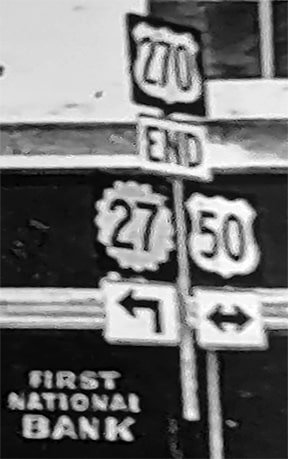
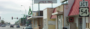
...but the next three trailblazers indicate only US 83. Historically, upon reaching the terminus of US 270 at its junction with US 54, an assembly correctly noted the end of the route...
|
Sanderson, Nov. 2001
|
...but later that assembly was changed to show US 270 continuing ahead with US 83 (instead of terminating at US 54). However, there were no additional US 270 markers ahead:
|
Sanderson, Apr. 2021
|
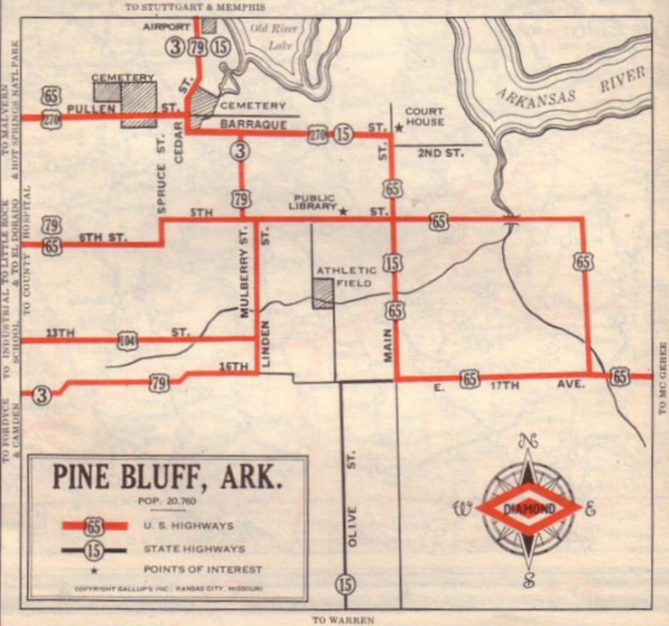
In summary, there is no longer a compelling rationale for the three-mile segment of US 270 in Kansas. It appears that KDoT agrees, because they are clearly not concerned enough with the route to correctly signpost it. Nor is there any good reason for US 270's 20-mile overlap with US 64 in the Oklahoma panhandle. So in my opinion the two states should end the nonsense by truncating US 270 back to its former terminus at Forgan. Meanwhile, getting back to the east end of US 270... in 1934 it was extended to serve Pine Bluff:
c. 1936, AHTD
|
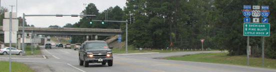
Since then, US 270 has been truncated twice, each time farther out from the city. So its history in Pine Bluff will be described in reverse. Today US 270's terminus is at White Hall (just outside Pine Bluff), at interchange 34 of the I-530/US 65 freeway. This photo was looking southeast on Sheridan Road, at the east end of US 270:
|
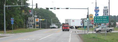
Backlin, Oct. 2007
|
|
That was taken from underneath the I-530/US 65 overpass (Pine Bluff is straight ahead). On the right, next to the traffic signal support mast is a small green sign, which is shown close-up here:
|
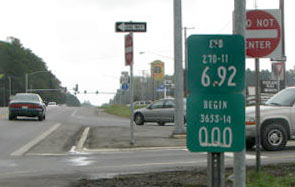
Backlin, Oct. 2007
|
|
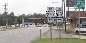
That basically says "End 270; begin 365S". Ahead, Sheridan is designated "AR 365 Spur", but until 1982 it was US 270 that continued that way. In about two miles Sheridan connects with mainline AR 365 (or Dollarway Road), which is historic US 65. This photo shows that intersection:
|
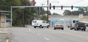
Backlin, Oct. 2007
|
|
The white van was heading southeast on Dollarway (old US 65), and the cars stopped at the light were at what was the east end of US 270 during the 1970s. To the right leads to downtown Pine Bluff. In that photo, the white van just went past the signs shown here:
|

Backlin, Oct. 2007
|
|
Today's AR 365 Spur to the right (Sheridan) was where US 270 began. But when US 270 was first extended eastward to Pine Bluff in 1936, it was signed straight ahead with US 65 into downtown. Ahead, Dollarway curves south to become Blake Street, but US 65-270 continued diagonally along Rhinehart Road, then east on Pullen Avenue:
|
Gallup's, 1937
|
|
At Cedar Street/University Drive, traffic jogged one block south, then continued east via Front Street/Barraque Street. At the courthouse, US 65 turned south on Main Street, but the US 270 designation ended at that intersection. This image was looking north on Main:
|
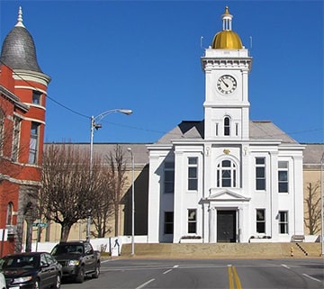
LordWalt, Jan. 2009
|
|
Historically that was northbound US 65, which continued to the left on Barraque. Also to the left was the east beginning of US 270. Traffic jogged up to Pullman, then northwest via Rhinehart and Dollarway, eventually reaching the junction shown here:
|
Backlin, Oct. 2007
|
|
Those signs are a nod to the US routes that formerly ran through here: originally US 65 continued straight on Dollarway, while US 270 split to the left onto Sheridan. Later US 270 was truncated to that point, so its east beginning was to the left. In the background is another assembly identifying the current designations of these roads, shown close-up here:
|
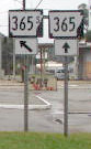
Backlin, Oct. 2007
|
|
Old US 65 is now AR 365, and the east beginning of AR 365 Spur is a former east beginning of US 270. If a driver heads that direction, they will soon come to the current east beginning of US 270:
|
Backlin, Oct. 2007
|
That is still eastbound on Sheridan. The overpass is I-530/unsigned US 65, and US 270 now begins at that interchange.
Research and/or photo credits: David Backlin; Jeremy Lance; LordWalt; Steven Nelson; Scott Nuzum; Mike Roberson; Dale Sanderson; Eric Stuve; Michael Summa
Page originally created 1999;
last updated Dec. 3, 2023.
last updated Dec. 3, 2023.
