End of US highway 301 |
 |
Summa
|
Summa
|
|
1932-1934
|
1934-1941
|
1941-1947
|
1947-1951
|
|
1951-1959
|
1959-1992
|
1992-2019
|
2019-present
|
Mileage: in 1989 AASHTO listed a figure of 1128 miles for US 301... however, that included the mileage of US 301's associated business/alternate routes. According to the state subtotals on AASHTO's 1989 spreadsheet, mainline US 301's actual end-to-end total was 1111 miles... but at the time, US 301 still ended near Wilmington. Since then it has been truncated a couple times, and our own 2020 measurement yielded 1098.5 miles.
|
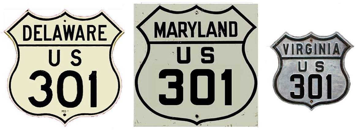
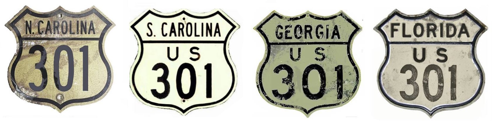
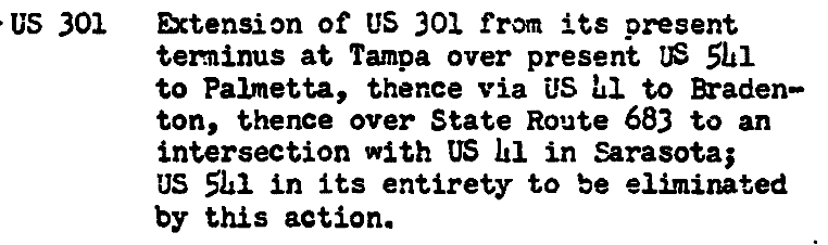
US 301 as originally commissioned in 1932 was significantly shorter than it is today, running only from Petersburg to Pee Dee. But the route was steadily extended both northward and southward during the early years, and it now stacks up quite well in comparison to other three-digit "branch" routes:
|
c. 1939, Rand McNally
|
|
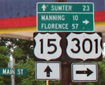
This photo was looking west on Main Street; US 301 ended here at Church Street (US 15) for about 15 years:
|
Nitzman, May 2007
|
US 301 now continues south with US 15 (that extension happened in 1947). Here, we are looking north on Church:
|
Nitzman, May 2007
|
Today US 15 and US 301 part ways here, but historically the south beginning of US 301 was to the right.
|
|
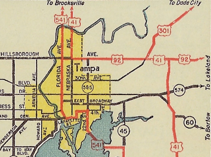
In 1947, US 301 was extended all the way down to Tampa. Traffic came in on Harney Road, and this map suggests that US 301 ended at Hillsborough Avenue (US 41-92). But the reality is US 301 continued west along Hillsborough, sharing a common terminus with US 92:
|
c. 1950, FDoT
|
|
That map also showed US 541 running through the downtown area, while US 41 bypassed the city to the north and east. But the following year, AASHO approved an extension of US 301...
|
|
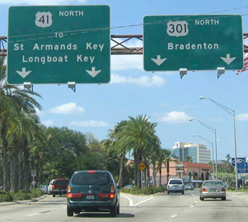
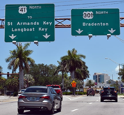
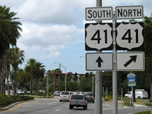
...and FDoT's 1952 official map was the first to show that US 41 had been changed to follow the former route of US 541, and that US 301 had been extended south via the former US 41. At that time US 301 reached its current terminus in Sarasota. This next photo shows how signage may have looked back then (more info about these colored route shields):
Summa, 1975
|
Cozart, Apr. 2004
|
Ivy/Nitzman, Jun. 2021
|
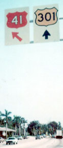
Those were both taken looking northbound on US 41; US 301 begins straight ahead. After a short distance, the first northbound confirming marker comes into view:

Cozart, Apr. 2004
|
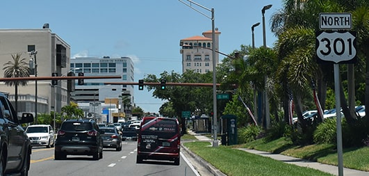
Ivy/Nitzman, Jun. 2021
|
|
Turning around and heading the opposite direction, these photos show the last southbound marker...
|
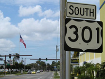
Morrison, June 2009
|
...and signage posted at the south end of US 301 at its junction with US 41:
|
Morrison, Jun. 2009 (same as of 2021)
|
|
On its north end, US 301 was originally extended in 1941; here is that agenda item from the minutes of AASHO's meeting:
|
|
|
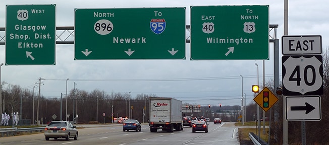
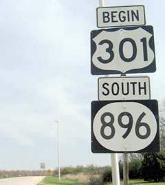
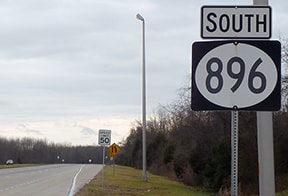
Maps and more info can be viewed on the Baltimore page. Then in 1959 the US 301 designation was truncated near Bowie MD, and instead of serving Baltimore it was routed across the Chesapeake with US 50. On the Delmarva Peninsula it went north, ending at its junction with I-295 and US 202; photos and more info on the Wilmington-New Castle page. US 301 in Delaware had some strange split routings until the 1990s, when the north end of the route was changed to a new terminus in Glasgow. Yet even as late as 2007 some road signs in the area still reflected the pre-1990 route. This first shot shows the north beginning of US 301 as seen from westbound US 40; kind of odd that it says "TO South 301", when it is 301:
|
Nitzman, Apr. 2004
|
|
Signage from the opposite direction on US 40 (eastbound) was even more confusing:
|

Nitzman, Apr. 2004
|
Bender, July 2010
|
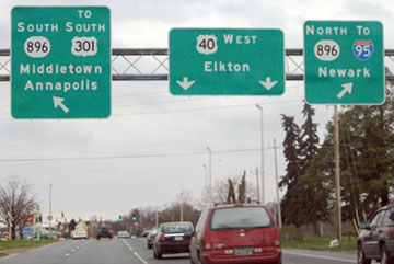
Between 2007-2010, the "To North 301" was changed to "To North 13". That problem also existed in signs on US 301 itself, at its northern terminus. Here is a sign bridge where -- instead of the expected "End 301" -- travelers would see the cryptic "To North 301" (which has since been changed to "To North US 13"):

Nitzman, Apr. 2004
|
Karners, Dec. 2016
|
|
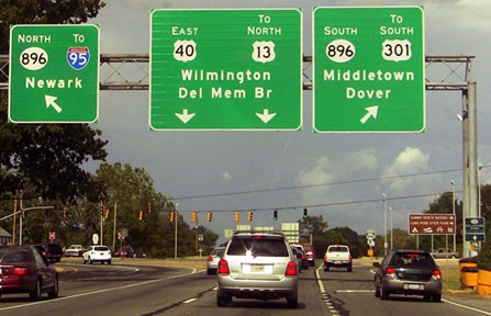
The "To North US 301" shown on this sign bridge (which was looking south on DE 896) has also been changed:

Nitzman, Apr. 2004
|
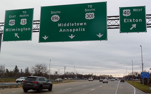
Karners, Dec. 2016
|
|
The north beginning of US 301 is straight ahead, at the intersection visible in the background... or at least it is supposed to begin there. In the past DelDoT had a sign posted that could not have stated it any more explicitly...
|
Nitzman, Apr. 2004
|
...and now US 301 signage is sparse-to-non-existent for the next several miles. Plus, as we have seen, they still insist on keeping the "TO US 301" verbiage at US 40...
|
|
...but all of that may have been because a toll road was under construction, which now serves as the new corridor for US 301. As a result, the north terminus of US 301 was moved to its junction with DE hwy. 1 at a place known as Biddles Corner (which is between Middletown and St. Georges). This new toll road opened to traffic in January 2019. This image was looking south on DE 1 at the exit to the north beginning of US 301:
|
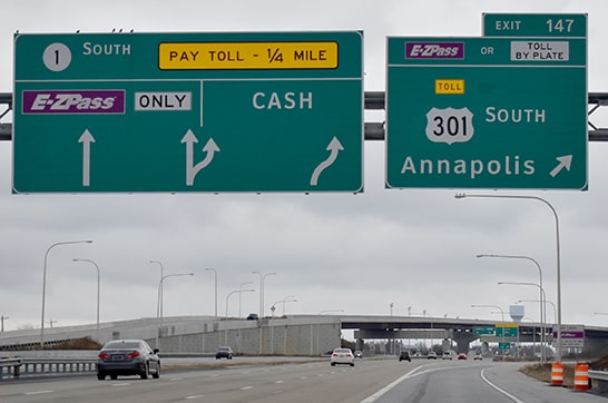
Nitzman, Dec. 2020
|
|
Drivers taking that exit will soon see the first southbound confirming marker:
|
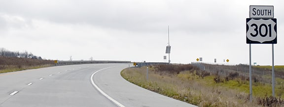
Nitzman, Dec. 2020
|
|
For drivers heading the opposite direction, the last northbound reassurance marker looks like this:
|
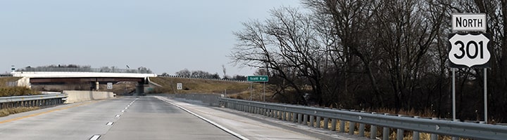
Nitzman, Dec. 2020
There was no "End" sign, but just ahead is a flyover ramp that merges US 301 traffic onto northbound DE 1:
|
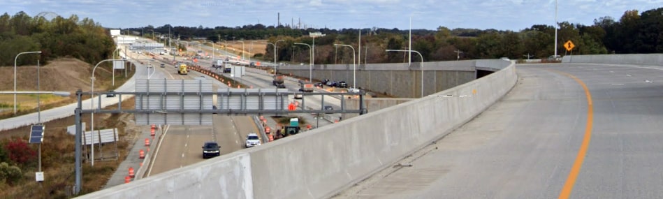
Google Maps Street View, Oct. 2019
The underpass is DE 1, and at far left is the exit ramp to the north beginning of US 301. At right is the on-ramp to DE 1, so that view essentially shows the north end of US 301. Just ahead, US 13 becomes visible to the driver's right side (as it runs parallel to DE 1), but US 301 has no direct connection to US 13.
Research and/or photo credits: Jake Bear; Jesse Bender; Justin Cozart; Andy Field; Brent Ivy; Karin and Martin Karner; Jeff Morrison; Alex Nitzman; Nathan Perry; Dale Sanderson; Michael Summa
Page originally created 2000;
last updated Dec. 4, 2023.
last updated Dec. 4, 2023.
