End of US highway 9 |
 |
|
1926-1934
|
1934-1946
|
1946-1974
|
1974-present
|
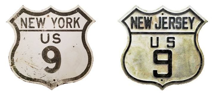
Summa
|
Note: US 9 includes a ferry segment, connecting North Cape May NJ and Lewes DE. This ferry marks the point where the signed direction of US 9 changes. In New York and New Jersey, US 9 is signed north-south; but in Delaware, the route is signed east-west.
|
Mileage: in 1989 AASHTO listed a figure of 673 miles for US 9... however, that included the mileage of US 9's associated truck routes, plus the mileage of US 9W. According to the state subtotals on AASHTO's 1989 spreadsheet, mainline US 9's actual end-to-end total at the time was 521 miles. That closely matches our own 2020 measurement, which yielded 520.5 miles. (None of these figures include the 16.2 mile ferry segment.)
The north end of US 9 was originally in Rouses Point NY. In about 1946 it was rerouted slightly and its terminus was moved to Champlain. More details can be found on the Rouses Point / Champlain page.
The north end of US 9 was originally in Rouses Point NY. In about 1946 it was rerouted slightly and its terminus was moved to Champlain. More details can be found on the Rouses Point / Champlain page.
|
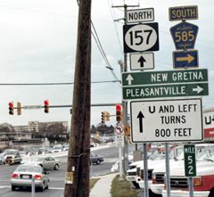
During the early years of the US highway system, several routes included a ferry segment. But today, only two remain: US 9 and US 10. And ironically, the original US 9 did not include a ferry segment. In fact, the designation did not even go as far south as Cape May. For about the first six years, the south end of US 9 was at its junction with US 30 in Absecon NJ:
|
Mason
|
|
That is now the south end of NJ hwy. 157, but it used to be where US 9 ended at US 30. This next photo is looking east on US 30:
|
Nasiatka, Nov. 2005
|
|
The south beginning of US 9 was to the left. (The sign says northbound NJ 157 is straight ahead because left turns are prohibited at this intersection. Traffic is instead directed to go past the light, make a u-turn, and then turn right.)
In 1934, US 9 was extended south to Cape May: |
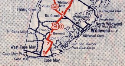
c. 1939, Rand McNally
|
|
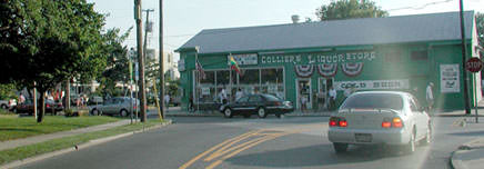
This shot was taken looking north on Lafayette Street, where US 9 began at Jackson Street (running across the bottom of the photo):
|
Wiley, 2000
|
|
This next photo is from the opposite direction (looking south on Lafayette at Jackson):
|
Mason
|
When the ferry across Delaware Bay was installed, its landing was built in North Cape May. In 1972, US 9 traffic was redirected to that ferry landing. Following is that agenda item from the minutes of AASHO's meeting in November of that year:
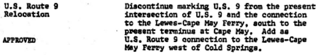
|
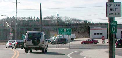
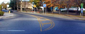
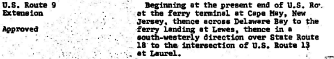
So US 9 no longer makes it into the town of Cape May; instead it is routed west on Sandman and Lincoln Boulevards, and then US 9 continues by turning off to the ferry landing:

West, June 2003
|
Morrison, Apr. 2023
|
US 9 actually ended there for two years, and technically that is still the "south" end of the route today, even though US 9 was officially extended further south into Delaware in 1974...
|
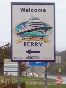
...because as soon as one drives off the ferry across Delaware Bay, the remainder of the route is signed east-west:

West, June 2003
|
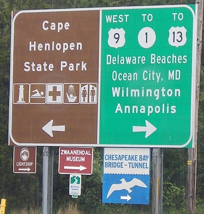
Morrison, Apr. 2023
|
|
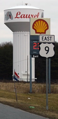
That photo shows the first signage heading away from the Lewes ferry landing; the east-west signage is consistent along the entirety of US 9's Delaware segment:
|
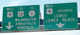
Rahul, May 2000
|
|
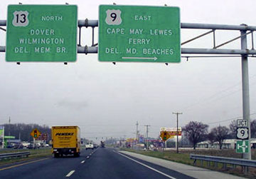
From there the route continues to its west terminus at US 13 in Laurel. These photos were taken looking southwest on Georgetown Road (just off to the right is the slip ramp to northbound US 13):
|
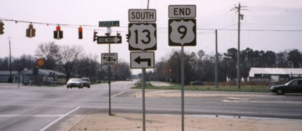
Strong, 2000
|
Nitzman, Jan. 2017
|
|
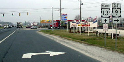
Heading the opposite direction (northeast on Georgetown Rd) the west beginning of US 9 is signposted thus:
|
Morrison, Apr. 2023
|
|
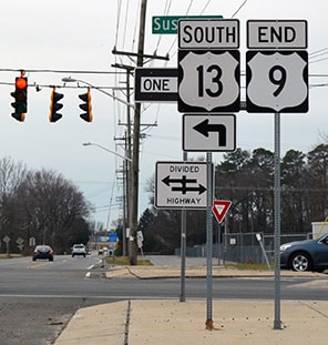
These next shots are looking north on US 13 at the west beginning of US 9:
|
Stuve, Mar. 2003
|
Stuve, Mar. 2003
|
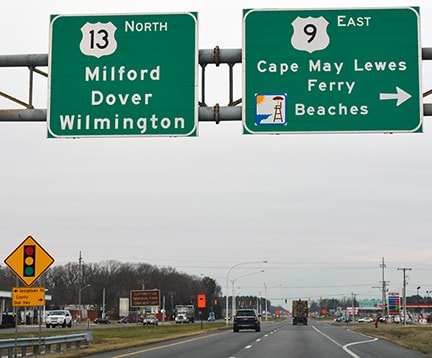
Nitzman, Jan. 2017
|
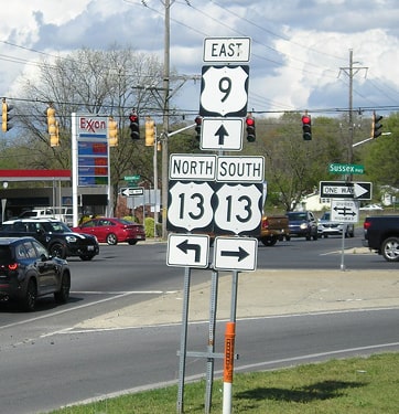
Drivers taking that right turn immediately encounter the southernmost US 9 trailblazer:
|
Nitzman, Jan. 2017
|
|
Continuing ahead, here is what one sees at the east terminus of US 9, approaching the ferry dock in Lewes:
|
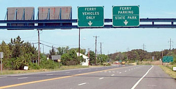
Rahul, May 2000
|
Research and/or photo credits: George Bourey; Christopher Mason; Jeff Morrison; J.P. Nasiatka; Alex Nitzman; Rahul; Dave Strong; Dale Sanderson; Eric Stuve; Michael Summa; Sam West; Mike Wiley
Page originally created 2000;
last updated Dec. 11, 2023.
last updated Dec. 11, 2023.
