End of US highway 29 |
 |

Summa
|
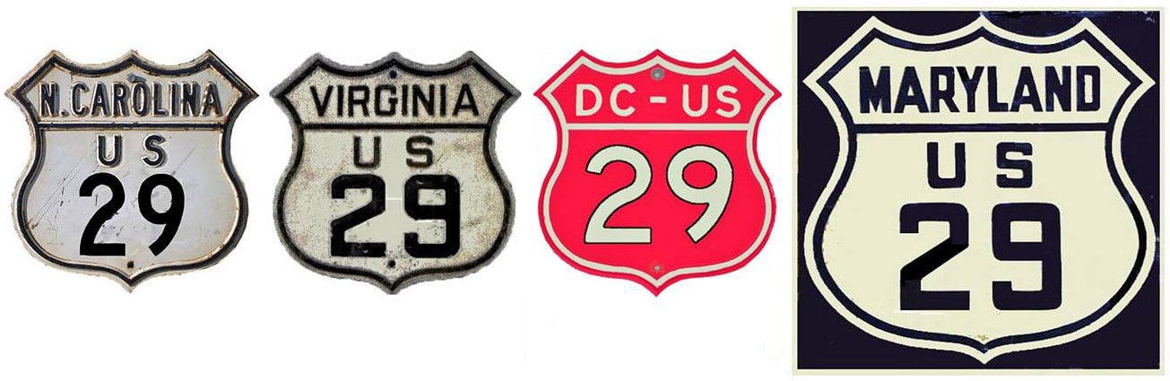
Summa
|
|
1926-1931
|
1931-1933
|
1933-1934
|
1934-1950
|
1950-present
|
Mileage: in 1989 AASHTO listed a figure of 1153 miles for US 29... however, that included the mileage of US 29's associated business/bypass/alternate routes. According to the state subtotals on AASHTO's 1989 spreadsheet, mainline US 29's actual end-to-end total at the time was 1036 miles. That closely matches our own 2020 measurement, which yielded 1039.6 miles (reroutings and realignments likely explain the difference). Historically, when it went to Baltimore, US 29 was 1048.5 miles long.
|
US 29 was an original 1926 route; at the time it went only as far south as US 80 in Alabama:
|
c. 1928, ALDoT
|
|
During that timeframe, US 29 followed today's AL hwy. 14 west out of Auburn, then AL 81 south into Tuskegee, so US 29 ended right at the downtown square. This shot is looking north on Main Street:
|
Karner, May 2013
|
|
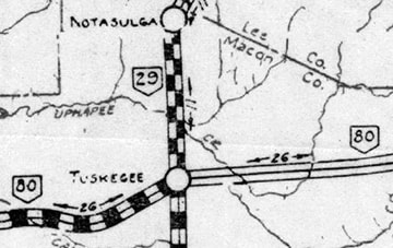
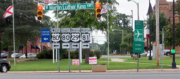
Today that is northbound US 29, which continues with US 80 to the right. But originally the southernmost segment of US 29 was straight ahead in the distance on Main, or AL 81. However, since Main is interrupted for one block there by the town square, traffic must go around it, so the historic beginning was a half-block to the right, and the historic endpoint was a half-block to the left. From Tuskegee, US 29 initially ran only to Kings Mountain:
|
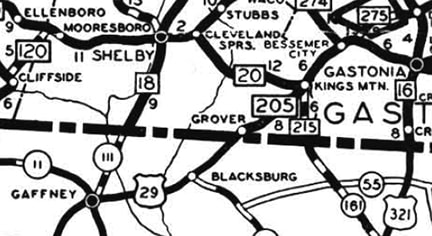
|
|
The designation ended at its junction with US 74, which was not marked on that part of the map, but it overlapped with NC hwy. 20. This photo was looking north on Battleground Avenue, or NC hwy. 216. The crossroad is King Street, which originally carried mainline US 74, so US 29 ended here:
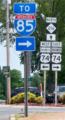
Karner, May 2013
|
In 1931 the north end of US 29 was extended to Culpeper. This photo was looking north on Main Street. US 15 came in from the right on Orange Road and continued ahead on Main, so US 29 ended here:

Roberson, Mar. 2007
This shot was taken from the opposite direction (south on Main). Southbound US 15 veered to the left on Orange, so straight ahead was the north beginning of US 29:
Roberson, Mar. 2007
|
|
In 1933, just two years later, US 29 was extended further north: to Baltimore.
In 1934, US 29 was extended south from Tuskegee along its modern route through Troy and Andalusia to Pensacola (although there may have been a brief moment during which the road south of Brewton was not yet open to traffic): |
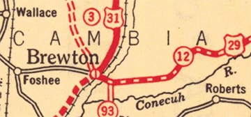
c. 1934, General Drafting
|
|
This photo was taken from southbound US 29 in Brewton, where it junctions with US 31:
|
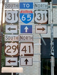
Karner, May 2013
|
Today US 29 continues south along with US 31, but for a brief time that may have been the south end of US 29. However, it was not long before the US 29 designation was opened to the south: from Brewton it overlapped with US 31 for 14 miles to Flomaton, and then it replaced historic US 331[i] running down to its current terminus in Pensacola.
|
Back in Maryland, US 29 traffic had been directed right through old town Ellicott City on its way to downtown Baltimore. But in 1950 it was truncated to its junction with US 40, and in 1954 US 29 was redirected along a new alignment, bypassing Ellicott City to the west, and ending at the Baltimore National Pike (which had been US 40 Bypass, but was then changed to mainline US 40), as illustrated on these maps:
|
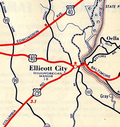
c. 1954, Rand McNally
|
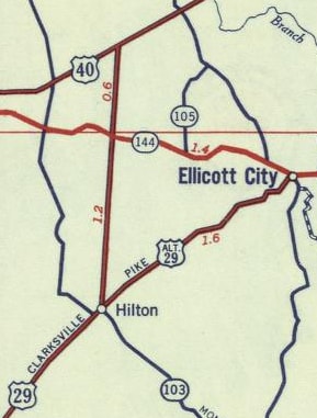
c. 1956, Gousha
|
|
This 1962 topo map suggests that the original construction of US 29's 1954 alignment included a grade-separated interchange at US 40 that was different than the modern configuration:
|
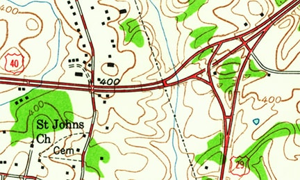
c. 1962, USGS
|
|
It appears that drivers on northbound US 29 who wanted westbound US 40 would have had to turn onto a short section of Ridge Road. Just beyond there, US 29 ended at what is now the ramp from northbound US 29 to eastbound US 40:
|
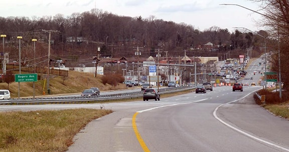
Karners, Jan. 2017
|
Looking the opposite direction (west on US 40), US 29 formerly went only to the left, using the same approximate alignment as today's ramp towards Columbia...
Wiley
|
Karners, Jan. 2017
|
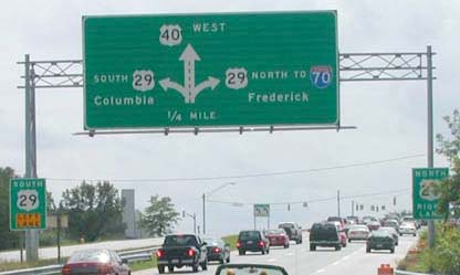
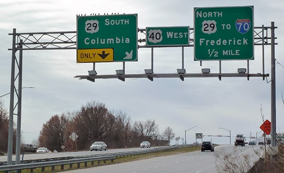
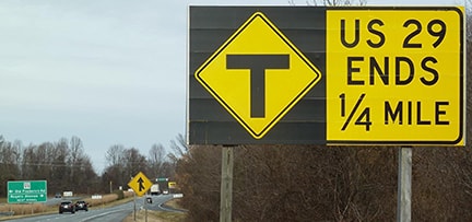
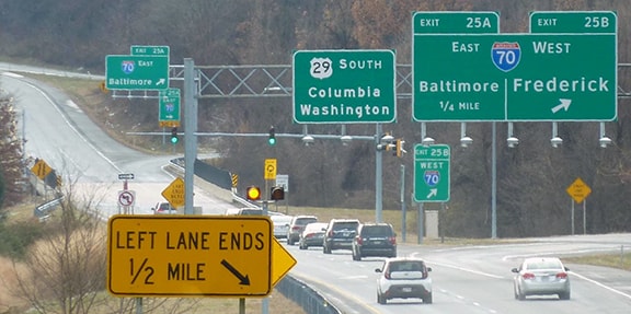
...but when I-70 was built through the area in about 1968, the US 29 designation was extended north (right) a mile or two to the I-70 interchange (exit 87). Actually it is signed just a little ways beyond there, ending at MD hwy. 99. For the past several years, approaching that junction, a couple different versions of an unusual "End" sign have been posted:

Nitzman, Sep. 2004
|
Karners, Jan. 2017
|
|
The signage in the distance is shown close-up here; these cars were at the north end of US 29:
|
Nitzman, Sep. 2004
|
|
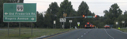
These shots show the same intersection, approaching via eastbound MD 99:
|
Karners, Jan. 2017
|
|
Formerly there was another sign ahead to mark the north beginning of US 29, but it was gone by 2017:
|
Nitzman, 2000
|
|
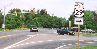
Historically, drivers who took that right turn would immediately see the first southbound US 29 confirming marker, but this was also gone as of 2017:
|

Wiley
|
|
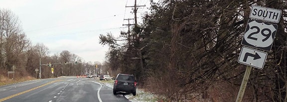
The small marker below the US 29 sign said "29th Division Memorial Highway". The signs visible in the distance are for the I-70 interchange; here is a closer view:
|
Karners, Jan. 2017
|
Research and/or photo credits: Nathan Edgars; Chris Elbert; Adam Froehlig; Karin and Martin Karner; Alex Nitzman; Mike Roberson; Dale Sanderson; Michael Summa; Mike Wiley
Page originally created 1999;
last updated Dec. 15, 2023.
last updated Dec. 15, 2023.
