Current and historic US highway endpoints in Wrightsville Beach, NC
1935-present
|
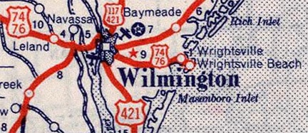
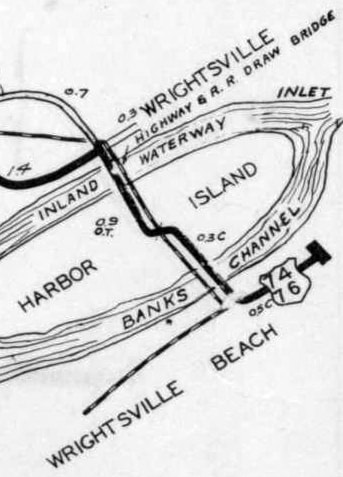
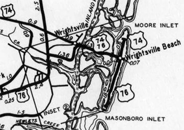
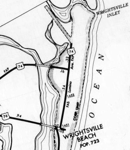
US 74 and US 76 join in Chadbourn NC and are concurrent for the next 50 miles eastward, all the way to the Cape Fear River. There the designations split, and they take different routes through Wilmington. On the east side of the city they rejoin for a short distance, only to split apart again on Harbor Island, using separate causeways over Banks Channel to Wrightsville Beach. This town is on a barrier island (a long, narrow island which parallels the coast):
The east end of US 76 was first extended to Wrightsville Beach in 1935. By 1936 US 74 had joined with it (sharing the US 76 causeway). On the island, the two routes were overlapped north on Lumina Avenue to a common terminus at Salisbury Street. (At the time, this was the north end of the island, as there was an ocean inlet approximately where Parmele Boulevard is located today):
|
|
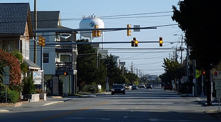
This photo was taken looking north on Lumina at Salisbury, and it shows the original Wrightsville terminus for both US 74 and US 76 (although the scene would not have looked like this, because Lumina ended here, rather than extending north into the distance):
|
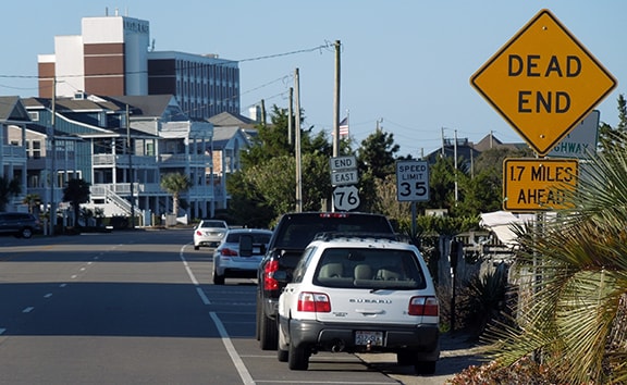
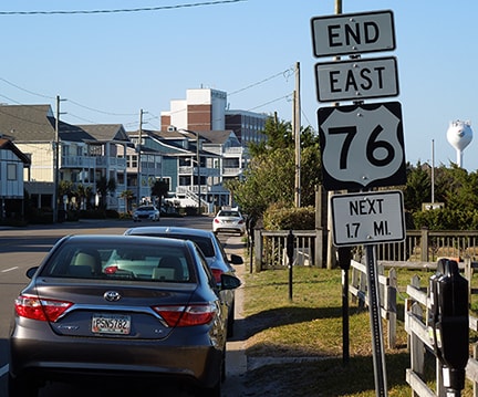
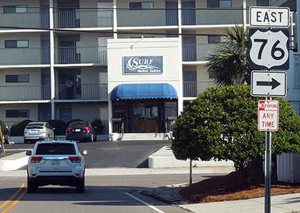
That was the east end of US 76 only until about 1940. At that time, the designation was changed to serve the south end of the island, as it does yet today. Immediately after turning south from the causeway onto Waynick Boulevard, signs attempt to reduce unnecessary traffic by sparing unsuspecting tourists the trouble of driving another two miles to a dead-end, only to have to turn around:
|
|
"Next 1.7 miles" seems like kind of an odd way to phrase it. Travelers who actually want to reach the endpoint continue ahead, where they are soon directed to turn east onto Sunset Avenue. The last US 76 trailblazer is the one that directs travelers to turn south again onto Lumina:
|
|
From there, it is only about a half-mile to the south end of Lumina, where US 76 ended from about 1940 to 1975:
After terminating there for 35 years, the US 76 designation was extended to the right a couple blocks on Jack Parker Boulevard, ending at the spot shown here:
|
|
The west end of Jack Parker is also the east end of US 76. (From there, one could continue north on Water Street for about one block, but the US 76 designation does not make that turn.)
|
|
Meanwhile, back to US 74, which continued to end on Lumina at Salisbury through the mid-1950s...
...when a couple changes took place: for one thing, a new causeway over Banks Channel was built. It aligned with Salisbury, and US 74 was routed onto it (meaning the central segment of Lumina no longer carries a US route designation). Also, the former "Moore Inlet" was filled in, providing Wrightsville Beach with more area for development to the north. Around the same time, US 74 was extended north to Parmele Blvd:
|
|
Coincidentally, just like US 76, the current terminus of US 74 is 1.7 miles to the north (left) from that turn. But unlike US 76, there were no signs calling attention to the dead-end in that direction. Rather, that sign was simply the last reference to US 74.
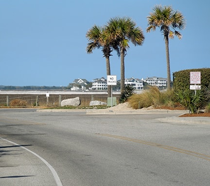
It was 1955 when US 74 was originally extended to the left. But for the next 34 years it went only a few more blocks, ending at Parmele (which angles off to the left in this photo): |
|
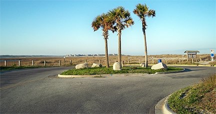
Historically, "Wrightsville Inlet" was not much farther ahead. But then that too was filled in, allowing Wrightsville Beach to expand again. Lumina was extended another mile or so to serve this area to the north, and in 1989 the US 74 designation was extended along this new road segment. There was no "End" sign, but one need not worry about going too far, because the road simply ends at a turnaround:
|
|
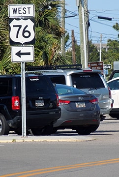
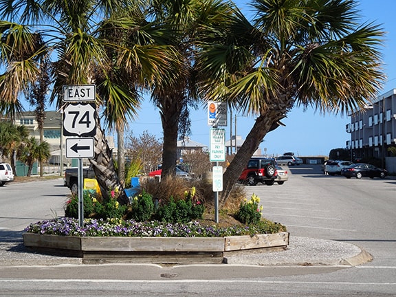
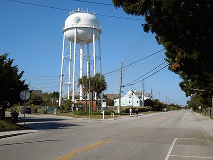
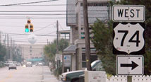
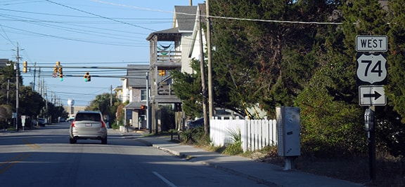
...but that sign was also gone by 2018; now the first US 74 sign is seen only by drivers alert enough to turn onto Salisbury despite having no sign to point the way. The white water tower (barely visible way off in the distance of those photos) is not far from the east end of US 76. This image shows the first westbound sign, posted on Salisbury immediately after turning west from Lumina:
|
Research and/or photo credits: Andy Field; Karin and Martin Karner; Mike Roberson; Dale Sanderson; Charles Turner; Mac Watkins; Morgan Younce
Page originally created 2005;
last updated Jul. 12, 2024.
last updated Jul. 12, 2024.
