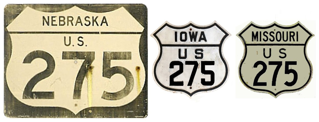
End of US highway 275 |
 |
|
1931-1938
|
1938-1963
|
1963-present
|
Summa
|
Note: US 275 is posted as a north-south route in Missouri and Iowa, but it is signed east-west in Nebraska.
|
Mileage: in 1989 AASHTO listed a figure of 271 miles for US 275... however, that included the mileage of US 275's associated business route. According to the state subtotals on AASHTO's 1989 spreadsheet, mainline US 275's actual end-to-end total at the time was 266 miles. That closely matches our own 2020 measurement, which yielded 266.3 miles. Historically, when it went to St. Joseph, US 275 was 347.1 miles long.
|
US 275 was commissioned in November 1931; at the time its south end was in St. Joseph. This photo was looking south on 4th at Jules Street. Ahead was westbound US 36, and eastbound US 36 was to the left, so US 136 ended here:
|
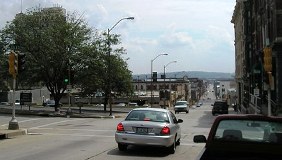
Morrison, Aug. 2006
|
|
Later, US 36 was redirected to run along 10th Street, to the east (left) of there. So US 136 turned left there on Jules, and ended at the five-way intersection of 10th Street and Frederick Avenue:
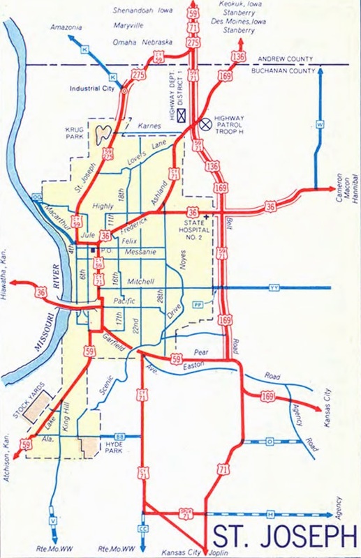
c. 1954, MO DoT
|
This photo was looking east on Jules. The cross street is 10th, but the cars stopped at the light are on Frederick, which comes in at a diagonal. Those drivers are on southbound Business I-29, which continues off the right edge of the photo. That was a later routing of US 36, so this perspective shows another historic south end of US 275:
Morrison, Aug. 2006
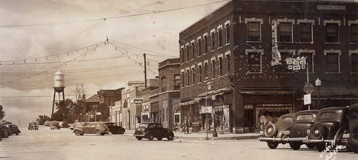
The original north end of US 275 was in Council Bluffs. But in 1938 the US 275 designation was extended to its current terminus in O'Neill:
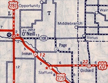
c. 1939, Rand McNally
|
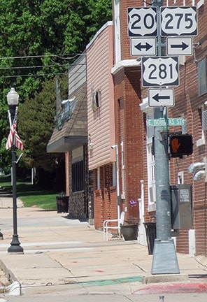
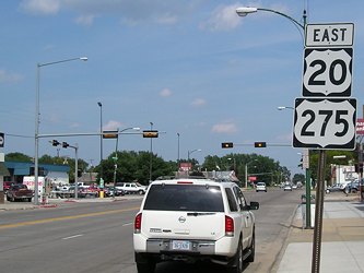
Despite its number, US 275 is signed east/west in Nebraska, so in that sense it is fitting that it does not end at its junction with the east/west US 20. Instead US 275 overlaps with US 20 for about 13 miles, and then ends at the north/south US 281. These photos were looking west on Douglas Street, which carries US 20 traffic through town. Douglas also serves as US 275 until this intersection (4th Street), where it ends. US 281 comes in from the south (at left) on 4th, then is routed straight ahead with US 20 for about six blocks, and then heads north again:

Taylor, 2000
|
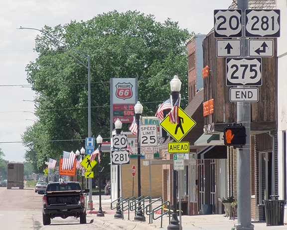
Sanderson, Jun. 2022
|


|
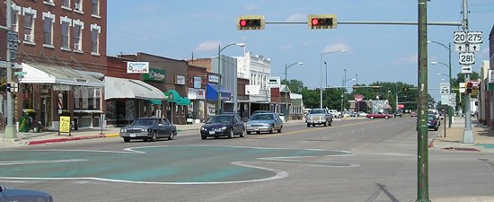
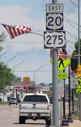
These shots were looking the opposite direction (east on Douglas). Here, southbound US 281 separates from US 20 by turning south on 4th; straight ahead is not only US 20 but also the west beginning of US 275:
Morrison, June 2006
As can be seen there, O'Neill -- a city quite proud of its Irish heritage -- has painted a giant shamrock in the middle of the intersection.
|
Sanderson, Jun. 2022
|
|
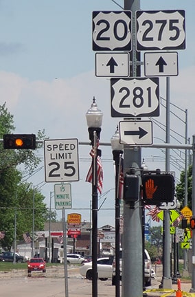
These next photos show the signage for traffic on northbound 4th, or US 281, which continues to the left on Douglas with US 20. To the right on Douglas is the beginning of US 275:
|

Morrison, Jun. 2006
|
Sanderson, Jun. 2022
|
|
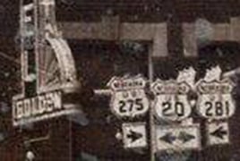
This next photo was looking the same direction (north on 4th), but it was taken shortly after the US 275 designation had been extended to O'Neill in 1939:
|
(date and attribution unknown)
|
|
Sanderson, Jun. 2022
|
|
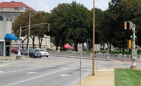
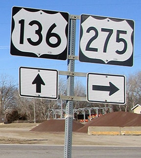
In 1963 the south end of US 275 was truncated to its current terminus in Rock Port. These photos were taken looking south; the crossroad in the background is US 136:
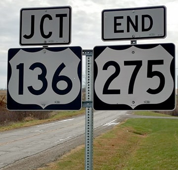
Handler, Nov. 2017
|

Sanderson, Oct. 2002
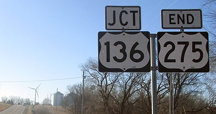
Dienhart, Feb. 2024
|
|
Rock Port is to the left about a mile. Historically US 275 continued that way, and a few miles further east to Tarkio. From there it was overlapped with US 59 about 70 miles south, to St. Joseph. Apparently after US 136 was commissioned it no longer made sense to have US 275 co-signed with other routes for its southernmost 80 miles, so the designation was truncated back to Rock Port. Behind the green sign, the red-and-white hatch pattern on the sign at the intersection is visible; that is also shown in this photo (behind the 275 arrow):
|

Sanderson, Oct. 2002
|
|
There, we are heading east on US 136; the south beginning of US 275 is to the left. Travelers who take that turn will soon see the first northbound US 275 sign:
|

Sanderson, Oct. 2002
|
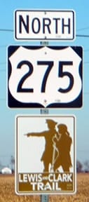
Barnes, Dec. 2016
|
This last photo shows the south beginning of US 275 as seen from westbound US 136:
Dienhart, Feb. 2024
|
Research and/or photo credits: Joseph Barnes; Neil Bratney; Paul Dienhart; Mark Handler; Jeff Morrison; Dale Sanderson; Dale Sauter; Michael Summa; Stephen Taylor
Page originally created 2000;
last updated Feb. 21, 2024.
last updated Feb. 21, 2024.
