Current and historic US highway endpoints in Trinidad, CO
|
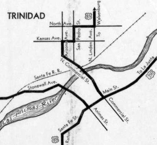
Originally, in 1926, Trinidad was served only by US 85 and US 350. From the north, US 85 came in on Linden Avenue and made several turns before heading southeast on Commercial Street, southwest on Main Street, and south on Santa Fe Trail. US 350 came in on Main, and ended at its junction with US 85 at Commercial:
|
|
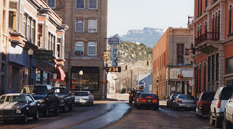
US 160 made its first appearance on the 1930 CDoT map. It seems likely that the designation would have been overlapped with US 350, sharing a common terminus at US 85 in Trinidad. However, the Trinidad insets through 1934 suggest that the designation ended at Beshoar Junction. On the other hand, that may have been an oversight, because the 1934 main map did indicate that US 160 had been co-signed north with US 85 through Trinidad to Walsenburg, and then west via the former US 450. Barring further information to the contrary, we will proceed under the assumption that, until 1933, US 160 overlapped with US 350, ending in Trinidad. This photo was taken looking southeast on Commercial:
|
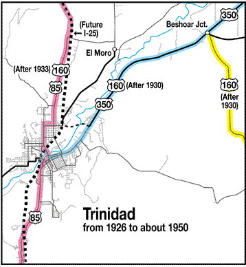
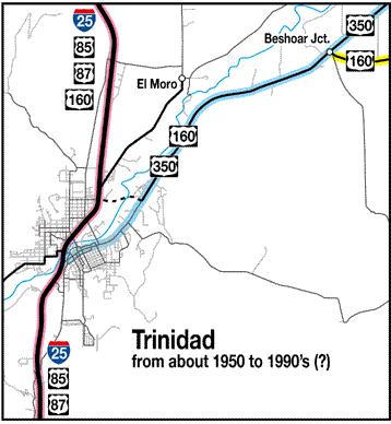
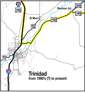
Originally that was southbound US 85, which continued to the right ahead on Main. The original west beginning of US 350 was to the left, and US 160 probably also began to the left from 1930-1933. In 1934 that became the perspective not only of drivers on southbound US 85, but also on eastbound US 160, which continued to the left with US 350. (Incidentally, the distinctive flattop mountain in the background is Fisher's Peak, which is a Trinidad landmark.) This map series illustrates the route designation changes that have taken place in Trinidad over the years:
In that first map, notice the odd alignment of US 160, east of Beshoar (yellow line). Until about 1950, traffic was routed south and east from there, through the towns of Trinchera and Branson, and then north to modern 160 via today's CO hwy. 389. Today's more direct corridor was shown as "under construction" on the 1949 map; "graded" in 1951; and "surfaced" in 1952.
|
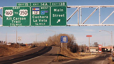
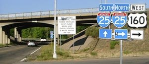
Also, in about 1959, the US 85 (and US 87) designations were moved over to what is now I-25. So the US 160 and US 350 designations were extended southwest along former US 85; they then ended at I-25. In about 1992, Kit Carson Trail was built so US 160 traffic could avoid downtown Trinidad with its narrow brick streets. Probably that was the same time that the US 350 designation was truncated to its current endpoint at Beshoar. This photo was looking north on I-25, which curves off to the left:
|
|
(The center panel there was removed by June 2006, because exit 14A no longer exists.) The exit to the right serves Main Street, which formerly marked the west beginning of US 350 and US 160 (when I-25 was first built). But US 160 traffic has now been shifted to Kit Carson Trail. After exiting there and making a right turn down by the gas station, a traveler finds themselves on the segment of Main that was the original US 85 through town. In a few blocks, they reach an intersection with Commercial Street:
|
|
That was looking northeast on Main. Northbound US 85 took a left here on Commercial, and straight ahead was the original west beginning of US 350 (and probably the west beginning of US 160 in 1930).
|
|
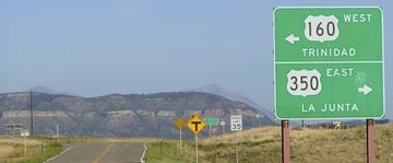
Today one must continue ahead about a mile-and-a-half to reach US 160 (at the Kit Carson bypass), and then another five miles beyond that to reach the modern west beginning of US 350:
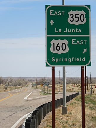
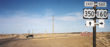
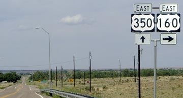
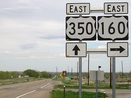
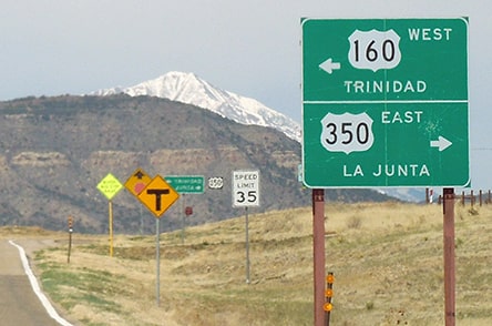
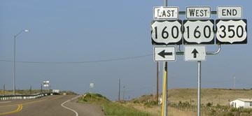
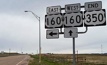
Those were all looking northeast, towards La Junta. That location is known as Beshoar Junction, named for a nearby railroad siding. Today eastbound US 160 takes a right there, and eastbound US 350 begins straight ahead. But from 1926-1995 that was all US 350, and it is possible that between 1930 and 1934 the west beginning of US 160 was to the right.
|
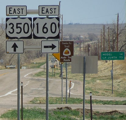
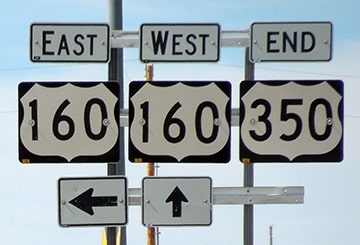
Today US 350 begins to the right, but historically it continued left. That could have been the original west end of US 160, but more likely it was co-signed left with US 350 into Trinidad. (Incidentally, one of the Spanish Peaks is visible behind the sign, as well as part of the Culebra Range at far left; both figure prominently on the horizon in this area.)
|
|
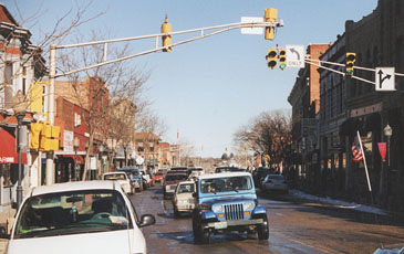
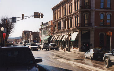
Westbound US 350 formerly continued ahead with US 160. Continuing that way a few miles, the highway becomes Main St in Trinidad. Today US 160 traffic is routed across the north end of town via the Kit Carson bypass, but originally highway traffic continued straight ahead on Main. The intersection with Commercial marked the original end of US 350, and probably the first end of US 160 as well:
|
|
That was looking southwest on Main. Southbound US 85 was ahead, and northbound was to the right on Commercial. In 1933, the US 160 designation was extended through Trinidad, so it followed US 85 north from there. After I-25 was built, US 85 was routed onto it. So the US 350/US 160 designations were extended a bit further ahead on Main. US 350 ended at its junction with I-25 (interchange 13B):
|
That was still southwest on Main. Note the incorrect US 160 sign, which probably dated back to a time before the Kit Carson bypass was opened (that reference to US 160 has since been removed).
Research and/or photo credits: Brent Ivy; Chris Kalina; Jeff Morrison; Alex Nitzman; Dale Sanderson
Page originally created 2003;
last updated Apr. 7, 2021.
last updated Apr. 7, 2021.
