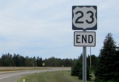
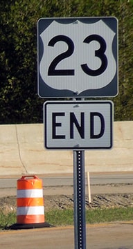
End of US highway 23 |
 |
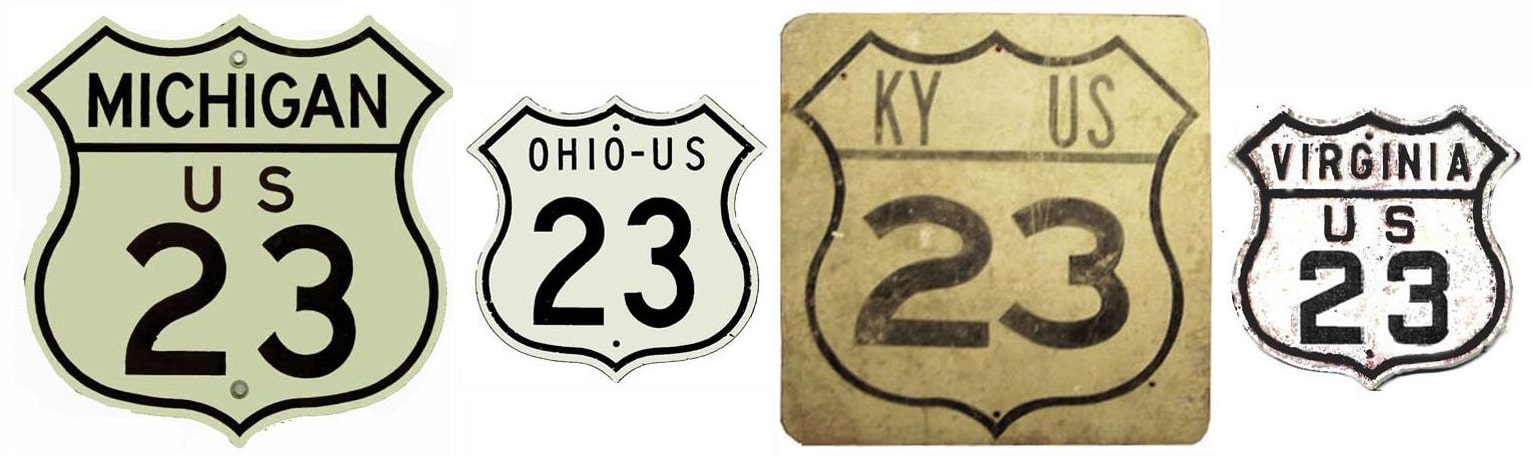
Summa
|
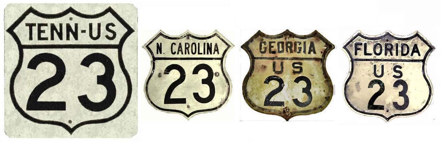
Summa
|
|
1926-1927
|
1927-1930
|
1930-1949
|
1949-present
|
|
Mileage: in 1989 AASHTO listed a figure of 1475 miles for US 23... however, that included the mileage of US 23's associated business routes. According to the state subtotals on AASHTO's 1989 spreadsheet, mainline US 23's actual end-to-end total at the time was 1444 miles. Our own 2020 measurement yielded 1412.7 miles (reroutings and realignments, particularly in Kentucky, likely explain the difference).
|
|
|
US 23 was an original 1926 route; back then its southern terminus was at US 52 in Portsmouth:
|
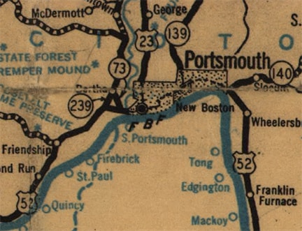
c. 1927, ODoT
|
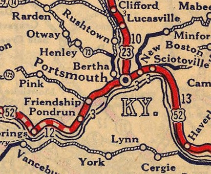
c. 1927, Rand McNally
|
|
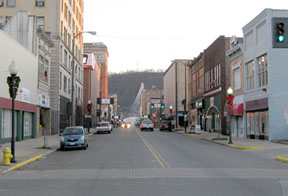
Today US 52 runs along the one-way couplet of 11th and 12th streets. This photo from there is interesting because of the unusual Business 23 sign, and because of the fact that it is overlapped with the mainline. Westbound 52 is behind the camera on 12th; the next intersection is 11th. US 23 is split into one-ways too. Northbound is one block to the east (left) on Gay Street, but this is south on Chillicothe Street, which likely carried the original US 23 (it aligns with the old bridge into Kentucky)...
|

Sanderson, Oct. 2002
|
|
...however, it is doubtful that was US 23's terminus. Instead, US 52 probably used Gallia Street to get downtown, so US 23 would have ended there (about six blocks ahead). This photo was taken from that area:
|
Eitel, Dec. 2007
|
In the distance, the modern bridge over the Ohio River is visible. US 23 would have ended just ahead, where US 52 came in from the left on Gallia.
|
But that did not last long at all, because within one year the south end of US 23 was approved to be extended to Pineville. Here is that agenda item from the minutes of AASHO's executive committee meeting in Oct. 1927:
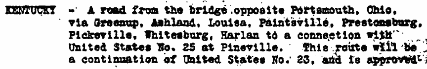
|
From Jenkins KY, US 23 was routed along today's US 119 (photos and more info on the Pineville page).
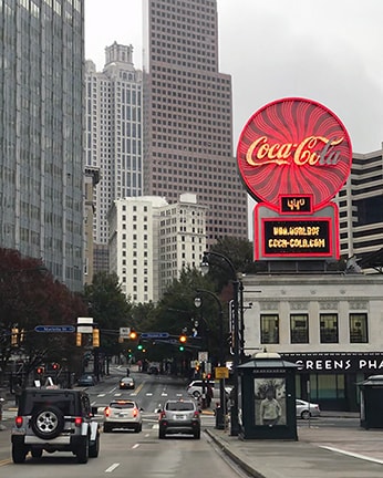
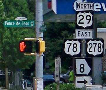
However, that endpoint was also short-lived: in 1930, US 23 was truncated at Jenkins and instead extended south to Atlanta. As shown on the following photo and map, US 78 (the only east-west route serving Atlanta at the time) originally went right through downtown via DeKalb, Decatur, and Marietta streets:
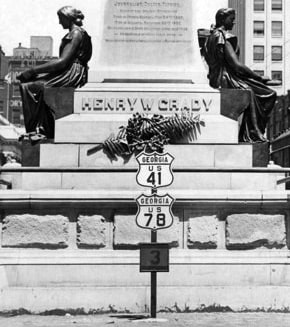
c. 1933, Atlanta Journal-Constitution
US 23 came in on Ponce de Leon Avenue with US 29, then turned south on Peachtree Street, ending at Marietta:
|
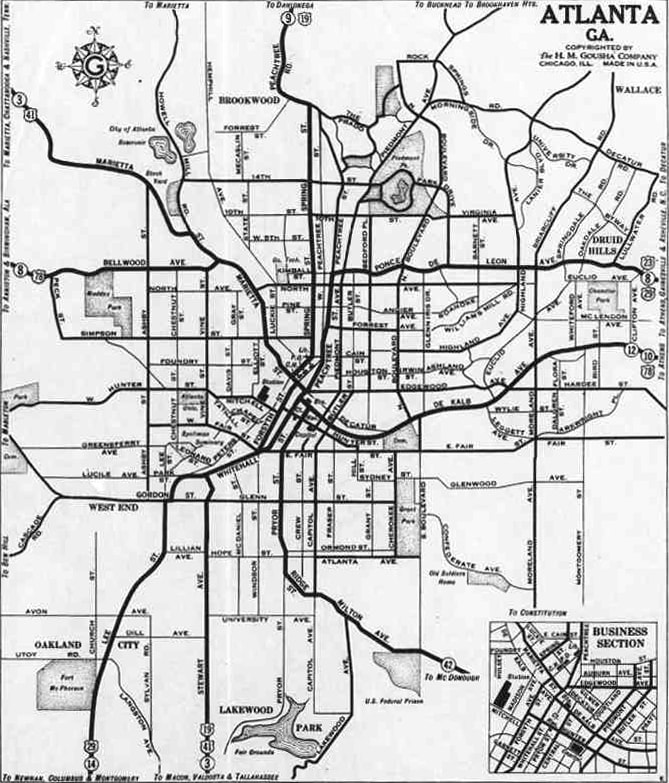
c. 1931, Gousha
|
|
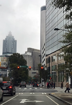
These shots were taken from northbound Peachtree, approaching that intersection:
|

c. 1950; Special Collections Dept, Pullen Library, Georgia State University
|
Sanderson, Nov. 2017
|
|
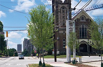
Those were taken right at Five Points, which is not only the center of Atlanta's street address system, but also the vernacular center of the city. However, highway traffic came through here for only a short time: already by about 1935, US 78 had been redirected onto Ponce de Leon, and US 29 had been redirected to use Spring Street, along with US 19. Most maps are not detailed enough to show exactly how far US 23 went. It could have ended on Ponce de Leon at Spring, but more likely it would have been co-signed down Spring to Marietta (jct. US 41). That would have allowed US 23 to junction all other US routes, and it also would have been the functional equivalent of its original downtown endpoint (bringing highway designations close to government buildings was a common practice in the early days). This interactive image is looking north on what was originally Spring, but is now Ted Turner Drive:
|
Sanderson, Nov. 2017
|
For a time, that was northbound US 19-29-41. US 41 split off to the left on Marietta, and US 23 probably began straight ahead, overlapped with US 19-29. To the northeast of Atlanta, US 23 originally went south from Buford, joining US 29 in Lawrenceville. But in 1938 US 23 was rerouted such that it went through Duluth and Norcross (using today's GA 13). This brought US 23 into the city via Piedmont Avenue (instead of Ponce de Leon); compare these two maps:
|
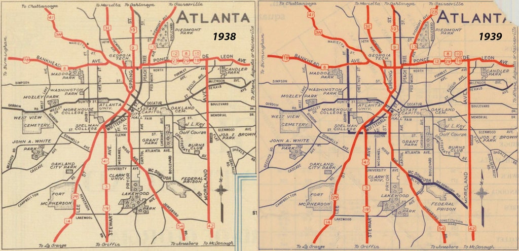
c. 1938-1939, GDoT
|
So it is possible US 23 could have been truncated to Piedmont at Ponce de Leon (US 29-78). These shots were looking north on Piedmont:
|
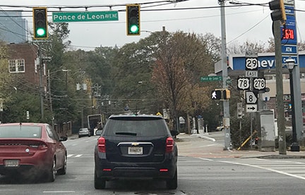
Sanderson, Nov. 2017
|
Karner, May 2013
|
Today that is US 29-78-278, each of which continue to the right on Ponce de Leon. It is possible that straight ahead was the south beginning of US 23. The photos below were looking the opposite direction (south on Piedmont):

(attribution unknown)
|
Karner, May 2013
|
US 23 could have ended there for up to 12 years. But it is also possible that the designation was co-signed with US 29-78 to the right, continuing to the same downtown endpoint pictured above.
Since 1949, the south end of US 23 has been in Jacksonville. In one sense, this extension was a strange addition to the US route system: of the approximately 317-mile route from Atlanta to Jacksonville, less than one-third (only 100 miles) of US 23 was solo mileage (the remainder was overlapped along other previously-existing US routes). And of that 100 miles, 66 of them were in the form of an alternate route between Atlanta and Forsyth, a corridor that was already served by US 41 (at the time). And finally, the southernmost 111 miles of US 23 were (and still essentially are) overlapped with US 1. Based on all that, I can only assume the purpose of the extension was simply to have travel between those two major cities facilitated by a single US route number.
Since 1949, the south end of US 23 has been in Jacksonville. In one sense, this extension was a strange addition to the US route system: of the approximately 317-mile route from Atlanta to Jacksonville, less than one-third (only 100 miles) of US 23 was solo mileage (the remainder was overlapped along other previously-existing US routes). And of that 100 miles, 66 of them were in the form of an alternate route between Atlanta and Forsyth, a corridor that was already served by US 41 (at the time). And finally, the southernmost 111 miles of US 23 were (and still essentially are) overlapped with US 1. Based on all that, I can only assume the purpose of the extension was simply to have travel between those two major cities facilitated by a single US route number.
|
The north end of US 23 has been in Mackinaw City since the beginning, although the exact location of its terminus has changed over the years. These photos were taken from southbound I-75 at the exit to the north beginning of US 23:
|
Bratney, June 2002
|
Morrison, July 2018
|
|
After traffic exits to the right, the road curves around and uses the blue overpass visible in the distance. On the offramp is the first southbound confirming marker:
|
Dienhart, Aug. 2020
|
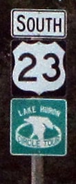
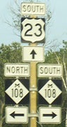
Formerly, travelers continuing that direction soon reached this trailblazer at Nicolet Street:
|
Long, July 2006
|
M-108 was decommissioned in 2010, but the original alignment of US 31 is about a block to the south on Nicolet.
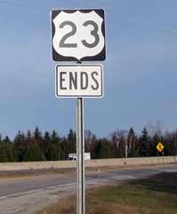
These next photos are from northbound US 23, where it terminates at the onramp to I-75: |
Ivy/Nitzman, 2009
|
Bratney, June 2002
|
Dienhart, Aug. 2020
|
Sanderson, Jun. 2022
|
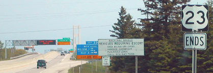
Since 1958 US 23 has been routed onto this connector that keeps traffic out of downtown Mackinaw City. But historically the highway continued to the north (a bit behind the camera and to the right) along Huron Avenue, and US 23 ended (along with US 27 and US 31) at the ferry landing (more info and photos on the Mackinaw City page). This is the same place where today's ferries depart for Mackinac Island. But back then the ferry was the only way to get cars between Michigan's upper and lower peninsulas. They crossed the Straits of Mackinac and provided a connection with US 2 at St. Ignace. In 1958, the Mackinac Bridge (over which I-75 is routed today) eliminated the need for that ferry service (one of the bridge supports is visible in the background of the photo above). At the Bridge dedication, each of Michigan's 83 counties chose a "Queen" to represent them; my very own mother was voted "Miss Missaukee County".
|
Research and/or photo credits: Christopher Bessert; Neil Bratney; Justin Cozart; Paul Dienhart; Mark Eitel; Brent Ivy; Karin and Martin Karner; Mark Long; Jeff Morrison; J.P. Nasiatka; Alex Nitzman; Dale Sanderson; Michael Summa
Page originally created 2000;
last updated Dec. 15, 2023.
last updated Dec. 15, 2023.
