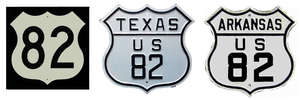
End of US highway 82 |
|
1932-1934
|
1934-1948
|
1948-1956
|
|
1956-1963
|
1963-1988
|
1988-present
|
|
Mileage: in 1989 AASHTO listed a figure of 1691 miles for US 82... however, that included the mileage of US 82's associated business routes. According to the state subtotals on AASHTO's 1989 spreadsheet, mainline US 82's actual end-to-end total was 1680 miles... but at the time, US 82 still ended in Las Cruces. Since then it has been truncated to Alamogordo, and our own 2020 measurement yielded 1598.3 miles.
|
|
|
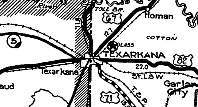
US 82 was commissioned in 1932 to begin in Texarkana AR:
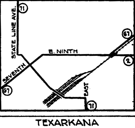
US 82 replaced what had been AR hwy. 2, which this inset map showed coming into town on 9th Street. At Broad Street, it was joined by US 67. These routes angled through the downtown grid via 7th Street; US 82 could have ended where it junctioned US 71, which appears to have been routed along Laurel Street at the time:
|
|
But more likely, US 82 would have continued west of there on 7th, ending either at the Texas line, or else turning south on State Line Avenue, ending at the Federal Courthouse and Post Office.
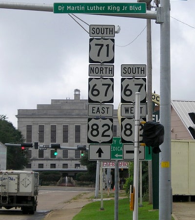
This image was taken looking south on State Line. MLK is the equivalent of 8th Street; today MLK and 7th form a one-way couplet. So at 7th (traffic signal visible ahead), US 82 either began to the left, or else it continued straight ahead for another block, ending at the courthouse (which is bisected by the state boundary): |
|
At the time, the east end of US 82 was in Columbus. The highway came into town on Main Street, overlapped with US 45. At 5th Street, US 45 continued by turning north, but the US 82 designation ended at that intersection. This image was looking south on 5th. At the traffic signal, US 45 continued by turning left on Main, and that was also the west beginning of US 82:
|
|
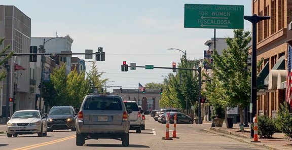
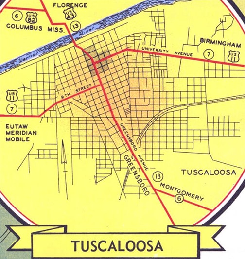
Neither of those endpoints lasted for long: in 1934 the east end of US 82 was extended either to US 43 at Northport AL (where it would have ended at the 5th Street/Rice Mine Road/Bridge Avenue intersection, just east of today's 5th St interchange on US 43/AL 69), or else more likely it overlapped with US 43 to end at US 11 in Tuscaloosa:
|
|
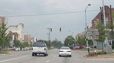
This photo was looking east on University Boulevard. Originally US 11 followed the route of what is now AL hwy. 215: ahead was northbound, and southbound was to the right on Greensboro Avenue. To the left on Greensboro was probably the east beginning of US 82 (Greensboro aligns with a now-dismantled bridge that once connected with Bridge Av in Northport):
|
|
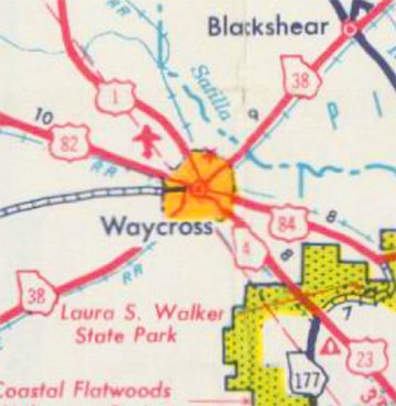
That same year (1934), US 82 was also extended to the west; photos and more info on the Lubbock page. Then in 1948 the east end of US 82 was extended to Waycross:
|
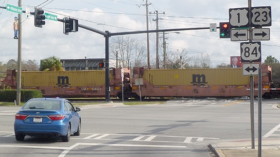
The photo below was taken looking east on Albany Avenue:
|
For a few years, US 82 came to that point and ended there at Plant Avenue (at the time, those US 1 and US 23 markers would have been correct, but since 1994 Plant has actually carried Business US 1-23).
In 1956, US 82 was extended further east, this time to Midway. But in 1988, back in Waycross, a new bypass resulted in a swap of the US 82 and US 84 designations to the east of town, so then the east end of US 82 was changed to its current terminus in Brunswick. |
|
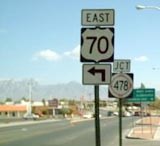
Meanwhile, the west end of US 82 was extended to Las Cruces in 1963. It was co-signed with US 70 all the way west from Alamogordo -- a distance of about 70 miles. The signage shown below was formerly posted at the junction with I-25...
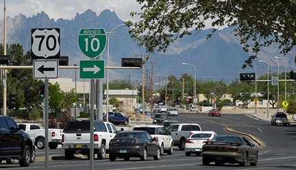
...but after this interchange was redesigned, the new signs no longer mention US 82. US 70-82 continued south into central Las Cruces via Main Street:
|
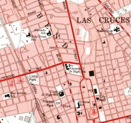
This photo was looking south on Main. US 82 overlapped with US 70 to this point, but only US 70 continued beyond this intersection (by turning right onto Picacho). US 82 ended here at its junction with US 80-180 (eastbound was straight ahead; westbound was to the right with US 70):
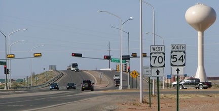
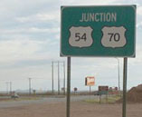
Historically that was eastbound US 70-80-180. The latter two turned right ahead on Main, while US 70 turned left. Also that direction was the west beginning of US 82, until about 1988: that is when the US 82 designation was truncated back to its junction with US 54-70, just north of Alamogordo. However -- based on the signs shown in some of the photos below, taken twenty years later -- one could easily get the mistaken impression that US 82 still continues through Alamogordo itself.
|
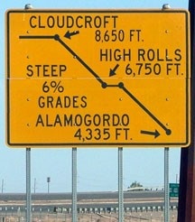
In about 2001, the routing of US 54-70 through Alamogordo changed a bit with the construction of a "relief route" (New Mexico's term for a bypass) along the west side of the city. Although this did not change the endpoint of US 82, the bypass connects to the intersection where US 82 terminates, so all of the signs at that junction were replaced. Following is a series of photos taken both before and after this bypass was operational. We will begin with an unusual sign heading north on the Charlie T. Lee Memorial Relief Route:
|
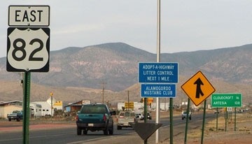
The intention is to let drivers know about the steep grades ahead on the westernmost segment of US 82, which begins by immediately climbing over the Sacramento Mountains (which are prominent in the background of many of the photos below). A similar sign was posted in Artesia, which is about 100 miles east, on the far side of those mountains. That photo prompts one to consider that US 82 begins on the Atlantic Coast and takes a path across the country that has very little in the way of topographic relief -- so the westernmost stretch of this highway is really quite climactic.
|
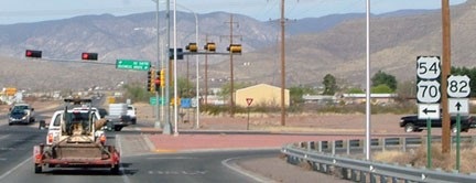
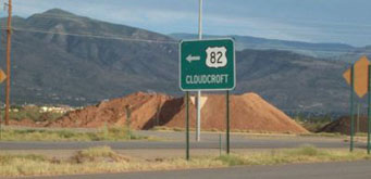
The west beginning of US 82 is straight ahead. Northbound US 54/eastbound US 70 continues to the left. To the right is White Sands Boulevard, which formerly carried US 54-70 through town, before the bypass existed. Next we will approach this intersection from the north, heading into Alamogordo:
|
|
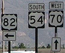
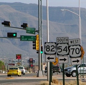
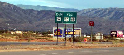
That assembly is in the median, and it is a little strange: it indicates US 70 traffic continues straight ahead (when the route actually turns right, onto the bypass), and it is ambiguous as to which way US 54 traffic should go (it should turn right, along with with US 70). At least it is clear that US 82 begins to the left, and another sign assembly just ahead, on the right side of the road, does a better job:
|
Here, US 54-70 traffic is directed to the right (as it should be)... but if a driver continues straight ahead, they will still see old signage dating back to when White Sands was mainline US 54-70. AASHTO approved a "Business 54-70" along White Sands at the same time they approved the rerouting of mainline 54-70 onto the bypass. But it seems more likely that NMDOT actually relinquished control of White Sands to the city.
|
At any rate, the old signs along White Sands have never been corrected, and there is no "Business" signage anywhere in the city... except on the green street signs at this particular intersection: here, the road straight ahead is not referred to as "White Sands Blvd", but rather as "Business Route", while the bypass is referred to as "Relief Route". Before the bypass, there was a simple sign marking the beginning of US 82:
|
|
That was gone by 2005, and there are no longer any US 82 signs heading southbound... although the road is still signed as if it is mainline US 54-70 (not "Business 54-70"). However, if one were to turn around and head north on White Sands, as of 2010 there were still three references to US 82... here are two of them:
|
|
The first one was just past the intersection with 1st Street, while the next one was just after 10th Street (and there is yet one more after the Indian Wells Road intersection). These are clues that White Sands might have been turned back to the city: none of the obsolete signs have been fixed. But on the other hand, that point could be irrelevant, because NMDOT does not seem to be conscientious about signage anywhere in the state. Regardless, US 82 does not actually begin until the junction near La Luz, a couple miles ahead:
|
|
A little underwhelming: there was no acknowledgement that US 82 ends, nor any mention of the fact that east US 70 and north US 54 are to the right. Before the bypass (straight ahead), west 70 and south 54 turned to the left on White Sands; that was the case back when this photo was taken...
|
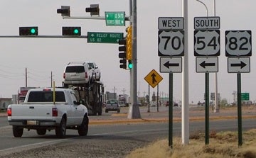
...although signage back then left a little to be desired as well. In 2009 it was reported that there were still references to US 82 in White Sands National Monument (that is between Alamogordo and Las Cruces). I did not observe that myself in 2010, but I did notice that US 82 was mentioned on a sign at the entrance to Holloman AFB (which is between Alamogordo and White Sands). Sometime prior to 2013, much better signage was installed at all four approaches to the junction where US 82 terminates.
Research and/or photo credits: Charlee; Andy Field; Adam Froehlig; Alan Hamilton; Karin and Martin Karner; Jeff Morrison; J.P. Nasiatka; Steven Nelson; Alex Nitzman; Steve Riner; Dale Sanderson; Michael Summa; Patrick Valdez
Page originally created 2000;
last updated Dec. 17, 2023.
last updated Dec. 17, 2023.
