Historic US highway endpoint in Great Falls, MT
|
1927-1945(?)
|
 |
|
When the US route system was first implemented in 1927, US 87E and 87W converged in Armington MT. From there, the unified US 87 approached Great Falls from the southeast (as it does today), but then continued through Choteau and Browning, and ended at the port of Piegan (in other words, US 87 followed the route of today's US 89 northwest from Great Falls):
|
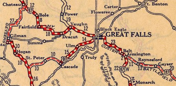
c. 1927, Rand McNally
|
|
US 87 used 1st Avenue North through downtown, then crossed the river and became Central Avenue on the west side. US 91 came in from the south via 6th Street SW, and that designation ended at Central Av West, at the junction with US 87.
|
|
|
US 89 was extended north into Great Falls in 1934. For some reason, the US 87 designation was truncated to Great Falls, and US 89 was extended to Piegan along the former US 87. So at that point, US 87 and US 89 came into town together via 1st Av N. They junctioned with US 91 at 6th St SW, and that was the common endpoint for both US 87 and US 91 for about four years. Then in 1938, US 91 was extended north with US 89 to Vaughn, where the two routes split. US 91 went through Shelby, ending at the Canada border at Sweet Grass:
|
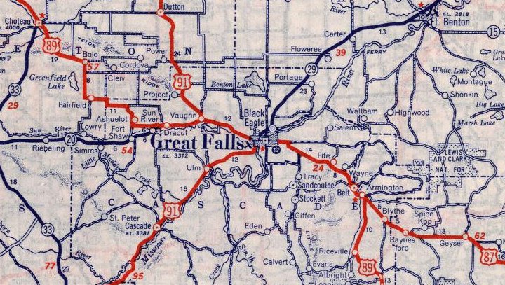
c. 1939, Rand McNally
|
|
US 87 continued to end at its junction with US 91 in Great Falls, until sometime around 1945, which is when the designation was extended northeast up to Havre. This photo was taken looking west on Central Av W:
|
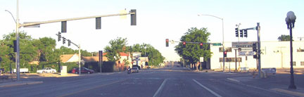
Elbert, July 2008
|
|
Originally that was northbound US 87, and US 91 began to the left on 6th St SW. Then for several years, that was the north end of US 87. The next shot is looking the opposite direction (east on Central):
|
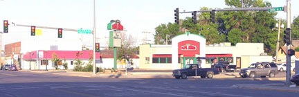
Elbert, July 2008
|
The cars at right are at what was originally the north end of US 91. Later, straight ahead was the north beginning of US 87.
Research and/or photo credits: Chris Elbert; Dale Sanderson
Page originally created 2008;
last updated Mar. 26, 2016.
last updated Mar. 26, 2016.
