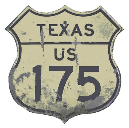
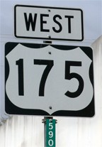
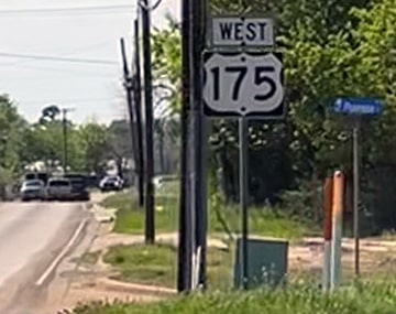
End of US highway 175 |
 |
|
Mileage: in 1989 AASHTO listed a figure of 114 miles for US 175. That closely matches our own measurement of 113.3 miles. Since then US 175 has been realigned in Dallas; as of 2020 it measured 109.9 miles.
|
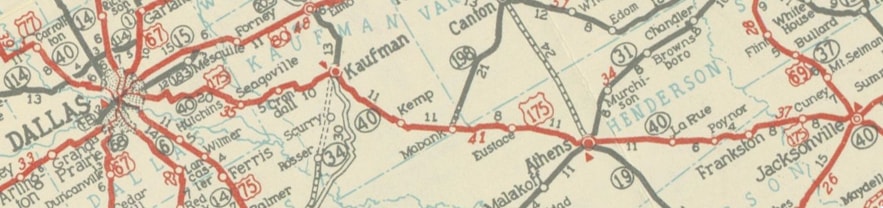
The south end of US 77 was originally in Dallas. In 1930 Texas requested that the road between Dallas and Jacksonville be added to the system as an extension of US 77. AASHO disagreed with this idea, suggesting that the US 77 designation should instead be reserved for a route heading more directly south from Dallas (and that is what happened a few years later). But that meant the Dallas-Jacksonville highway would require a new number, so in late 1930 the US 175 designation was created for that purpose...
c. 1936, TX DoT
|
...however, US 175 runs more east-west than north-south, and it is signed east-west... so US x80 would have been a more appropriate number.
|
Since then, US 175's endpoints have always been in Dallas and Jacksonville. However, it has terminated at three different intersections in Jacksonville, and it has had at least three different endpoints in Dallas. Photos of the historic downtown endpoints there are shown on the Dallas page.
|
In the mid-1960s, when Seagoville Rd was upgraded and became the Hawn Freeway, the US 175 designation followed that connection to what was then known as S. Central Expwy, and ended there (since that carried US 75 traffic through Dallas):
|
Karners, Jan. 2012
|
That was known to locals as "Dead Man's Curve". US 175 formerly ended there, but at the time of that photo it continued to the right (and then in 2020 a new alignment of US 175 opened straight ahead; more on that below). These next photos were looking south on S. Central Expwy (which was later known as SM Wright Fwy):
Wiley, 2001
|
Wiley, 2001
|
That is now designated US 175, which exits to the right, then passes under to the left, becoming the Hawn Frwy, heading towards Kaufman. However, that was formerly US 75 (continuing on what is now TX hwy. 310), and the US 175 designation began at that junction.
|
|
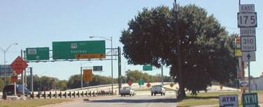
Since about 1988, the US 75 designation no longer makes it this far south, so the US 175 designation was extended north a bit via old US 75 (SM Wright), ending at I-45's interchange 283. These shots were from southbound I-45:
Wiley, 2001
|
Lintz, Feb. 2018
|
|
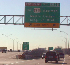
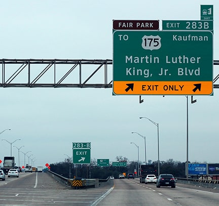
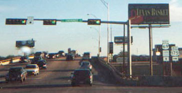
Notice the sign read "TO US 175". That took drivers to a transition ramp which served both US 175 and MLK traffic. Where that ramp split, the signs indicated that one was now truly on US 175:
|
Wiley, 2001
|
|
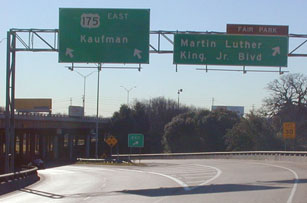
These shots show the former north end of US 175, looking north on SM Wright. Historically US 75 continued straight ahead, and followed Central through downtown (that is now called Cesar Chavez Blvd, and the new Clearview version of that sign reflects that change, as you will see below). But now US 75 ends on the other (north) side of downtown, so US 175 was extended up to this point:
|

Wiley, 2001
|
Karners, Jan. 2012
|
|
Just past the bridge that last US 175 confirming marker was posted, although an "END 175" assembly would have been more appropriate in that location. At any rate, that sign was removed in 2020...
|
Sanderson, Feb. 2021
|
|
...probably corresponding to the timeframe when the US 175 designation was officially removed from SM Wright. That was because a new direct connection to I-45 was built, such that US 175 now crosses SM Wright in a perpendicular direction and ends at a new interchange numbered 282. (Plans call for SM Wright to ultimately be vacated, but at the time of these photos, that process was only partially complete, and plenty of US 175 signage still remained along the old route). This image was looking south on I-45 at the west beginning of US 175:
|
Sanderson, Feb. 2021
|
|
The first confirming assembly was about 1.5 miles ahead, right about where traffic from southbound SM Wright formerly merged with the Hawn Fwy:
|
Sanderson, Feb. 2021
|
|
Heading back the opposite direction, the last westbound US 175 marker was posted after the on-ramp from Lake June Road:
|
Sanderson, Feb. 2021
|
|
There was no "End" signage ahead, but this photo shows where US 175 now ends at its junction with I-45:
|
Sanderson, Feb. 2021
|
|
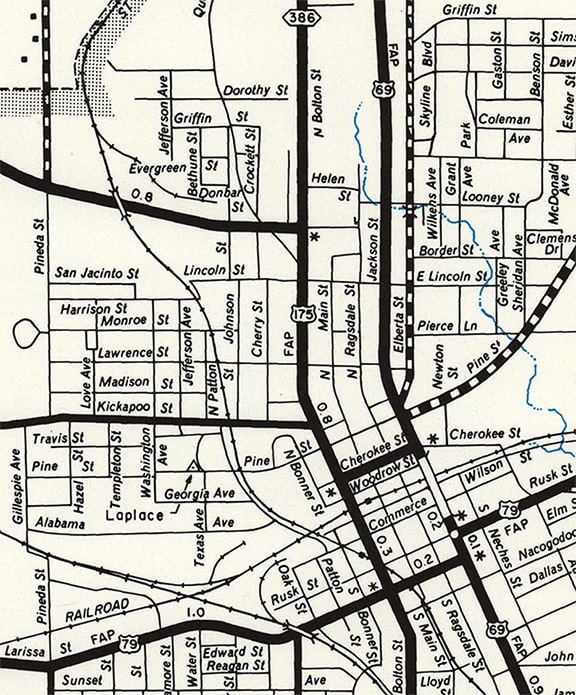
The 1940 TXDOT map of Cherokee County is not very detailed, but it does show that all highways converged on three square blocks of downtown Jacksonville, bounded by streets surrounding the City Hall: Bolton, Jackson, Rusk, and Larissa. All highways radiated out from that rectangle in a "pinwheel" arrangement: US 69 went north via Bolton and south via Jackson, while US 79 went east via Rusk and west via Larissa. US 175 is shown coming in via Frankston Street:
|
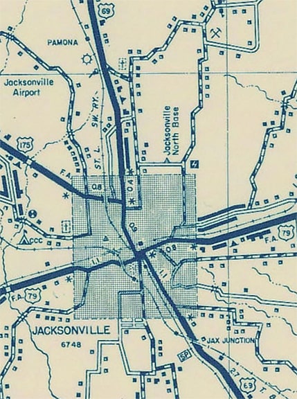
c. 1940, TXDoT
|
That map suggests US 175 could have ended on Frankston at Bolton, but based on common signage practices of that time (especially in Texas) I suspect US 175 traffic actually would have been directed to continue south on Bolton with US 69, ending somewhere on the rectangle. Where exactly? It is hard to be certain, but it could very well have been signposted to the original City Hall (which was torn down in the 1960s).
|
|
This photo was taken looking north on Bolton, which was formerly US 69. To the left on Frankston could have been the original east beginning of US 175, but it is more likely this was simply the junction where US 69 and 175 split, with US 69 continuing straight ahead, and US 175 turning to the left:
|

Nelson, Aug. 2007
|
|
We know from a 1947 TXDOT minute order that US 69 was changed: instead of staying on Bolton from Frankston all the way south to US 79 (Rusk and Larissa), traffic was directed east on Cherokee, then resumed southward on Jackson (according to the minute order, old US 69 along Bolton between Cherokee and Larissa was changed to FM 347). The 1955 USGS 1:50k topo illustrated that, as did this 1961 TXDoT map:
|
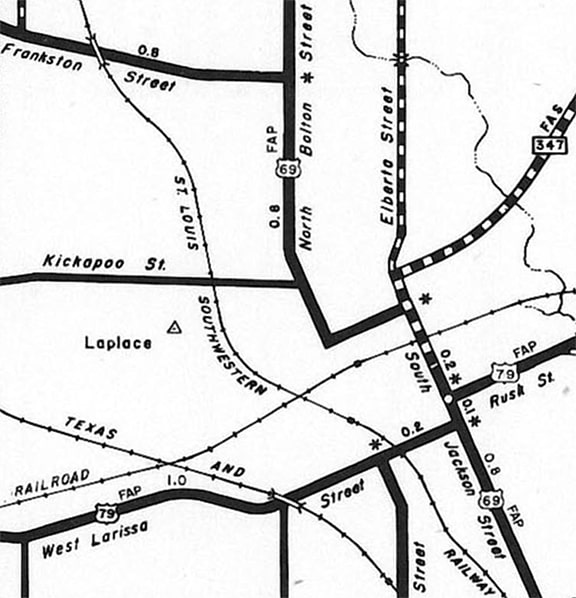
c. 1961, TXDoT
|
Those maps also illustrated the reason US 69 used Bolton (instead of Jackson) to head north of the city: at the time Jackson went only as far north as Looney. Also note Frankston did not continue east of Bolton (as it does today via Alexander Boulevard). So like the 1940 map, these also suggested that US 175 could have ended on Frankston at Bolton, but again, I doubt that was the case. For reasons I will explain below, I am quite certain that US 175 would have been directed south with US 69 to a junction with US 79 near the City Hall. If so, then US 175 probably ended on Jackson at Larissa.
|
|
But things changed again just two years later, in 1963. At that time Jackson was extended north of Looney, and US 69 traffic was changed to follow Jackson all the way through town. We know it was 1963 because that was the year Spur 386 was established to run along former US 69 (Bolton) north from Frankston (note that this Spur designation was changed in 2003 to become an extension of FM 347). All of this was shown on TXDOT's 1972 map, which is also the earliest map I have seen that illustrates US 175 continuing south from Frankston via Bolton (the 1982 USGS 1:24k topo showed the same thing)...
|
c. 1972, TXDoT
|
...but I suspect US 175 had actually been directed downtown all along. Why? As previously mentioned, that is how Texas typically did things, but there is an additional reason: if US 175 did not already extend south from Frankston into the downtown area, then in 1963 there should have been a minute order authorizing that extension. But the lack of a minute order suggests that US 175 already extended downtown. So when US 69 was moved off Bolton and Cherokee, it was not necessary to give the old route a new designation, because it was already US 175.
|
|
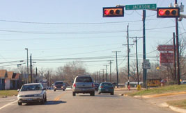
At the time, US 79 traffic used Rusk east of Jackson, but it was still following Larissa Street west out of town. In 1999, Rusk was upgraded west of Jackson so that US 79 traffic could remain on Rusk all the way through town. When that happened, US 175 shields no longer appeared on the replacement signage, so the designation was essentially cut back to its junction with US 69, such that US 175 ended on Cherokee at Jackson. This photo was looking west on Cherokee from Jackson, and showed the first US 175 trailblazer:
|
Wiley, 2001
|
|
From there, US 175 continued west on Cherokee for three blocks; then north about a half-mile on Bolton; and then west on Frankston, out of town. Above, the car at left had just reached the east end of US 175. Straight ahead (across Jackson) the driver would have seen the signage shown here:
|
Wiley, 2001
|
|
The assembly on the left was for northbound Jackson traffic; it is shown face-on in this photo...
|
Wiley, 2001
|
...and this photo shows the old beginning from southbound:
swissJohn, 2000
|
|
On the far side of the overpass is downtown Jacksonville and the junction with US 79.
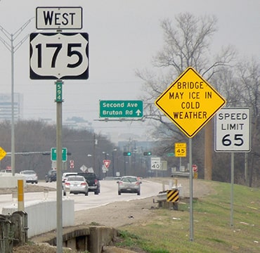
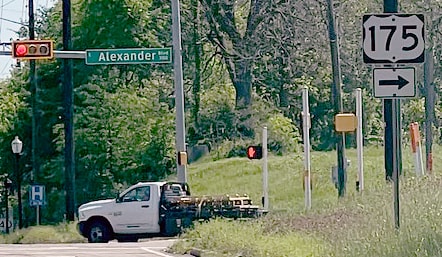
A short time later, in 2002, US 175 was extended straight through its intersection with Bolton on a new road called Alexander. As of 2023, the last eastbound US 175 marker was posted just past its junction with CR 3405: |
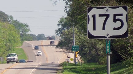
Sanderson, Mar. 2023
|
|
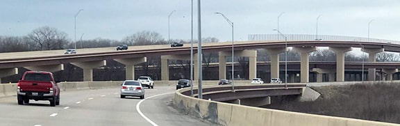
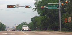
Almost three miles ahead, US 175 still ends at its junction with US 69, but this is now a half-mile north of the former terminus on Cherokee.
Stuve, Mar. 2010
|
Sanderson, Mar. 2023
|
|
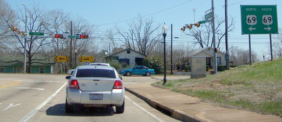
This photo shows the east beginning of US 175 as seen from southbound Jackson...
Sanderson, Mar. 2023
|
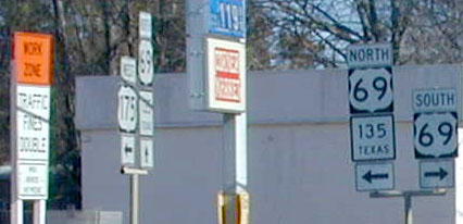
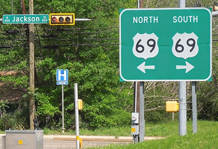
...and this photo was taken looking north on Jackson, or US 69:
Cozart, Apr. 2003
(detail)
|
|
US 175 begins to the left. That was a new intersection at the time of that photo, and signage back then was quite inadequate. Twenty years later the situation still had not changed much. At least there was some advance signage, but it did not include a directional tab:

Brooks, Aug. 2011
|
Sanderson, Mar. 2023
|
|
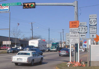
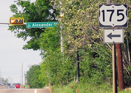
Drivers taking that left turn will see the first US 175 confirming assembly in about two blocks, just past the intersection with Bolton:
|
Sanderson, Mar. 2023
|
Research and/or photo credits: Robert Brooks; Justin Cozart; Karin and Martin Karner; Josh Lintz; Steven Nelson; Dale Sanderson; Eric Stuve; swissJohn; Mike Wiley
Page originally created 2000;
last updated Apr. 4, 2023.
last updated Apr. 4, 2023.
