End of US highway 65 |
 |
Summa
|
Summa
|
|
1926-1934
|
1934-1935
|
1935-1951
|
|
1951-1979
|
1979-2005
|
2005-present
|
Mileage: during the time of US 65's maximum historical extent (Minneapolis to New Orleans) it was 1236.8 miles long. By 1989 it had been truncated to Albert Lea, and AASHTO listed a figure of 1030 miles for US 65... however, that included the mileage of US 65's associated business/spur routes. According to the state subtotals on AASHTO's 1989 spreadsheet, mainline US 65's actual end-to-end total was 988 miles... but at the time, US 65 still ended in Natchez. Since then it has been truncated to Clayton, and our own 2020 measurement yielded 960.1 miles.
Originally the US 65 designation went only to Vidalia LA, because there was no bridge across the Mississippi to Natchez:
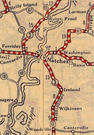
c. 1927, Rand McNally
|
|
In 2005, the south end of US 65 was truncated another 19 miles, to Clayton LA. Here is the story in the words of an e-mail reply from a LADoTD official:
"...the Louisiana Department of Transportation and Development has submitted an application to AASHTO requesting that US 425 be extended from its intersection with US 165 in Bastrop along US 165 to Mer Rouge, then along LA 133, LA 137, LA 15 and US 84 to US 61 in Natchez. We have also requested that US 65 end at Clayton instead of at US 61 in Natchez. This would hold the number of route designations to two in Mississippi. The purpose is to facilitate travel between the capitals of the States of Louisiana and Arkansas. Currently travel from Baton Rouge to Little Rock involves seven different route designations. Under this request, travel from Baton Rouge to Little Rock could be accomplished via three US routes, namely US 61 and US 425 in Louisiana and US 425 and I-530 in Arkansas."
"...the Louisiana Department of Transportation and Development has submitted an application to AASHTO requesting that US 425 be extended from its intersection with US 165 in Bastrop along US 165 to Mer Rouge, then along LA 133, LA 137, LA 15 and US 84 to US 61 in Natchez. We have also requested that US 65 end at Clayton instead of at US 61 in Natchez. This would hold the number of route designations to two in Mississippi. The purpose is to facilitate travel between the capitals of the States of Louisiana and Arkansas. Currently travel from Baton Rouge to Little Rock involves seven different route designations. Under this request, travel from Baton Rouge to Little Rock could be accomplished via three US routes, namely US 61 and US 425 in Louisiana and US 425 and I-530 in Arkansas."
|
There was nothing wrong with the desire to unify that corridor with a single US route number, but there was an even better option available (see the US 425 page for more details). However, AASHTO rubber-stamped the proposal, so US 65 now ends disgracefully at a 3-digit branch route with an illegitimate number.
|
Ivy/Nitzman, Oct. 2021
|
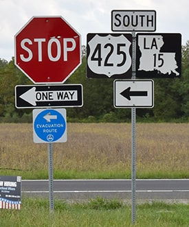
The US 425 designation now runs through this area along with LA hwy. 15. Historically US 65 continued to the left (south), but that junction is now where US 65 ends. (Incidentally, for several years on this page, I questioned why those blue evacuation route signs point south, towards the Gulf, but in 2023 someone explained it to me: the signs are not there for hurricane evacuation, but rather they point away from the nearby Grand Gulf nuclear power generator, in case an evacuation is necessary due to a meltdown.)
|
Anyway, this junction has been reconfigured, as a result of recent upgrades in this corridor. US 425 is now a four-lane divided highway in this area, and the opposing lanes bifurcate through Clayton. The original two-lane segment now carries northbound traffic only. Southbound is on new pavement, built on a historic railroad right-of-way. This photo shows what the old junction looks like now:
|

Backlin, Dec. 2008
|
|
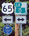
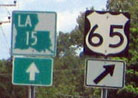
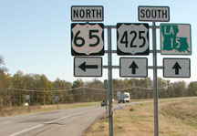
Northbound LA 15 is still to the right (as well as northbound US 425). But for southbound, one must continue ahead, and then turn left, so that is where US 65 ends now. Here we are looking north on what was once US 65, but what is now northbound US 425, and the south beginning of US 65 is to the right:
|
Ivy/Nitzman, Oct. 2021
|
|
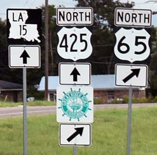
These photos show the view approaching the junction from the north via LA hwy. 15. Southbound US 65 used to continue ahead, but now this is southbound US 425, and US 65 begins to the left:
|

Ivy/Nitzman, Oct. 2021
|

|
Drivers making that left turn soon come to a stop sign at the intersection with the northbound lanes of US 425:
|
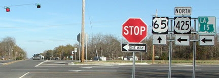
Backlin, Dec. 2008
|
|
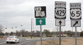
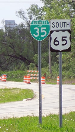
Straight ahead is the first northbound US 65 sign, shown close-up here:
|

Cozart/Nitzman, June 2004
|
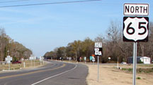
Backlin, Dec. 2008
|
Ivy/Nitzman, Oct. 2021
|
On its north end, US 65 originally went to St. Paul, but after about eight years it was changed such that it terminated in Minneapolis. A 1934 Minnesota state highway map shows US 65 extending northward to US 210 at McGregor (now MN 210). There was at least one commercial map from the same year that showed US 65 extending all the way up to US 71 at Littlefork, and another that indicated US 2 at Swan River was the northern terminus. However, US 65 north of the Twin Cities was never approved by AASHO and it was never signposted that way. The north end of US 65 remained in Minneapolis from the mid-1930s until 1979, when it was truncated to its current terminus in Albert Lea. Here is that agenda item from AASHTO's meeting in June of that year:

|
For quite some time, the last northbound reassurance marker has been posted heading east on Main, about a mile after making the turn from Broadway:
|
Morrison, May 2006
|
Sanderson, Jun. 2022
|
|
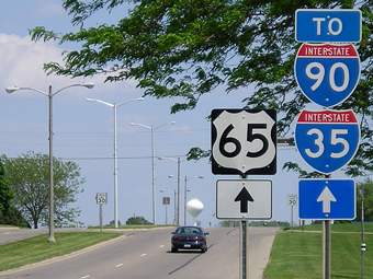
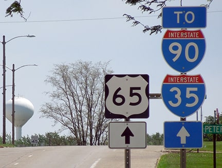
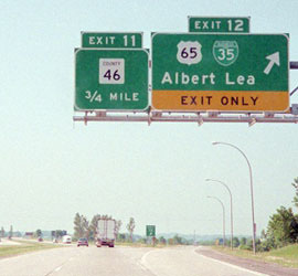
The north terminus of US 65 is an on-ramp to northbound I-35 (although it is I-90 that is referenced on signs there, since that interchange is just to the north):
|
Sanderson, Jun. 2022
|
|
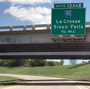
This next photo shows where US 65 merges with I-35 at interchange 12:
|
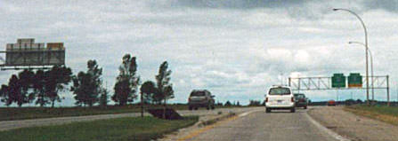
Castleman, summer 2001
|
|
The car at left is on northbound I-35; the green signage in the distance is for the cloverleaf at I-90.
Here is the signage from southbound I-35 for the north beginning of US 65... |
Castleman, summer 2003
...as well as the first southbound trailblazer, which was posted at Blake Avenue:
|
Sanderson, Jun. 2022
|
Research and/or photo credits: David Backlin; Monte Castleman; Justin Cozart; Brent Ivy; Jess Kilgore; Steve Lockwood; Jeff Morrison; Steven Nelson; Alex Nitzman; Dale Sanderson; Michael Summa
Page originally created 2003;
last updated Dec. 17, 2023.
last updated Dec. 17, 2023.
