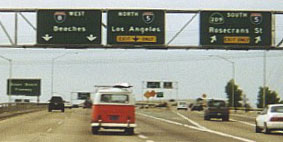
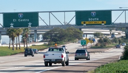
Historic US highway endpoints in San Diego, CA
|
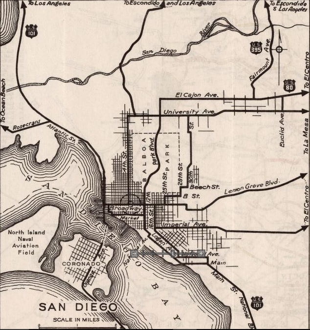
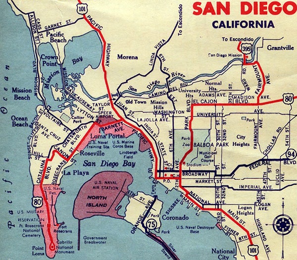
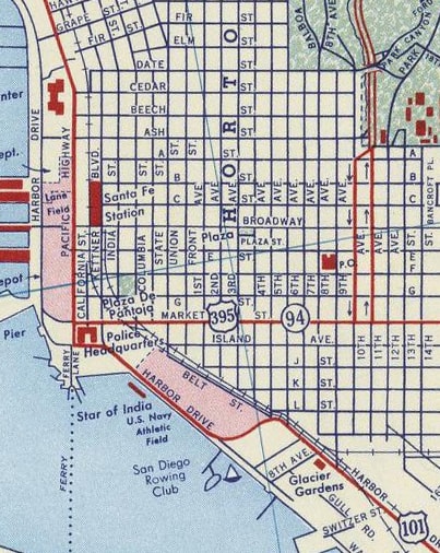
Initially, US 80 came into the city on 4th Avenue (labeled "4th Street" on this map), and the designation ended at Broadway (which carried US 101). US 395 was extended to San Diego in about 1934, but this 1936 map is the earliest detailed one I have seen that shows it. It came in on Fairmount Avenue, joined with US 80 along El Cajon Avenue, and the two shared a common endpoint downtown:
|
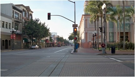
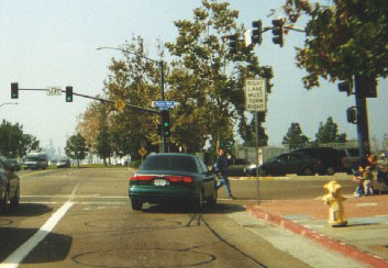
This photo is looking south on 4th. Broadway is the cross street, so this was the original west end of US 80, and the south end of US 395 starting in about 1934:
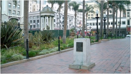
At far right is visible part of a small park called Horton Plaza. In this park was the old Pacific Milestone (removed in 2020), which had references to both the Lee Highway and the Old Spanish Trail:
|
It is not surprising that these routes ended at the same place where the named auto trails ended. But that lasted only until about 1937. Around that time, US 101 was changed such that it used Market Street (instead of Broadway), and US 80-395 came in via Park Boulevard (nee 12th Avenue) instead of 4th:
|
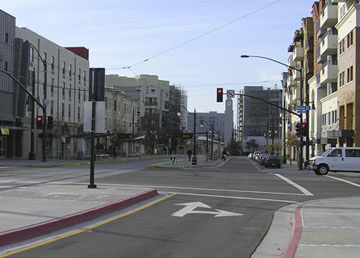
This shot was looking south on Park at Market -- the next terminus of US 80-395. Southbound US 101 was straight ahead on Park, while northbound was to the right on Market:
|
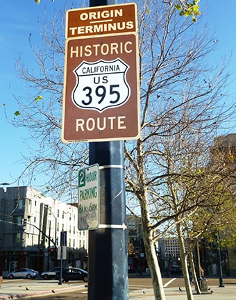
Not long after that photo was taken, the Historic Route 395 Association recognized the former terminus with a cool sign:
|
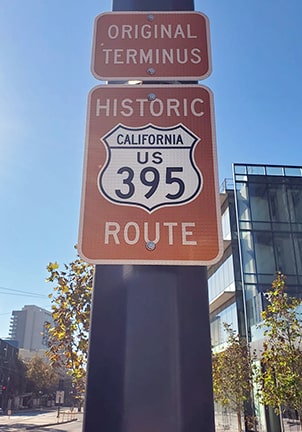
That was taken down in 2017 because of construction, but it was later replaced with a similar version:
|
Cool sign, but of course the original south terminus of US 395 was actually in Spokane. And Park at Market was not even the original California terminus (that was actually 4th at Broadway, as noted above). So instead of "Original Terminus", I would prefer to see that panel worded "Terminus 1937-1943".
|
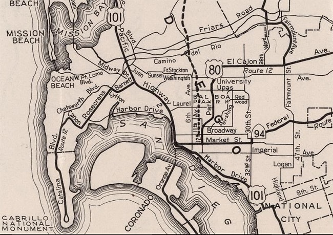
At this point it should be noted that during the WWII years, maps published by Gousha indicated that US 80 was extended west and south down Point Loma, ending at Cabrillo National Monument...
|
...however that was apparently not corroborated by other commercial publishers. And notably, maps produced by Caltrans during that timeframe labeled the Point Loma corridor only as "Route 12". So it seems unlikely that US 80 was ever signposted anywhere west of downtown San Diego.
|
|
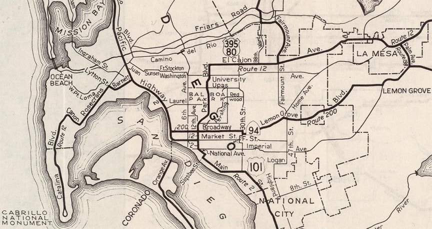
This 1944 map was one of the earliest to show the Cabrillo Freeway under construction (US 395 began using that in about 1947). It was also one of the first maps to show that US 101 had been rerouted off Market, and onto Harbor Drive instead. When that happened, US 80-395 was extended west from its previous endpoint, ending at Pacific Highway:
|
|
Northbound US 101 would have been to the right, and southbound would have been to the left (via historic Pacific Highway; but after Seaport Village was built in the late 1990s, this area was completely reconstructed, and the road to the left is now a dead-end). Here is another perspective of that intersection, looking north on what was historically Pacific Highway:
|
|
|
That was northbound US 101, and to the right on Market was the beginning of US 80-395. For US 395, that remained the case until about 1976, when that designation was truncated to its current endpoint in Hesperia. At the upper right of this 1956 map, US 395 is shown coming south on what is now the Cabrillo Freeway (CA 163), and then splitting into the 10th-11th Avenue couplet. At Market, US 395 went west, ending at US 101:
|
|
The 1965 Caltrans map showed US 101 had been rerouted onto what is now I-5, and it showed US 395 ending on the Cabrillo Fwy at its interchange with I-5. But that was probably an error, because the next issue of the map (and every other map through 1975) showed US 395 signed all the way to Seaport Village.
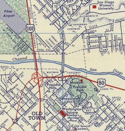
But US 80 ended there only until about 1954. When the Cabrillo Fwy opened in about 1947, US 80 was extended west from El Cajon, via Normal and Washington Streets, where it then joined US 395 south and west to the endpoint shown above. But in 1954, US 80 traffic was completely diverted off El Cajon, and instead onto roads that were originally known as Alvarado Canyon Road and Camino del Rio. This corridor was later called the Alvarado Freeway, but now it is known as the Mission Valley Freeway, or I-8. The US 80 designation ended at the interchange with US 101 (today's San Diego Freeway, or I-5): |
Straight ahead was the west beginning of US 80. That was true until about 1968, when the US 80 designation was completely removed from California.
Research and/or photo credits: Chris Elbert; Alan Hamilton; Karin and Martin Karner; Dale Sanderson; Shayne Stephens
Page originally created 2001;
last updated Aug. 22, 2022.
last updated Aug. 22, 2022.
