|
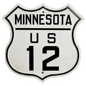
This "standard" black-and-white US route shield was adopted back when the highway system itself was implemented in the 1920s. Starting in the mid-1940s, some state departments of transportation began to experiment with adding color to the US route shield. By the mid-1950s, several states had adopted some form of a colored US highway sign (although the changes were not implemented uniformly among the different states, as neither AASHO nor any federal agency had officially approved the practice). These changes coincided with the "Golden Age" -- the timeframe during which US routes were at the pinnacle of their popularity.
|
|
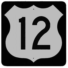
But it was not long before the 1960s rolled around, and at that point the US highway system began to decline in favor, as implementation of the new Interstate highway system started. Perhaps the earlier push towards colored US route shields was a factor that influenced AASHO's decision to choose a design for the new Interstate shields that also included color. But it quickly became apparent that motorists might get confused when trying to distinguish between the blue-and-red Interstate shields and colored US highway shields. By the mid-1960s, most states had ended their colored US route shield program, instead adopting a new standard black-and-white shield that was specified in the revised MUTCD of 1961:
|
|
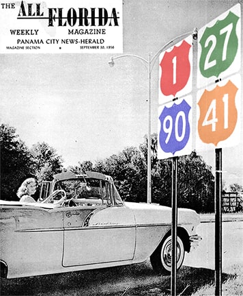
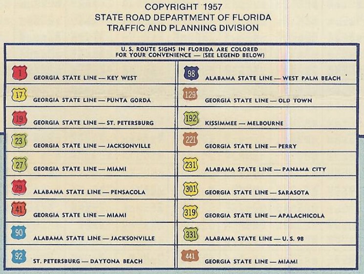
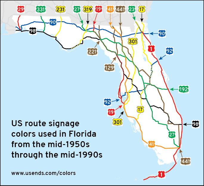
Florida was not the only state to use colored US route shields, nor were they the first. But they certainly became the most well-known. Why? For one thing, most other states that used colored route shields did so only for intra-city navigation, but Florida was one of the few that implemented colored shields on a statewide basis. Also, FDoT continued posting colored shields well into the 1990s, which was about thirty years beyond the time when other states stopped. Florida started using colored US highway signs in 1956, and the 1957 issue of the official state highway map was the first to show them:
|
|
Florida used seven different colors, and they were originally assigned in such a way that no two routes having the same color shield would intersect. (An exception occurred later, when the green US 192 was extended west to intersect the green US 27.)
|
Some additional photos showing how these colored Florida signs actually looked can be viewed on the following pages: US 1 :: US 19 :: US 27 :: US 41 :: US 92 :: US 129 :: US 192 :: US 221 :: US 231 :: US 331 :: US 301 :: Miami :: Pensacola :: St. Pete :: Sanderson
The now-defunct website us-highways.com put it like this: "In 1956, the language of the MUTCD allowed the use of colored shields. But by the 1980s, the verbiage in the MUTCD had changed, prohibiting the use of colors other than black and white on the standard US highway shield. So after three decades of use, Florida's colored US highway signs were suddenly considered non-standard. FHWA refused to allow Federal gas tax funds to be spent on new or replacement colored US shields. The colored US shields were no more expensive than a standard US marker, although yellow and orange markers did require more frequent replacement. FDOT maintenance forces placed colored shields up at state expense. Florida officially ceased producing colored US route markers on August 27, 1993. No new colored US shields were made after that time, but old stocks were used until they were exhausted. The last of the old colored shields were posted in 1996. Each year that passes, there are fewer of the old colored signs left. They are being replaced with standard MUTCD black and white signs. Occasionally a county or private entity will post a sign in the old color scheme, but that is a rare event."
|
|
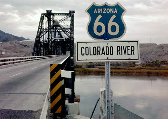
Arizona also used colored route shields statewide, from 1955-1964. However, they implemented their color scheme with both US and state highway markers. Also, they deployed only four colors, each one indicating a specific direction-of-travel, as illustrated on this legend from the 1961 official highway map:
Signs in the field did not look exactly like those illustrations; following are some actual photos:
|
|
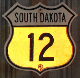
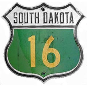
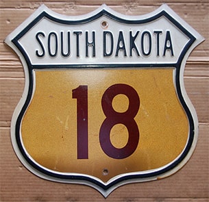
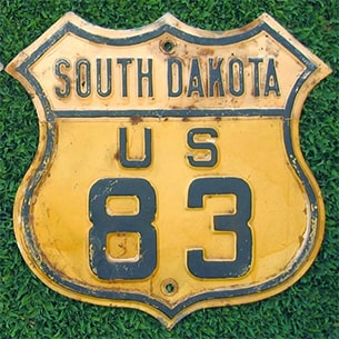
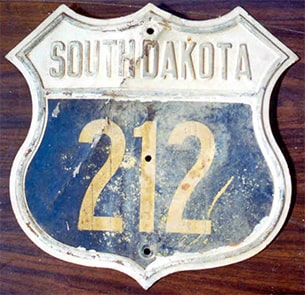
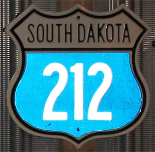
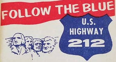
South Dakota used colored route shields on a statewide basis. However, if you zoom in to this photo, on both the far left and far right sides, you can see a US 16 shield that looks black (rather than green, like the one shown above). So more information is needed about South Dakota's methodology. This image is from a pamphlet promoting "the blue route" (US 212 through South Dakota) as the shortest all-weather road between the Twin Cities and Yellowstone:
|
|
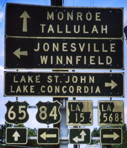
From 1956-'64, Louisiana used white-on-green US route shields, apparently on a statewide basis; this photo was taken in Ferriday:
|
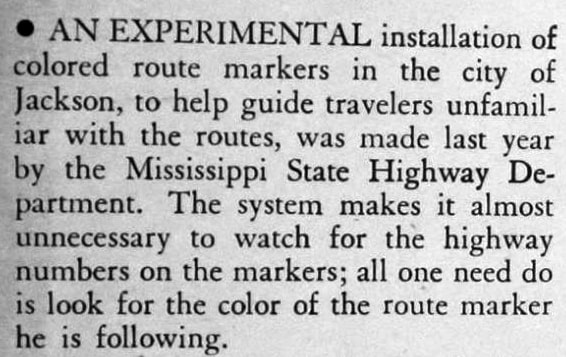
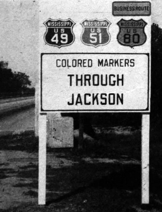
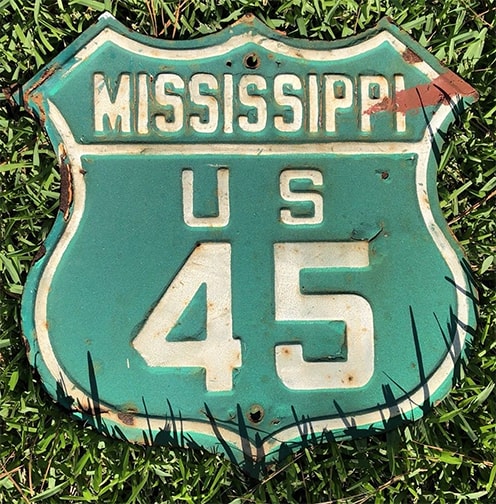
It appears that the idea for colored US route shields originated with highway officials trying to help drivers navigate through larger cities. Before modern freeways were built, following a US route through a town could sometimes involve making several turns. It was thought that adding color to the route markers would aid motorists with intra-city navigation. The earliest experiments with this idea (of which I am aware) were in Jackson Mississippi in 1947 (although this same article quoted a state highway maintenance engineer who said he did not believe the idea originated with his agency). In Mississippi this was done not only with US routes, but with state highways as well:
|
|
That article specified that US 49 was red in Jackson; US 51 was blue; Business 80 was yellow; but mainline US 80 used standard black-and-white signage. Obviously other cities had different highways and different colors...
...and the same highway was not necessarily the same color in different cities. For example, US 49 was red in Jackson, but yellow in another city. Both blue and green shields are known for US 51.
|
|
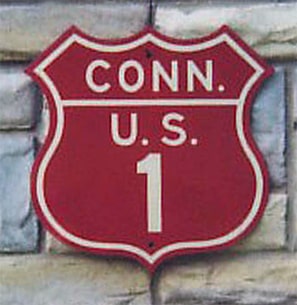
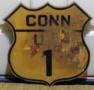
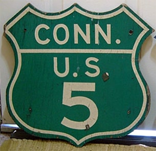
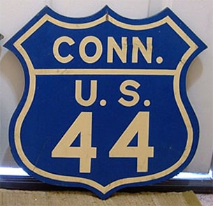
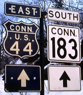
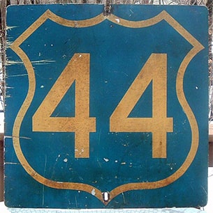
Connecticut began experimenting with colored US route shields shortly afterward, in 1948 (more info):
Reportedly US 6 shields were black-on-yellow.
|
|
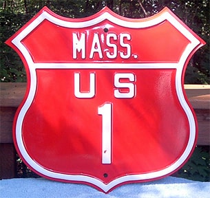
It is possible that the New England states coordinated their US route colors, because here we see examples of shields in Massachusetts and Rhode Island that used the same colors as Connecticut:
|
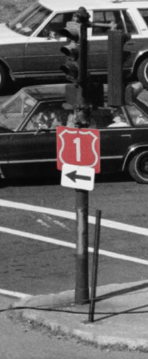
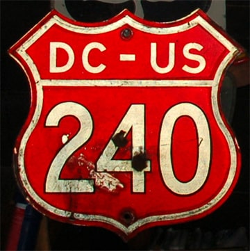
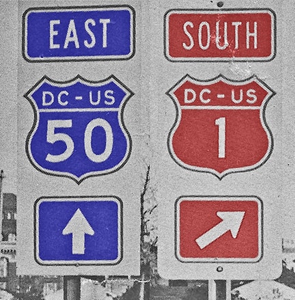
District of Columbia used colored route shields to indicate direction, similar to Arizona. In the previous photo, the US 50 shield was yellow (not white), and my understanding is that eastbound shields were blue. Northbound US 240 was obviously blue, and this red US 240 was used for southbound traffic:
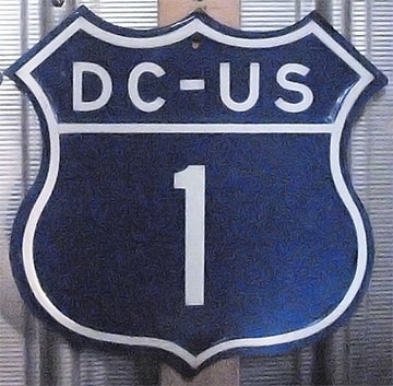
Likewise, that blue US 1 shield was for the benefit of northbound drivers, and red shields were used for southbound:
|
|
For a brief time (about 1956-1961) New Jersey used green US route shields...
|
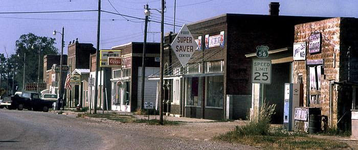
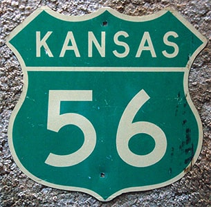
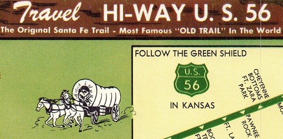
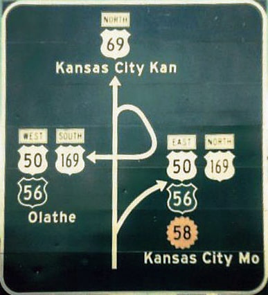
...and US 56 was commissioned in 1957, right during the height of popularity of colored route shields. Kansas initially posted the route using white-on-green shields statewide, and some of those signs were still extant into the 1980s:
|
|
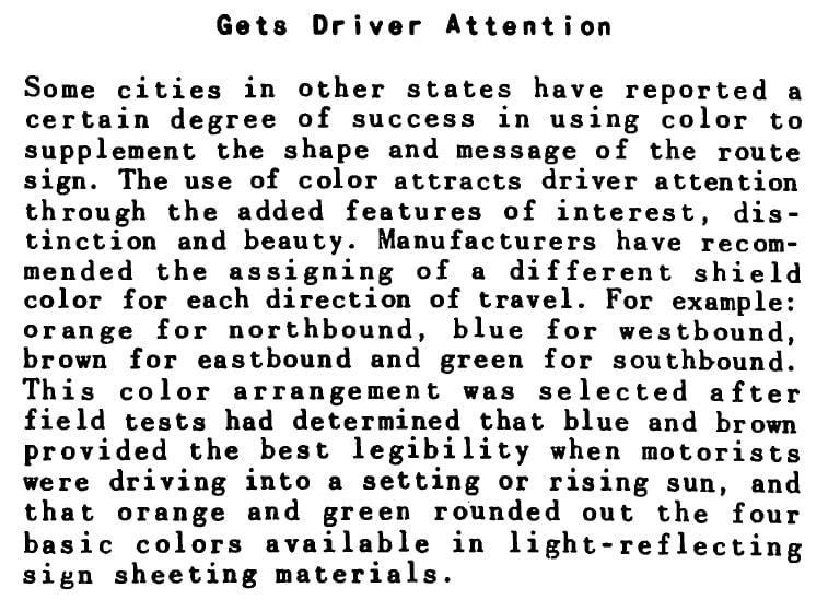
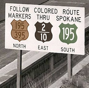
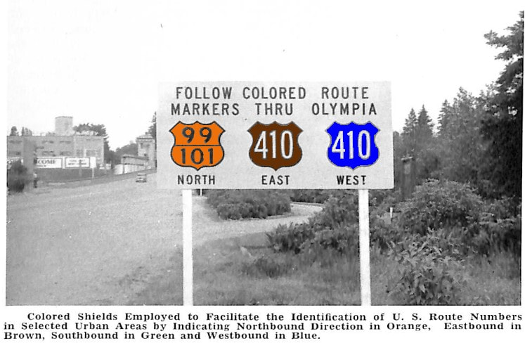
According to the paragraph below, during the 1950s and '60s Washington used the same direction-based color scheme as Arizona, but it appears they did so only within the larger cities (excerpt from Oct. 1954 issue of State of Washington Department of Highways News):
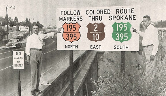
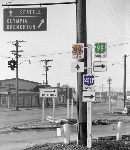
Following are some photos that were in that same news article (I manually colorized the second and third ones based on the color description):
|
|
I suspect that second photo was taken after the first, and here's why I think it was corrected: That sign was posted on the High Bridge over Latah (aka Hangman) Creek, in which case southbound US 395 would have been behind the camera, so it did not make sense to reference it heading that direction at that location.
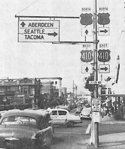
This next colorized photo shows a similar sign that was posted in Olympia: |
|
That previous image was from Tacoma, looking northwest on Bay Street at Portland Avenue (although that intersection has changed significantly since the time of that photo). Clearly the US route shields were different colors; based on the info above US 99 must have been orange; south 99 was green; and west 410 was blue.
Other states have used colored US route shields in a different manner than any of the examples noted above. Reportedly from the 1930s-70s, Indiana used gold-on-blue (or white-on-blue) markers for both US and state highways; below is an example from South Bend: |
Since 1978, Idaho has used brown highway markers on its officially-designated scenic byways (US and state routes). Possibly a different color scheme was used during the 1950s, but few details are known.
Research and/or photo credits: Jake Bear; Kathy Black; Mark Bozanich; Scott Broady; Robert Droz; Robert Edgar; Nathan Edgars; Francis Khoury; Jim Lindsay; Dale Sanderson; Michael Summa; Mike Traverse; Joel Windmiller
Page originally created 2016;
last updated Sep. 10, 2023.
last updated Sep. 10, 2023.
