Current and historic US highway endpoints in Jacksonville, FL
|
1927-present
|
 |
|
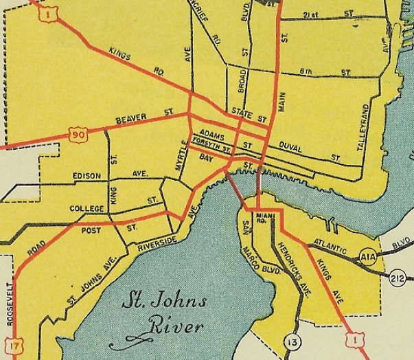
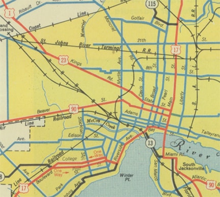
To begin, here is a map that shows how routes through the city were arranged in 1927, when the US highways were first assigned:
|

c. 1927, Gousha
|
|
US 90 is shown coming in on "Enterprise St" (which is now known as Beaver Street), meeting US 1 at Myrtle Avenue. US 90 probably did not end there, but rather was signed along Adams Street, ending at Main Street, near the City Hall and Courthouse. US 17 came in on Main Street, and probably ended at the same intersection. The perspective in this image is south on Main:
|
Karners, Dec. 2016
|
|
US 90 probably began to the right on Adams, while US 17 probably ended there. That was likely US 17's only endpoint in Jax, because already by 1932 it had been extended south out of town. However, maps from the mid-1930s indicate that highway traffic had been shifted off Adams, and onto Bay Street instead. So at that time, it seems likely that US 90 would have ended on Bay at Main. This image was taken two blocks ahead, still looking south on Main:
|
Karners, Dec. 2016
|
|
US 90 may have begun to the right on Bay. However, starting in about the mid-1940s, maps showed that US 90 traffic remained on Beaver all the way to Main:
|
c. 1950, FDoT
|
|
It is possible that the designation could have been overlapped with US 1-17 south a few blocks to its old endpoint, but it seems more likely that US 90 would have ended on Beaver at Main. This is yet another image looking south on Main:
|
Karners, Dec. 2016
|
|
US 90 probably began to the right on Beaver. That was the last map to show US 90 ending in Jax; in 1950 the designation was extended about 15 miles west, to its current terminus in Jacksonville Beach. However, it was approximately the same time that the US 23 designation was extended to a new endpoint in Jax, which was two blocks north of US 90's former endpoint:
|
c. 1952, FDoT
|
|
Originally both directions of US 23 used State Street, and the designation ended at its junction with US 17 on Main. Following are a couple clips from 1952 photos that show signage at that intersection (I recommend clicking on these photos in order to view the full, original images). This first one was for drivers at the end of US 23, looking east on State at Main...
|
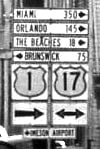
(linked to source)
...and this one was north on Main, showing the beginning of US 23 to the left on State:
|
(linked to source)
|
|
Today State serves as the westbound counterpart to Union Street, and Main is the southbound counterpart to Ocean Street. According to a late-2001 article in Jacksonville's newspaper, the terminus of the US 23 designation is still officially at US 1-17. Apparently there was once an "End" sign, but it was knocked down and never replaced. A state transportation engineer was quoted as saying: after they were done with a project to resurface State and Union streets, a new "End" sign (and also a "Begin" sign) will be posted. However, this had not happened by the time I was there in 2003, and still not as of 2015. At the time of my visit, the sign shown in the photo below was the only one that even mentioned US 23 downtown:
|
Sanderson, Oct. 2003
|
|
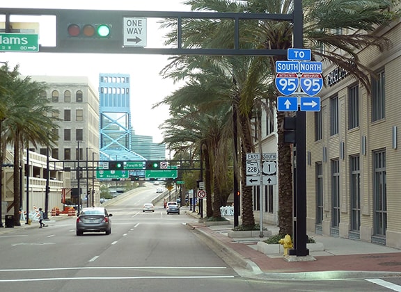
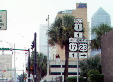
That was looking south on Main; northbound US 23 begins to the right on State. By 2008 that assembly had been replaced, and US 17 had been rerouted; here are some more recent photos (including one where US 23 was mis-signposted as "West"):
|

Karners, Dec. 2009
|

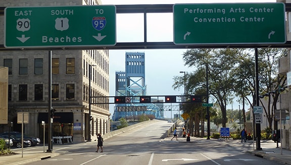
Nitzman, Oct. 2022
|
|
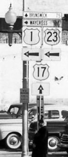
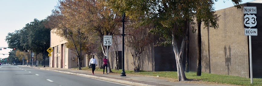
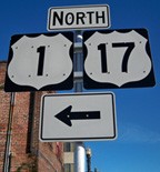
At least a couple more US 23 signs have been added in this area since then, one of which is shown below. Southbound US 23 uses Union Street (one block ahead) and ends at Ocean (one block to the left). In the past, a driver approaching from the left on State had this perspective:
|
Nasiatka, Aug. 2002
|
|
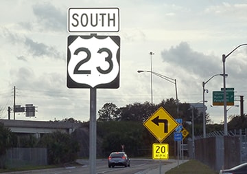
That was looking west on State at Main. Northbound US 23 begins straight ahead, and although at the time of that photo there was no mention of US 23 there, in about 2017 a new "Begin" assembly was posted just west of Main:
|
Nasiatka, Nov. 2019
|
|
Historically, southbound US 17 was to the south on Main, but now it is straight ahead. The first confirming assembly is visible in the distance, shown close-up here...
|

Karners, Dec. 2009
|
...although that is somewhat recent: back in 2003, one had to drive over a mile before finding a confirming marker:
|
Sanderson, Oct. 2003
|
|
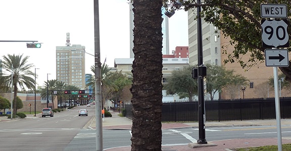
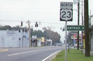
That was on State (which may be called Kings Road at that point), posted just before Myrtle Street (the intersection in the background, which is historic US 1). Heading the opposite direction, US 23 was well-signed where Kings splits into State and Union and goes under I-95...
|
Karners, Dec. 2016
|
|
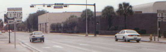
...but beyond that point, there was no more indication that Union still carried the US 23 designation. Here we are looking east on Union at Main (which at the time of this photo was southbound US 1-17):
|
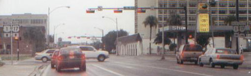
Nasiatka, Aug. 2002
|
|
The south end of US 23 is a block ahead, at Ocean (northbound US 1-17):
|
Karners, Dec. 2009
|
Research and/or photo credits: Robert Droz; Karin and Martin Karner; J.P. Nasiatka; Alex Nitzman; Mike Roberson; Dale Sanderson
Page originally created 2003;
last updated Dec. 29, 2023.
last updated Dec. 29, 2023.
