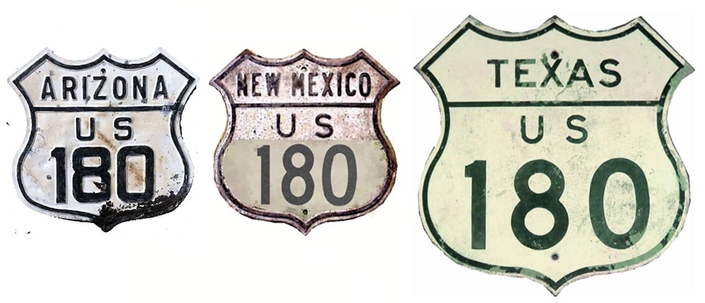
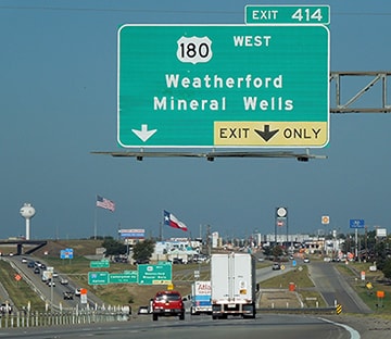
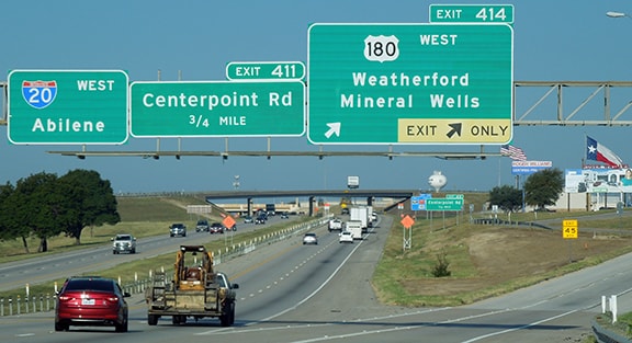
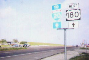
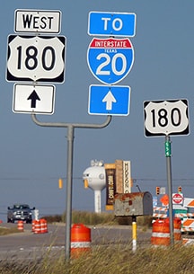
End of US highway 180 |
|
1943-1949
|
1949-1961
|
1961-1979
|
|
1979-1991
|
1991-1997
|
1997-2003?
|
2003?-present
|
|
Mileage: at its maximum historic extent (between Grand Canyon and Handley) US 180 was 1146.1 miles long. In 1989 AASHTO listed a figure of 1135 miles for US 180, but that was when it ran between Grand Canyon and Ft. Worth. Since then it has been truncated on both ends, and our own 2020 measurement yielded 1111.6 miles.
|
|
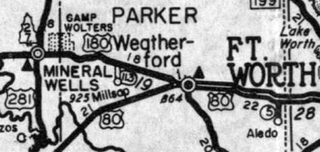
Today's US 180 is actually the second route to be assigned that number (from 1926 to 1935, US 180 [i] ran between Caballo NM and Florence Jct. AZ). US 180 [ii] was commissioned in 1943; its east end has always been somewhere along a 40-mile stretch between Ft. Worth and Weatherford TX, either in or around one of those two cities. The original east terminus of US 180 was in Weatherford, but not at the same place it ends today. I-20 had not yet been built, so it was still US 80 that went west out of Ft. Worth to serve Weatherford:
|
|
On the west side of town, where US 80 angled southwest towards Abilene, US 180 began by heading slightly northwest towards Mineral Wells (following the route of what had previously been Alternate US 80).
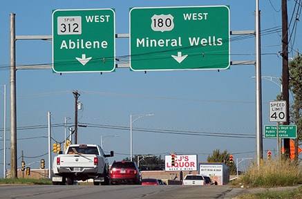
Today old US 80 through Weatherford is designated US 180. Current TX Spur 312 is the original route of US 80, and the junction where that splits off from US 180 once marked the east beginning of that route. This image was looking west on Palo Pinto Street (current US 180): |
|
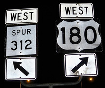
That was once westbound US 80, which continued to the left on Ranger Highway. The original beginning of US 180 was to the right on Mineral Wells Highway. An assembly giving the same information was posted ahead at the gore point:
|
The US 180 designation was extended east in 1949, concurrent with US 80 through Ft. Worth to a little community called Handley (which had been annexed into the Ft. Worth city limits just a few years prior).
|
|
Why this was done is not immediately obvious. It might have made sense to overlap US 180 with US 80 to junction US 81 in downtown Ft. Worth, but what would have been the purpose of dual-signing a route for its last ~40 miles, only to have it end at the Ft. Worth city boundary? Yet the records are clear that this is exactly what happened, and the maps agree:
|
Although I-820 is shown on that map (the freeway running north-south), one cannot conclude that US 180 originally ended there, because 820 had not been built in 1949. So what was the explanation? A 1967 DFW area highway planning map may contain an implied answer: it indicates that US 80 and US 180 (co-signed eastward from Weatherford) were to part ways again near the vicinity of today's I-30/University Drive junction. US 80 was to follow I-30 up into downtown, then Lancaster Av (today's TX 180) eastward into Dallas. US 180 was to follow a planned freeway skirting the south edge of downtown, roughly along Rosedale Street. That would have rejoined US 80 in Handley, so that is the junction where US 180 would have ended.
|
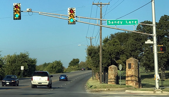
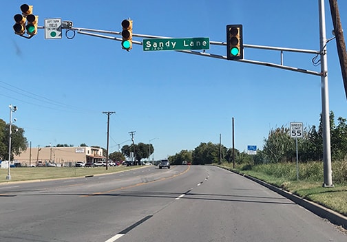
...and although I have not seen a TXDoT map detailed enough to show exactly where the designation ended, the Kennedale topo shown above indicates that the intersection with Sandy Lane marked the east terminus. Here is a current view of that intersection, looking west on Lancaster:
|
|
Today that is westbound TX 180, but historically US 80, and starting in 1949 the east beginning of US 180 was straight ahead.
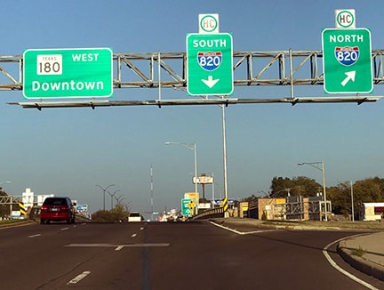
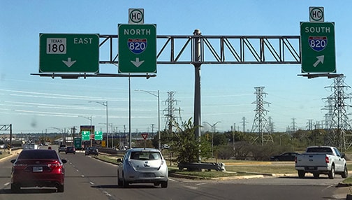
About 1.5 miles that direction is the interchange with I-820, which was extended through this area in the mid-1960s. At that time the US 180 designation was truncated to that interchange, such that it began straight ahead, still overlapped with US 80: |
|
US 180 was truncated to a point in western Ft. Worth in 1979, perhaps when it became apparent that no highway was ever going to be built along the south edge of downtown. Where exactly was its terminus? TXDoT records are explicit on this: it was at what is now I-30's interchange 2, where TX Spur 580 splits off. The minutes of AASHTO's meeting in June of that year also reference the same terminus...
|
...which raises the question again: why there? A little background might help to explain: when the interstates were first commissioned through DFW, I-30 ended at I-20 east of downtown Dallas (at today's junction of I-30 and US 80), and the freeway that runs between the city centers was designated I-20. This freeway was initially a toll road. Later, I-20 traffic was routed around the south loop (as it is today), and the I-30 designation was extended west through Dallas and Ft. Worth (as today), along what had been I-20.
|
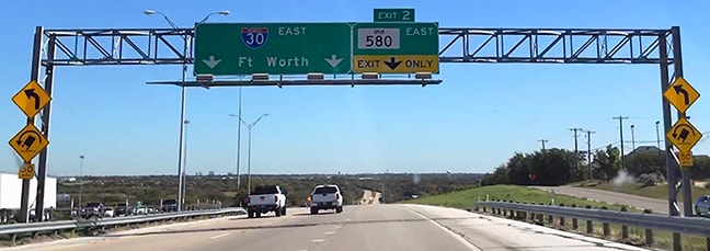
However, at first, modern I-20 between exits 421 and 428 did not exist. Instead, from exit 421, I-20 traffic was routed east on what is now I-30; then east on today's Spur 580; then south on I-820. So at the time, the west beginning of I-30 was at what is now I-30's exit 2. US 180 was overlapped with US 80 to that point, but US 80 continued eastward on its own, through Fort Worth and Dallas. Here is how that scene appears today:
|
Today that is eastbound I-30, approaching the Spur 580 exit. But historically that was I-20/US 80/US 180 -- all of which continued to the right along Spur 580 -- and I-30 began to the left ahead. So why did TXDoT dual-sign US 180 to this point? One possibility is: the tolls were soon to be removed from I-30, so maybe they planned to reroute US 80 onto that freeway, and then extend US 180 along what had been US 80 (Lancaster Av, Division St, etc.) At any rate, what ended up happening is US 80 simply stayed on its historic route for a few more years. So it was pointless to co-sign US 180 east of Weatherford, and in 1991 TXDoT obtained AASHTO's approval to truncate the route to its current terminus:
|
The irony about all this now is that neither US 80 nor US 180 actually make it into the city limits of Dallas or Ft. Worth, and there is no longer any US route connecting the two cities. Much of that historic segment of US 80 has been renumbered as TX 180. Here is the current east beginning, as viewed from westbound I-20:
|
|
Straight ahead on Palo Pinto Street was eastbound US 80, while westbound was to the right on Ranger Highway. Today US 180 continues ahead via former US 80 through downtown Weatherford, briefly bifurcating where it goes around opposite sides of the lovely Parker County courthouse. The last eastbound marker was posted at Center Point Road:
|
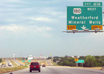
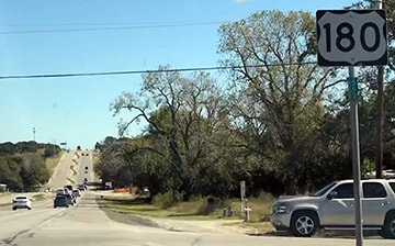
About two miles ahead from there is the current west end of US 180. There is an onramp to eastbound I-20, but US 180 continues about a half-mile beyond there, ending at the offramp from westbound I-20 (the actual terminus is quite anticlimactic, and it was difficult to get a decent photo when I was there in 2017, because the entire area was under construction). West from there another ten miles (via I-20 and I-30), one reaches US 180's brief historic endpoint at the exit to Spur 580 (photo above). Prior to that, US 180 continued further east, past downtown Ft. Worth, ending in Handley at I-820; and earlier still, US 180 extended as far east as Sandy Lane:
Interestingly, even though US 180 has not existed in this part of Ft. Worth since 1979, an erroneous reference to US 180 was installed in this area over 40 years later.
|
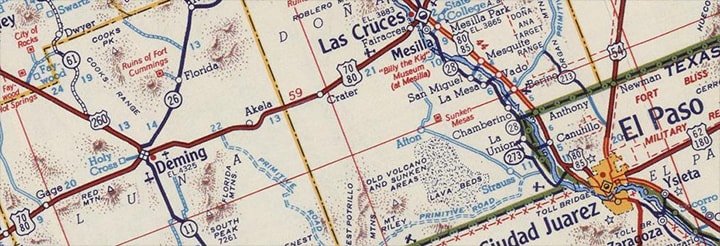
The original west end of US 180 was in El Paso. At the time, from El Paso, one could follow US 80 west through Las Cruces to Deming NM, and then (if they so chose) US 260 northwest to Holbrook AZ:
|
|
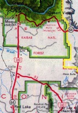
So the change that was made to the US 180 designation in 1961 is difficult to understand: instead of simply extending US 260 west from Holbrook to the Grand Canyon, the US 180 designation was extended west from El Paso to Deming (overlapped with US 80 the entire distance, over 100 miles); then northwest, replacing US 260 to Holbrook; west with US 66 to Flagstaff; then north to the Grand Canyon... or, more accurately, to a little place the official Arizona state highway map labels "Valle", which is at the junction with AZ hwy 64. Then in 1961 the route was extended north with AZ 64 to Grand Canyon Village:
|
|
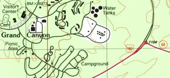
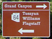
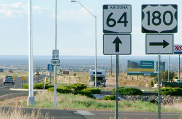
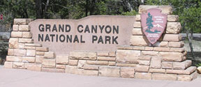
...however, it appears AZ DoT has been a little uncertain about what they want to do with this designation: in 1997 US 180 was truncated back to its former terminus in Valle... but by 2004 signage had been extended north again, up to the National Park boundary at Tusayan. There was no mention of US 180 within the National Park itself, but heading south right about at the park boundary, a US 180 shield was co-marked with AZ 64:
|
|
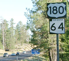
That was looking west on US 180 at Valle; by 2004 the "End" tab had been replaced with a right arrow. And this shot (heading north at Valle) shows ambiguous signage: while the assembly in the foreground indicated that US 180 began to the right, in the distance US 180 was shown to also be overlapped ahead with AZ 64:
|
Research and/or photo credits: James Allen; Justin Cozart; Greg Cramer; Chris Elbert; Jeff Jensen; Karin and Martin Karner; Steven Nelson; Dale Sanderson; Michael Summa
Page originally created 1999;
last updated Jul. 8, 2024.
last updated Jul. 8, 2024.
