US highway endpoints in Erie, PA1927-present
|
 |
|
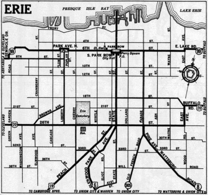
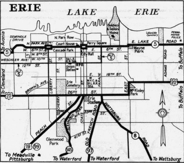
When the US routes were first commissioned in 1926, plans called for US 120 (not US 6) to serve Erie. But plans changed already by 1927, and US routes were probably not signed in Pennsylvania until 1928 anyway. By that time, both the west end of US 6 and the north end of US 19 were in Erie. The inset from the 1930 PennDOT official state highway map shows both routes meeting US 20 a block apart:
|
c. 1930, PennDoT
|
|
State Street north of US 20 was drawn as if it carried a highway designation at least to PA 99 along 6th Street, and possibly all the way out to Dobbins Landing on Lake Erie (even though it looks like State did not bisect Perry Square at the time). Was State really a highway? If so, what was it designated? And where did the designation end? None of that is not clear from that map. Adding to the uncertainty, the main state map on the other side shows things a little differently:
|
c. 1930, PennDoT
|
|
There, US 20 and PA 99 are shown as red lines running through Erie. But there are no red lines connecting the two, suggesting that State Street was either a state route or simply a local arterial. Supporting that theory is the next available inset, from the 1940 edition:
|
c. 1940, PennDoT
|
|
By that time, US 6 no longer served Erie, but already by then US 19 was clearly shown ending at 26th Street. And State was still shown with a gap in Perry Square. So the 1930 inset seems a little suspect. Unless further evidence to the contrary is revealed, we will assume that no US route ever extended north of US 20 in Erie.
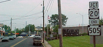
US 6 more or less followed its current route as far west as Union City, but from there it was routed northwest along modern-day PA hwy. 97, and then PA 505 in Erie, ending at US 20. This photo is looking east on 26th Street, which carries US 20: |
Morrison, Oct. 2013
|
|
To the right on State was once where US 6 began. That is probably also where US 120 would have begun during the very brief period when it was planned to go as far west as Erie. In the early 1930s, US 6 was extended more westerly from Union City (along today's US 6N), and its old route from Union City to Erie became US 6N [II]. So the photo above shows the beginning of that route as well. This next photo is looking north on Glenwood Park Avenue:
|
Bees
|
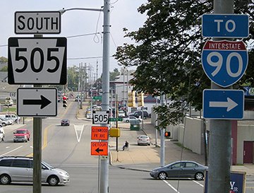
Just ahead, traffic on Glenwood reaches a stop sign at State, where PA 505 technically makes a left turn for a few yards before ending at 26th. That is the historic endpoint of US 6 and 6N. But neither of those routes terminated there for more than a few years; in the mid- to late-1930s, US 6 was rerouted again, this time along its present course through Meadville. Its "intermediate" route between Mill Village and West Springfield became US 6N [iii], and US 6N [ii] leading into Erie was decommissioned.
|
Since that time, only one US route has ended in Erie: US 19, which has been serving the city since the inception of the US route system. Despite a reroute south of town in 1928, US 19 continued to use Peach Street until 1932. That year, the US 19 designation was changed such that it followed Old French Road and Parade Street into town (today's PA 97). Formerly PA 97 ended at the same intersection where PA 8 ends today; here are a couple photos taken looking north on Parade:
|
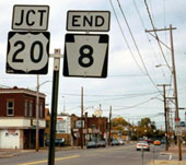
Pine
|
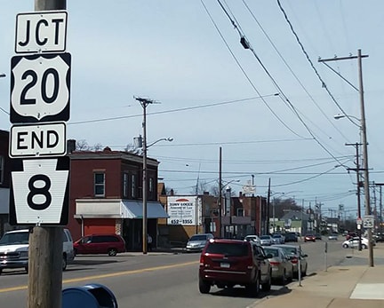
O'Domski, Apr. 2017
|
|
That was the north end of US 19 from 1932-1936. That was the year US 19 was rerouted onto Peach again, and its endpoint has been the same ever since. This image shows the last northbound US 19 marker, posted about four miles before its terminus:
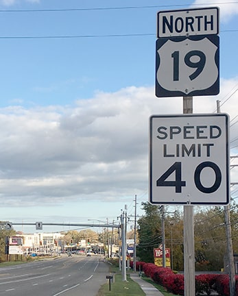
Bourey, Oct. 2019
|
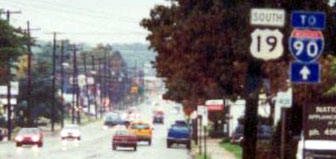
These next views were looking north on Peach, just before its junction with 26th:
Bees
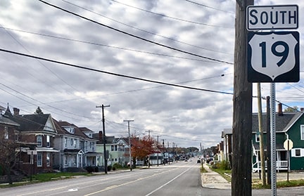
That was gone as of 2013, but it was replaced in 2019:
Bourey, Oct. 2019
|
|
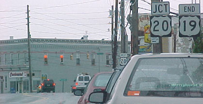
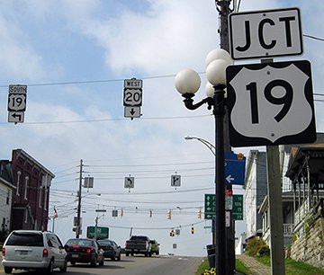
Unfortunately most of the signs at this junction have been replaced with those ugly "acorn" style US route shields. These photos were taken just ahead, and they show more of the signage at the north end of US 19:
|
Morrison, Oct. 2013
|
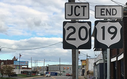
Bourey, Oct. 2019
|
|
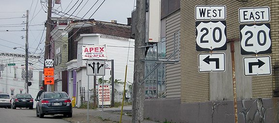
Below we are looking west on 26th:
Morrison, Oct. 2013 (unchanged as of 2019)
|
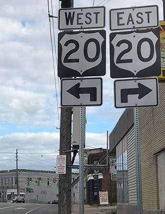
Westbound US 20 continues straight ahead, while taking the next left (onto Peach) puts a driver at the north beginning of US 19. Here is a shot from the opposite direction:
Morrison, Oct. 2013 (unchanged as of 2019)
|
|
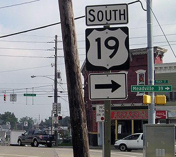
Upon turning right onto Peach, the first southbound US 19 marker looks like this:
|
Mortell, 1998
|
Bourey, Oct. 2019
|
Research and/or photo credits: John and Barb Bee; George Bourey; Jeff Kitsko; Jeff Morrison; Robert Mortell; Shawn O'Domski; Denny Pine; Dale Sanderson
Page originally created 1999;
last updated Nov. 2, 2019.
last updated Nov. 2, 2019.
