End of US highway 2 (eastern segment)
 |
|
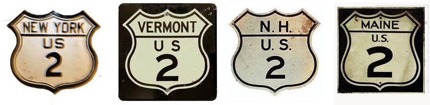
1926-present
|
|
Mileage: in 1989 AASHTO listed a figure of 461 miles for the east segment of US 2. That closely matches our own 2020 measurement, which yielded 459.8 miles. Historically, if it ever connected with the Canada border in Rouses Point, US 2 would have been 460.6 miles long.
|
|
|
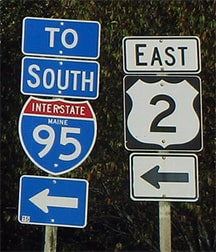
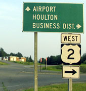
The east end of the eastern segment of US 2 is near the Canada border just outside Houlton ME. I-95 runs east/west through Houlton and into New Brunswick. US 2 heads east out of Houlton, but just shy of the Canada border the highway turns north, and that is where the last eastbound US 2 marker is posted:
|
Dienhart, Sep. 2019
|
(To the left is also how one would get to northbound I-95, although there are only a few hundred feet of I-95 remaining before the road crosses the Canada border.) Immediately to the left drivers encounter this "End" assembly where US 2 terminates at the last interchange on I-95 (formerly exit 63, now exit 305):
|
Miller, Nov. 2001
|
Taylor, Oct. 2004
|
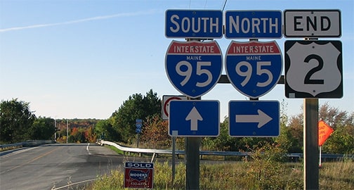
Dienhart, Sep. 2019
|
|
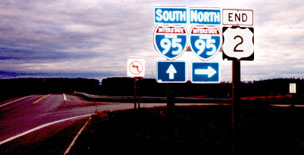
Straight ahead leads only to the onramp for southbound I-95 (the next photo was taken from that overpass). If one were to go right in the photo above (to north I-95), they would be on the on-ramp visible at far right in this photo:
|
Miller, Nov. 2001
|
|
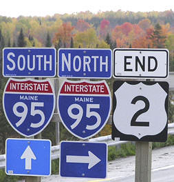
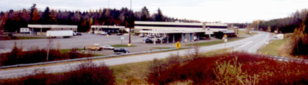
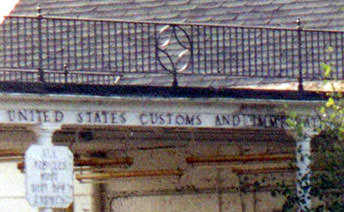
That was looking east along the northbound barrel of I-95. The building in the median is the US customs station. The Canada line is right about where the road bends in the distance. Of course, before I-95 was built, it was US 2 that provided access to this border crossing, so its historic east end was in the distance (we'll see more of that below). But first, here is a shot from the last exit on northbound I-95:
|
Buchanan/Nitzman, June 2005
|
|
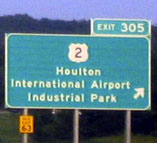
That exit leads to the east beginning of US 2. The offramp has the following assembly:
|
Buchanan/Nitzman, June 2005
|
|
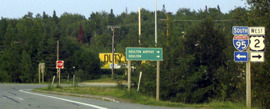
When a driver turns that direction, they are heading south, but US 2 traffic is directed to take another right:
|
Buchanan/Nitzman, June 2005
|
...and drivers are shortly reassured with the first westbound sign...
|
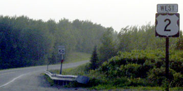
Buchanan/Nitzman, June 2005
|
|
...but in the opposite direction was where US 2 ran before I-95 was built, and before an extension of a runway at the Houlton airport. Just off modern US 2, the old border inspection station still stands, mellowing with age:
|
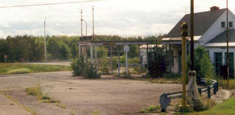
Mortell, 1998
|
Mortell, 1998
The west end of the eastern segment of US 2 has always been in Rouses Point.
|
Research and/or photo credits: George Bourey; Carter Buchanan; Paul Dienhart; Matt Miller; Robert Mortell; Alex Nitzman; Dale Sanderson; Steven Taylor
Page originally created 2000;
last updated Feb. 27, 2023.
last updated Feb. 27, 2023.
