Historic US highway endpoints in San Antonio, TX
|
1927-1977
|
 |
|
When the US routes were first assigned in 1926, two of them had endpoints in San Antonio (US 181 and US 290), as shown here:
c. 1931, Clasons
|
Then, a few years later, Gallup maps showed that US 385[i] was overlapped with US 290 to a common terminus, as shown on this map...
c. 1932, Gallup
|
|
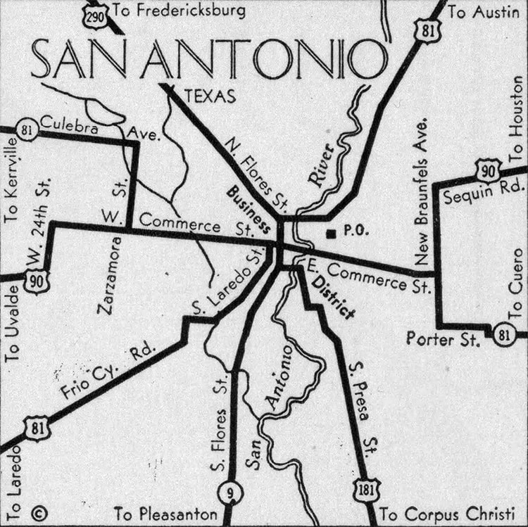
...but since that is not corroborated on any other source, I lean towards the idea that it never actually happened. US 181 came in from the south on Presa Street, and then used Alamo Street to connect with US 90, which was routed along Houston Street at the time. US 290-385 came in from the northwest on Fredericksburg Road (today designated as Loop 345), which becomes Flores Street and passes through downtown.
It was not long before things changed: in 1935, US 290 was rerouted such that it no longer served San Antonio at all. And about the same time, US 385[i] was completely decommissioned when it was swallowed up by US 87: |
c. 1938, TX DoT
|
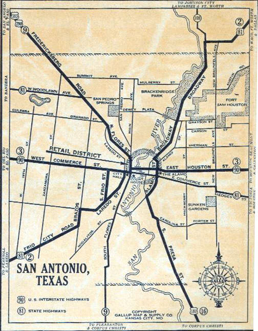
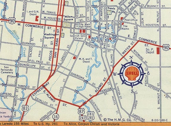
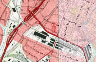
Not only had US 87 been routed through the city, but so had US 281. US 90 was using Commerce Street instead of Houston. And US 81 was routed out of town via Flores and Nogalitos Street (rather than Laredo Street and Frio City Road). US 181 was the only route that still ended in San Antonio. The designation went at least as far as Alamo, which served not only as US 81, but also as US 281 at various times. But neither of those maps are detailed enough to verify the endpoints. However, this map contains an interesting detail:
c. 1954, Humble Oil (linked to source)
|
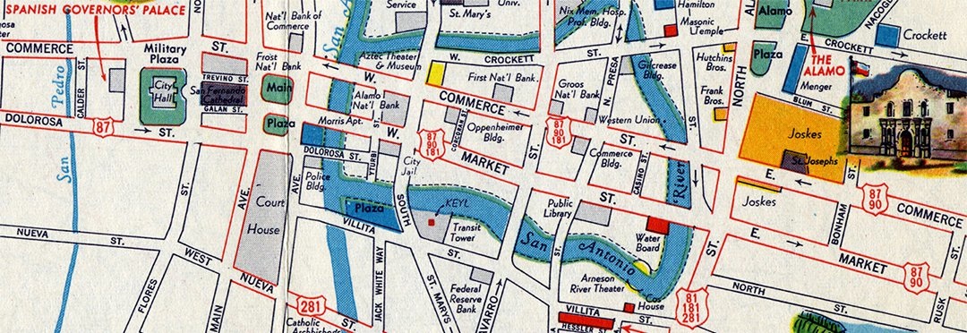
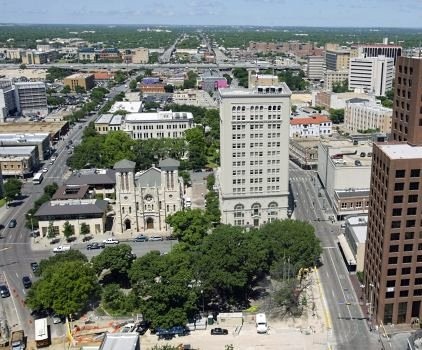
At lower right, US 181 is shown on Alamo, but it did not end at the Commerce/Market couplet (where it junctioned US 87-90). Rather, it was overlapped with those routes to the west. In the early days of the US route system, and certainly in Texas, it was a common practice to sign routes all the way into the central business district, to a point at or near the city hall and/or the courthouse, so this map was probably accurate in that regard. And if that was the case as late as the 1950s, then it seems likely that all US routes (including 290 and 385) originally ended in that same general location. Here is a view of that area, looking west:
|
|
|
The skyscraper in the center of the photo is the Frost Building, which was a bank when it was first built in 1922, but now holds City Hall offices. Just to the left (south) of there is the San Fernando Cathedral, the cultural focal point of the city. Behind that is where the original City Hall building. And in front, the area with trees is San Antonio's Main Plaza. The Bexar County Courthouse is just off the left edge of that photo. The road on the right is Commerce (one-way westbound), and its eastbound counterpart on the left is Dolorosa, which jogs to become Market at lower left. That is the area where all of the original US routes probably terminated. This photo was looking south on Flores at Commerce, with the old City Hall in the background. Northbound US 181 came from the left on Commerce and ended here; southbound US 181 began one block ahead (to the left on Dolorosa)...
|
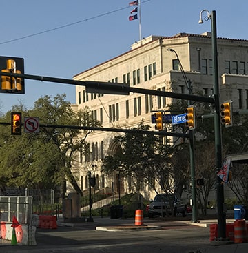
Sanderson, Apr. 2022
|
|
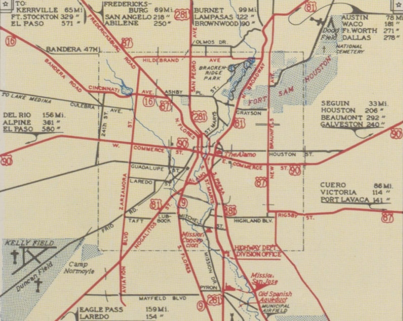
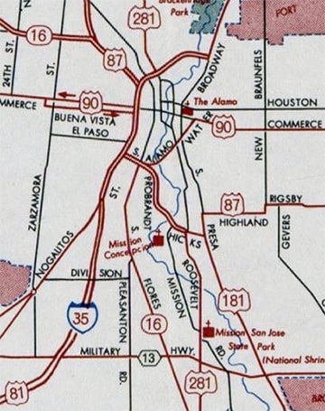
...but by 1956 maps were showing that US 87, 181, and 281 had all been rerouted to avoid that part of downtown:
|
c. 1956, Gousha
|
c. 1962, TXDoT
|
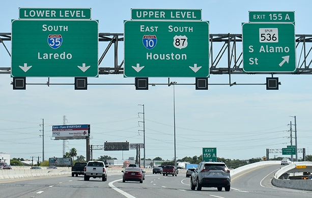
US 181 was directed off Presa and onto a bypass of sorts that followed Steves Avenue, Probrandt, and Alamo. Those maps do not make it clear whether US 181 ended at Alamo (jct. US 90) or at the Pan-Am Expressway (jct. US 81, which now carries interstates 10 and 35 too). However, the USGS map from that timeframe indicates that US 181 did extend to its junction with the new US 81 freeway:
c. 1967, USGS
|
|
This photo was taken looking north on the freeway; at one time the north beginning of US 181 was to the right on Alamo:
|
Nitzman
|
|
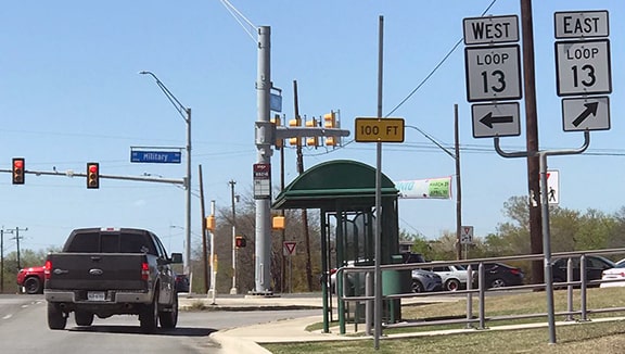
TXDoT minute orders indicate that US 181 was cut back to its junction with Loop 13 (Military Drive) in 1968; that is reflected on this 1973 map:
c. 1973, TXDoT
|
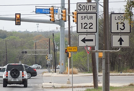
This photo shows that junction, looking north on Presa at Military:
Sanderson, Apr. 2022
|
|
For a brief time, US 181 ended there. This next perspective was from westbound Military at Presa:
|
Sanderson, Apr. 2022
|
|
US 181 began to the left. But that did not last long either; US 181 was truncated to its current terminus on the outskirts of San Antonio in 1974; the remainder of Presa north to Military became Spur 122:
|
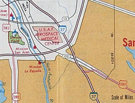
c. 1975, TXDoT
|
That should be the end of the story, except it should be noted that AASHTO's 1989 route log specified that US 181 extended north with I-37, and that the two routes shared a common north terminus at the junction with the I-35 and US 281 freeways. However, there is nothing in the TXDoT minute orders that suggests this change ever happened. Anyway, photos and more info about the current terminus can be found on the main US 181 page.
Research and/or photo credits: Jenn Dolari; Robert Droz; Brent Ivy; Martin Karner; Alex Nitzman; Dale Sanderson; Stephen Taylor
Page originally created 2005;
last updated Dec. 11, 2023.
last updated Dec. 11, 2023.
