End of US highway 211 |
 |
|
1926-1929
|
1929-1945?
|
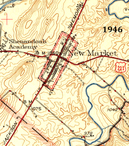
1945?-1980
|
1980-present
|
Summa
|
Mileage: in 1989 AASHTO listed a figure of 69 miles for US 211... however, that included the mileage of US 211's associated business routes. According to the state subtotals on AASHTO's 1989 spreadsheet, mainline US 211's actual end-to-end total at the time was 61 miles. That closely matches our own 2020 measurement, which yielded 59.0 miles (reroutings and realignments likely explain the difference). Historically, when it went to DC, US 211 was about 101 miles long.
|
|
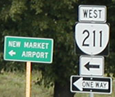
The west terminus of US 211 has always been in New Market. We begin with a shot from I-81 at the exit marking the beginning of US 211:
|

Nitzman, June 2004
|
|
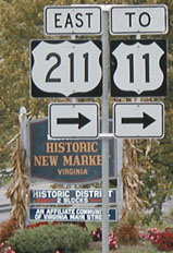
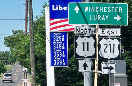
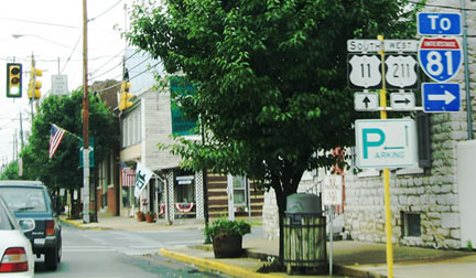
These shots show the signage visible as one exits northbound I-81 at New Market. The tanker truck in the background is southbound on I-81. Note that it is US 211 to the right, but VA hwy. 211 to the left:
|

Utendorf, Oct. 2002
|
Utendorf, Oct. 2002
|
Utendorf, Oct. 2002
|
|
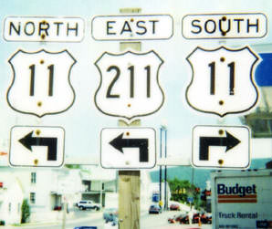
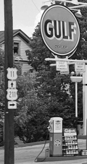
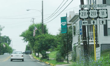
US 211 begins to the right on Old Cross Road. After a couple blocks it joins US 11, which runs parallel to I-81. The cutout shields shown in this first photo have long since been replaced with markers as shown in the second photo:
|
Summa, 1995
|

Karner, May 2013
|
|
Straight ahead on Old Cross was the original beginning of US 211, from 1927 until 1951, when Lee Highway was built to bypass the eastern segment of Old Cross:
|
Now US 211 continues to the north (left) on Congress Street, and soon reaches the intersection marking its next historic beginning:
Karner, May 2013 (unchanged since at least 2000)
|
|
Now we will head back the opposite direction; this photo was looking east on US 211:
|

Nitzman, June 2004 (unchanged as of 2013)
|
When that alignment of Lee Hwy was opened, that became US 211's endpoint, at its junction with US 11. Next is another view of that junction, approaching from the north:
|
Nitzman, June 2004
|
|
For 10 or 15 years, US 211 began to the left on Lee Highway. When I-81 was opened in about 1964, the US 211 designation was extended ahead with US 11 for a couple blocks, and then west again on its own to a junction with I-81:
|
Nitzman, June 2004
|
|
Today, US 211 continues to the right on Old Cross, but originally the west beginning of US 211 was to the left on Old Cross. This photo was approaching this intersection from the east on Old Cross:
|

Roberson, July 2007
|
|
Originally US 211 ended there, at its junction with US 11. That lasted until 1951, when US 211 was rerouted to its current alignment. And since 1964, US 211 continues straight ahead, ending at the I-81 interchange. Straight ahead is VA hwy. 211, but that has never been part of US 211:
|
Nitzman, June 2004
|
From New Market, it is only about 60 miles to US 211's current western terminus at Warrenton. However, until 1980, US 211 went beyond Warrenton for perhaps another 60 miles:
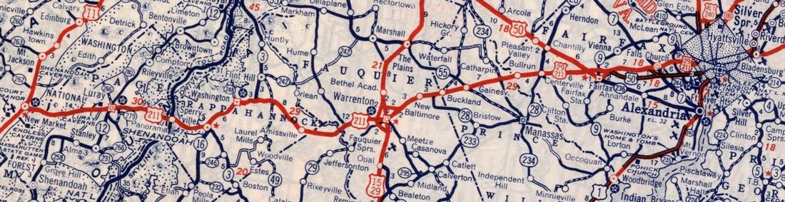
c. 1940, Rand McNally
|
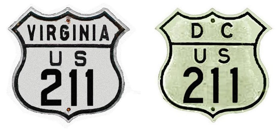
Surprisingly few US routes defy the "number-direction parity" concept. US 211 is one of the exceptions: it runs east/west, and is signed east/west, but it was numbered as a north/south branch route. US 211 has a junction with US 50 in Fairfax, so a better designation would have been US x50. Originally AASHO thought US 211 ended in Fairfax, but already by early 1927 Virginia had corrected them, stating that it actually overlapped US 50 and ended on the Francis Scott Key Memorial Bridge at the DC line. By about 1929, US 211 had been extended further east; I am aware of at least two maps indicating that it entered the District of Columbia, ending on K Street at 17th Street (US 1)...
|
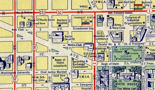
c. 1942, Esso
|
|
...however, most maps past 1945 or so seem to indicate that the US 211 designation had been cut back to the DC line on the Key Bridge in Rosslyn (a section of Arlington, just across the Potomac River):
|

c. 1956, Gousha
|
|
Here is an historic photo of the bridge, as well as a modern photo from down on the surface:
|
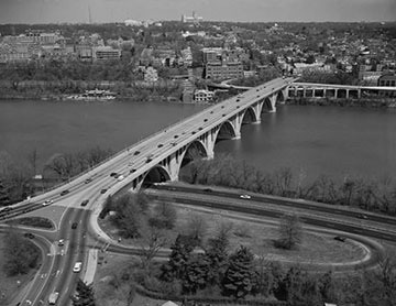
Library of Congress, HAER collection, date unknown
|
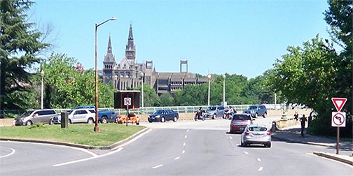
Karner, May 2013
|
That was in Rosslyn, looking north on Lynn Street, which today carries northbound US 29. In the middleground is the foot of the Key Bridge, which continues off to the right; for a time US 211 ended there. (Part of Georgetown University is visible on the far side of the Potomac.)
|
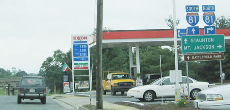
In 1934, US 29 was extended northward to Warrenton, and from there it overlapped with US 211 through Arlington (and then beyond, on its own). So US 211 could have been truncated to Warrenton as early as 1934, but perhaps since it was the first route to serve that corridor, it remained on that segment. It was not until nearly 50 years later (1980) that US 211 was truncated to its current east terminus in Warrenton. These photos show the odd place where the "End" sign was posted (looking east on Lee Highway at the Blackwell Road intersection):
|
Strong, 2000 (unchanged in 2006)
|
Karner, May 2013
|
|
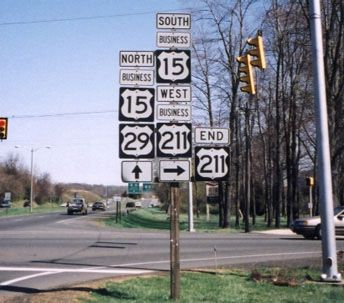
Downtown Warrenton is about a mile to the right (there was also a nearly identical assembly posted about a block before that point). The green signs in the distance give directions at the interchange with the US 15-17-29 bypass. So why does the US 211 designation end there, instead of extending to that junction? It is quite uncommon for a main route to end at a business route. This next series begins from southbound US 15-29. US 211 should start here...
|
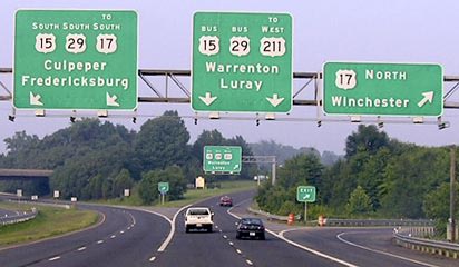
Elbert, July 2006
|
|
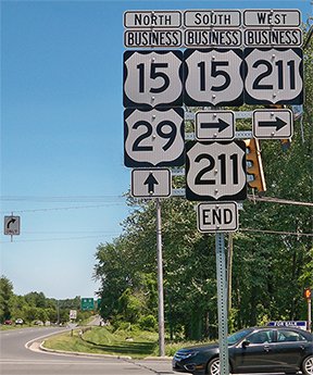
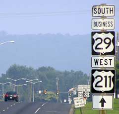
...but it does not; instead that exit is signed "TO US 211". Drivers exiting there will encounter the assembly shown here as they approach the junction with Blackwell:

Elbert, July 2006
|
The east beginning of US 211 is at the same intersection as the east beginning of its own business route. Continuing past that traffic signal, the sign below is posted...
Elbert, July 2006 (unchanged as of 2013)
|
...but notice the assembly in the distance, shown close-up here. Seems like this would have been posted closer to Blackwell. And the "Begin" sign itself is pretty unusual as well:
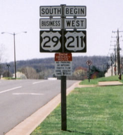
Strong, 2000 (unchanged as of 2013)
|
Research and/or photo credits: Chris Elbert; Martin Karner; Alex Nitzman; Mike Roberson; Dale Sanderson; Dave Strong; Michael Summa; Kel Utendorf
Page originally created 2000;
last updated Nov. 29, 2023.
last updated Nov. 29, 2023.
