End of US highway 550 |
 |
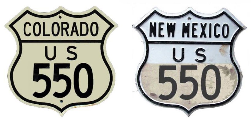
Summa
|
|
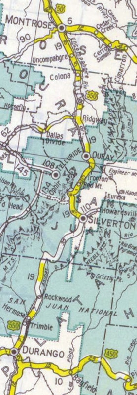
Mileage: in 1989 AASHTO listed a figure of 160 miles for US 550... however, that included the mileage of US 550's associated business route. According to the state subtotals on AASHTO's 1989 spreadsheet, mainline US 550's actual end-to-end total was 157 miles... but at the time, it still ended in Farmington. Since then US 550 has been extended to Bernalillo, and our own 2020 measurement yielded 303.8 miles.
|
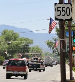
The north end of US 550 has been in Montrose since the US highway system was implemented in 1926, and for the first 84 years it was at the same intersection:
|
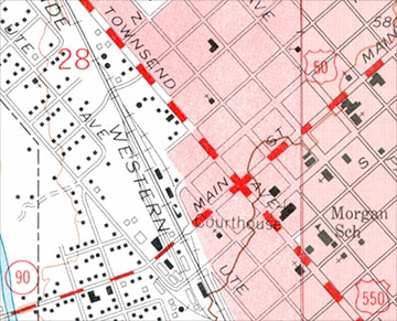
c. 1962, USGS
|
It would appear that Colorado DoT has never had an "End US 550" sign posted at its terminus on northbound Townsend Avenue. This photo shows the last northbound marker:
|
Karners, Aug. 2010
|
|
That was at South 8th Street. About a half-mile ahead is the historic endpoint; these photos were looking north on Townsend at Main Street:
Sanderson, Sep. 1999
|
Sanderson, Aug. 2003
|
|
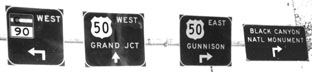
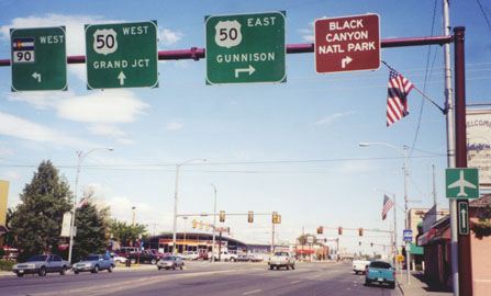
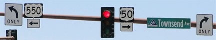
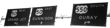
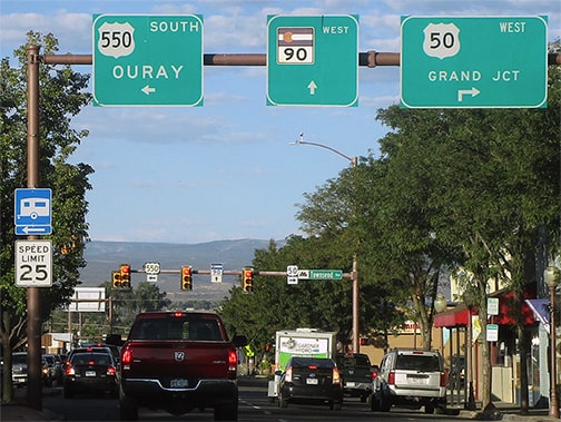
From 1927 until 2010, US 50 made a right angle at that intersection. During the first ten years of that timeframe, US 550 began to the west (left on Main). From there, traffic was directed south on Chipeta Road, which joins today's US 550 after about three miles. After 1936, US 550 was changed to follow Townsend, and for the next 74 years it ended there. In 2010, US 50 was rerouted, such that it uses San Juan Avenue instead of Main. In other words, US 50 traffic is no longer routed through this intersection, so US 550 was extended ahead about a mile (along former US 50) in order to reach the new US 50. On the sign bridge shown above, initially the two panels on the right were simply taken down (one of them appears to have been moved to the location of the photo below). However, the "US 50 West Grand Jct" sign was not changed to read "TO US 50", nor was there any evidence that the road ahead is now US 550. And, as of 2011, that entire sign bridge is gone, and now northbound traffic looking for CO 90 is not given any directions. Drivers who continue ahead about a mile encounter new signs that imply the true north end of US 550, but there was no "End" sign:
|
Sanderson, July 2010
Sanderson, July 2010
|
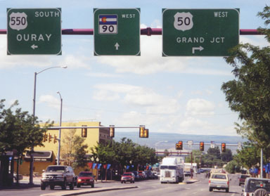
Westbound US 50 traffic approaching that intersection on San Juan continues to the right on Townsend, while the north beginning of US 550 is to the left:
Sanderson, July 2010
|
Sanderson, July 2010
|
|
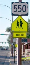
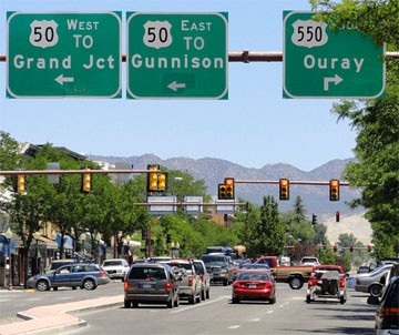
Next we will head south on Townsend, or east on US 50. In this direction, the San Juan Mountains make for a scenic backdrop. Approaching San Juan Avenue, these panels indicate the new north beginning of US 550:
|
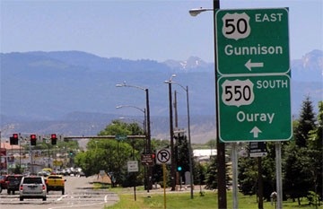
Sanderson, July 2010
|
Sanderson, July 2010
|
|
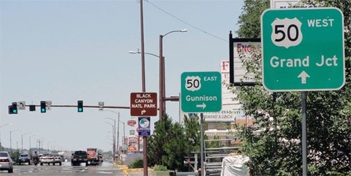
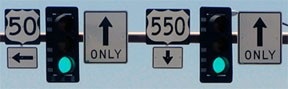
Ahead, there was no immediate confirmation for US 550 traffic -- the first mention of that route did not occur for about a mile:
|
Sanderson, July 2010
|
Formerly that sign bridge had an additional panel, directing eastbound US 50 traffic left on Main towards Gunnison. Now that whole thing is gone, so the first standard confirming marker is an old one, just past Main:
|
Sanderson, July 2010
|
|
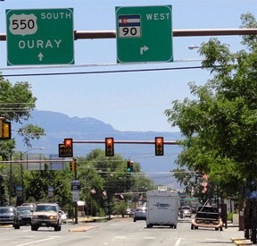
These next photos show the signage as one approaches that intersection from the west on CO 90 (Main), which is the perspective of a driver at the original north end of US 550, but at the time of this first photo, US 550 began to the right. Today, it is actually US 550 that runs both directions on Townsend, but observe how the junction was signed after that change was implemented:
|
Sanderson, Sep. 1999
|
Sanderson, July 2010
|
|
US 550 was still described as going only south on Townsend, while northbound Townsend is signed only as "TO US 50". The "TO" was added to both panels on the left, and the "ahead" arrow was greened out and replaced with a "left" arrow... which is a little odd, because if one simply continues ahead on Main, they will reach US 50 in about a mile... whereas, if they follow the signs, they will travel about three miles before reaching the same place.
Even so, that setup was better than the one that replaced it in about 2012. Now there are no US 50 signs at all, and even worse, this makes it look like both routes continue straight ahead, rather than turning right or left onto Townsend: |

Google Maps Street View, Oct. 2021
|
These next photos show the approach to this intersection from the opposite direction (east on Main), where the Uncompahgre Plateau is visible on the horizon:
Sanderson, Aug. 2003 (unchanged as of July 2010)
|
Dienhart, Sep. 2022
|
Sanderson, Sep. 1999 (unchanged as of July 2010)
|
Until 1936, US 550 began straight ahead, and then until 2010 it began to the left. Originally this was westbound US 50, which continued to the right. Now it is US 550 that goes to the right (as well as left), but as of 2022, neither of those sets of signs had been changed (presumably because they are no longer CDoT's responsibility).
|
c. 1931, CDoT
|
Those were the only two US routes with which it connected, so there was no logical north/south (odd) number that could have been assigned to US 550. These photos show where US 550 historically ended:
|
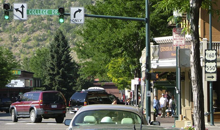
|
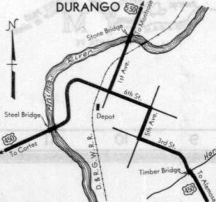
Those were looking south on Main Avenue at College Drive. US 160 ran along College (although it was called "6th Street" back then), and US 550 ended there. Despite signage at that intersection, neither US 160 nor US 550 are still routed along these streets. US 550 runs along a bypass about two blocks to the west (right), and the US 160 bypass is ahead about two blocks, on the other side of the Durango-Silverton Train railyard.
Here, we are looking west on College at Main. This was formerly westbound on US 160, and the south beginning of US 550 was to the right: |
Sanderson, July 2004
|
|
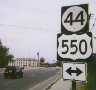
In 1934 the US 550 designation was extended south through Aztec and Farmington NM, and then west, where it ended at Shiprock for the next 50+ years. However, this change still did not provide an opportunity to renumber US 550 as a north/south branch, because the north/south route at which it ended (US 666) was also misnumbered as an east/west route:
|
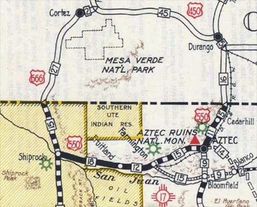
c. 1937, NM DoT
|
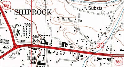
c. 1983, USGS
|
|
By the time of these photos, both US routes had been renumbered. This first one was looking at the former end of US 550 from westbound US 64. Today US 491 overlaps with it ahead for a few blocks before they split again (on the other side of the San Juan River). Historically US 550 ended here; southbound US 666 was ahead, and northbound was to the right:
|
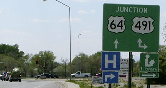
Sanderson, July 2004
|
|
Here, we are looking the opposite direction (eastbound US 64/northbound US 491). This was formerly northbound US 666, which continued to the left; ahead was the beginning of US 550:
|
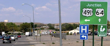
Sanderson, July 2004
|
|
This photo was from southbound US 491; until 2003 this was southbound US 666, which continued to the right. US 64 was extended through here in 1989; prior to that it was US 550 that began to the left:
|
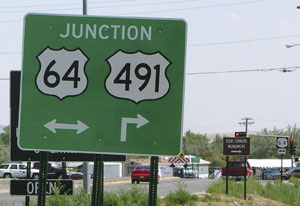
Sanderson, July 2004
|
|
In 1989 the US 550 designation was cut back to Farmington (when its former route to Shiprock became an extension of US 64).
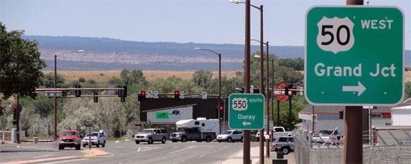
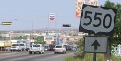
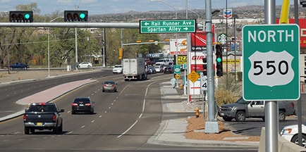
Then at their April 1998 meeting, AASHTO approved New Mexico's request to remove the US 550 designation from the highway between Farmington and Aztec -- that road is now NM 516. Today US 550 goes south from Aztec to Bloomfield, and then along former NM 44 through Cuba to Bernalillo (just north of Albuquerque). All along the southernmost segment of US 550, travelers enjoy good vistas of the Sandia Mountains; this photo shows the last southbound marker: |
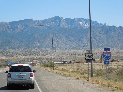 |
|
A bit further ahead from there is the south end of US 550, at I-25's interchange 242. An "End" sign has never been posted there, but the road straight ahead is designated NM 165:
|
Sanderson, Mar. 2016
|
|
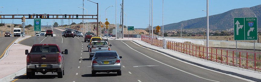
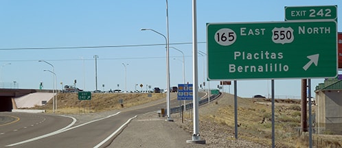
These photos were taken from northbound I-25; for drivers exiting here, the south beginning of US 550 is to the left:
|
Sanderson, June 2006
|
Sanderson, Mar. 2016
|
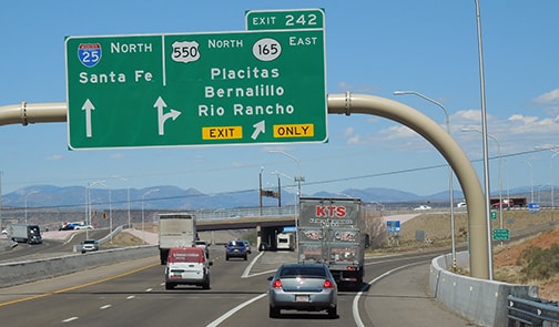
Note that initially US 550 was signed as "West" (not "North"). Presumably that was because the route that US 550 replaced (NM 44) was signed east/west (at least around Bernalillo), and at first the two routes were dual-signed. Here is exit signage heading the opposite direction (south on I-25):
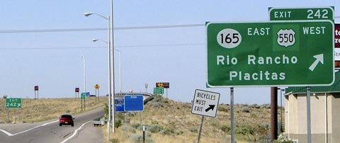
Sanderson, June 2006
|
Sanderson, Mar. 2016 (unchanged as of 2023)
|
That first photo shows how the old NM 44 marker was greened out and replaced with a US 550 shield. Drivers who exit there and turn right have seen a variety of confirming markers over the years:
Allen, 2000
|
Sanderson, June 2006
|
Sanderson, Mar. 2016
|
|
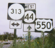
Ahead, at the intersection with Camino del Pueblo (old US 85), there was no reference to NM 313, but this photo (taken from northbound Camino del Pueblo), shows a sign that was formerly posted there:
|
Allen, 2000
|
Since NM DoT has decommissioned US 85 in their state, US 550 still does not connect with any north/south US routes. Apparently it is destined to remain one of the surprisingly few US routes that defy the concept of number-direction parity.
|
Research and/or photo credits: James Allen; Paul Dienhart; Karin and Martin Karner; Scott Pekeris; Matt Salek; Dale Sanderson; Michael Summa
Page originally created 2000;
last updated Jul. 9, 2024.
last updated Jul. 9, 2024.
