End of US highway 264 |
 |
Summa
|
1932-1950
|
1950-1996
|
1996-2003
|
2003-present
|
|
Mileage: in 1989 AASHTO listed a figure of 276 miles for US 264... however, it is unclear where that number came from, because according to the state subtotals on AASHTO's 1989 spreadsheet, mainline US 264's actual end-to-end total at the time was 218 miles (or 255 including the mileage of US 264's associated business/alternate routes). Our own 2020 measurement yielded 215.7 miles.
|
|
|
US 264 was commissioned in 1932; at the time its east end was at Englehard, where a ferry went across Pamlico Sound to the town of Hatteras (near the cape of the same name). According to a 1936 NCDoT map of Hyde County, the endpoint was here...
|
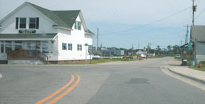
Roberson, Apr. 2008
|
...where today US 264 makes a bend to the north.
|
|
The original west end of US 264 was at its junction with US 64 in Zebulon:
|
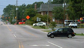
Nelson, 2006
|
That was looking west on Gannon Avenue. The black car was heading south on Shepard School Road/Poplar Street, or what was originally westbound US 64, which continued by turning away from the camera there on Gannon. So US 264 ended there at its junction with US 64.
|
|
Later on, both US 64 and US 264 were rerouted onto the current freeways, so for several years the west end of US 264 was at the freeway junction just northeast of there. In fact, heading west on US 264 today, overhead signage still makes it look like US 264 ends at the junction with US 64:
|
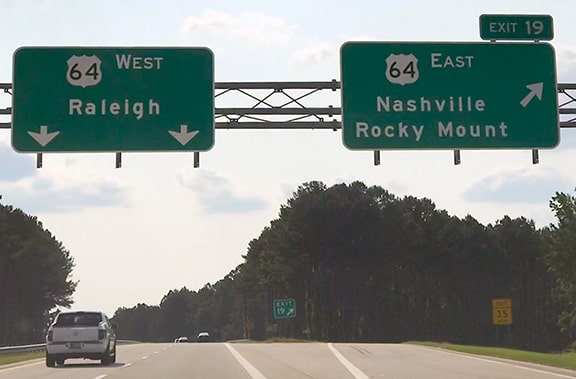
Sanderson, Jun. 2019
|
|
US 264 actually did end there until 1996, but then it was extended further west with US 64 into Raleigh. These photos were taken from westbound US 64-264, at their old junction with I-440 (interchange 13):
|
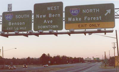
Nitzman, 2001
|
|
US 264 ended there, but US 64 joined with I-440 and continued west by skirting the south side of Raleigh. Just ahead, there was an "End" sign:
|

Nitzman, 2001
|
|
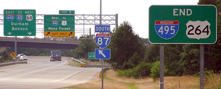
If one proceeds straight ahead, they find themselves heading towards downtown on New Bern Avenue. That "End" assembly was still there in August 2005, but a month prior to that a new bypass opened east of Raleigh -- US 64 and 264 are now routed onto that (and the road shown above is now Business 64). This image was taken looking north on westbound I-440, at exit 14:
|
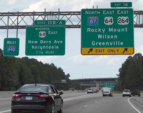
Sanderson, Jun. 2019
|
|
Exit there to reach the west beginning of US 264. The first eastbound reassurance was posted thus:
|
Sanderson, Jun. 2018
|
|
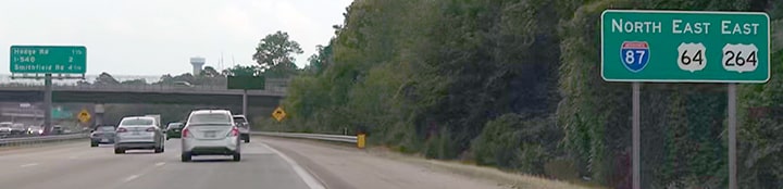
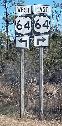
Heading the opposite direction, the last westbound US 264 sign looked similar:
|
Sanderson, Jun. 2019
|
|
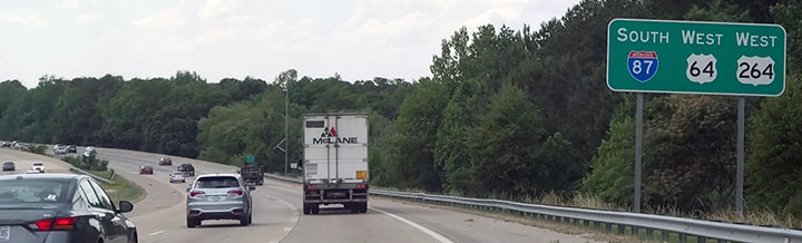
Ahead, these photos show the "End" signs that have been posted on westbound US 64-264:
Curley, 2005
|
Sanderson, Jun. 2019
|
|
Westbound US 64 still joins with I-440 around Raleigh; the sign visible in the distance pretty much spells all that out. It has changed in recent years:
|

Nitzman, Jan. 2008
|
|
In 1950 the US 264 designation was extended further east and north along the Sound shoreline. It joined with US 64 near Manns Harbor and crossed Croatan Sound, terminating at a place known as Whalebone Junction -- on the Outer Banks of NC, a little south of Nags Head.
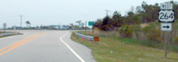
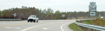
In 2003, the US 264 designation was truncated to its junction with US 64 outside Manns Harbor (this was made official with AASHTO at their May 2003 meeting). This image is from the perspective of a driver approaching that junction: |
Sandersons, Feb. 2020
|
|
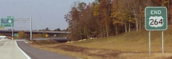
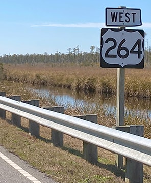
Just ahead from there, US 264 ends at its junction with its parent route. At that location there was an "End 264" assembly in 2002, but as of 2008 there was no longer any trace of that. This shot was looking east on US 64:
|
Roberson, Apr. 2008
|
|
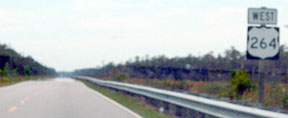
US 264 once continued ahead, but now it begins to the right. Here, we are looking the opposite direction:
|
Roberson, Apr. 2008
|
Sandersons, Feb. 2020
|
|
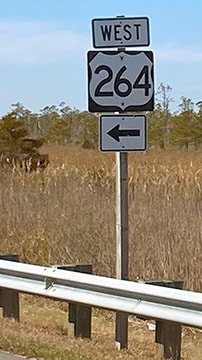
For travelers taking that left turn, the first westbound confirming assembly looks like this:
|
Roberson, Apr. 2008
|
Sandersons, Feb. 2020
|
Research and/or photo credits: Chris Curley; Jeff Morrison; Steven Nelson; Alex Nitzman; Adam Prince; Mike Roberson; Dale Sanderson; Forrest+Grace Sanderson; Michael Summa
Page originally created 1999;
last updated Dec. 3, 2023.
last updated Dec. 3, 2023.
