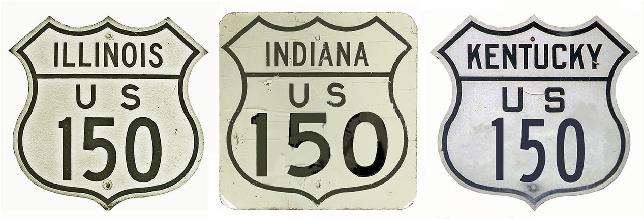
End of US highway 150 |
 |
|
1926-1934
|
1934-1976
|
1976-present
|
Summa
|
Mileage: in 1989 AASHTO listed a figure of 577 miles for US 150... however, that included the mileage of US 150's associated bypass route. According to the state subtotals on AASHTO's 1989 spreadsheet, mainline US 150's actual end-to-end total at the time was 571 miles. Our own 2020 measurement yielded 563.2 miles (reroutings and realignments likely explain the difference). Historically, when it went to Rock Island, US 150 was 572.1 miles long.
|
|
US 150 has been around since the beginning, but the route as originally commissioned in 1926 was quite short:
|

c. 1927, Rand McNally
|
|
Its east end was in New Albany. At the time, US 31W traffic from Louisville KY crossed the Ohio River via the Kentucky & Indiana Terminal Bridge, and ended up on Vincennes Street in New Albany. This photograph was taken from that perspective:
|
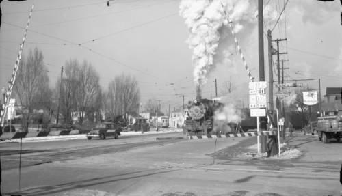
Dec. 1945 (Richardson, Denver Public Library; linked to source)
|
(detail)
|
By the time of that photo, the US 150 designation had been extended across the bridge and into Kentucky, so the driver was already on both routes. That intersection is where they split, with US 150 turning left on Main Street, and US 31W continuing straight ahead. But until 1934, the east beginning of US 150 was to the left on Main. About a mile in that direction, traffic was directed to the north on State Street, and after another six miles, that joins with the current alignment of US 150.
|
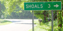
From New Albany, US 150 ran only about 66 miles to the northwest. As illustrated on the map above, US 150 originally turned west on what is now IN hwy. 550 at Lacy (a couple miles south of Shoals). At the time, westbound US 50 did not cross the White River at Shoals, like it does today. Instead, it stayed on the south bank, following Spout Spring Road / CR 63:
|
Sanderson, July 2007
|
|
Where that meets today's IN 550, US 50 turned west (right) to Loogootee, and to the east (left) was the original beginning of US 150. This photo was looking west on IN 550:
|
Sanderson, July 2007
|
|
US 150 originally ended there. Straight ahead was westbound US 50, and eastbound was to the right. But in 1930, the White River was bridged by US 50 in Shoals. So for the next year or two, US 150 was extended to the right, along Spout Spring/former US 50. It came into Shoals either on Water Street or Main Street, ending at 4th Street (which carried the "new" US 50). This photo was taken looking east on US 50-150; for a brief time US 150 began to the right on Main:
|
Morrison, Nov. 2019
|
|
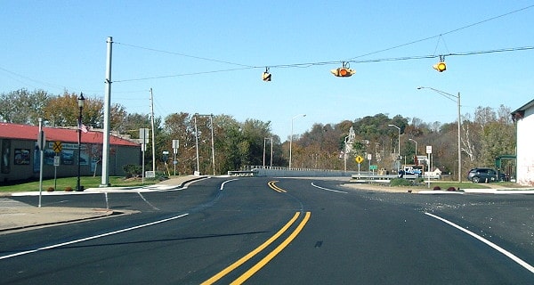
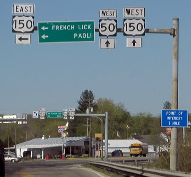
But that lasted for only a year or two; already by 1932 the "new" US 150 had been built between Lacy and Shoals. So then the west terminus of US 150 moved a few blocks ahead (east), to the current junction. This photo shows the overhead signage located there:
|
Morrison, Nov. 2019
|
|
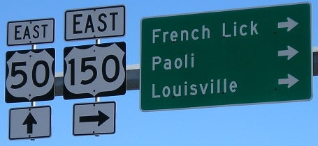
Today, heading west on US 150, that route continues to the left with US 50. But for a brief time, this was the west terminus of US 150:
|
Morrison, Nov. 2019
|
|
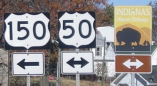
And finally, the perspective from westbound US 50, which continues ahead. Today US 150 also continues ahead, but for a couple years, the west beginning of US 150 was to the left:
|
Dienhart, May 2018
|
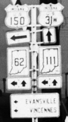
But already by 1934, the US 150 designation had been extended ahead with US 50. The routes diverged at Vincennes, and US 150's west terminus was extended to Rock Island. Also in 1934, US 150 was extended eastward to its current terminus in Mount Vernon.
|
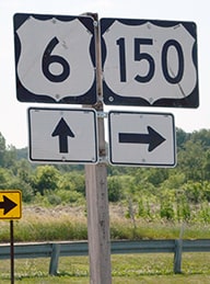
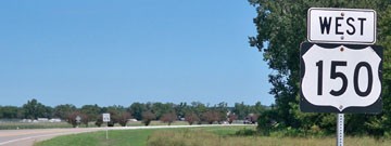
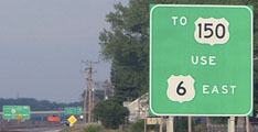
The minutes of AASHTO's November 1976 meeting show that the westernmost few miles of US 150 were truncated, such that the designation now ends where it meets US 6 on the outskirts of the Quad Cities, rather than serving the central business districts. These photos were taken looking eastbound on US 6, at the west beginning of US 150:
|
|

|
Similar signage is visible in the background of this shot, which was looking the opposite direction (west on US 6):
|
|
|
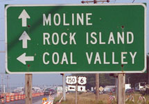
Despite what is shown on that sign, that highway junction is actually within Moline city limits, but it is another five miles or so to downtown. If instead a driver takes that left turn, they will soon see the first eastbound confirming marker:
|
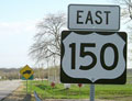
Morrison, Apr. 2006
|
Dienhart, Nov. 2023
|
|
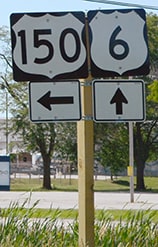
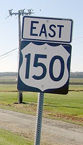
Downtown Coal Valley is about two miles ahead. Heading the opposite direction, the last westbound US 150 marker looks like this:
|
Karners, Aug. 2010
|
|
Less than a mile ahead, travelers encounter an "End" assembly:
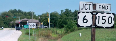
|
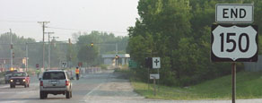
Sanderson, June 2001
|
Karners, Aug. 2010
|
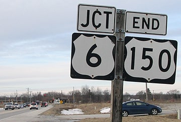
Dienhart, Mar. 2019
Formerly that "End" sign was posted prior to the actual junction (near the stoplight visible in the distance); while signage at the intersection itself referenced the intersecting route (US 6) and directions to the interstates...
...but as can be seen in this next photo, the "End" sign has recently been moved to the same location as all the rest of the signage:
|
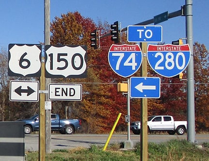
Dienhart, Nov. 2023
|

|
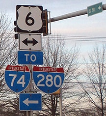
One could argue that it would be appropriate to overlap US 150 with US 6 to the left, to the freeway interchange (which is only about a mile to the west). But from eastbound I-280, this was the only reference to US 150:
|
Sanderson, Aug. 2005
|
The green signs in the distance are at exit 18, serving I-74 and US 6.
|
Research and/or photo credits: Paul Dienhart; Nathan Edgars; Jason Hancock; Karin and Martin Karner; Jeff Morrison; Alex Nitzman; Robert Richardson; Dale Sanderson; Michael Summa
Page originally created 2001;
last updated Dec. 9, 2023.
last updated Dec. 9, 2023.
