End of US highway 73 |
 |
|
1926-1930
|
1930-1933
|
1933-1935
|
1935-1965
|
|
1965-1983
|
1983-1984
|
1984-2008
|
2008-present
|
Summa
|
Mileage: in 1989 AASHTO listed a figure of 112 miles for US 73. That closely matches our own 2020 measurement, which yielded 113.2 miles.
|
|
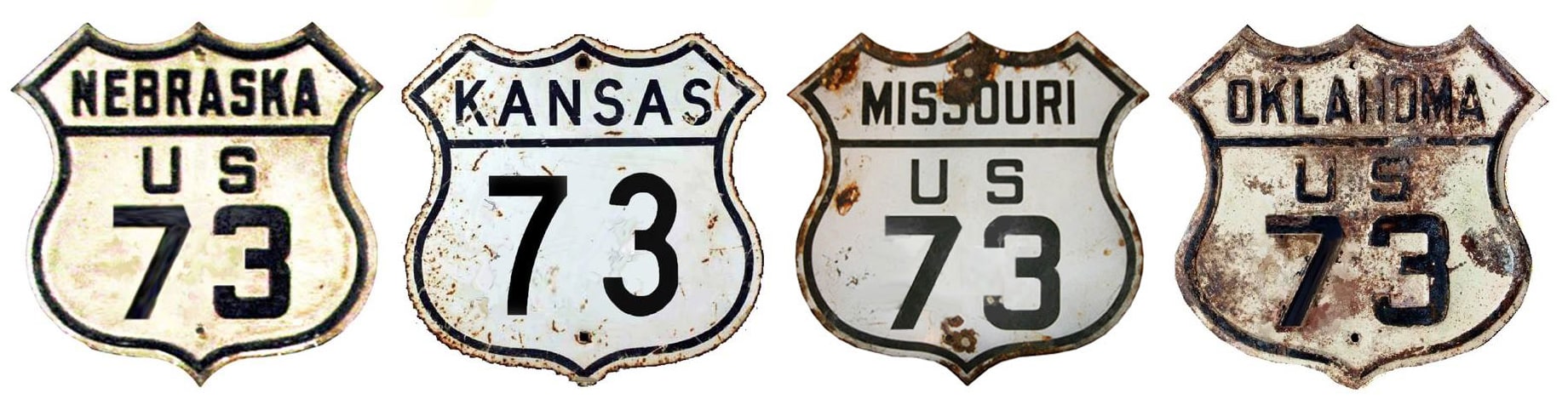
US 73 was an original 1926 route. Through most of Kansas, the route split into US 73E and US 73W. Those two branches reconverged just north of the Oklahoma line, and US 73's south end extended all the way down to Atoka:
|
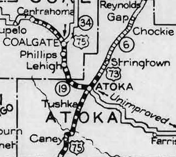
c. 1928, OKDoT
|
|
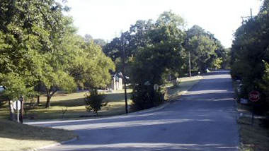
However, the modern junction of US 69 and US 75 does not mark the location of the historic terminus. Rather, it seems more likely that US 75 came into town from the north on Sandy Creek Road, and then turned south on California Avenue. Originally US 73 crossed Muddy Boggy Creek to the east of the current US 69 bridge, and entered Atoka via Ohio Avenue. It then stair-stepped over to California via Court Street, Mississippi Avenue, and 2nd Street. That is the perspective of this interactive image:
|
|
|
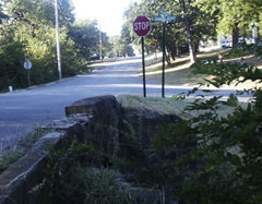
That is the original south end of US 73. The crossroad is California, or old US 75. Mississippi (current US 69) is a block behind the camera. In 1930, California was extended north from Sandy Creek, and that intersection became the new terminus of US 73. This photo was looking north on California:
|
Brooks, Sep. 2005
|
|
Northbound US 75 continued to the left on Sandy Creek, and US 73 began straight ahead on California. This view was from the opposite perspective, so we are looking at the former end of US 73:
|
Brooks, Sep. 2005
|
|
Southbound US 75 was straight ahead on California, and northbound was to the right on Sandy Creek. The stone bridge in the foreground is inscribed with the date "1930".
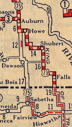
Originally the north end of US 73 was also at its junction with US 75; this was just south of Auburn: |
c. 1927, Rand McNally
|
This image was looking south on US 75; Auburn is about four miles behind the camera. This county road leading to Howe was once the north beginning of US 73:
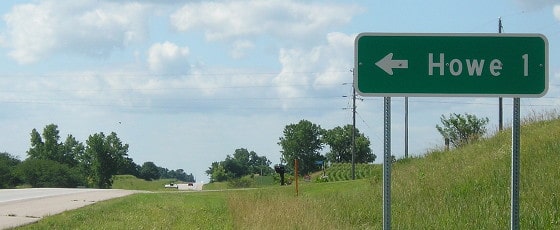
Morrison, Aug. 2019
|
|
After US 73 was changed to its current alignment around 1936, its historic segment (from there through Howe, Stella, and Shubert, to the current US 73) became NE hwy. 54. The segment from US 75 to Stella has since been removed from the state highway log, but old US 73 from Stella to Shubert is still maintained by the state as NE 62, and from Shubert to modern US 73 is now NE 67.
This photo was looking west on the county road coming from Howe, at its junction with US 75. This was the original north terminus of US 73: |
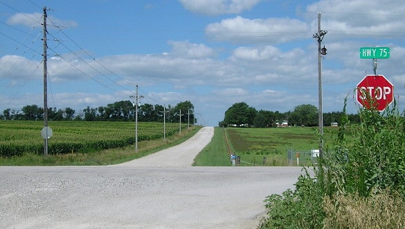
Morrison, Aug. 2019
|
|
In 1933 the north end of US 73 was extended to US 20 in South Sioux City. That remained the case for over 30 years, but in 1965 the designation was truncated to Winnebago (although AASHO did not formalize that until their Dec. 1971 meeting):
c. 1977, NDoR
|
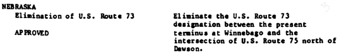
This photo was looking west on northbound US 75, which continues to the right from here with US 77. Winnebago is just to the right:
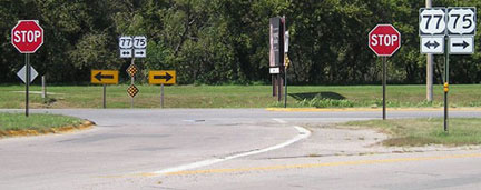
Morrison, Sep. 2007
Historically that was the north end of US 73. That junction has since been reconfigured into a roundabout. Here we are heading south out of Winnebago on US 75-77. US 75 takes a left here, onto what was the former north beginning of US 73:
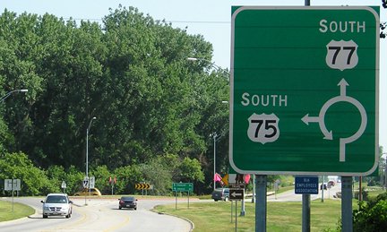
Morrison, Jul. 2013
|
|
Between about 1935-1957 (when US 73 ran through here instead of ending here), straight ahead was designated US 73W, and to the left was designated US 73E. The two routes joined up again about 40 miles down the road, in Tekamah. These photos were looking the opposite direction (northbound): to the right on southbound US 75 was once the north beginning of US 73:
|
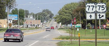
Morrison, Sep. 2007
|
Morrison, Jul. 2013
|
|
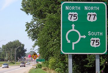
Prior to 1984, US 75 overlapped I-29 between Omaha and Sioux City, but in May of that year it was rerouted to follow what had been US 73 between those cities. Thus the northernmost segment of US 73 became superfluous, so it was truncated again. Since then its terminus is at a junction about a mile north of Dawson:
|
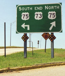
Sanderson, Oct. 2002
|
Morrison, Aug. 2019
|
|
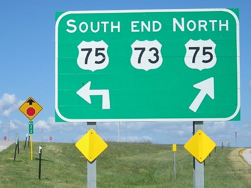
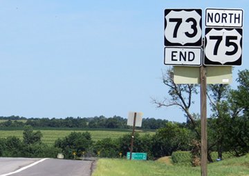
A driver at the north end of US 73 is actually heading due west; the road makes a "Y" intersection with US 75. The road on the left above goes to a stop sign at US 75. The slip ramp to the right curves to a merge lane for northbound US 75. Historically, if a traveler chose that direction, they encountered another "End" sign:
|
Lance, 2000
|
McMillin, July 2013 (gone as of 2018)
|
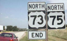
The sign in the distance gives mileage to Auburn (17), Nebraska City (38), and Omaha (80). Until 1984, US 73 north of here was overlapped with US 75 into Omaha. There the two routes split, with 73 heading north along the west bank of the Missouri River, and US 75 on the Iowa side. When I-29 was built through Iowa, the US 75 designation was moved to the Nebraska side. At that point, the US 73 designation became unnecessary north of Dawson. These photos show historic and current signage at the beginning of US 73 as seen from southbound US 75:

McMillin, July 2013 (unchanged since at least 2002, but gone as of 2018)
|
Handler, Mar. 2018
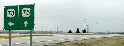
Drivers turning left at that point will soon encounter the first southbound US 73 trailblazer:
|
Handler, Mar. 2018
|
|
This photo shows the north beginning of US 73 as seen from northbound US 75:
|
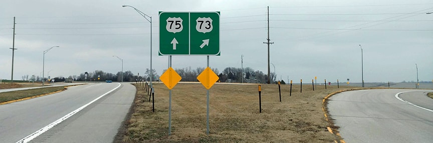
Handler, Mar. 2018
|
Not long after the US route system was implemented, AASHO began encouraging the states to eliminate split routes, so in 1935 much of the southern part of US 73 (including all of US 73E and 73W) was replaced by US 59 and US 69. After that, mainline US 73 followed what had been US 73E to Kansas City KS, and then joined US 40 eastward to a new terminus in Kansas City MO. That lasted for at least 30 years, and maybe almost 50: it is uncertain when US 73 signage was removed from that overlapped segment. The USGS topo maps from 1957 and 1964 showed US 73 in Missouri, but the 1970 edition did not have any US 73 labels east of I-635. However, it was not until 1983 that AASHTO officially approved a truncation to US 73...
|
...and when they did, the proposal as written was to remove US 73 from the entire overlap (such that it would have ended at its junction with US 24-40 at State):
|

from Oct. 1983 AASHTO minutes
|
|
The signs may have been removed long before AASHTO's approval. But just four years later, when I-435 was completed through the area in 1987, Kansas re-extended the US 73 designation to the new interchange:
|
c. 2007, KDoT
|
|
In these photos, taken from State, the overpass is I-435. They show historic signage for both the beginning of US 73 (heading westbound) and its terminus (heading eastbound):
|

Morrison, Oct. 2007
|
Prusia
|
|
This was the beginning of US 73 as seen from northbound I-435:
|
Field/Nitzman, Oct. 2004
|
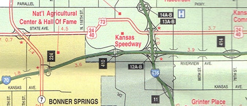
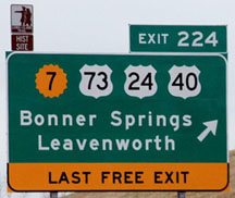
In Oct. 2008, KDoT received AASHTO's approval to remove US 24-40-73 from State, and instead to direct those routes south along with K-7, to I-70's interchange 224. So that interchange became the location of US 73's southern terminus.
|
|
Signage to that effect was posted in Feb. 2009, and captured photographically shortly thereafter -- these shots were taken from westbound I-70:
|
Kennedy, Mar. 2009
|
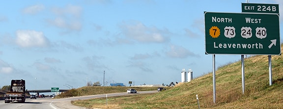
Nitzman, Nov. 2016
|
|
This photo was looking the opposite direction (east on I-70):
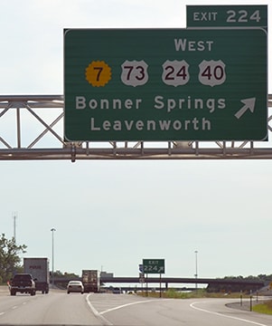
Ivy/Nitzman, June 2015
|
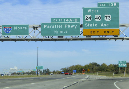
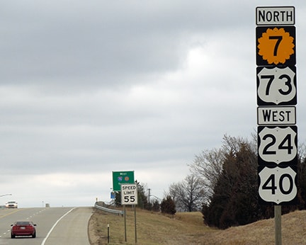
The first northbound US 73 confirming marker is just north of Speaker Road and the southside ramps:
Sanderson, Mar. 2018
Visible in the distance is the I-70 overpass, and the sign for the northside on-ramp (to westbound I-70/Kansas Turnpike).
|
|
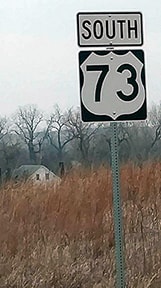
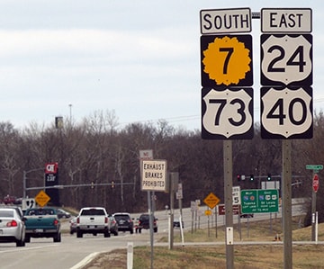
Heading the opposite direction, the last southbound US 73 marker was posted just prior to Elizabeth Street (right outside a local KDoT office)...
Sanderson, Mar. 2018
|
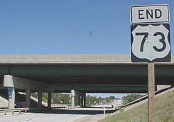
...and a little ways ahead, an "End" assembly was posted right at the I-70 overpass:
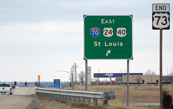
Sanderson, Mar. 2018
|
Research and/or photo credits: Neil Bratney; Dan Drackley; Nathan Edgars; Andy Field; Mark Handler; Brent Ivy; Richie Kennedy; Jeremy Lance; Brian McMillin; Jeff Morrison; Alex Nitzman; Ben Prusia; Dale Sanderson; Michael Summa
Page originally created 2000;
last updated Jan. 24, 2024.
last updated Jan. 24, 2024.
