End of US highway 21 |
|
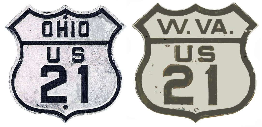
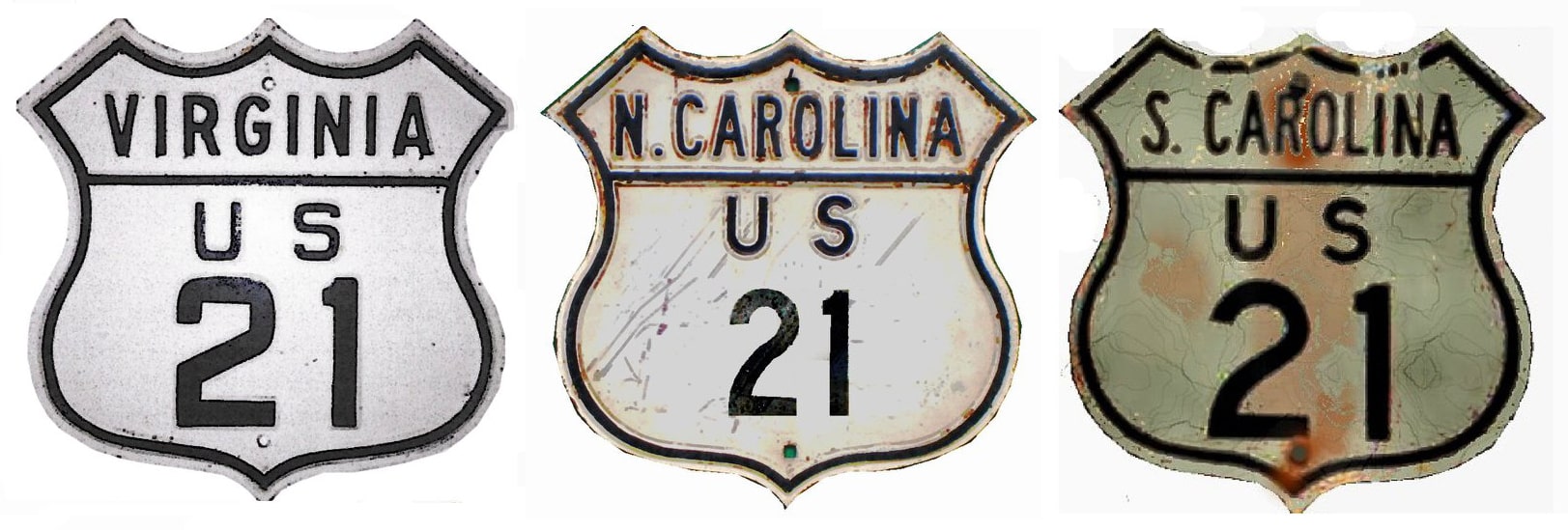
1926-1934
|
1934-1953
|
1953-1967
|
|
1967-1968
|
1968-1979
|
1979-present
|
|
Mileage: in 1989 AASHTO listed a figure of 422 miles for US 21... however, that included the mileage of US 21's associated business routes. According to the state subtotals on AASHTO's 1989 spreadsheet, mainline US 21's actual end-to-end total at the time was 393 miles. That closely matches our own 2020 measurement, which yielded 393.4 miles. Historically, when it went to Cleveland, US 21 was approx. 830 miles long.
|
|
|
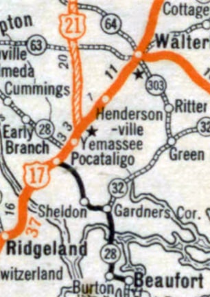
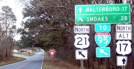
US 21 was among the original routes commissioned in 1926; as shown on the preceding map its southern terminus was in Yemassee. This photo was taken heading north out of town on "Hendersonville Highway", which currently carries both US 21 and US 17A. But originally this was mainline US 17, and US 21 began to the left on "Low Country Highway":
|
|
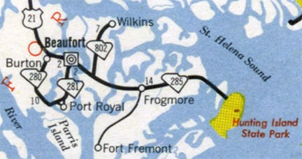
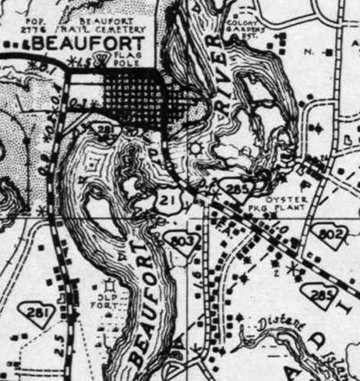
In 1934 the south end of US 21 was extended to Beaufort (as shown above). More detailed maps from that timeframe show US 21 passing through the city and crossing the river, but ending immediately after that on Ladies Island, near the junction with SC hwy. 803 (Meridian Road). It was SC 285 that continued further east along Sea Island Parkway to Hunting Island):
|
|
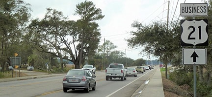
This photo was looking north on US 21 from a point just west of Meridian Rd:
|
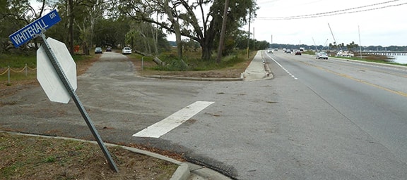
That was right about where US 21 began for almost 20 years. But the original bridge was not straight ahead, along the modern alignment of US 21. At far left is a road disappearing into the trees; that is shown from a slightly closer perspective in this next photo:
|
|
Originally US 21 traffic used the road visible on the left, and from about 1935-1953, that was the south beginning of US 21. Today US 21 is on the right, using a bridge which was built in 1960. The original bridge no longer stands, so the old road on the left ends at Whitehall Point, and is usually closed. But the Karner's visit happened to fall on a day when some work was being done along that road, so they obtained permission to drive the historic segment. Some additional great photos from there can be viewed here and here.
|
|
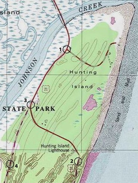
By the time the new bridge was built in 1960, US 21 no longer began there, because in 1953 the US 21 designation was extended still further south... or more accurately, east onto Hunting Island, via the former SC 285. Mike Roberson has carefully analyzed historic SC county maps, and he has found four slightly different locations for the endpoint. For the first couple years, US 21 ended almost immediately after landing upon Hunting Island. By 1957 it had been extended south about a half-mile on Sea Island Pkwy, then east along a road that skirted the north side of the Hunting Island lighthouse, and then south again for a short distance along the shoreline. That was the situation shown on this USGS topo map:
|
|
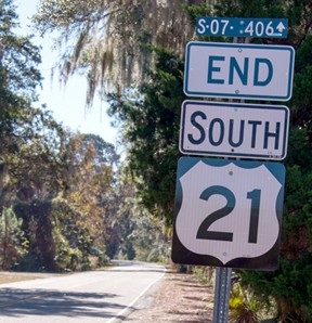
The circles indicate the four endpoints. #1 is the junction that marked US 21’s original Hunting Island endpoint. Within a few years, US 21 had been extended down to #2. By 1970 US 21 had been cut back to #3, such that it ended on Sea Island Pkwy at the turnoff to the lighthouse -- that is where this photo was taken:
|
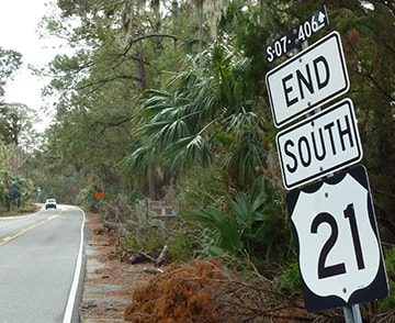
Directly to the left from there is where the old road to the lighthouse cut towards the beach, so US 21 really did end there for about 20 years. The "S-07" refers to South Carolina's seventh county alphabetically (Beaufort), and the "406" refers to the designation of the state secondary road ahead...
|
|
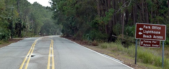
...however, that "End" tab is no longer accurate, because at some point the old lighthouse road was vacated, and a new access road into Hunting Island State Park was built a little ways further ahead. The approximate location of this junction is shown on the map above as #4, and by 1986 the US 21 designation had officially been extended down to that modern access road:
|
|
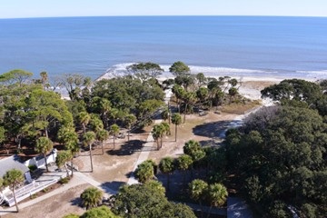
Today, the road from the lighthouse heading south along the shoreline is no longer extant because of beach erosion. Although historic US 21 from the lighthouse heading northwest to Sea Island Pkwy (between endpoints #2 and #3) has been vacated and there is no longer vehicular access to it, one can still see the cut through the trees on aerial photos, and it is likely that the pavement itself still exists in some places. So this segment is probably still walkable and/or bikeable. Some of its corridor is visible in this shot:
|
|
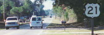
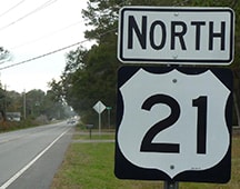
That was taken from the top of the lighthouse; the bare cut through the trees was US 21 from about 1955 to 1968. The road continued off the right side of the photo, into what is now open water. Heading the opposite direction, formerly the first northbound shield wasn't posted until about five miles north of the terminus...
|
...but as of 2020 even that one was gone, with the first marker now being about 11 miles north of the terminus.
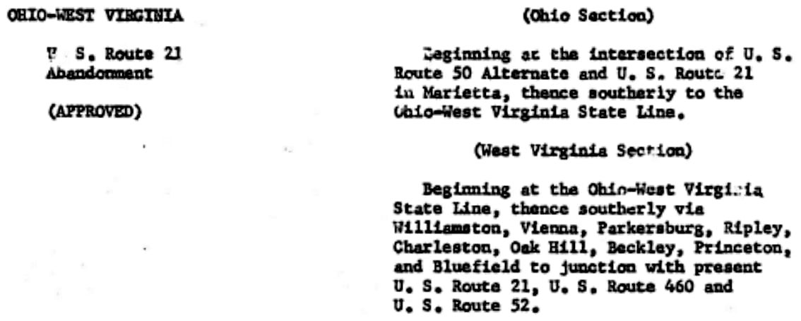
For 45 years the northern terminus of US 21 was in Cleveland; photos and more info can be found on the Cleveland page. In late 1967 (after I-77 was open throughout Ohio), AASHO approved ODoT's request to eliminate the US 21 designation from that state:
A few months later, West Virginia followed suit by having US 21 decommissioned to Bluefield (just north of the Virginia line)...
|
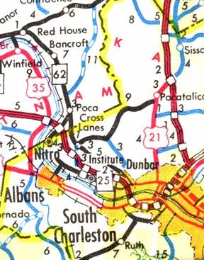
...however, it may have taken longer for all signage to be removed from those states. For example, this section of the 1974 official highway map of West Virginia indicates that US 21 was still signed as far north as Pocatalico for a few years:
|
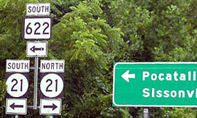
The terminus was at I-77's exit 114. If one exits there today, the signage shown here is posted:
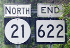
Today the north beginning of WV 622 is to the left; for a few years that was the north beginning of US 21; its historic route is now designated as county route 21. Looking the other direction, the north end of modern WV 622 is a historic north end of US 21:
|
In 1979, AASHTO approved Virginia and West Virginia's request to truncate the north end of US 21 to its current terminus in Wytheville:
|
Originally -- a few miles east of Wytheville, at Fort Chiswell -- US 52 joined with US 11, and the two highways overlapped into downtown Wytheville, along Main Street. That is where they met US 21 coming north out of Statesville NC. US 11 continued south and west to Bristol, while US 21 and US 52 were co-signed north on 4th Street, toward Bluefield WV.
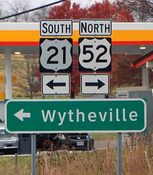
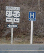
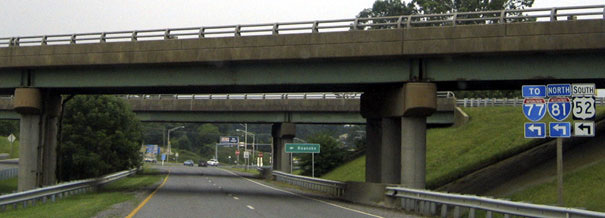
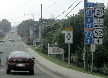
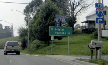
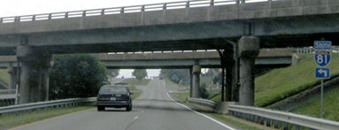
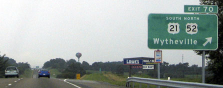
Now, US 52 still joins with US 11 at Fort Chiswell... but only because US 11 is the same as I-77/81 at that point. US 11 traffic leaves the interstate at exit 73 to follow its historic route along Main through central Wytheville, but US 52 is directed to remain on I-77/81, bypassing town on the north side. Today, drivers who want the quickest route to Bluefield use exit 72 and follow I-77 north. But continuing south and west on I-81, the next interchange (exit 70) is signed for the old route to the north: US 52. That same exit is also signed for the north beginning of US 21. This assembly was posted on the off-ramp: |
|
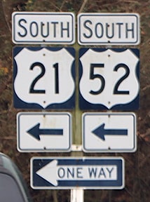
That is a divided highway: that photo was taken from the median, so the sign for northbound US 52 (which goes off to the right, behind the camera) is not visible. Southbound US 52 is directed to the left, because that's how one would get back on I-81, going the other direction. Turning that way, this assembly is visible:
|
|
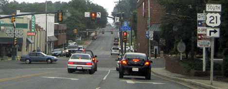
That is southbound US 52 (which continues to the left), as well as the north beginning of US 21, which leads to downtown Wytheville, and then on into North Carolina. But the first marker on the mainline is not posted until about a mile ahead, where traffic is directed to join with southbound US 11:
|
Northbound US 52 is straight ahead, and southbound is to the right with (oddly enough) northbound I-81. US 21 was once signed ahead with US 52 into Bluefield. That is where the routes split, but US 21 still had a life of its own, serving Beckley, Charleston, and Parkersburg, before crossing the river. In Ohio, US 21 continued through Cambridge, New Philadelphia, Massillon, and Akron, before finally ending in downtown Cleveland. The northern stretch of US 21 was truncated primarily because its functionality was replaced by I-77. The new interstate completely erased some stretches of old 21 -- particularly in Ohio -- and it closely parallels most other segments. However, most of old 21 is still drivable.
Research and/or photo credits: Mark Clifton; David Dawson; H.B. Elkins; Karin and Martin Karner; J.P. Nasiatka; Alex Nitzman; Adam Prince; Mike Roberson; Dale Sanderson; Michael Summa; Mac Watkins
Page originally created 1999;
last updated Dec. 29, 2023.
last updated Dec. 29, 2023.
