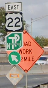
End of US highway 22 |
|
1926-1931
|
1931-1936
|
1936-present
|
Mileage: in 1989 AASHTO listed a figure of 662 miles for US 22... however, that included the mileage of US 22's associated business/alternate routes. According to the state subtotals on AASHTO's 1989 spreadsheet, mainline US 22's actual end-to-end total at the time was 651 miles. That closely matches our own 2020 measurement, which yielded 648.7 miles (reroutings and realignments likely explain the difference).
|
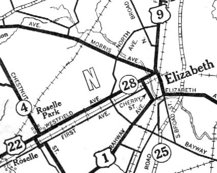
US 22 was an original 1926 route; at the time its east end was in Elizabeth:
|
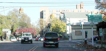
US 1-9 came in from the north on Broad Street, and then turned west on Westfield Avenue. At Cherry Street, US 1-9 turned south again, but straight ahead on Westfield was the east beginning of US 22. This photo was taken looking east on Westfield:
The black car was at the historic east end of US 22. Straight ahead was northbound US 1-9, while southbound was to the right on Cherry. (That is still the east end of NJ hwy. 28, which is why there is signage posted there.)
|
|
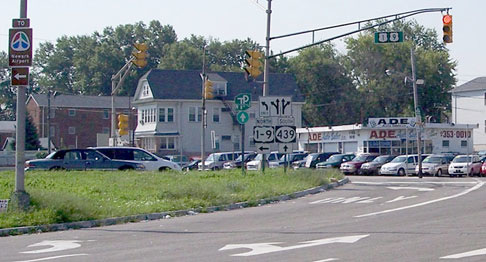
Then in 1931, US 1-9 was moved to the current alignment, but US 22 was still on the old alignment (NJ 28). So then US 22 ended at what is now the intersection of US 1-9 / NJ 439, south of downtown Elizabeth. In other words, US 22 turned south on Elmora Street, ending at Bayway Circle...
|
|
...although it is unclear whether there was a circle at that intersection at the time (the map above does not indicate one, but it was not at a scale that shows full-street detail).
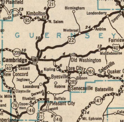
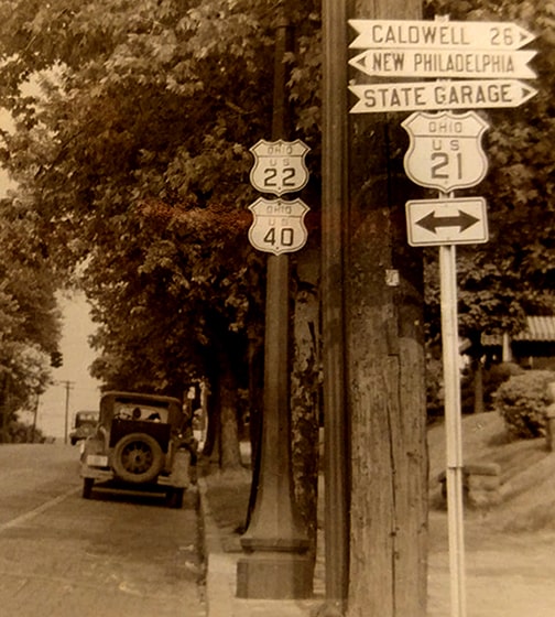
Meanwhile, the west end of US 22 was originally at its junction with US 21 in Cambridge: |
This photo was taken looking east on Wheeling Avenue, which carries US 40-22 traffic. The intersection was 11th Street, which historically was signed as US 21 through town. For just a few years (and possibly at the time of this photo), the west beginning of US 22 was straight ahead (US 22 and US 40 split one block ahead):
|
|
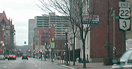
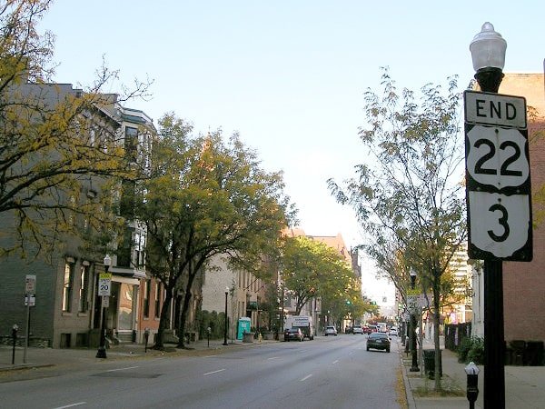
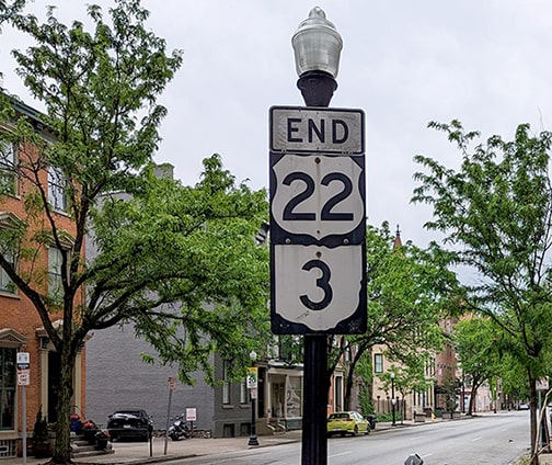
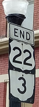
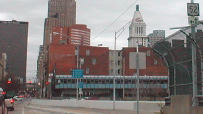
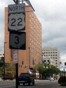
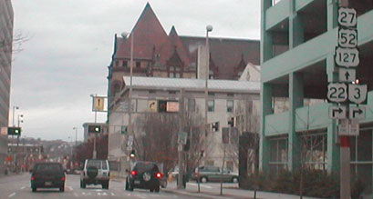
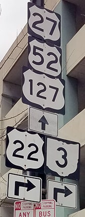
In 1931, US 22 was extended west with US 40 to Zanesville, and on from there to Cincinnati. The highway designation ended at a couple different places in town until the 1970s, when the routing was changed to its current configuration. These photos were looking west on 9th Street between Race and Elm streets:
|
|
|
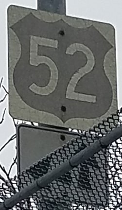
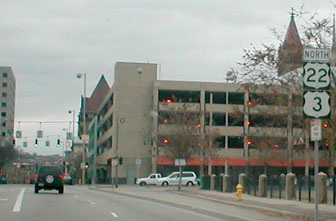
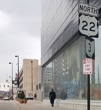
(Incidentally, that US 52 sign is from before the realignment of US 52 eastbound). Central Av is the intersection ahead. US 27-42-127 south and US 52 east is to the right; left is US 27-127 north, US 52 west, and the beginning of US 22/OH 3. After taking that left on Central Av, this photo shows the first confirming marker on US 22 east/OH 3 north:
|
|
That scene has changed quite a bit since the first photo, due to construction of the Duke Energy Center there. Good that the error US 3 shield has been replaced, but that should be "East" US 22 (not "North"). A couple blocks further ahead, US 22/OH 3 turns right on 7th Street:
|
|
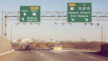
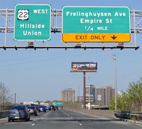
In 1936, the original segment of US 22 between Elizabeth and Somerville (today's NJ hwy. 28) was decommissioned, and the US 22 designation was applied instead to the current corridor, which bypasses downtown Elizabeth. Since then, the east end has been in Newark, at its junction with US 1-9. Of course today's freeways and interchanges had not yet been built, but despite that, the location of US 22's terminus essentially has not changed. There are a couple photos in the National Archives that show how the junction looked during the 1950s, here and here. Today, heading east, the last US 22 marker is positioned at the offramp to Freylinghuysen Avenue:
|
|
Drivers on Freylinghuysen who want to head east are directed up an onramp with US 22 signs, but once they are on US 22 all remaining signage refers only to the intersecting routes at the eastern terminus. This older photo shows the options available to drivers once they have reached the end of US 22...
|
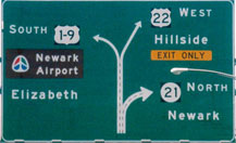
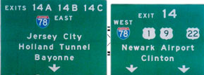
...but since then the signage at the east end of US 22 has been replaced:
|
|
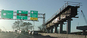
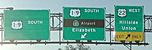
These signs were posted further ahead, where US 22 finally splits off...
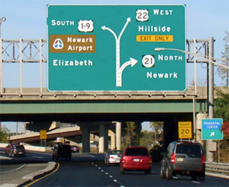
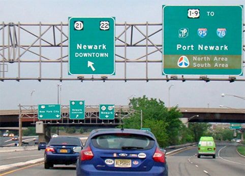
...although those photos were taken back when construction was in progress on a now-completed viaduct for NJ 21. The following photos show more recent signage:
|
|
This photo shows the beginning of US 22 from the new NJ 21...
...and this one shows the signage as seen from southbound I-95 (New Jersey Turnpike)...
|
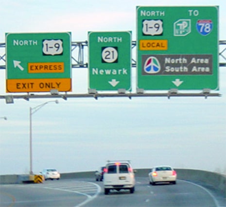
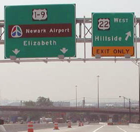
...and this image shows the beginning of US 22 as seen from northbound US 1-9:
|
|
Drivers exiting to the east beginning of US 22 are reassured with the first ground-mounted sign shown here...
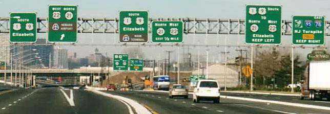
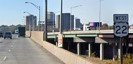
...and that is also visible in the distance of this next photo, which illustrates that the very first reference to westbound US 22 is on this overhead sign bridge:
|
Research and/or photo credits: Shawn De Cesari; David Golub; David Greenberger; Mike Head; Christopher Mason; Dan Moraseski; Jeff Morrison; Robert Mortell; Jeremy Moses; Alex Nitzman; Mike Roberson; Dale Sanderson; Jon Sieker; Michael Summa
Page originally created 2000;
last updated Dec. 29, 2023.
last updated Dec. 29, 2023.

