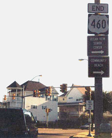
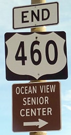
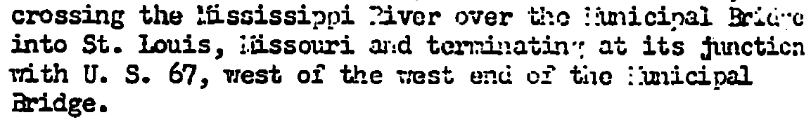
End of US highway 460 |
 |

Summa
|
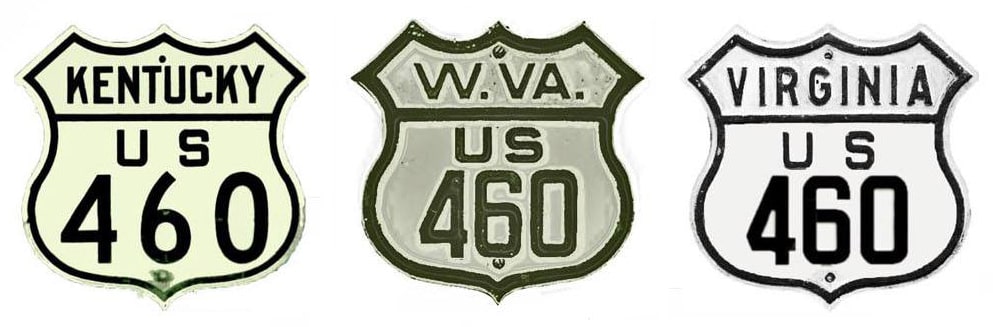
Summa
|
|
1933-1943
|
1943-1946
|
1946-1975
|
1976-present
|
|
Mileage: in 1989 AASHTO listed a figure of 744 miles for US 460... however, that included the mileage of US 460's associated business/alternate routes. According to the state subtotals on AASHTO's 1989 spreadsheet, mainline US 460's actual end-to-end total at the time was 655 miles. That is reasonably close to our own 2020 measurement, which yielded 645.8 miles (reroutings and realignments likely explain the difference).
|
Historically, when it extended to St. Louis, US 460 was almost exactly 1000 miles long.
|
|
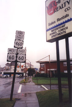
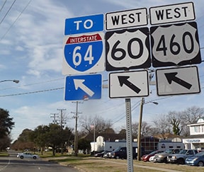
US 460 was commissioned in 1933. Its east end has always been in the Hampton Roads area, but not at the same intersection where it ends today. Initially it came north on Pleasure House Road and ended at US 60 (Shore Drive), as shown in this image:
|
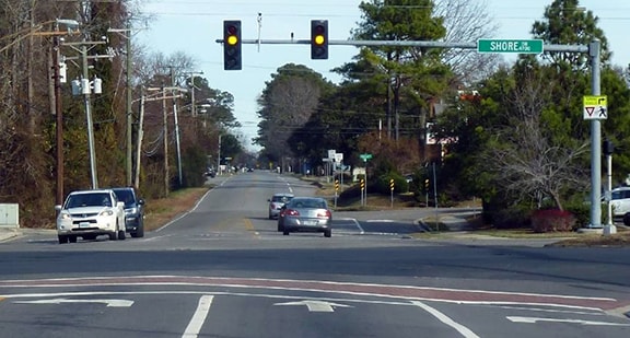
Karners, Jan. 2017
|
|
Today that is within Virginia Beach city limits.
At the time US 460 was an intra-state route, with its west terminus at Roanoke. From the outset, Roanoke insets on Virginia's official state highway maps clearly showed US 460 coming into town on "Lynchburg Avenue" (today's Orange Avenue), forming a junction with US 11 at Williamson Road... |
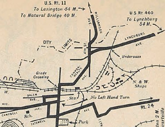
c. 1933, VDoT
|
|
...however, what they were not clear about is whether US 460 ended at that junction, or whether US 460 overlapped US 11 southward to a terminus in downtown Roanoke. Since I have never seen any map, photo, or document that supports a downtown endpoint, for now I am assuming the endpoint was at the junction north of town (incidentally, that junction also carried both US 11 and US 220 after the latter designation replaced US 311 through Roanoke). Here is an interactive image showing that former endpoint (Orange westbound at Williamson):
|
|
|
In 1943 the east end of US 460 was changed such that it ended in downtown Norfolk. This image is looking south on Monticello Avenue, which at the time was an extension of Granby Street and carried Alternate US 58. To the left on Brambleton Avenue was the beginning of US 460 (which joins the current route of US 460 about a half-mile in that direction):
|
Karners, Jan. 2017
|
|
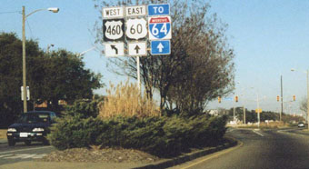
In 1958 the east end of US 460 was moved to its current location in Norfolk. These photos were looking north on Granby Street, at its junction with Ocean View Avenue (US 60):
|
Sanderson, Oct. 1999
|
Nitzman, 2001
|
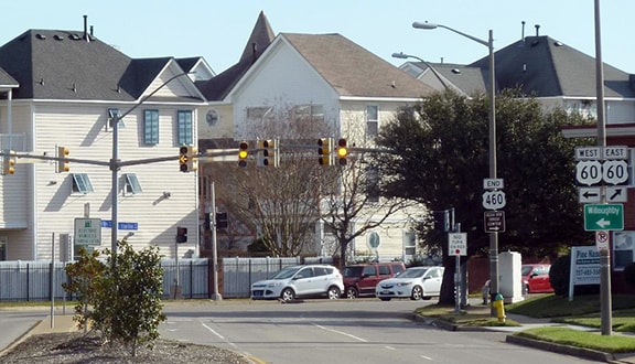
Karners, Jan. 2017
|
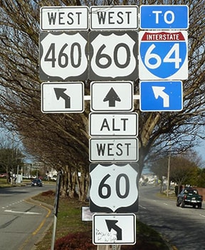
Following are close-ups of the assemblies visible in the preceding photo:
|
|
This was the east beginning of US 460, as seen from westbound US 60... but the "East" tab was a mistake, and not long after this photo was taken, this assembly was fixed to read "West":
|
Nitzman, 2001
|
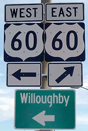
Southbound Granby begins to the left, and that is the beginning of US 460 as well. Since then, a shield for Alternate US 60 has been added:
|
Karners, Jan. 2017
|
|
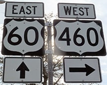
Here is the view from the opposite direction (east on Ocean View):
|
Karners, Jan. 2017
|
The east beginning of US 460 is to the right. The first westbound marker was posted about a block ahead, at the intersection with A View Avenue, where Granby makes a bend to the south (note the other shield specifies mainline US 60, but it should actually read "West Alt. US 60":
|
Karners, Jan. 2017
|
|
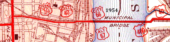
In 1946 the west end of US 460 was extended to downtown St. Louis: just over the Mississippi, via the MacArthur Bridge (which was referred to as the Municipal Bridge at the time of AASHO's approval):
|
|
|
US 67 ran along 7th Street at the time, as shown on the 1954 USGS topo. Initially this was a typical at-grade intersection, but later topos show that an extension was built over 7th, which immediately curved south to end at Chouteau Avenue:
|
USGS, 1:24k scale
|
|
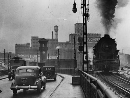
The date of this photo is uncertain, but it quite accurately represents how the last mile of US 460 would have looked in 1947 as traffic descended from the bridge into downtown St. Louis:
|
|
|
The MacArthur Bridge is now closed to automobile traffic, and the offramps have been dismantled, so there is not much left to see from the ground. But until about 2008 a decent aerial view was possible from the top of the Gateway Arch. This photo was taken looking south from one of the east windows:
|
Sanderson, July 2007
|
|
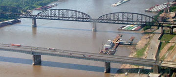
That is the Mississippi River; the Illinois shore is visible at upper left. The closest bridge is known to locals as the Poplar Street Bridge, but that can be a little confusing to visitors, because it is more than just a "street": while it does align with Poplar, it actually carries interstate highway traffic. The bridge behind that is the MacArthur. The upper deck was once used by US 460 traffic; it is closed now, but the lower deck is still used by trains. On the Missouri side landing, the railroad and the old highway diverge, as can be seen in this shot:
|
Sanderson, July 2007
|
|
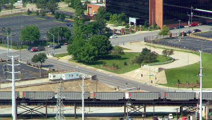
That was also looking south, but from one of the west side windows. Running across the bottom of the photo is the rail line that connects to the MacArthur Bridge. Just above that at far left, an elevated roadway is visible, with two white modulars sitting on it. Historically that carried highway traffic to MacArthur (off the left edge of the photo). To the right of the modulars, a bridge carried traffic over 7th Street, connecting with the curved road in the grassy area on the far side of 7th. That curve ends at Chouteau, and that was formerly a west end of US 460. (That curved segment has since been removed and replaced with a surface-level parking lot.)
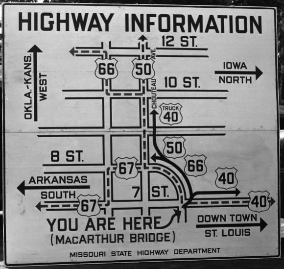
Down on the surface, at one time there was a remarkable sign posted at US 460's terminus: |
date unknown (linked to source)
|
|
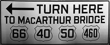
This was a sign directing travelers to the west beginning of US 460:
date unknown (linked to source)
|
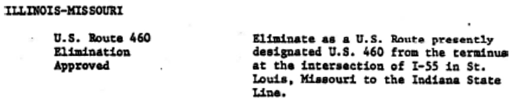
The Poplar Street Bridge opened to traffic in 1967, and most highway traffic was redirected to use it. Some photos from that timeframe -- as well as official state highway maps from both Missouri and Illinois -- suggest that around that time the US 460 designation was no longer signposted on the Missouri side, and it may have been truncated to its junction with I-55/70 in East St. Louis for a few years. Then in 1975 both states received approval to completely eliminate US 460; here is that agenda item from AASHTO's meeting in November of that year...
|
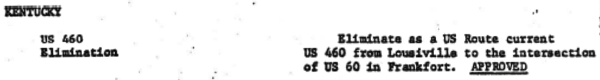
...and at the very next meeting Kentucky obtained permission to remove US 460 between Frankfort and the Indiana state line:
|
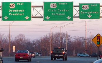
That left only the Indiana portion of US 460, but oddly there does not seem to have been an AASHTO action decommissioning that segment. At any rate, it was 1976 when the west end of US 460 was truncated to its current terminus in Frankfort:
|
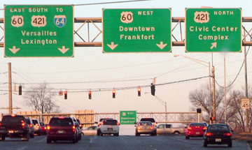
Sanderson, Feb. 2007
|
|
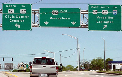
That was looking west on Main Street, where US 460 ends at Versailles Road, which is where it junctions with its parent route (US 60). This photo is looking the opposite direction on Main, heading east out of downtown:
|
Elkins, May 2000
|
|
US 60 is routed southward on Versailles, but if one continues straight, they find themselves on Georgetown Road, at the west beginning of US 460. Next we are looking north on Versailles (wb US 60 and nb US 421); the west beginning of US 460 is to the right:
|
Sanderson, Feb. 2007
|
Research and/or photo credits: H.B. Elkins; Karin and Martin Karner; Alex Nitzman; Mike Roberson; Dale Sanderson; Michael Summa
Page originally created 1999;
last updated Dec. 7, 2023.
last updated Dec. 7, 2023.
