End of US highway 158 |
|
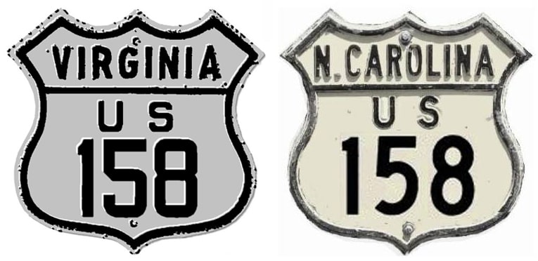
1932-1940
|
1940-1950
|
1950-present
|
|
Mileage: in 1989 AASHTO listed a figure of 384 miles for US 158... however, that included the mileage of US 158's associated business/alternate routes. According to the state subtotals on AASHTO's 1989 spreadsheet, mainline US 158's actual end-to-end total at the time was 347 miles. That closely matches our own 2020 measurement, which yielded 349.4 miles (reroutings and realignments likely explain the difference).
|
|
Claim to fame: US 158 is by far the longest current intra-state US route (although historically, when US 98 was a single-state route, it was significantly longer).
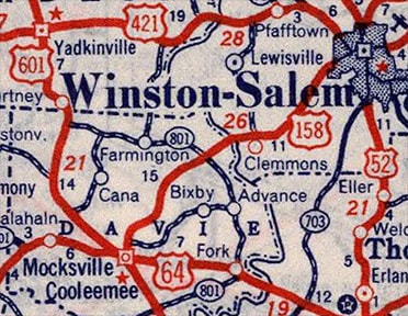
The west terminus of US 158 has always been in Mocksville, although the specific endpoint in town has moved a couple times: |
|
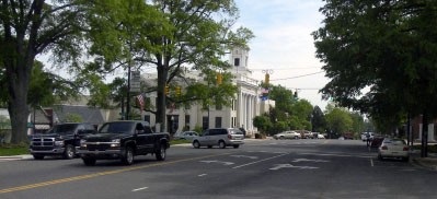
Originally US 64 and US 601 came in from the northwest on Wilkesboro Street. Initially traffic cut over to Main Street using Gaither Street, so at the time US 158 ended on Main at Gaither. This interactive image is looking south on Main:
|
|
|
US 158 ended there; both straight ahead and to the right on Gaither was US 64-601.
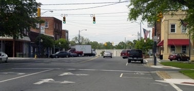
In 1937, US 64-601 was changed to follow Wilkesboro - Salisbury Street - Depot Street - Main, so US 158 was extended one block south, ending on Main at Depot. This photo was also looking south on Main: |
|
That was US 158's second endpoint; just as in the first photo, both straight ahead and to the right on Depot was US 64-601.
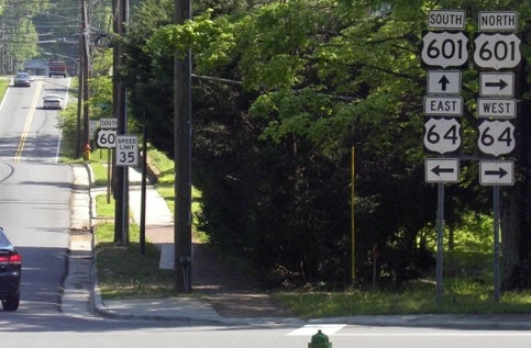
Then in about 1947, US 64-601 stayed on Salisbury all the way down to Sanford Street/Lexington Road, so US 158 was extended another two blocks to its current terminus on Main at Lexington. This shot was also from southbound Main: |
|
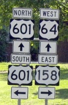
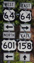
That is eastbound US 64 and southbound US 601, but here 601 traffic splits off to the right on Main. To the left is the west beginning of US 158. Next we are looking the opposite direction (west on Lexington, or westbound US 64)...
|
...US 158 begins to the right on Main. This next shot was taken looking north on Main, or northbound US 601:
|
|
US 601 continues to the left on Lexington, but straight ahead is the west beginning of US 158. Two blocks in that direction we reach Depot:
|
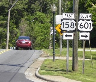
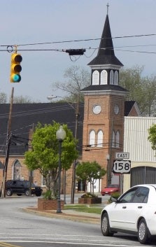
Until about 1949 that was US 64-601, which continued to the left on Depot. Straight ahead was a former west beginning of US 158. At the next block (Gaither) was the original west beginning, and today that is where the first eastbound marker is posted:
|
|
Originally the east end of US 158 was in Franklin.
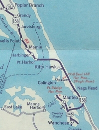
In 1940, US 158 was truncated at Murfreesboro, and instead extended east through Elizabeth City to Barco; then south through Kitty Hawk to Nags Head... and then back west to Manteo: |
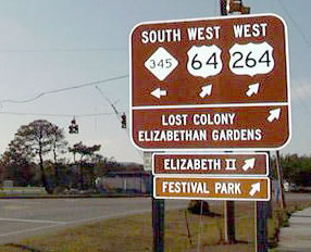
The junction shown here is where US 158 ended; this was looking west on US 64-264:
|
At the time US 158 ended there, NC 345 went both left (to Wanchese) and right (to Manteo). In 1950, long before that photo above was taken, the US 158 designation was truncated to its current terminus: a place known as Whalebone Junction, which is on the Outer Banks of NC, a little south of Nags Head. So after that, it was US 64-264 that continued northward to serve Manteo. But since that photo, things have changed again: US 264 no longer makes it as far east as Manteo. US 64 continues straight ahead to a new bridge over Croatan Sound (and to the current east beginning of US 264); while Business 64 is the route that goes north into Manteo.
Research and/or photo credits: David Montgomery; Alex Nitzman; Mike Roberson; Dale Sanderson; Matt Stefora; Michael Summa
Page originally created 1999;
last updated Dec. 9, 2023.
last updated Dec. 9, 2023.
