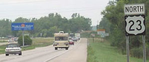
End of US highway 223 |
 |
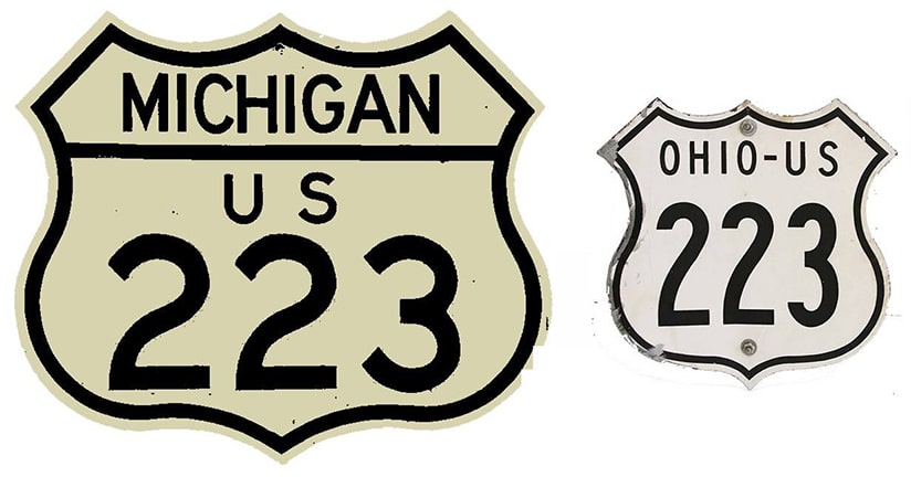
Summa
|
Mileage: in 1989 AASHTO listed a figure of 59 miles for US 223... but that assumed a Toledo endpoint. US 223 has since been truncated to Sylvania, and our own 2020 measurement yielded 47.1 miles.
|
US 223 was commissioned in 1930, along what until then had been the southernmost segment of US 127. Even at its maximum extent, its length was less than 60 miles. The map below illustrates the fact that, until 1961, it was US 112 (not US 12) that ran east-west through Somerset. And originally US 223 extended south all the way into downtown Toledo:
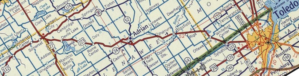
c. 1956, Gousha
|
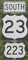
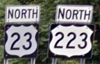
In 1977 US 223 was realigned to go due east from Riga MI, where it connects with the US 23 freeway at interchange 5. In Michigan, US 223 is co-signed with US 23. That is also true in Ohio now, but that was not always the case:
|
Hargraves, 2002 (Michigan)
|
Hargraves, 2002 (Ohio)
|
Stuve, July 2014
|
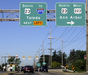
|
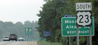
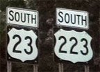
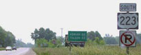
Note the "South" directional on those signs; more on that below. In 1987 Ohio had US 223 truncated out of Toledo; since then its terminus is at the hwy. 51-184 interchange (the first southbound exit, the green sign for which is visible in the distance). Signs do not instruct US 223 traffic to exit there, but drivers who do so encounter an "End US 223" sign on the offramp:
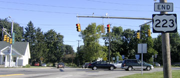
Field/Nitzman, Sep. 2005
|
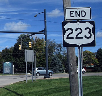
Dienhart, Oct. 2023
|
|
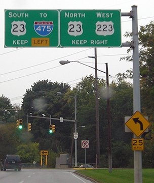
That is Monroe Street running across the photo. It actually carried the original US 223, so it is somewhat ironic that modern US 223 ends at its own historic route.
This photo was looking west on Monroe, from the opposite side of the US 23 freeway. Note that Ohio signs this "West" on US 223 -- which is very odd, because the half-mile segment that exists in Ohio is about as north/south as a road can get, and the remainder of the highway in Michigan is signed north/south! |
Morrison, Oct. 2013
|
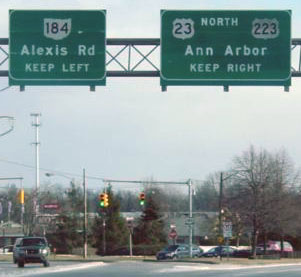
|
Monroe curves to the left -- that was the route of historic US 223, but today that is OH 51, which ends at the intersection just ahead, where Alexis Road (OH 184) comes in from the right. After making that curve, drivers would formerly encounter the sign bridge shown here:
|
Field/Nitzman, Sep. 2005
|
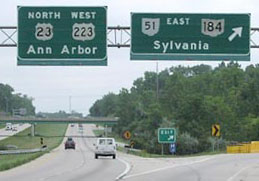
|
Originally US 223 continued northbound by going straight ahead for about a half-mile before angling north on Sylvania's Main Street. But today US 223 begins to the right with US 23. In 2013 this interchange was reconfigured to include roundabouts, and the replacement signage heading this direction no longer included any reference to US 223. Same heading the opposite direction (east) on Monroe, but historically overhead signage had it correct:
|
Garnell, Jan. 2003
|
|
It was not mentioned on that sign, but OH 51 (Monroe) angles to the right (that is how one gets to the onramp for northbound US 23-223). Historically US 223 followed that road all the way downtown (as did US 127 before that). This photo was looking north on US 23 at interchange 234 (the last exit in Ohio):
|
Hargraves, 2002
|
|
Suddenly a US 223 sign began appearing along with US 23 -- it is rare that a US route terminus occurs at a junction with a state route (instead of another US route or an interstate). Formerly that was the only mention of US 223, as it was not referenced ahead on the confirming signpost:
|
Hargraves, 2002
|
Street View, June 2014
|
Today, there is no mention of US 23 or 223 on the overhead signage, but ahead US 223 does have a reassurance marker.
|
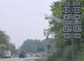
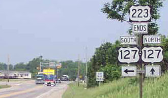
The north end of US 223 has always been in Somerset. This photo was from eastbound US 12:
|
Hargraves, 2002 (signs replaced by 2013)
|
|
About a half-mile to the right on US 127, the mainline becomes US 223, and traffic wanting to remain on US 127 must exit to the right:
|
Hargraves, 2002
|
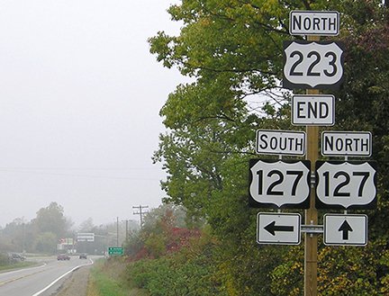
Morrison, Oct. 2013
|
|
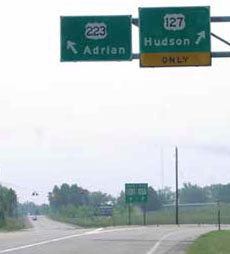
Travelers who veer left there will soon see the first southbound US 223 confirming marker:
|
Hargraves, 2002
|
|
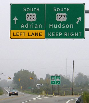
Heading the opposite direction, these photos show the "End" signage:
|
Hargraves, 2002
|
Morrison, Oct. 2013
|
|
Approaching Somerset from the south on US 127, this interesting sign was posted:
|
Hargraves, 2002
|
|
It would be more typical to use standard junction signage, but that sign was in "construction zone" orange, so maybe there are a lot of accidents at that intersection, the signage for which is shown here:
|

Hargraves, 2002
|

Morrison, Oct. 2013
|
Research and/or photo credits: Paul Dienhart; Andy Field; Dan Garnell; Don Hargraves; Jeff Morrison; Alex Nitzman; Dale Sanderson; Eric Stuve; Michael Summa
Page originally created 2002;
last updated Oct. 26, 2023.
last updated Oct. 26, 2023.
