End of US highway 31 |
 |
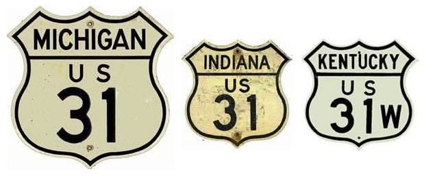
Summa
|
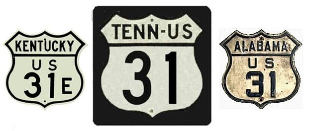
Summa
|
|
1926-1940
|
1940-1960
|
1960-1980(?)
|
1980(?)-present
|
Mileage: in 1989 AASHTO listed a figure of 1580 miles for US 31... however, that included the mileage of US 31's associated business/bypass/alternate routes, and it also included the mileage of both US 31E and US 31W. According to the state subtotals on AASHTO's 1989 spreadsheet, mainline US 31's actual end-to-end total at the time was 1290 miles (via US 31W). That closely matches our own 2020 measurement, which yielded 1287.7 miles (again via US 31W; the US 31E option is about 10 miles longer). At its historic maximum extent, US 31 was 1315 miles long.
|
US 31 was one of the original 1926 routes. At the time, its northern terminus was at Rogers Park MI (that is essentially at modern-day exit 352 on I-75, about eight miles north of St. Ignace). Why did the route end at such an unlikely place? Well, US 2 did not always serve St. Ignace. Originally it passed to the north of Brevort Lake to modern M-123, which it followed to Rogers Park:
|
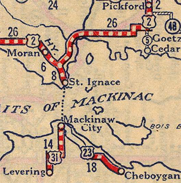
c. 1927, Rand McNally
|
|
Where M-123 ends today, US 2 continued north (left) to end at Sault Ste. Marie, and that is essentially where US 31 began to the south (right)...
|
Halonen, July 2002
|
|
...but of course I-75 had not yet been built, so traffic actually followed Mackinac Trail, which runs along the east shoulder of I-75. US 2 and US 31 originally met at a "Y" junction, and those old roadways still exist. When traffic moved to the interstate, the old junction became a small wayside known as Rogers Park (a monument to Frank Rogers, former state highway commissioner, is located there):
|
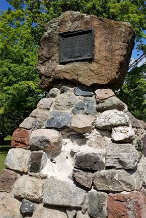
Anzicek, Aug. 2019
|
|
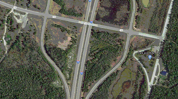
This area is interesting from an aerial perspective. In this animated image, original US 2 is shown with a red line; US 31 and the "Y" junction is shown in yellow:
|
|
|
At ground level it is somewhat difficult to get instructive photos, but here is one showing historic eastbound US 2 curving to the north; the old centerline striping is still visible:
|
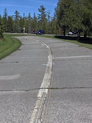
Sanderson, Jun. 2022
|
|
In about 1937, US 2 was changed such that it ran along the Lake Michigan shoreline between Brevort and St. Ignace, then north to connect with its original route at Rogers Park. However, US 31 continued to overlap with US 2 up to Rogers Park for another few years:
|
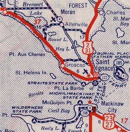
c. 1939, Rand McNally
|
The original route of US 2 was still shown there: north of Brevort Lake, down through Moran and Allenville, then east.
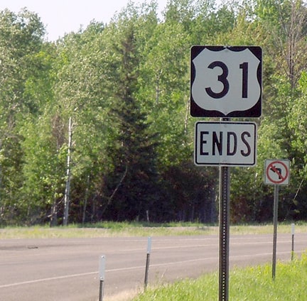
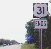
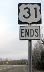
It was not until 1940 that the US 31 designation was truncated to the ferry docks in Mackinaw City, where it ended along with US 23 and US 27. That situation lasted almost 20 years, until the Mackinac Bridge was completed in 1957. Then the north end of US 31 was rerouted away from the ferry docks, instead ending at the south landing of the Bridge (more info on the Mackinaw City page). |
|
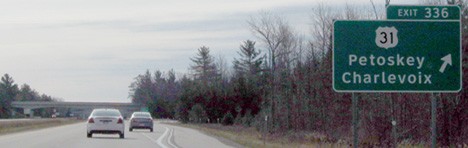
That was the case until about 1990, when US 31 was cut off to its modern terminus: just south of Mackinaw City, at I-75's interchange 336. Shown here is US 31's last northbound trailblazer...
|
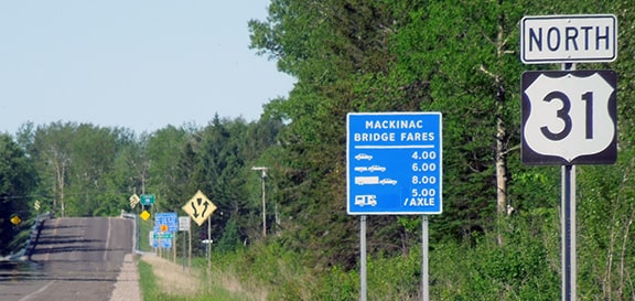
Sanderson, Jun. 2022
|
|
...and in these photos, we are on the ramp that merges with northbound I-75:
|
Sanderson, Jun. 2022
|
|
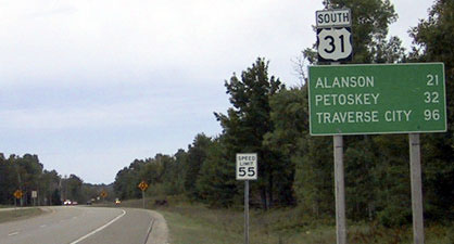
Mackinaw City is ahead about two miles. Heading the opposite direction (south on I-75), the north beginning of US 31 is heralded thus...
|

Sanderson, Jun. 2022
|
|
...and these photos show the first southbound marker:
|
Mortell, 2002
|
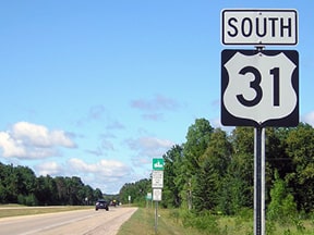
Morrison, July 2018
|
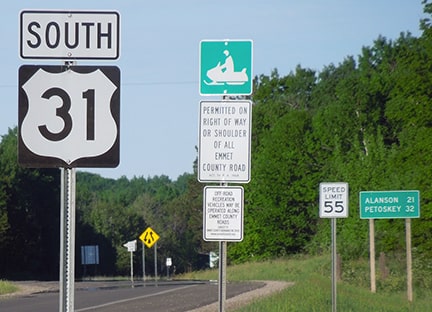
Sanderson, Jun. 2022
|
Mackinaw City is at the southern terminus of the Mackinac Bridge, which serves Michigan's Upper Peninsula. At the Bridge's dedication ceremony in 1958, each of Michigan's 83 counties chose a "Queen" to represent them; my very own mother was voted Miss Missaukee County.
The south end of US 31 has always been at or near Mobile. Before I-65 was built, US 31 was the main north-south highway in Alabama, connecting Decatur, Birmingham, Montgomery, and Mobile. Today the two highways essentially parallel each other throughout the state, but a notable divergence occurs at Bay Minette, north of Mobile: whereas I-65 crosses to the north of Mobile Bay and then heads south into Mobile, US 31 heads south first to Spanish Fort.
|
|
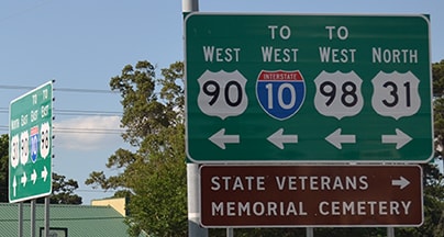
Currently the US 31 designation ends there: on the east shore of Mobile Bay, at its junction with US 90 (and formerly US 98, but recently that has been rerouted just to the west). In these photos, the approach to Battleship Parkway is visible straight ahead (the original causeway across Mobile Bay, connecting Spanish Fort and Blakeley Island; Mobile itself is about seven miles in that direction):
|

Nitzman, 1999
|
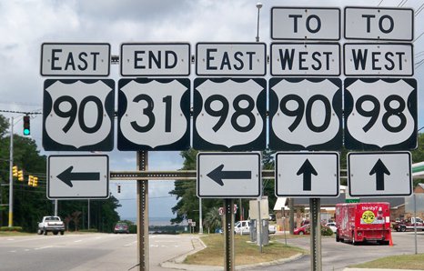
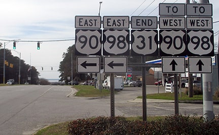
Karner, May 2013 (as of 2015, the positions of "End 31" and "East 98" were swapped)
|
Dienhart, Jan. 2019
|
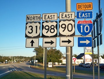
If one were to turn left onto eastbound US 90-98, they would actually be heading south for a time. The driver would intersect I-10, and then US 90 and 98 would split. US 90 begins heading east, roughly along I-10. US 98 continues south for a few more miles, serving Daphne and Fairhope. But then it, too, turns back east, and it meets up with US 90 again in Pensacola FL. Looking north on westbound US 90-98, the south beginning of US 31 is signed thus:
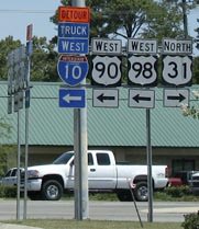
Nitzman, June 2006
|
Karner, May 2013
|
Nitzman, May 2016
|
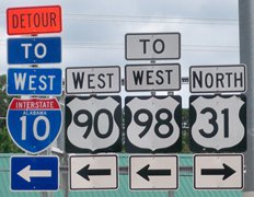
The assembly visible at far left is shown in these photos:
Karners, Dec. 2009
|
Nitzman, May 2016
|
|
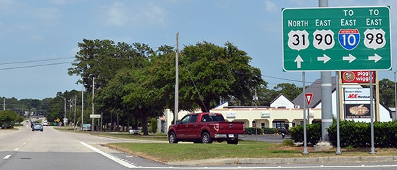
That is from eastbound US 90-98, which turns south here. Straight ahead on Spanish Fort Boulevard is the southernmost stretch of US 31 (which actually heads east for a few miles before turning to the north). Not far in that direction is a junction with another highway, and that is where the first northbound trailblazer is posted:
|

Nitzman, May 2016
|
Behind the camera is Battleship Pkwy. Today it carries US 90-98 traffic, but historically it also carried US 31. The Mobile page discusses the places where US 31 may have ended, back when it extended all the way to that city.
|
Research and/or photo credits: Josh Anzicek; Christopher Bessert; Paul Dienhart; Nathan Edgars; Adam Froehlig; Robert Halonen; Karin and Martin Karner; Jeff Morrison; Robert Mortell; Alex Nitzman; Russell Rein; Rich Rowland; Dale Sanderson; Michael Summa
Page originally created 1999;
last updated Jun. 14, 2022.
last updated Jun. 14, 2022.
