End of US highway 127 |
|
1926-1930
|
1930-1959
|
1959-2002
|
1999-present
|
|
Mileage: in 1989 AASHTO listed a figure of 640 miles for US 127... however, that included the mileage of US 127's associated bypass routes. According to the state subtotals on AASHTO's 1989 spreadsheet, mainline US 127's actual end-to-end total was 628 miles... but at the time, US 27 still ended in Lansing. Since then it has been extended to Grayling, and our own 2020 measurement yielded 746.5 miles... that is, along the signposted portion of US 127. The official but unsigned segment in Chattanooga brings the total to 749.8 miles.
US 127 was among the original 1926 routes. Originally its south terminus was in Toledo. But in 1930, US 127 was rerouted to go south from Somerset MI (as it does today), so US 223 was commissioned to replace US 127's original segment between Somerset and Toledo. From then until 1959, its southern terminus was in Cincinnati. Then US 127 was extended to its current southern terminus in Chattanooga.
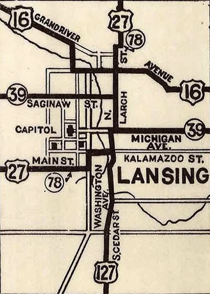
US 127's northern terminus was in downtown Lansing. It came into town on Cedar Street, while US 27 came in on Main Street, then jogged north on Washington Avenue, then east again on Kalamazoo Street, as shown on this historic map: |
So initially US 127 met its "parent" route (US 27) on Cedar at Kalamazoo, and either ended there, or else 27 and 127 were dual-signed up to the junction with US 16 at Grand River Avenue. MDoT's 1951 map was the first issue to show that US 27 no longer jogged along Washington or Kalamazoo, but rather remained on Main all the way to Cedar before turning north. But at that time US 127 definitely did not end at its junction with US 27; rather the designation overlapped with 27 up to US 16, where it terminated. We know this because in 1958 Michigan received permission from AASHO to truncate US 127 to Main. So then Cedar and Main became US 127's third endpoint in Lansing.
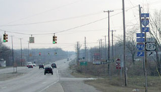
As with most other cities in recent history, much of the highway traffic in the Lansing area has been re-routed off the original surface streets and onto newer freeways. In 1965, AASHO granted MDoT's request to remove US 127 from Cedar completely, instead routing traffic along a new segment of today's US 127 freeway. But initially that was complete only as far north as Exit 78; so from there US 127 traffic was directed west on Grand River and Oakland Avenue, ending at the Cedar/Larch couplet (jct. US 27).
|
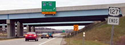
That was formerly the north beginning of US 127 (now signed "TO US 127"). In 1988, US 27 was re-routed to follow I-69 around Lansing. Then in 2001 today's US 127 freeway (the St. John's bypass) was completed northward from I-69. But at the time that segment was still designated US 27, so the north end of US 127 was at I-69's interchange 90, just north of Lansing. This photo was taken from northbound US 127, at what was then the I-69/US 27 interchange:
|
|
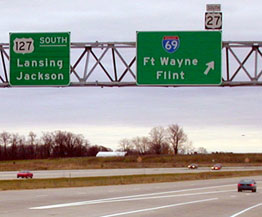
At the time, northbound US 27 was straight ahead, and southbound was to the left (although from this direction traffic would have exited to the right). Today, the US 127 designation has been extended north (straight ahead along the former US 27) to its new north end near Grayling. That "End" sign is gone now (as is the US 27 sign at far left). This photo was heading south on what was then US 27, but is now US 127. US 127 began here, while US 27 exited right and looped around Lansing with I-69...
|
...but in 1999, the US 27 designation was removed from I-69, and now it does not begin until all the way down in Ft. Wayne IN. That "South 27" sign has been removed, and that interchange no longer marks the north beginning of US 127.
Research and/or photo credits: Neil Bratney; Adam Froehlig; Don Hargraves; Mike Head; Brent Ivy; Alex Nitzman; Dale Sanderson; Michael Summa; Mike Wiley
Page originally created 2000;
last updated Dec. 8, 2023.
last updated Dec. 8, 2023.


