End of US highway 41 |
|
1926-1949
|
1949-1952
|
1952-present
|
2000-present
|
Mileage: in 1989 AASHTO listed a figure of 2297 miles for US 41... however, that included the mileage of US 41's associated business/bypass/alternate routes. According to the state subtotals on AASHTO's 1989 spreadsheet, mainline US 41's actual end-to-end total at the time was 2006 miles. That closely matches our own 2020 measurement, which yielded 2010.8 miles (reroutings and realignments likely explain the difference). That puts the midway point of US 41 right in downtown Nashville TN.
|
*Note: US 41 is signed north-south along its entire length, except along its southernmost extent in Miami-Dade County, which is signed east-west.
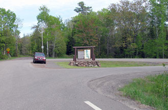
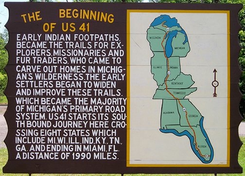
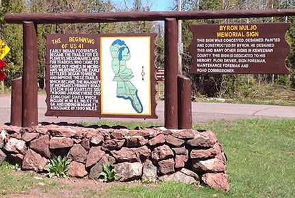
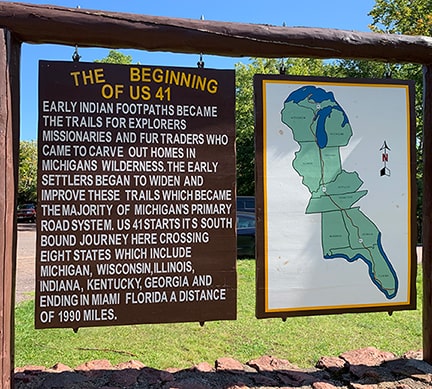
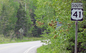
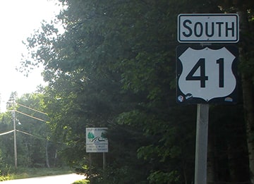
US 41 is among the routes originally commissioned in 1926. At first its north end was right in Copper Harbor, but it was not long before it was extended at least to Ft. Wilkins State Park, if not to its current terminus, which is about 2.5 miles east of Copper Harbor. This photo is looking at the turnaround that marks the endpoint:
|
|
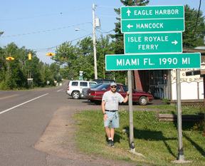
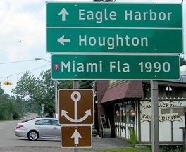
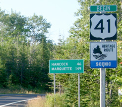
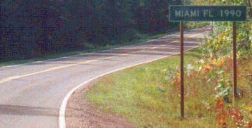
It is uncommon to see mileages posted for cities nearly 2000 miles away, but MDoT is to be commended for doing their part to help travelers understand the scope of this highway. This junction actually marks the northernmost point on US 41. Many people find this hard to believe, but this part of Michigan (including all of this northernmost segment of US 41) is actually a little further north than the northernmost point in Maine. By 2013 that sign was replaced:
|
|
Now we have the Clearview font; "Hancock" has been replaced by "Houghton"; no more mention of the Isle Royale ferry; and Miami-bound traffic is still not informed that they must turn left. US 41 continues by turning left here, but originally this junction marked the north beginning of US 41... and interestingly, that is where the state has posted a "Begin" sign:
|
|
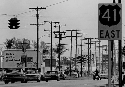
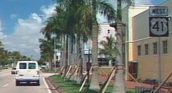
That particular "Miami" sign is also gone now... and originally US 41 went only as far as Naples FL. At the time, since the Naples-to-Miami leg runs east/west, that segment was assigned an east/west number: US 94. But in 1950, US 41 was extended to Miami, replacing what had been US 94. Initially, the entire Naples-to-Miami segment was signed east-west...
|
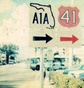
...and that was also right about the time when Florida began using colored US route shields (as you can see in that photo). But those colors were phased out beginning in the 1990s, and currently north-south directional tabs are used everywhere along US 41 except within Miami/Dade County. More info on the Naples page and the Miami page. In 1952, the US 41 designation was extended east of Miami for another six miles:
|
(Info about that strange colored shield.) Heading that direction, the first US 41 marker looked like this:
|
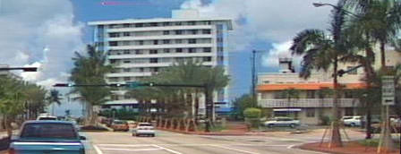
Officially, that is still the terminus of US 41. However, for some reason, in 2000 FDoT decided to remove all references to US 41 east of its junction with US 1 in Miami. In fact, for several years there were even "End US 41" assemblies posted at Brickell Avenue. So by all appearances, US 41 was truncated back to its former terminus in downtown Miami. Then in late 2013, AASHTO approved FDoT's request to divert US 1 traffic off Brickell and instead onto I-95. Shortly thereafter, FDoT removed the "End US 41" signage at Brickell.
US 41 runs along SW 8th Street through some interesting sections of Miami, including Little Havana, where it is referred to as "Calle Ocho". The US 41 designation is still referenced from its junctions with US 441, I-95, and even Brickell. However, drivers following US 41 will be disappointed in the road's general lack of acknowledgement in Miami and environs. As of 2016, the last "East US 41" assembly was posted at 22nd Avenue, but by 2019 another one was installed just east of 8th Ave (US 441). For the remaining two miles to I-95 (and 2.5 miles to Brickell) there were no more trailblazers. So now it is unclear where FDoT wants travelers to think US 41 ends. And it is still unclear why they want the designation to officially continue all the way to Miami Beach, but they do not want to signpost its easternmost few miles.
US 41 runs along SW 8th Street through some interesting sections of Miami, including Little Havana, where it is referred to as "Calle Ocho". The US 41 designation is still referenced from its junctions with US 441, I-95, and even Brickell. However, drivers following US 41 will be disappointed in the road's general lack of acknowledgement in Miami and environs. As of 2016, the last "East US 41" assembly was posted at 22nd Avenue, but by 2019 another one was installed just east of 8th Ave (US 441). For the remaining two miles to I-95 (and 2.5 miles to Brickell) there were no more trailblazers. So now it is unclear where FDoT wants travelers to think US 41 ends. And it is still unclear why they want the designation to officially continue all the way to Miami Beach, but they do not want to signpost its easternmost few miles.
Research and/or photo credits: Patrick Allen; Chris Bessert; Sandra Bond; Paul Dienhart; Robert Droz; Martin Karner; Bruce Kasprzyk; Dan Moraseski; Jeff Morrison; Robert Mortell; Dale Sanderson; Dan Schallenkamp; Michael Summa
Page originally created 2001;
last updated Nov. 13, 2023.
last updated Nov. 13, 2023.


