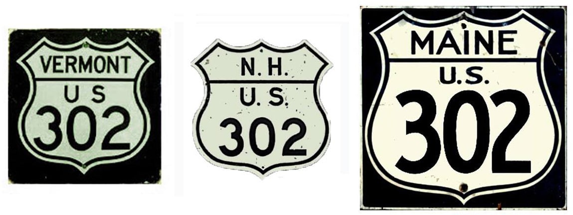
End of US highway 302 |
 |
Summa
|
1935-present
|
Mileage: in 1989 AASHTO listed a figure of 174 miles for US 302... however, that included the mileage of US 302's associated business route. According to the state subtotals on AASHTO's 1989 spreadsheet, mainline US 302's actual end-to-end total at the time was 171 miles. That closely matches our own 2020 measurement, which yielded 168.6 miles (reroutings and realignments likely explain the difference).
|
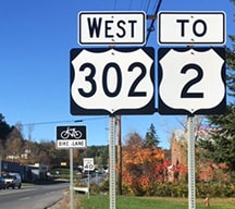
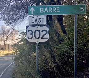
US 302 was commissioned in 1935; its west endpoint has always been in Montpelier:
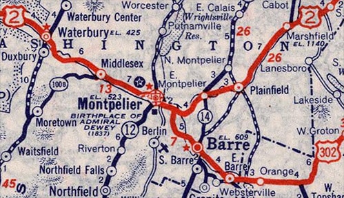
c. 1939, Rand McNally
|
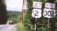
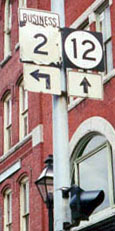
This photo shows the west beginning as viewed from westbound US 2:
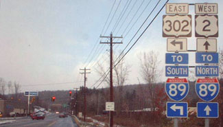
Kerr, Nov. 2002
|
Around 2010, that junction was reconfigured into a roundabout. These photos show the last westbound marker as well as the "End" assembly near US 302's terminus:
|
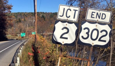
Bourey, Oct. 2019
|
However, more than one historic topo map indicated that the US 302 designation was originally overlapped with US 2 into downtown Montpelier. During the early years of the US route system, it was common for routes to overlap into the center of towns, and these maps suggest that Montpelier was no exception:
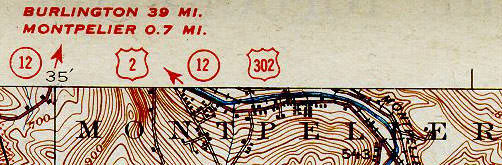
USGS, c. late 1920s?
|
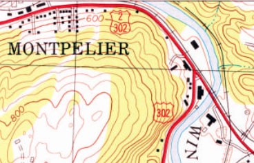
USGS, c. 1978
|
|
If so, then US 302 would have joined US 2 heading west on River Street, which becomes Berlin Street closer to town, and then signage may have directed traffic north on Main Street. Where US 2 turned west again on State Street, US 302 probably would have ended:
|
Field/Nitzman, 2000
|
Heading the opposite direction on old US 2 (east on State Street), signs for US 302 may have begun to the right on Main:
|
Field/Nitzman, 2000
|
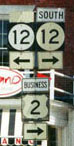
Even today, references to US 302 are still posted at the intersection of Main and Berlin, although most signs indicate that east on Berlin leads TO US 302:
Field/Nitzman, 2000
|
Field/Nitzman, 2000
|
Field/Nitzman, 2000
|
|
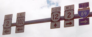
Straight ahead from that last photo, one comes to the current west beginning of US 302:
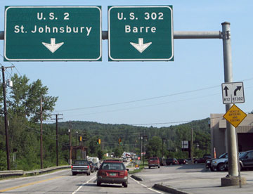
Nitzman, Aug. 2007
|
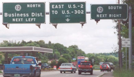
That was looking east on River (US 2); on the white sign at right, the straight-ahead arrow read "RT2", and the curve-right arrow said "RT302". Travelers taking that right would soon see the first eastbound US 302 marker:
|

In Portland, the east endpoint of US 302 has changed over the years. Originally the US 302 designation split off Forest Avenue onto Deering Avenue, and followed that to its junction with US 1:
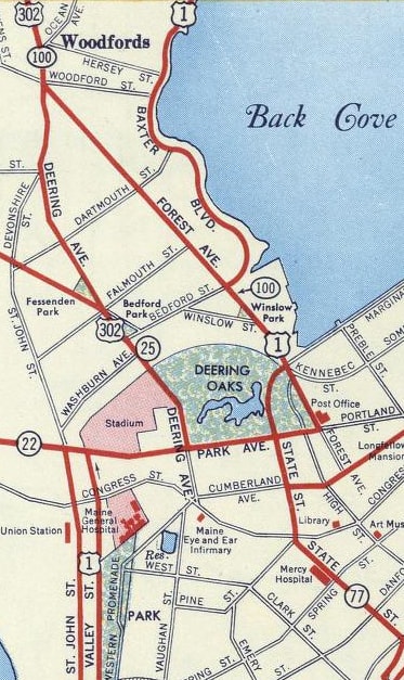
c. 1956, Gousha
|
Here is recent signage for traffic heading south on Deering. The traffic signal ahead is at Park Avenue; US 302 ended here at its junction with US 1 (although US 1 traffic is now directed to use I-295):
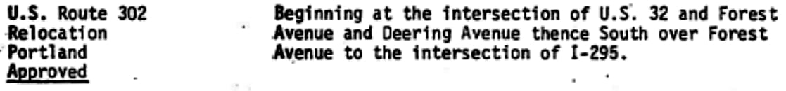
Heading that direction, Deering does not have an interchange with I-295. So after that freeway had been built, perhaps it was decided that US 302 should be directed along a road that does have a connection with the interstate highway. AASHTO approved that change in Oct. 1978:
|
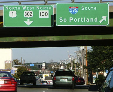
This photo was taken from southbound I-295; US 302 begins at this interchange:
|
Sanderson, Oct. 2004
|
|
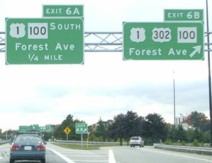
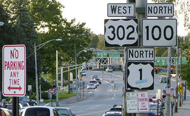
Now for the perspective from southbound US 1: here, we are heading west on Baxter Boulevard. Southbound US 1 traffic was directed to head south on Forest, but according to signage from this direction, US 302 began to the north on Forest:
|
Sanderson, Oct. 2004
|
Sanderson, Oct. 2004
|
|
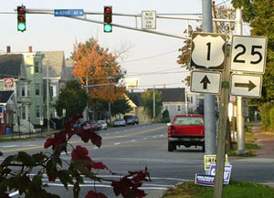
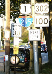
That made sense: technically, US 302 also goes left to I-295, but drivers heading that direction probably do not really need to know that. If one were to head south on Forest, they would immediately see this sign at the I-295 interchange...
Google Maps Street View, Aug. 2018
|
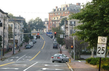
...but drivers continuing a half-mile straight ahead also come to this sign at Park Av:
Sanderson, Oct. 2004
|
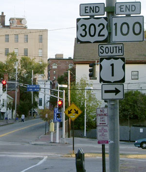
It is possible that was an historic endpoint of US 302. But today I-295 runs a few blocks behind the camera, and according to Maine DoT logs, US 302 ends there. However, for quite some time, US 302 has been signed through the interchange for another half-mile (where historically southbound US 1 continued to the right on Park). And even though the new End sign at I-295 has been up since at least 2007, the old End sign at Park was still there as of 2018.
|
|
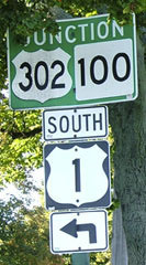
And that was not the only sign that indicating that US 302 went all the way to Park... This series shows what was probably the most complicated perspective: that of a driver following northbound US 1. This shot was taken heading east on Park:
|
Sanderson, Oct. 2004
|
|
That left turn put drivers on westbound High Street, which then curves to a traffic signal at Forest, just south of the I-295 interchange. There was really nothing in terms of directional signage for traffic turning on High. But for drivers who ignored that left turn sign and instead took the next left (on Forest), they would see this:
Sanderson, Oct. 2004
|
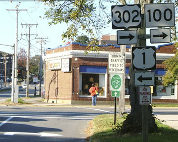
The cars at far left (behind the No Parking sign) were on westbound High. So why was traffic for these routes directed onto High? Perhaps because on Park there was more space for left turn queue at High than at Forest. Just ahead was the signage shown here, at the true beginning of US 302:
Sanderson, Oct. 2004
|
|
The intersection in the distance is Baxter Blvd, where northbound US 1 traffic was directed to turn right:
Sanderson, Oct. 2004
|
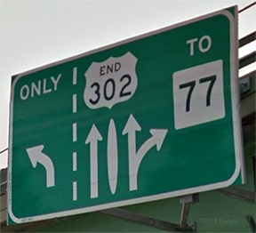
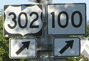
Unfortunately there was no direction there for those wanting to stay on US 302 (or ME 100). In fact, even for drivers who correctly guessed that they should continue straight on Forest, there was no confirming assembly for another 3/4ths of a mile:
Sanderson, Oct. 2004
That was at the five-way intersection where Forest makes a slight curve to the north. That sign was posted a little late, because if a driver was in the left lane at that point, they were locked into a left turn at Woodford Street... or else a sharp left, which would put them on eastbound Deering (which, as I mentioned above, is the original route of US 302 east of this point).
|
Research and/or photo credits: George Bourey; Eric Bryant; Andy Field; Cameron Kaiser; Doug Kerr; Alex Nitzman; Dale Sanderson; Michael Summa
Page originally created 2000;
last updated Nov. 27, 2021.
last updated Nov. 27, 2021.
