photo by Bob Lemons, 1948, courtesy of Oregon Historic Photo Archive
End of US highway 28 |
 |
|
|
|
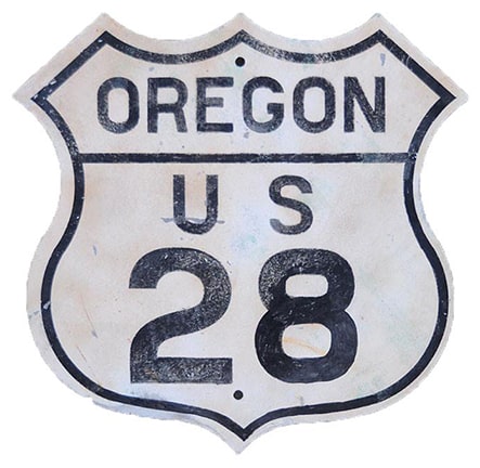
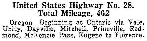
US 28 was among the original 1926 routes. At its zenith, it ran from one end of Oregon to the other; this excerpt is from AASHO's Apr. 1927 route log:
The east terminus of US 28 was at US 30 in Ontario:
|
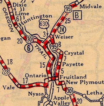
c. 1927, Rand McNally
|
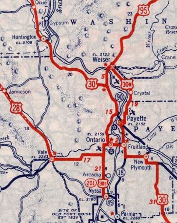
c. 1939, Rand McNally
|
These photos show modern signage from the perspective of US 28's historic endpoint. Below we are looking east on Idaho Avenue:
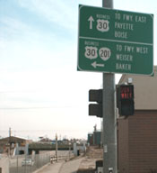
Sanderson, Mar. 2001
|
Sanderson, Mar. 2001
|
Elbert, July 2010
|
|
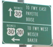
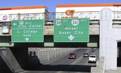
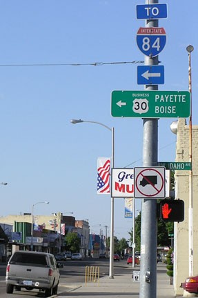
About a half-mile ahead is I-84 interchange 376, and a mile ahead is the Snake River, which forms the boundary between OR and ID in this region. Business US 30 goes left and straight from the intersection ahead (Oregon Street). Prior to I-84's construction, that was mainline US 30, so US 28 ended at that intersection. (Interesting how the older sign referred to I-84 as simply "Freeway". Maybe that was because they were skeptical that its number might change again: it was formerly designated "I-80 N".) More to the point, though: US 28 traffic began to the right (south) on Oregon, through the main business district, and then turned west on SW 4th Avenue. This next photo shows modern signage at the historic endpoint:
|
Elbert, July 2010
|
|
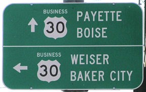
That was looking north on Oregon. Here we are heading west on Business 30, which used to be mainline 30:
|
Elbert, July 2005
|
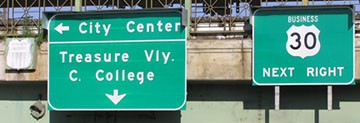
Elbert, July 2010
|
|
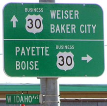
At the upcoming intersection, US 30 turned right, and the east beginning of US 28 was to the left on Oregon (the "201 South" sign was in the wrong place; it should have been down in the "College" and "Vale" part of the sign). These shots show the signage posted at the intersection itself:
|
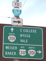
Sanderson, Mar. 2001
|

Elbert, July 2010
|
|
I-84's exit 374 is about 1.5 miles to the right. At the time of that first photo, the directions for OR 201 were correct on that sign. However, thanks to a bypass completed in about 2003, OR 201 does not come through here at all anymore... but these signs were not changed until 2009 or 2010.
One more perspective: these were looking south on Oregon: |
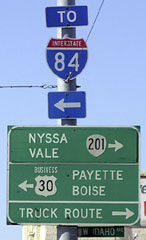
Elbert, July 2005
|
Elbert, July 2010
|
|
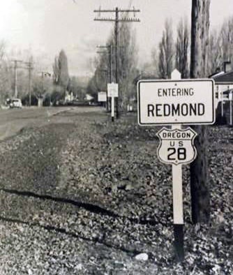
Eastbound US 30 turned left there, and US 28 began straight ahead. It followed what is now US 26 about halfway across Oregon, to Prineville, but then used today's OR hwy. 126 through Redmond to Sisters:
|
Originally Santiam Pass was not developed as a state highway, so US 28 traffic was directed over McKenzie Pass (today's OR 242, rejoining OR 126 near McKenzie Bridge):
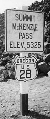
c. 1948, attribution unknown
|
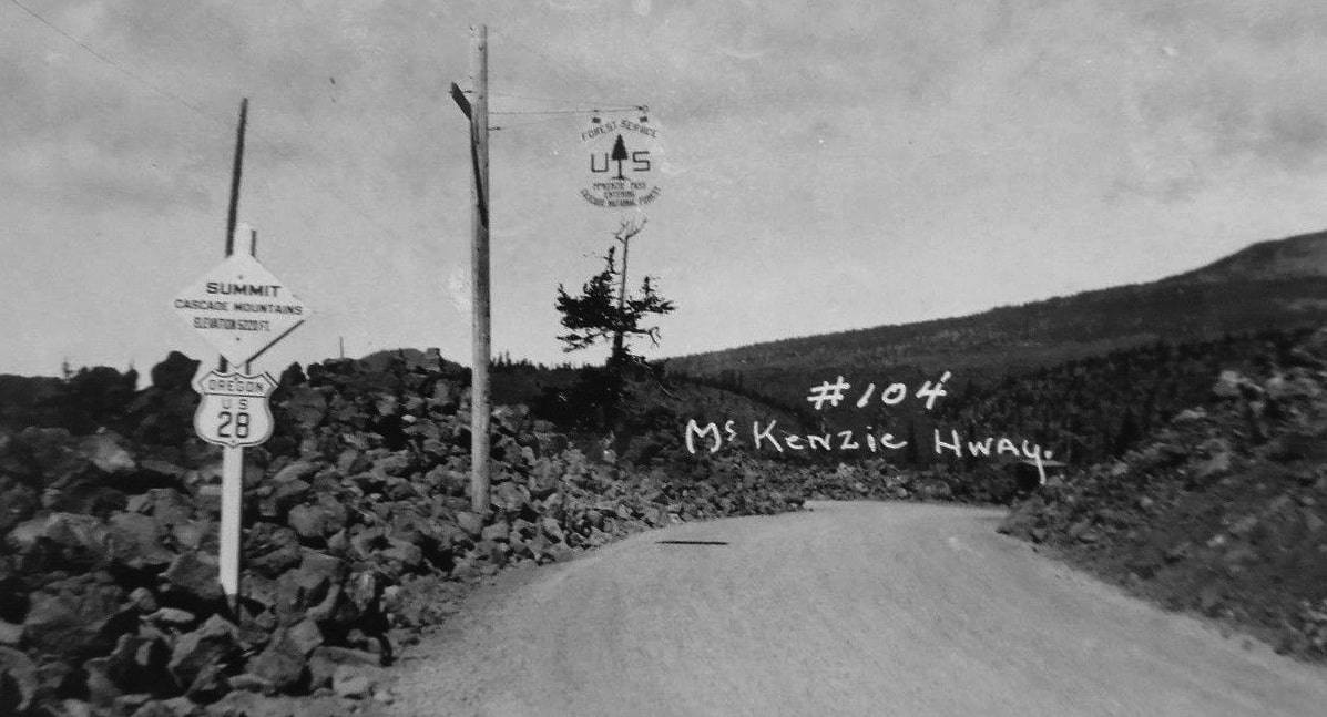
(date and attribution unknown)
|
From Eugene, US 28 never followed today's OR 126 westward. Instead, traffic joined US 99 north to Junction City, and then proceeded west via today's OR 36. Originally, the west end of US 28 was at the Pacific coast in Florence:
|
c. 1927, Rand McNally
|
|
At the time, there was no bridge over the Siuslaw River, so US 101 traffic had to use a ferry. The north landing was at the foot of Laurel Street: drivers proceeded up Laurel, then east on 2nd Street, then north on Quince Street, joining the current US 101 alignment at about 13th Street. US 28 came in on what is now OR 126, ending at Quince:
|
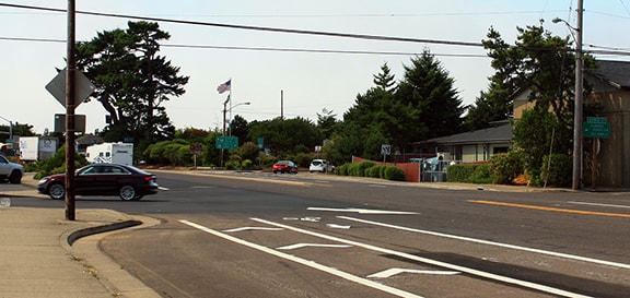
Elbert, Aug. 2018
|
|
Originally the crossroad carried US 101 traffic. When the Siuslaw River Bridge opened in 1936, US 101 was changed to follow its current alignment through town (signs for which are visible one block ahead). So US 28 was extended ahead, ending at the new US 101; here is a close-up shot:
|
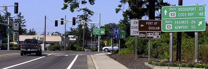
Elbert, Aug. 2004
|
|
Here, we are looking north on US 101:
|
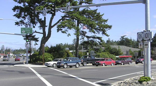
Elbert, Aug. 2004
|
What a cool tree on that corner. For about one year, US 28 began to the right; the signage mounted above the traffic signal points eastbound OR 126 traffic towards Mapleton and Eugene. Next is a view from the opposite direction (south on US 101):
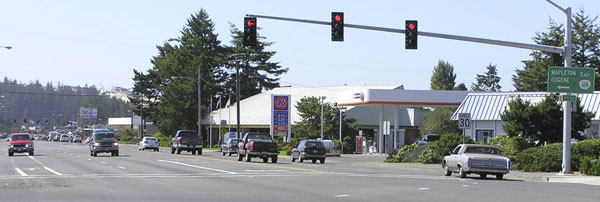
Elbert, Aug. 2004
|
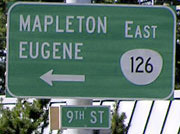
Elbert, Aug. 2004
|
To the left was the west beginning of US 28 from 1936-1937. Prior to that, the west beginning was at Quince, about one block to the left. In 1937, the segment of US 28 between Eugene and Florence was decommissioned; more info about its endpoint from then until 1951 can be found on the Eugene page.
Research and/or photo credits: Nathan Edgars; Chris Elbert; Bob Lemons; Dale Sanderson; Michael Summa
Page originally created 2000;
last updated Dec. 15, 2023.
last updated Dec. 15, 2023.
