End of US highway 69 |
 |
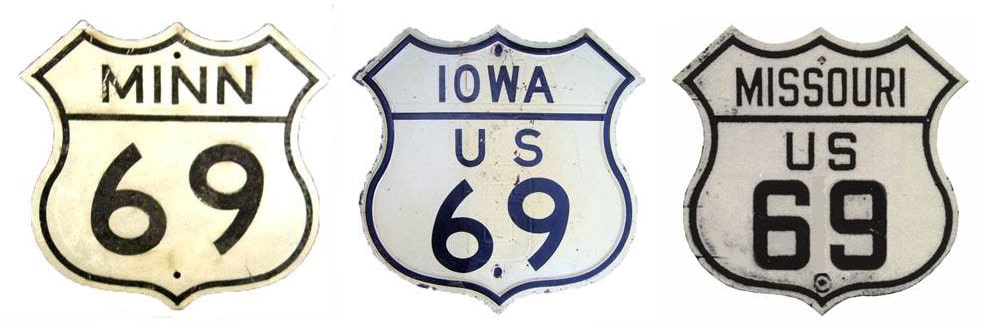
Summa
|
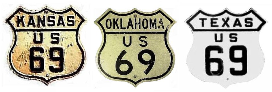
Summa
|
|
1926-1934
|
1934-1935
|
1935-present
|
|
Mileage: in 1989 AASHTO listed a figure of 1184 miles for US 69... however, that included the mileage of US 69's associated business/bypass/alternate routes. According to the state subtotals on AASHTO's 1989 spreadsheet, mainline US 69's actual end-to-end total at the time was 1136 miles. That is reasonably close to our own 2020 measurement, which yielded 1130.7 miles (reroutings and realignments likely explain the difference).
|
During the time of its maximum historic extent in Port Arthur, US 69 was slightly longer: 1133.8 miles.
|
|
US 69 was an original 1926 route, but back then it was tiny: only about 150 miles long. Initially its south end was in Kansas City, but before a decade had passed, it received a significant extension to the south: Port Arthur, where it remains to this day.
Originally the north end of US 69 was in Leon: |
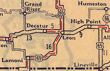
c. 1927, Rand McNally
|
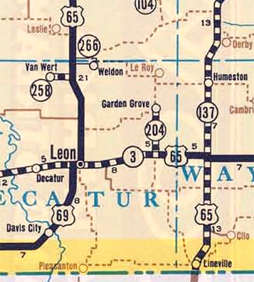
c. 1934, IADoT
|
|
This photo was looking south on Church Street at First Street:
|
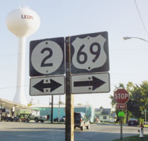
Sanderson, Oct. 2002 (unchanged as of Apr. 2007)
|
Today that is southbound US 69, which continues to the right with IA 2 for a half-mile before turning south again. But historically that was southbound US 65, which continued to the left. To the right was the north beginning of US 69. This shot is east on First at Church:
|
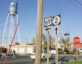
Sanderson, Oct. 2002 (unchanged as of Apr. 2007)
|
That was the original north end of US 69. Ahead was southbound US 65, and left was northbound US 65.
|
In 1934, US 65 was rerouted like it is today through southern Iowa: instead of heading west to Leon, it went north through Indianola to Des Moines. So US 69 was extended north from Leon along the former route of US 65, joining the "new" US 65 about 5 miles south of Indianola. The two routes overlapped into Des Moines, where for about five or six months US 69 ended at its junction with US 6. This photo was looking west on Grand Avenue:
|

Morrison, Oct. 2006
|
|
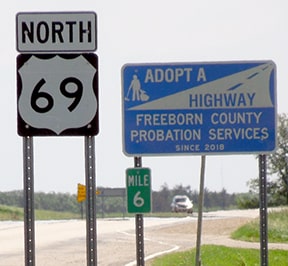
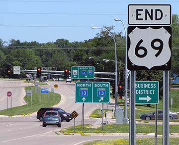
The building with the green awnings (at right) was probably there back in 1934. At the time, that was US 6, and traffic at the north end of US 69 came in from the left. But in 1935, the US 69 designation was extended further north: overlapped with US 65 through Des Moines, and from there further on to Albert Lea. As of 2022, the last northbound US 69 marker was in Twin Lakes, 6.5 miles from its terminus:
|
Sanderson, Jun. 2022
|
|
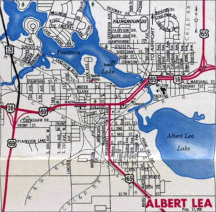
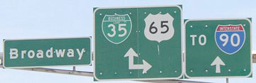
Originally US 69 came into town on South Broadway, meeting US 65 about eight blocks south of Main Street (which carried US 16 at the time). It would have been customary for the two routes to overlap up to Main, with US 69 ending at its junction with US 16. These photos show signage for drivers heading north on Broadway (US 65) at Main:
|
Sanderson, Jun. 2022
|
Morrison, May 2004
|
|
US 16 ran along Main; northbound US 65 continued (as it does yet today) by turning right on Main (with what used to be eastbound US 16), but US 69 ended there. That lasted for only about four years: it was around 1939 when US 69 traffic was shifted over to its current alignment, which is about a mile west of Broadway. These photos were taken on northbound US 69 approaching its current terminus at Main:
|

Morrison, May 2004
|
Castleman, July 2016
|
Sanderson, Jun. 2022
|
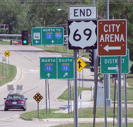
Kudos to the DoT for adding that "End US 69" assembly (which was done sometime after 2013). The green signs ahead are shown close-up below:
Morrison, May 2004
|

Morrison, May 2004
|
Castleman, July 2016
|
|
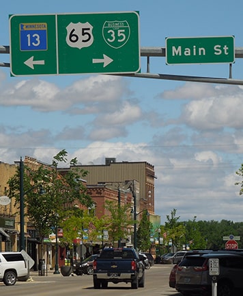
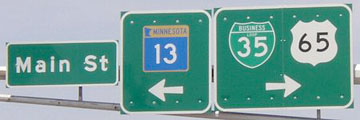
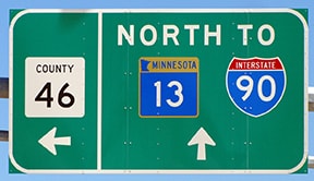
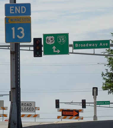
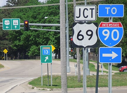
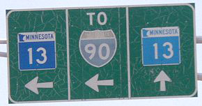
Main was formerly US 16, which may help to explain why the US 69 designation ends atypically (at a junction with a state route). But US 16 has long been decommissioned through here; now it is southbound MN hwy. 13 to the right, while left is CR 46. Straight ahead is northbound MN 13, which connects with I-90 a few miles ahead at interchange 154 (I-35 traffic is also encouraged to use that road, rather than taking a right and heading through downtown Albert Lea). After I-90 was built, it would have made sense to extend the US 69 designation north (straight ahead) to I-90. Or else it should continue east (right) for one mile to US 65... which, in fact, it did historically. Official maps from 1946-1961 illustrated that...
|
c. 1961, MNDoT
|
|
...and this photo shows that US 69 was signposted at that intersection. The perspective here was northbound Broadway at Main. US 65 continued to the right on Main, while to the left was the beginning of both US 69 and MN 13:
|
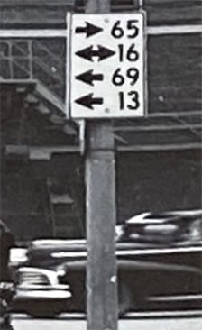
c. 1940s (attribution unknown)
|
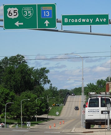
In other words, when US 69 was first moved off Broadway, it continued to end at the same intersection (Broadway and Main), even though it approached from the west instead of the south. So we will turn that direction; these photos were looking east on Main at Broadway:
|
Castleman, summer 2002
Morrison, May 2004
|
Sanderson, Jun. 2022
|
|
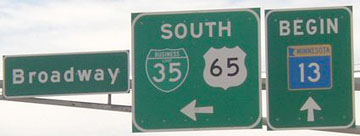
Southbound US 65/Business I-35 is to the right; northbound is straight ahead, and US 69 formerly ended here (where MN 13 ends now). Today, the north end of US 65 is about three miles straight ahead.
These photos were from the opposite perspective (looking west on Main at Broadway): |
Sanderson, Jun. 2022
|
Morrison, May 2004
|
|
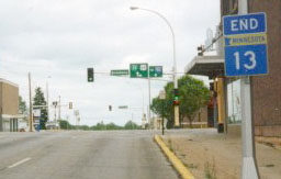
From 1935-1939, US 69 began to the left. Then, from 1939 to probably sometime in the 1960s, US 69 began straight ahead (just as MN 13 begins that way today). About a mile ahead, we reach the current north beginning of US 69. These photos were from westbound Main (historic westbound US 16, now northbound MN 13):
|
Sanderson, Jun. 2022
|

Morrison, May 2004
|
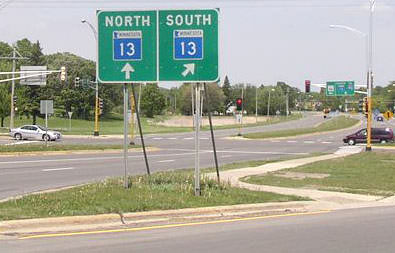
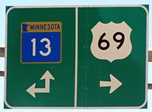
MN 13 continues to the right, and US 69 begins to the left. Here is the signage for traffic heading the opposite direction (east on CR 46):
Morrison, May 2004
Since that segment of the road is no longer under state jurisdiction, that first sign may date back to a time when US 16 still ran through here: instead of the MN 13 sign on the right, there may have been a "US 16" shield originally. It has since been replaced:
|
Sanderson, Jun. 2022
|
Castleman, July 2016
|
|
From there, drivers turning to the right (south on US 69) immediately encounter the first southbound trailblazer:
|
Sanderson, Jun. 2022
|
Research and/or photo credits: Monte Castleman; Nathan Edgars; Adam Froehlig; Jason Hancock; Jeremy Lance; Scott Maness; Jeff Morrison; Robert Mortell; Bob Otterson; Ben Prusia; Dale Sanderson; Michael Summa
Page originally created 2000;
last updated Apr. 6, 2023.
last updated Apr. 6, 2023.
