Historic west endpoints of US highway 36 |
 |
|
1937-1967
|
1967-1974
|
1974-1977
|
1977-present
|
|
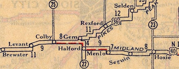
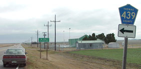
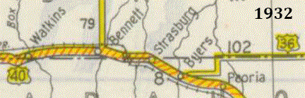
The original west end of US 36 was a few miles east of Colby, near the town of Gem. Based on this map, it probably began by heading north from US 40-N (modern US 24) via what is now County Road 439:
|
c. 1927, Rand McNally
|
|
This photo was taken looking east on US 24; Colby is about seven miles behind the camera, and US 83 is two miles ahead:
|
Sanderson, Nov. 2001
|
|
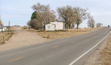
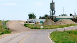
CR 439 to the left goes north two miles to Gem, and that was probably the original east beginning of US 36. But that lasted only a couple years: in 1928 the west end of US 36 had been extended to Byers. This photo was looking mostly east but also slightly south on CO hwy. 36:
|
Sanderson, Oct. 2003
|
|
Today the CO 40 designation begins straight ahead, while eastbound CO 36 turns left on Main and almost immediately has an interchange at I-70 (and becomes US 36 at exit 316). Historically this was all US 40, but according to old CDoT maps, this was not the intersection where US 36 split off from US 40. Note in the distance the CO 40 marker, the green mileage sign, and the trees at far left -- those are shown more closely in this photo:
|
Sanderson, Oct. 2003
|
|
The gravel road off to the left is now CR 10; it heads due east from there. That appears to have been the original route of US 36: it went east five miles, then north 2 miles on today's CR 197, then east again on its present route. Here is a view from a bit further ahead:
|
Sanderson, Dec. 2003
|
|
Eastbound US 40 continued to the right via modern CO 40, and old US 36 began heading due east via the road at left. Today, about a mile ahead, I-70 interrupts the alignment of CR 10... but there is a paved overpass, which further suggests the historic importance of that road. Next is a view from the opposite perspective:
|
Sanderson, Dec. 2003
|
|
That was looking at the former west end of US 36; historic US 40 runs diagonally across the photo, and "downtown" Byers is just to the right. In about 1933, US 36 was slightly rerouted such that it bypassed Byers about 2 miles to the north...
|
CDoT
|
|
...and at that time, US 36 stayed on the county line road straight into Strasburg, ending at its junction with US 40:
|
Sanderson, Aug. 2006
|
|
That was looking west along CR 2. The paved road is CO hwy. 36 today, but historically it served as US 40. US 36 came west to this point and ended at this junction. Here we are looking the opposite direction (east on historic US 40):
|
Sanderson, Aug. 2006
|
|
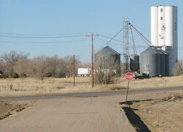
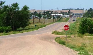
Where US 40 curved to the southeast ahead, US 36 began by continuing due east, straight ahead along the county line road (CR 2). That was the alignment of US 36 for about 20 years: the highway was not rerouted through Byers again until 1955. But at that time modern US 36 (which heads on a diagonal north and east from Byers) had not been built. Instead the highway used Xmore Rd south to CR 10, then west into Byers. 1964 was the first map showing today's diagonal road.
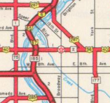
But none of those changes are relevant to the endpoint of US 36, because long before any of them had taken place, US 36 had been extended west with US 40 into Denver. The 1937 map is the first one to indicate that US 36 had been extended into the city via Colfax Avenue (Denver's east-west "Main Street"), and it ended in town for the next three decades: |
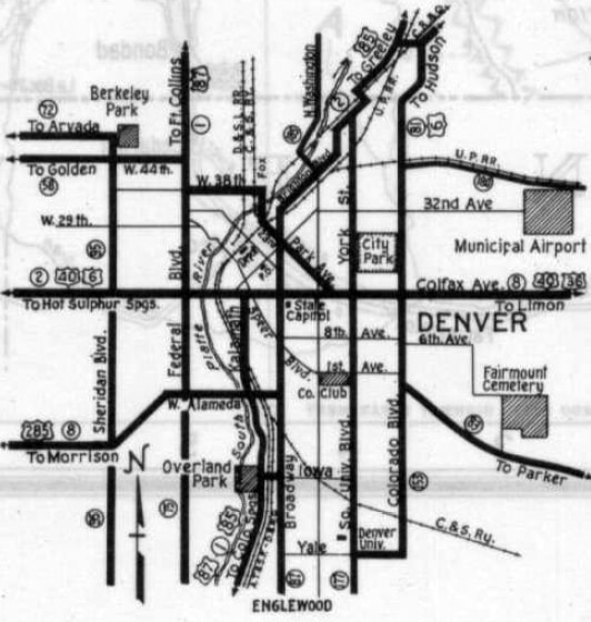
c. 1937, CDoT
|
Historic CDoT maps are not clear with regard to exactly where the designation terminated in Denver during that 30-year period. But consider: for the preceding nine years, US 36 had ended at its various junctions with US 40 in small towns on the high plains east of Denver. So what was it that prompted officials in 1937 to overlap the designation west with US 40 into the city? A possible explanation is that it had to do with US 6. 1937 was the year that US 6 was extended through Denver and on to southern California. In other words, Denver suddenly found itself served by another transcontinental highway. Officials may have reasoned that many travelers would be using US 6, and it therefore made sense to connect other routes to that one.
|
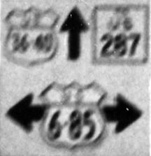
Whatever the rationale, maps from the late 1930s and early '40s (with cartography by two different organizations) make a fairly strong case for US 36 ending at its junction with US 6 in Denver. At the time, US 6 traffic came into the city on Colorado Boulevard and then turned west on Colfax. So US 36 came in on Colfax, and ended at Colorado Blvd:
|
Sanderson, Aug. 2006
|
|
That was looking west on Colfax; the signal ahead is at Colorado Blvd. US 6 came in from the right and continued straight ahead, so US 36 ended there.
In the mid-1940s, US 6 was rerouted through the city, such that traffic was directed to stay with US 85 down Brighton Boulevard and then south on Broadway. At Larmier Street, US 6 split off, heading southwest to Colfax*, and then west. The 1947 CDoT map was the first to include a US 36 marker west of Colorado Blvd: |
c. 1947, CDoT
|
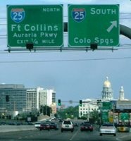
|
*(Note that it is not possible for drivers to make that movement anymore: in recent years, Auraria Parkway replaced the functionality of Larimer, which no longer goes all the way through the Auraria Campus.) US 36 certainly could have ended at Broadway (US 85-87). But again: what was it that prompted this extension? Most likely it was the rerouting of US 6. If so, then US 36 probably did not end at Broadway -- it likely continued west of there on Colfax, ending at Larimer. That area has changed so much since the 1940s that today it is pretty much impossible to get a photo there. But here is an historic photo that comes close to showing what that junction looked like at the time:
|
c. 1923 (linked to source at Denver Public Library)
|
|
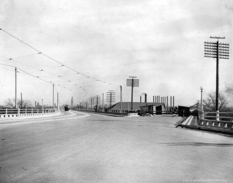
That was looking east along Colfax, with the southwest beginning of the Larimer viaduct angling to the left. Westbound US 6-40 traffic came to this junction and diverged, with US 6 heading left on Larimer, and US 40 continuing straight ahead on Colfax. Straight ahead was also probably the west beginning of US 36. That was the case until about 1951, so this next image was taken about 12 years after US 36 no longer began here. But it does at least suggest how this area looked around that time. Like the photo above, this too was looking east on Colfax:
|
from CDoT's 1963 official state highway map
|
|
CDoT was proud of that project at the time, because Lawrence Street had just been extended southwest, allowing it to carry northeastbound traffic, while Larimer became one-way southwestbound.
In about 1951, US 6 was rerouted again: now it continued with US 85-87 south on Broadway, past Larimer, all the way to 8th Avenue, where it split off and headed west (eventually curving into 6th Avenue): |
c. 1952, CDoT
|
So at that point, US 36 was most likely truncated back to Broadway, and if so, then this photo was taken during the timeframe when the west beginning of US 36 was straight ahead:
c. 1953-1958 (linked to source at Denver Public Library)
(detail)
|
That was looking east on Colfax from Broadway. Here is a modern photo taken looking the opposite direction (west on Colfax):
|
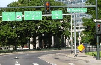
Sanderson, Aug. 2005
|
|
Today Colfax is not only US 40, but also US 287 and Business I-70. Broadway is no longer a state highway, but during the 1950s it was US 6-85-87, so US 36 ended at that junction. However, in 1959, the "Valley Highway" was completed past downtown (it soon became a segment of I-25):
|
c. 1959, CDoT
|
|
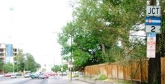
US 6-85-87 traffic was redirected onto this new freeway, and Broadway has not been used as a US highway since. So US 36 was probably extended west of Broadway, ending at the new US 6-85-87. This photo was looking west on Colfax at its junction with I-25:
|
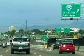
Sanderson, Aug. 2006
|
|
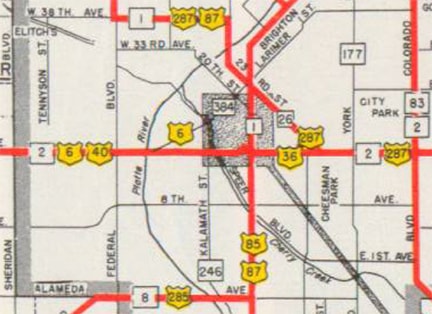
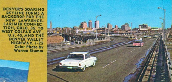
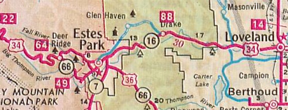
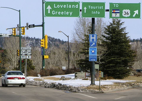
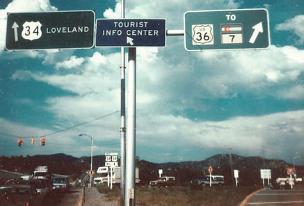
The Denver-Boulder Turnpike was built in 1953. The bonds were paid off in 1967, so the tollbooths were removed, and by 1968 US 36 had been extended west from Denver. From Colfax and I-25, US 36 went north**, then northwest on the Turnpike, through Boulder, and on to Estes Park on former CO 66. For the next ten years, the west end of US 36 was right in Estes.
**1970 was the year that US 36 traffic was changed such that it used I-70 and I-270 to get to the Turnpike. |
c. 1968, CDoT
|
|
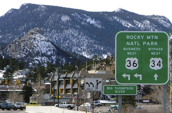
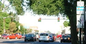
These photos were taken on eastbound Wonderview Avenue, which carries US 34 (formerly US 34 Bypass) around downtown Estes and then curves south to a junction with Elkhorn Avenue:
|
Sanderson, Feb. 2005
|
Dienhart, Aug. 2022
|
|
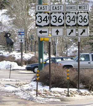
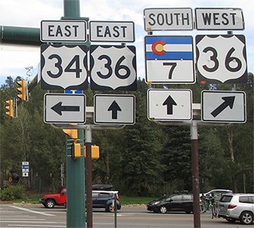
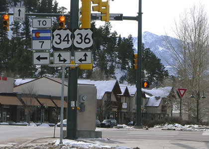
Eastbound US 34 continues to the left, via Big Thompson Avenue. Straight ahead the roadname changes to St. Vrain Avenue, which serves as eastbound US 36 (and that was the beginning of US 36 from 1967-1977). But today US 36 extends westbound to the right, via Elkhorn (along with westbound Business 34). If only all the approaches to this intersection were as well-signed... here we are looking the opposite direction (westbound US 36 on St. Vrain):
|
Sanderson, Feb. 2005
|
|
That was formerly the west end of US 36. Today's sign fails to indicate that the business route is also "Business 34" and is therefore an option for US 34 traffic as well. And what about drivers who want eastbound US 34 (to the right)? In the distance behind the bottom right corner of the "Big Thompson River" sign, an assembly is visible for traffic approaching from the right via westbound US 34:
|
Sanderson, Feb. 2005
|
Historically US 36 began to the left. Today's signage leaves it unclear that Business 34 is straight ahead via Elkhorn, while mainline (or "bypass") 34 is to the right via Wonderview. And how do travelers know which way is eastbound US 36, and which way is westbound? These photos were taken looking the opposite direction (east on Elkhorn):
Sanderson, Feb. 2005 (SH 7 sign severely rusted as of 2022)
|
Summa
|
|
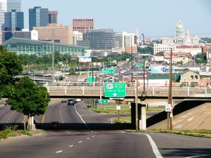
It is unclear exactly when that last photo was taken (sometime in the 1970s or 80s), but that is likely how signage appeared when the west beginning of US 36 was to the right. We will head that direction, back to Denver, in order to review the historic endpoints there from an eastbound perspective. This is an overview shot, which was taken looking east on Colfax at Federal:
|
Sanderson, Aug. 2006
|
|
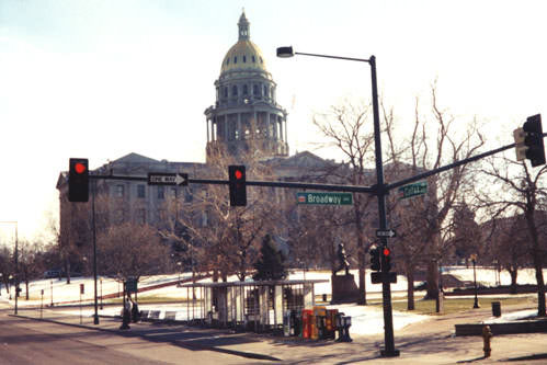
That is eastbound US 40 / Business I-70, which both continue ahead, as does southbound US 287. Northbound 287 is to the left on Federal, while right on Federal is southbound CO 88. In the distance on the right the gold-domed State Capitol is visible, and just in front of it, the City and County Building. Colfax runs just to the north (left) of those buildings. In the left background is part of Denver's central business district. Not far ahead is the interchange with I-25:
|
Sanderson, Aug. 2006
|
|
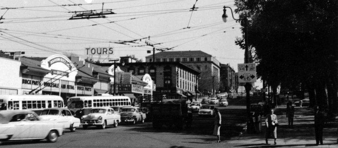
US 36 began straight ahead from 1958-1968. (And really from 1946-1951 as well, because that is right about where Larimer [and US 6] split off from Colfax.) About another mile in that direction is the Broadway intersection:
|
Sanderson, 2000
|
|
Ahead was the west beginning of US 36 from 1951-1958. Continuing ahead just over two more miles, we reach Colorado Blvd:
|
Sanderson, Aug. 2006
|
From 1937-1946, eastbound US 6 came to this intersection and then went north (left). So US 36 began straight ahead during that timeframe. In 1978 the US 36 designation was extended west of Estes, along former CO hwy. 66, to its current terminus in Rocky Mountain National Park.
Research and/or photo credits: Paul Dienhart; Mike Roberson; Dale Sanderson; Michael Summa
Page originally created 1999;
last updated Sep. 10, 2022.
last updated Sep. 10, 2022.
