Travels to Sanderson |
|
|
I have always lived in Denver, not far from the north end of US 285. Long ago, while looking at a map, I discovered the other end of 285 was in a town that shared my surname. Suddenly it became clear to me that I must drive the entire highway, and see Sanderson for myself. The opportunity first arose in 1988, when I was in college. I drove a tired old 1966 Barracuda down there, and had plenty of car trouble along the way... guess I'm kinda lucky I made it. Here is one of the few photos I took during that trip:
|
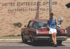
Sanderson, Aug. 1988
|
|
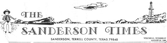
I had gone into the post office to get some "Sanderson" postmarks (the desk clerk told me he had moved to Sanderson from Connecticut, of all places). Afterwards I set up my tripod and took that photo (I was holding a fan in order to indicate how hot it was... Sanderson is in the Chihuahuan Desert, and I had never seen a roadrunner or a vulture until that trip). This was the masthead from the local newspaper:
|
|
|
25 years after that first trip, I had another opportunity to visit Sanderson. In 2013, I drove US 285 from end-to-end again (photos and info about both endpoints can be found on the US 285 page). This time I took hundreds of photos, and of course one of them had to be in front of the post office:
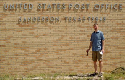
Sanderson, Aug. 2013
|

|
I also took this photo, which captures both of the main reasons for my visits to this remote part of the country:
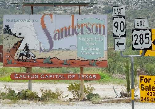
Sanderson, Aug. 2013
|
We spent quite a bit of time visiting with the owner of a cool shop called "Papalote", and got a kick out of their T-shirts:
Inside was an old wooden highway mileage sign, which presumably would have originally been posted on eastbound US 90, near the Brewster-Pecos county line:
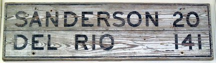
Sanderson, Aug. 2013
|


|
Sanderson TX is about 185 miles east of the west end of US 90. Oddly, about 1600 miles east of that point, there is also a Sanderson in Florida. That town is also on US 90, and it is only about 50 miles west of the highway's east end. I was there in 2003, playing hooky from a conference I had in Jacksonville. Here is one of the exit signs from I-10:
|

Cozart, summer 2003
|
Florida originally numbered their interstate exits sequentially, but there has been so much new development in the state that in 2001 they finally converted to numbering their exits corresponding to mile markers (like most other states). But for the sake of people following old maps, they also marked the old exit numbers; that is what the "Old 46" sign referred to.
|
|
Sanderson is a very small town - population 700. Not much to photograph; unfortunately the post office was a modern (and uninteresting) building:
|
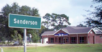
Sanderson, Oct. 2003
|
|
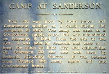
That was coming into town on eastbound US 90. This was the sign for westbound traffic, and just ahead was an historical marker:
|
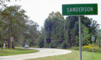
Sanderson, Oct. 2003
|
Sanderson, Oct. 2003
|
|
These photos were taken looking south on Baker county road 127. Note the white building on the far side of the tracks: that is the general store - more about it later. This old blue US 90 sign was a relic from when Florida further differentiated their US highways with colored shields:
|
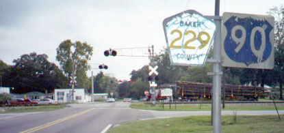
Sanderson, Oct. 2003
|
Ioannidis, summer 2003
|
|
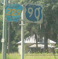
Straight ahead about a mile on CR 229 is an interchange with I-10 (the one photographed above). West (right) on US 90 also has an interchange in about two miles; eastbound US 90 parallels I-10 all the way into Jax. Here is a highway mileage sign for Sanderson that was quite old (for years the standard has been white lettering on green signs):
|
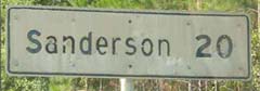
Ioannidis, summer 2003
|
Sanderson may be a small town, but there are people with ties to the community who have contacted me regarding this webpage. Someone who grew up there informed me that the "good" (old) post office building is still standing, one block west of the 229/90 sign shown above. Also, the general store mentioned above formerly belonged to her great-grandmother! From what I observed, that was still the unofficial gathering place (or, more accurately, it was the only place where I noticed any activity whatsoever).
Research and/or photo credits: Justin Cozart, Costa Ioannidis; Dale Sanderson
Page originally created 1997;
last updated Oct. 8, 2016.
last updated Oct. 8, 2016.
