|
Why is it difficult to obtain accurate end-to-end mileage for many US highways?
(Last updated 10/25/2021) This comes as a surprise to some, but US highways are actually not federal highways... at least not in the sense that they are owned and maintained by the federal government. Rather, the US routes are actually just state highways... although they are "special" in the sense that at some point they were granted permission by AASHO (later AASHTO) to be signposted with a US route shield.

Originally, the primary purpose of the US highway system was to identify the most heavily-traveled routes and to aid travelers on those roads by providing inter-state numbering continuity. But since the federal government does not maintain these roads, there is no federal authority that has a reason to keep accurate route logs and mileages. The closest such entity would be AASHTO, but that is not a federal agency; the acronym stands for the American Association of State Highway and Transportation Officials. AASHTO has no real enforcement authority over the various state departments of transportation, but nevertheless the states do (usually) defer to AASHTO's decisions regarding US routes.
Historically AASHO/AASHTO published route logs that included the length of each US route, using mileages that were derived from the totals provided to them by the individual state DOTs. But the last time they updated their route log was in 1989. That particular release (the pdf version) included a TOC page with each route number and a mileage figure... but for most routes those figures did not accurately represent the end-to-end mileage of the mainline US routes. How do we know this? Because (as AASHTO stated right on that page) those mileage figures included the length of any associated bannered routes: 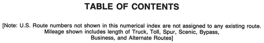
Note that last line there, meaning the so-called "total" mileages listed on that page were never meant to represent the end-to-end mileages of the mainline US routes (but unfortunately that is exactly how many people have misinterpreted them over the years since). By digging into the spreadsheet version of that route log, one can manually calculate the actual end-to-end mileage of the mainline routes, but that requires some analysis (and in some cases correcting mistakes), and at any rate AASHTO never published a summary of those numbers.
On top of all that, those mileage figures have become too outdated to be considered reliable at this point anyway. During the 30+ years since 1989, many US highways have been rerouted and/or realigned. Around 2010 AASHTO expressed a desire to correct/update their route log, but it appears the state DOTs showed very little interest, and I am under the impression that AASHTO has tabled the idea for now. Many US routes run through several states (some more than a half-dozen). If just one of those states provided an inaccurate figure to AASHTO (or if they have changed the alignment of a US route since 1989), then that means the mileage published in 1989 is no longer accurate. And I have found that state DOTs do sometimes publish misleading or inaccurate information for their own routes. For those reasons, mileages published on Wikipedia are sometimes incorrect (because editors are required to cite "official" sources, but they are not required to validate the accuracy of their sources). As a result of all these factors and more, one can often find conflicting figures for the length of any given US highway. So how can anyone be sure which figure is the correct one? I finally realized the only way I would feel confident about stating mileage figures was to measure the routes myself, and to evaluate how my results compare to the "official" figures.
It is almost always of one of the longer US routes about which people want to know the mileage and/or the midway-point. And that makes sense: I mean, the halfway point along US 46? Who cares. But the midway point of, say, US 6 or US 20? Now that's kind of interesting. But it takes quite a bit of effort to figure that out... at least the way I do it, which allows me to stay accurate within one-tenth of a mile per 100. And it is even more difficult to calculate the mileage of a route that no longer exists, or that has non-driveable interruptions in its historic alignment (like US 66). However, during the COVID-19 pandemic I found myself with extra discretionary time, and I used it to measure all 291 current and former US routes. The results can be found in the header section on the page for each US highway.
I am the first to admit that my method may have slight inaccuracies of its own. But 95% of the time my figures very closely match AASHTO and/or DOT figures, which gives me confidence that the method can be trusted. And it also gives me the confidence to question mileage figures that are significantly different than mine.
0 Comments
Your comment will be posted after it is approved.
Leave a Reply. |
AuthorCategories
All
Archives
July 2024
|
 RSS Feed
Copyright © 1998-2024
