|
By 1970, US 666 had reached its maximum historical extent, from Douglas AZ to Monticello UT (represented by the blue line on this map):
0 Comments
Just outside the north edge of Great Smoky Mountains National Park is a scenic Tennessee highway connecting I-40 near Newport to Gatlinburg and Maryville. During the late 1970s and early 1980s, it appears TNDoT was determined to unify this corridor with a single US route designation. They first attempted to accomplish this by extending the US 74 designation west from Asheville NC (which was the route's western terminus from 1926-1987). Following is the route description from the actual minutes of the June 1978 meeting of AASHTO's route numbering committee:
In 1967 the US 270 designation was at its maximum extent, from Pine Bluff AR to Syracuse KS. That year the Kansas DOT petitioned AASHO* to extend the US 270 designation even further:
In 1963 the US 13 designation was extended about 50 miles southwest from its former terminus in Goldsboro to Eastover NC. So at that time US 13 attained its maximum length and its current route, which is shown as a thin blue line on this map:
US 163 was commissioned by AASHO* at their June 1970 meeting. The designation ran from Kayenta AZ on the south up to Crescent Junction UT on the north (illustrated by the green lines on this map):
In 1972 Florida asked AASHO* to assign a new US highway designation between US 1 at Titusville and US 19 at Weeki Wachee; following is the route description from the actual minutes of the meeting:
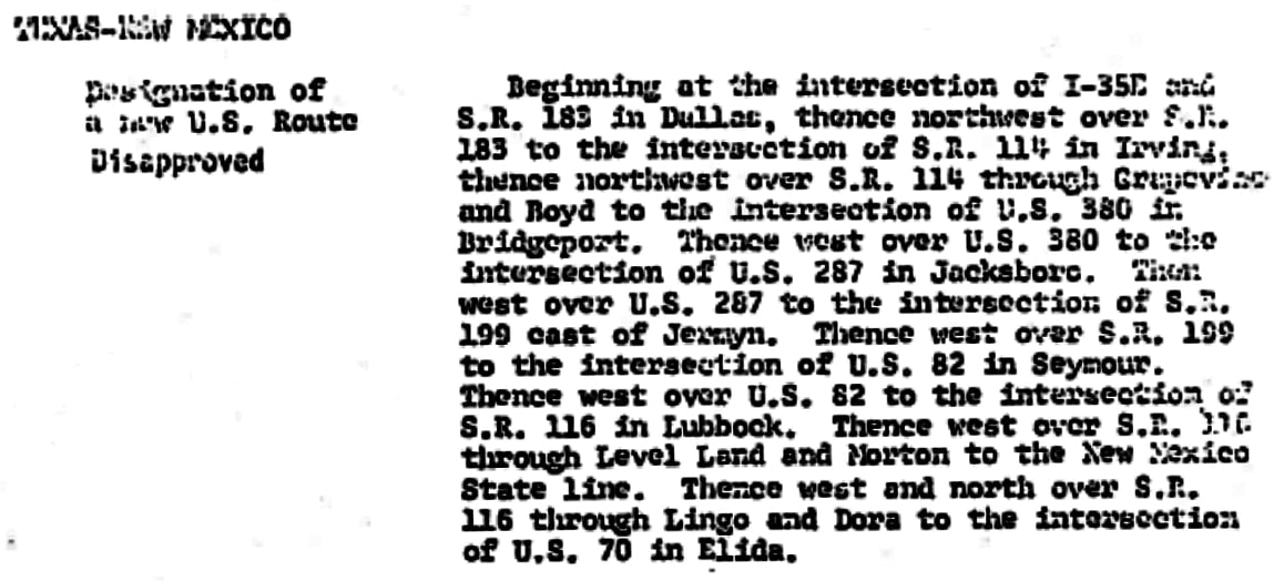
In 1975 TX and NM asked AASHTO to assign a new US highway designation between Dallas and Elida NM; following is the route description from the actual minutes of the meeting:
|
AuthorCategories
All
Archives
July 2024
|


 RSS Feed
