|
(last updated 6/19/2023)
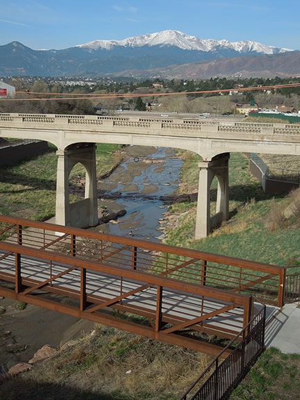
Do you ever think about what was here, before you were here? Before we all were here, with all of our roads, neighborhoods, houses, parks, buildings? We could go way back, millions of years, when the area that would later be known as "Denver" was still submerged beneath the western edge of a vast interior sea. Or we could go back not quite as far, maybe just 200 or 300 years, to a time when the only humans living in this area were those who belonged to the local Native American tribes. As they went in search of game, or moved their camps from one place to another, they formed trails, particularly along the streams in the area. Settlers of European descent did not begin to arrive here in earnest until the 1850s, less than 200 years ago. The old Native American trail along the east bank of Cherry Creek started to be used by new groups of people, who referred to it as the Cherokee Trail, the Goodnight-Loving cattle trail, or the Denver-Santa Fe stage line.
5 Comments
(last updated 9/6/2022)
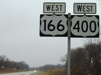
1992 was the first time I went through Norton. At the time I was not yet what I would describe as a "roadgeek", but I still thought this sign was worth stopping for a photo: 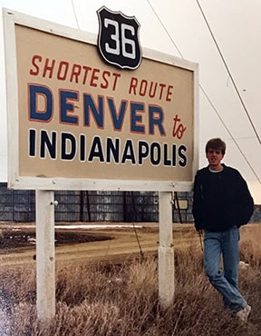
1992
Prior to I-25, there was a different main highway that connected Denver to several of the Northern Front Range cities in Colorado. The number of this highway has changed a few times during the past century, but its general corridor has remained the same: it still runs through Ft. Collins, Loveland, Berthoud, Longmont, Lafayette, Broomfield, Westminster, and Denver. Not all of those cities had even been established at the time of the 1916 map shown below, but the highway corridor running along the Northern Front Range is readily apparent (going forward I will refer to this road as the NFRH, for "North Front Range Highway"):
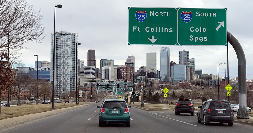
The other day I was driving north on C-470, and I wanted to go east on the 6th Avenue Freeway towards downtown Denver. That movement is shown on the map below:
I rarely drive that direction along C-470, but I have lived in Denver for a long time, and I'm pretty confident about knowing my way around. So as I approached, I was quite certain that I would need to follow eastbound I-70, and that the exit for eastbound US 6 would come up shortly after that.
But then I saw this: the first sign that references US 6 on northbound C-470:
I am about to ask a simple question. It is not a trick question, so no reason to over-think it. The map below (like most maps) is oriented with north at the top. You might not be able to make out much detail, but that's ok, because all I want you to do is take a look at the highway shown in blue. And the question is simply this: does this highway run north-south? Or does it run east-west?
One of the many interesting things about this segment of US 34 is that it essentially follows the valley of the Colorado River between its headwaters in Rocky Mountain National Park and its confluence with the Fraser River in Granby. Consequently US 34 also provides access to all of the major water collection components of the Colorado-Big Thompson Project. Those include Grand Lake (Colorado's largest and deepest natural lake) and three artificial impoundments (Shadow Mountain Lake, Lake Granby, and Willow Creek Reservoir). Since there are many examples of highways which were originally built parallel to rivers, but which later had to be realigned because of water storage projects that were built in those valleys, I set out to explore whether US 34 had any historic alignments that existed prior to the reservoirs in the Middle Park area.
Sanderson, Mar. 2018
|
AuthorCategories
All
Archives
July 2024
|

 RSS Feed
Copyright © 1998-2024
